
Survey maps along the old trail for the most part didn’t appear until after the line had shut down – mostly in the period 1868-72, but closer in to the mountains, the surveys occurred in the mid-1860s – there were gold and property rights involved. Unfortunately, the mapping of the Latham area didn’t take place until 1865; the year after the disastrous flood that caused the original location to be abandoned. By that time, the cut-offs to Denver from Junction had become the main route and the trail from Latham to LaPorte became secondary at best. The main trail went from Junction (Ft Morgan) directly SW to Denver, then back north to LaPorte and on into Wyoming unless one was headed west and skipped the Denver section – not the majority of traffic.
The original route from Latham to Laporte is inferred from the 1864 maps which indicate the road. There are no stations in-between listed on the official time tables but the distance from Latham to LaPorte was about 30 miles – swing stations usually being only 10-15 miles apart. There is a station roughly midway maintained by a historical society in what much later (1890s) became Windsor – now known as the Halfway House – but as the claim also states the structure was built in 1873, it would not have been used by the Overland/Wells-Fargo companies. Another more likely stop was Sherwood’s Ranch, a few miles east of present-day Ft Collins.
It seems reasonable a swing station near here would have been active in the earliest days; with all the other swing stations at least mentioned, it seems unusual a station here doesn’t warrant any attention. But that was the same problem with the South Platte and Eagles Nest stations as well.
These are the things that make tracking obscure details fun ….
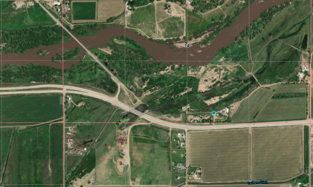
Start with the crossing of the South Platte at Latham. Based on the survey maps of 1865, the crossing then appears to be at the same location now; the present crossing of US34BR into Greeley – within the 20-acre area of the west half of the SW quadrant of T5N R65W.
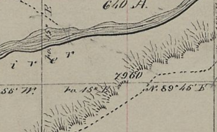
The junction of the old map is indicated on the new.
5N65WS14SWSE 1864 (junction)
40.39261884051857, -104.62841944615846
The original crossing appears to be quite close to the current bridge – the likely original crossing is indicated below.
Or also likely, the indicated crossing was an earlier highway bridge
But close to this location corresponds to the 1864 map
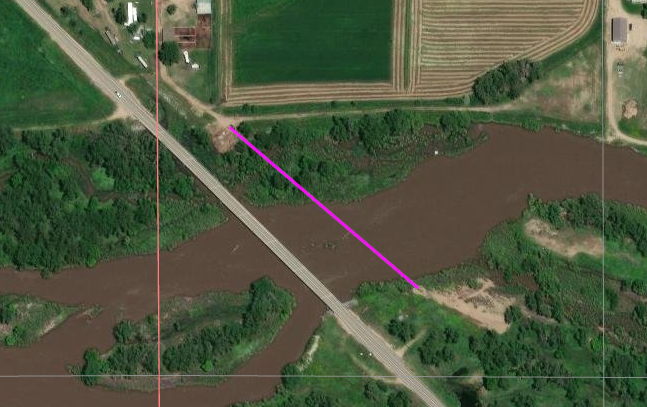
The original crossing appears to have been at the location indicated
The bridge is US34BR into Greeley to the NW
South Platte and Cache la Poudre Rivers
crossing marked in RED
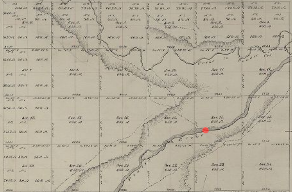
This 1902 map shows the region between the confluence of the Cache la Poudre and South Platte Rivers on the east to “New Windsor” on the west. The crossing appears to be in the same place for all three time periods; there is no hint of the Overland trail on the 1902 map – the trail would have roughly followed the railroad which still exists. There is no hint of Latham on any maps I’ve examined other than a trace of “Latham Ditch”.”.
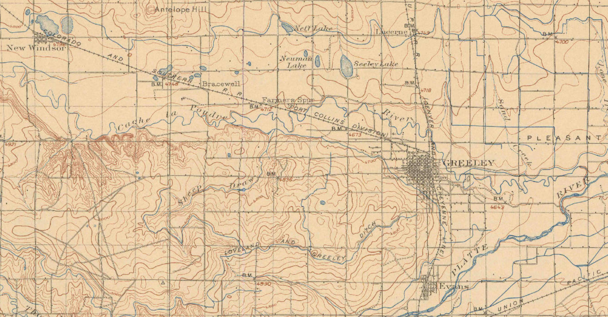
The original route based on 1865/66 surveys is marked on the following maps: alongside the south bank of the Cache la Poudre River through what is now downtown Greeley, crossing to the north bank near the NW side of Greeley and getting to high ground; continuing to follow along the bluffs north of the river above what would become Ft Collins – the fort wasn’t established until 1864 although there was a military presence in 1862 – and on to LaPorte – the next stop; a major home station.
This area is now over-loaded with what most call “civilization” and true remnants of the trail rarely – if at all – exist except on historical markers or segments turned into traffic-heavy modern roads.
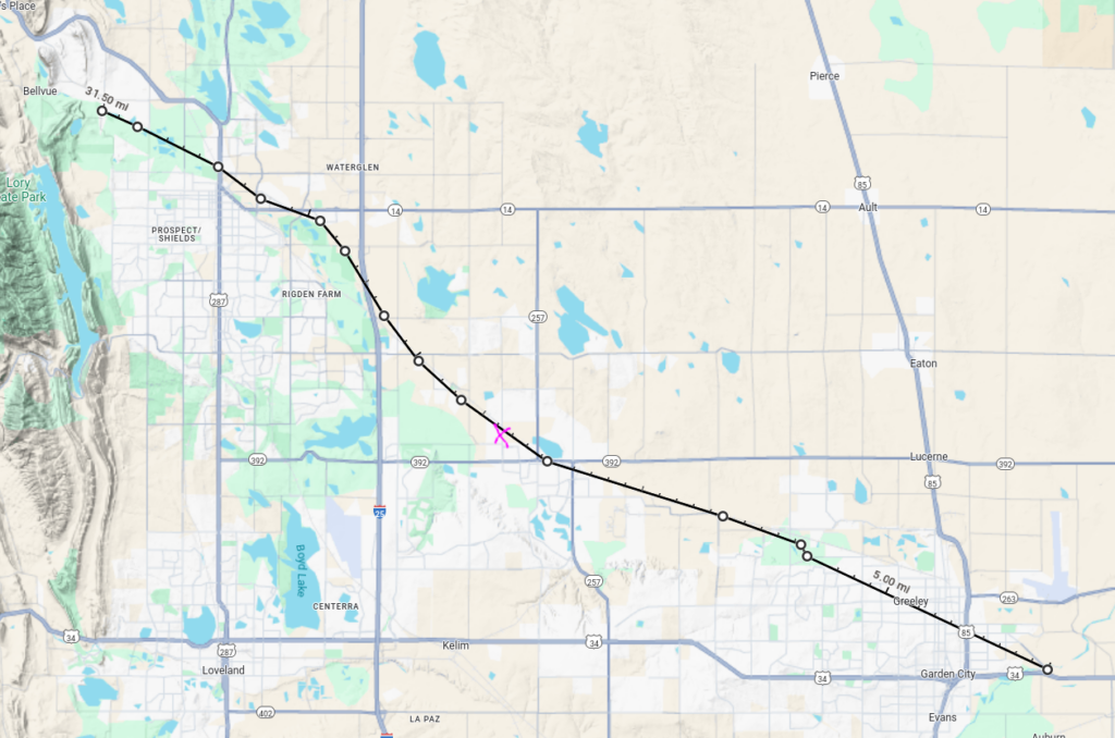
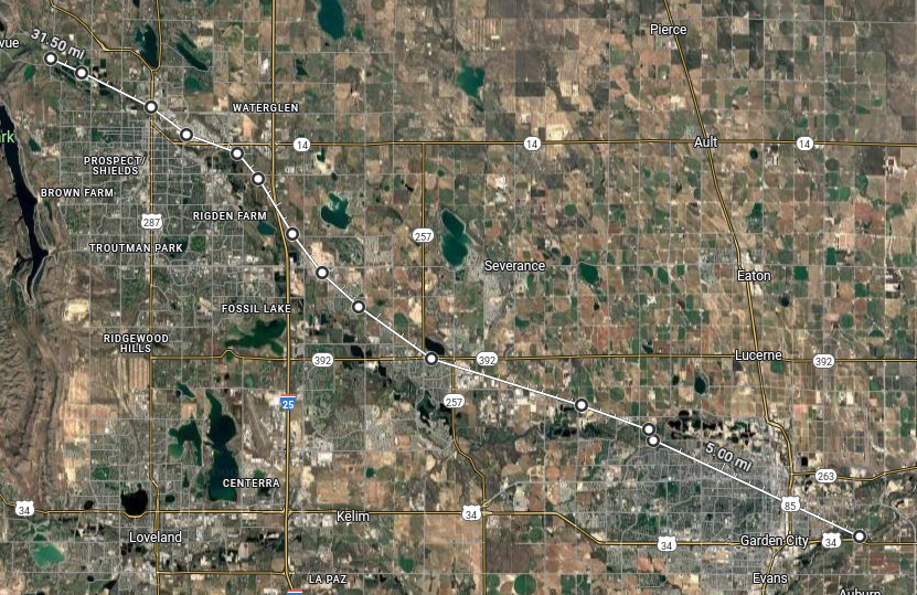
From Latham to LaPorte. This segment was relegated to secondary status after 1864 although both Latham and LaPorte remained major stations.
US287 runs NS on the left; I-25 runs NS left of center; US85 runs NS on the right; US34 runs EW along the bottom.
Further up the trail from the crossing of the South Platte, travellers crossed over the la Poudre to the north bank on what is now the north side of Greeley. From there, the trail closely follows the railroad – it is likely the railroad used the trail for part of its right-of-way.
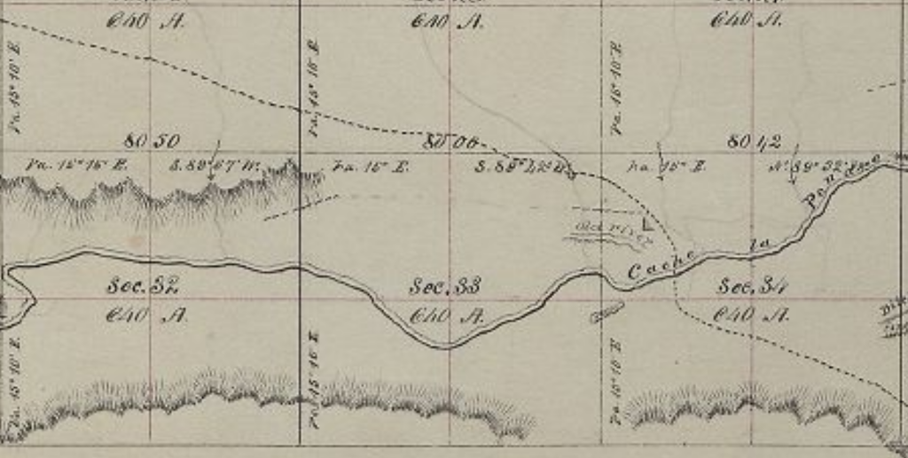
crossing the Cache la Poudre
40.445110180118355, -104.76637948766346
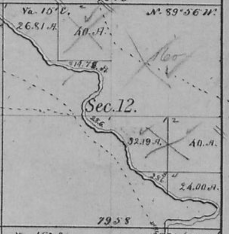
6N66WS34NWSE 1864
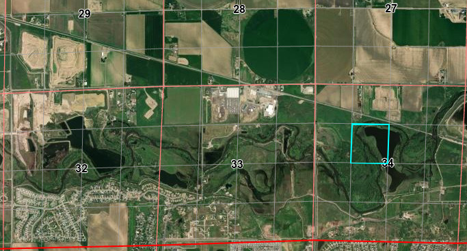
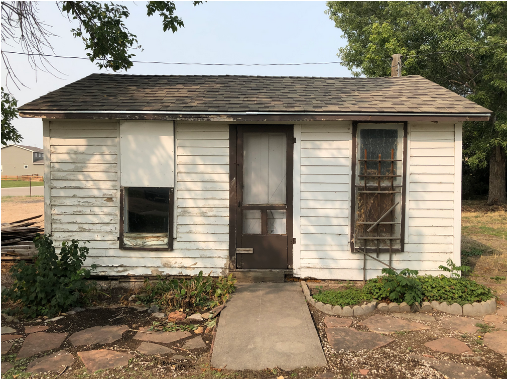
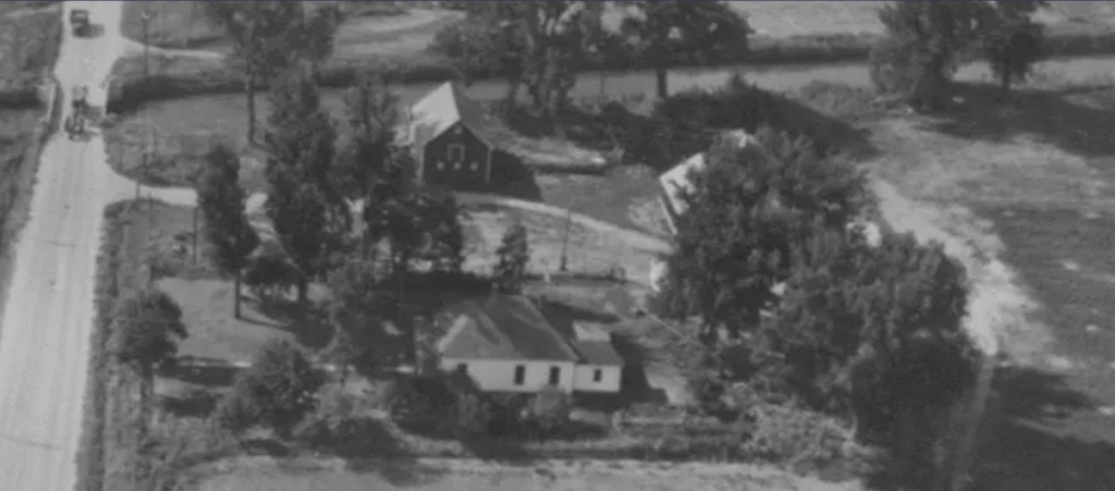
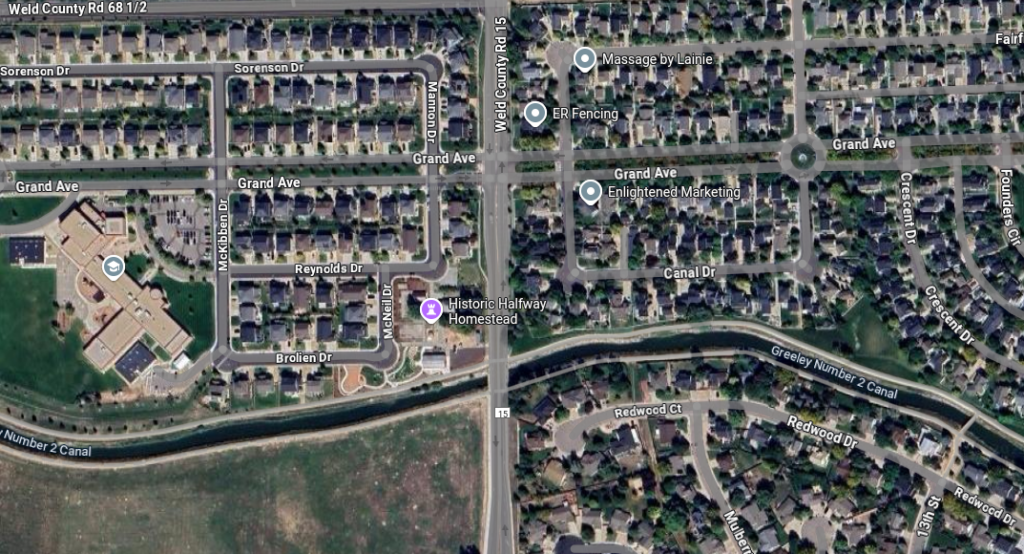
About halfway along the run from Latham to LaPorte, one would expect to find a swing station. This “Halfway House” stage station in now-Windsor is claimed to be on the Overland Trail route – it is; but it was built in 1873, several years after the Overland/Wells-Fargo stage lines shut down but many years before the town of Windsor existed (1890).
In addition to being a stage stop on a local run, it was also at the same time a pub and post office. The structure still exists as an outbuilding on private property. It is the oldest building in Windsor.
6N67WS18SENE
40.48426440340697, -104.92713988633022
County Road 15 on left
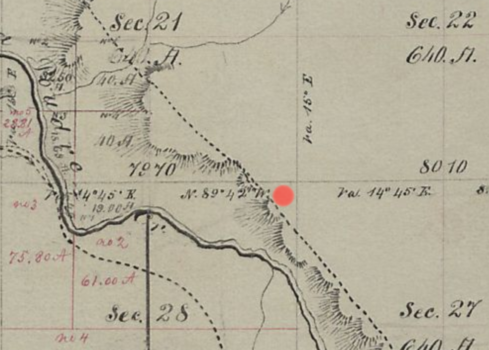
An almost certain candidate for a swing station is the Sherwood ranch. Jesse and Frederick Sherwood joined the gold rush in 1860, using an ox-team to haul supplies from Wisconsin. They started mining at Russell Gulch, but eventually settled in at a ranch along the Cache la Poudre near-on 5 miles below what would become Fort Collins. Logs were hauled from the mountains for building materials and they began raising and selling livestock, feed, and vegetables. There is a minor reference stating this ranch had been a station on the line.
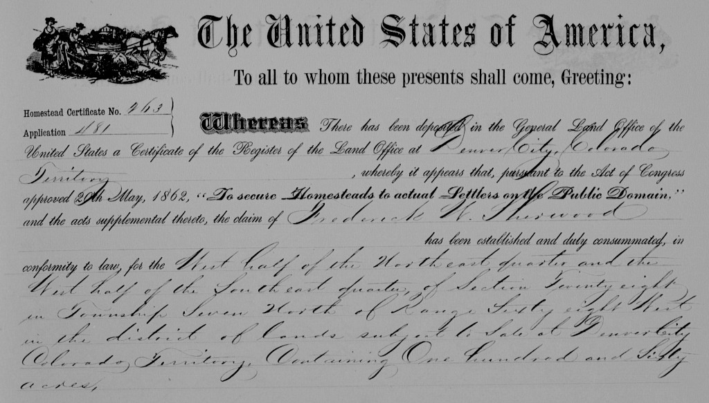
7N68WS28NE/SE
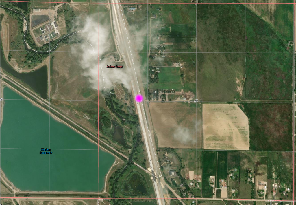
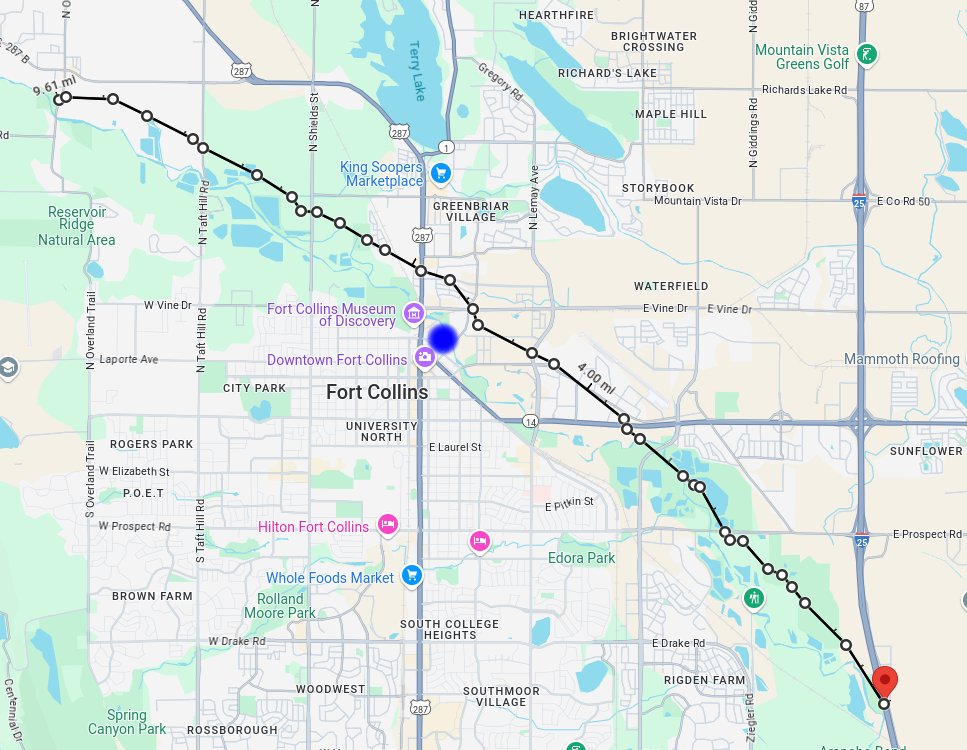
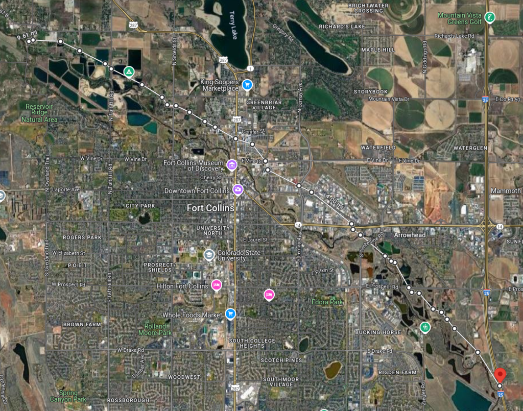
A minor piece of trivia, the trail crosses I-25 at an acute angle where located with the MAG dot in the right image; north of Exit265 but just south of the weigh station.
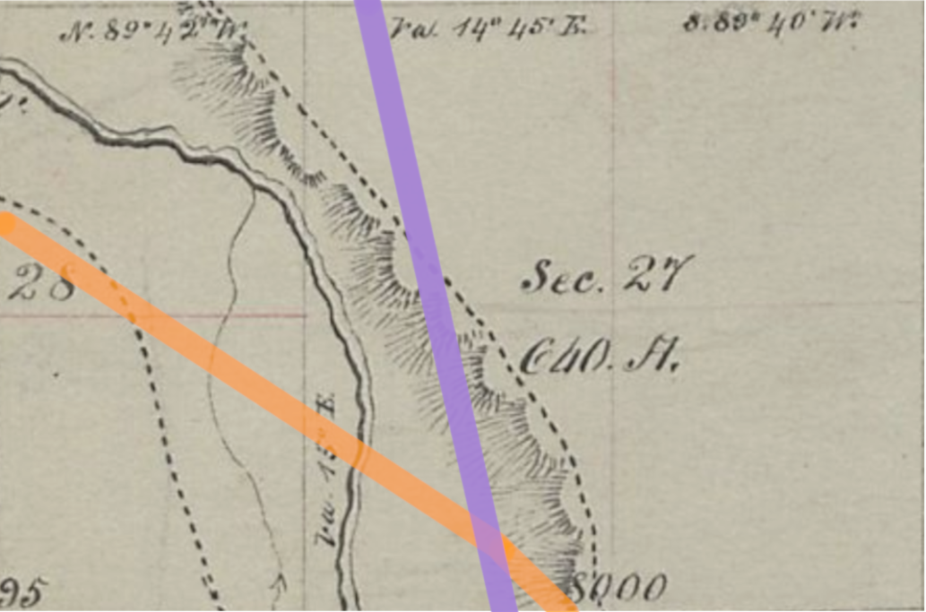
40.544942016336066, -104.99720953926372
I-25 & RR marked
Fort Collins
7N69W
40.590101055621474, -105.07299755156059
Camp Collins was established near LaPorte in 1862 to protect the mail run of the Overland Stage. The camp was moved to what is now the city of Fort Collins after being severely damaged by flooding in the summer of 1864. When re-established in its new location (away from the saloons and dance halls of LaPorte) on the Denver Road (today’s Jefferson St/Riverside Rd/CO14), it was renamed Fort Collins. The fort didn’t last long; it was abandoned in 1866. Portions of the site are now a park but nothing remains of the original fort.

The town itself began building shortly after the 80+ acre fort was abandoned but wasn’t officially platted until the military surrendered the property in 1872.
Although quite likely the stage stopped near here, there is no record of an “official” station being located here.
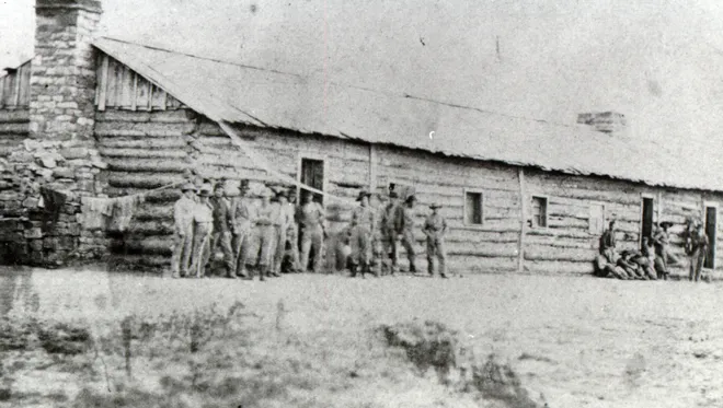
The fort location was roughly bordered by today’s Lincoln Ave, Jefferson Ave (CO14), N College Ave (US287), and the Cache la Poudre River. About 150 soldiers were stationed here. Life at the fort has been described as “boredom on the frontier“. The main military duties were escort services for the mail. The fort was on the south bank of the river; the trail on the north side.
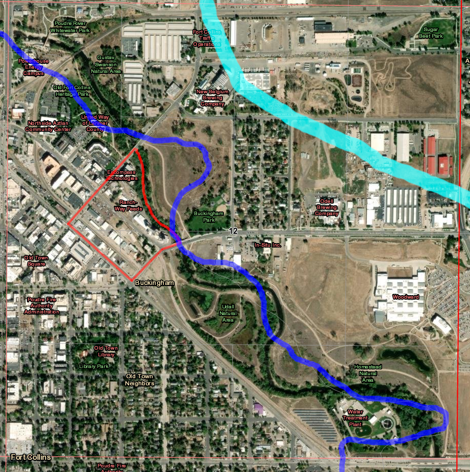
Fort outlined in RED; Overland Stage in CYN
1877 River in BLU
Things have shifted a bit.
On the old map, the original trail is the one north of the river; the “Denver Road” on the south.
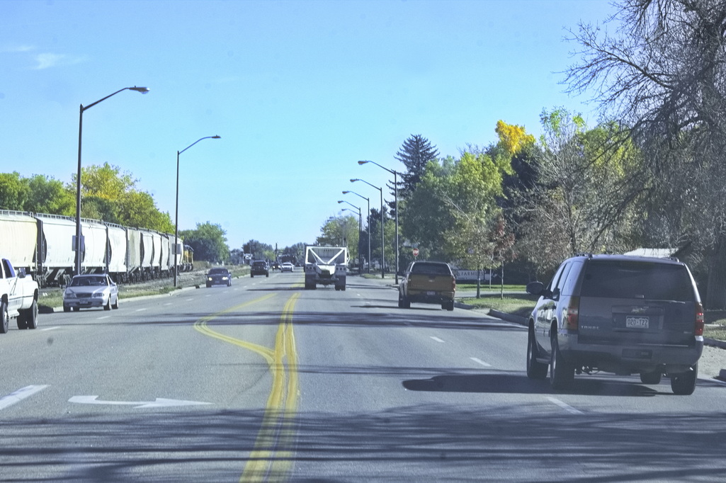
Below is a modern segment of the Denver Road.
The railroad runs through the old fort site
The stage route from I-25 to LaPorte
Fort at BLU dot
Trail crosses US287 40.60114455515733, -105.07667401105024
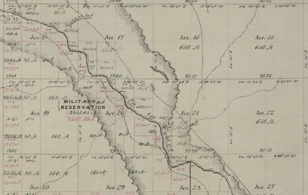
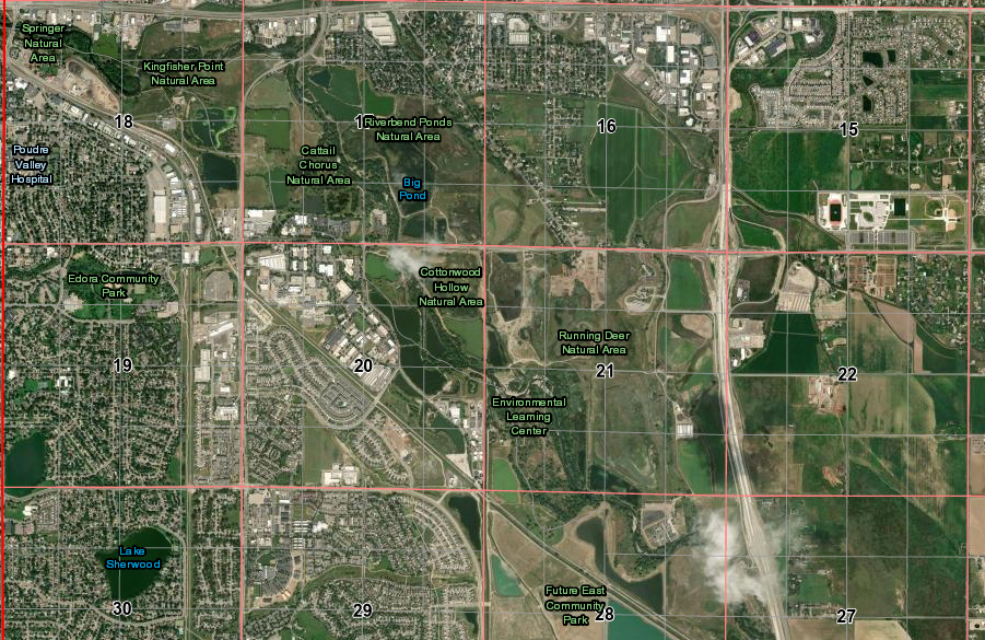
Maps of the fort region of Ft Collins
From here, it was a short ride up the river to LaPorte, a major home station on the line.
Next: LaPorte and on to Wyoming