Westbound and Down!
And so this journey begins …
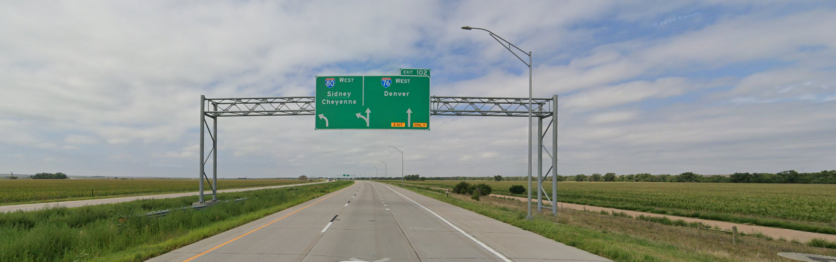
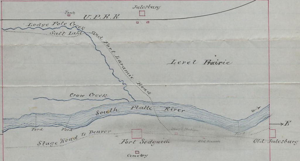
I’ll head west … from the junction of I-80 and I-76 in Nebraska to the junction of I-80 and I-84 in Utah, skipping the detour to Denver.
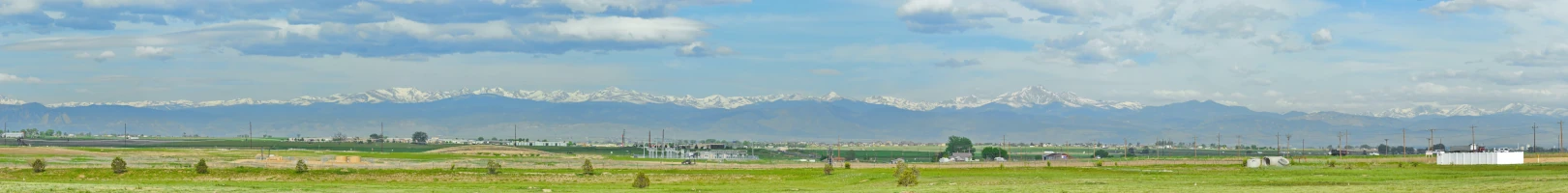
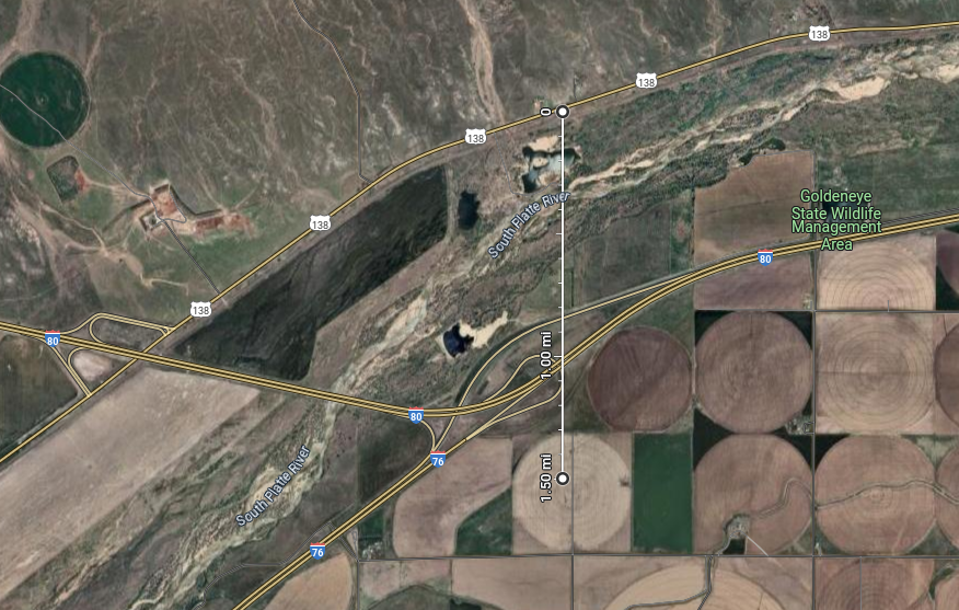
Heading southwest in Nebraska on I-80 – Colorado, I-76, and the South Platte River route is just ahead.
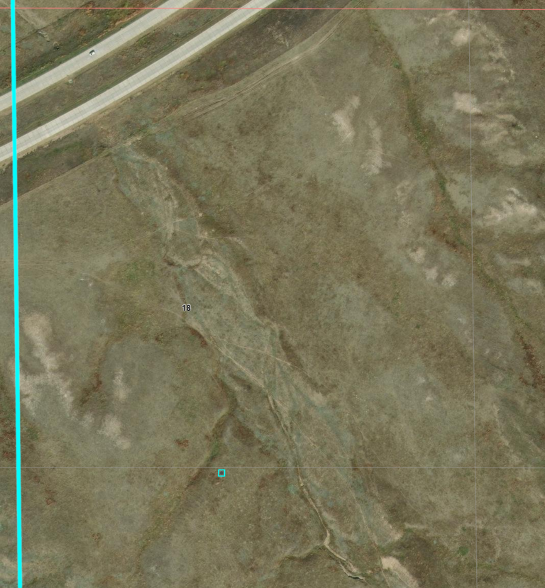
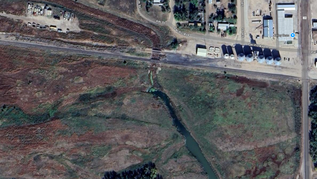
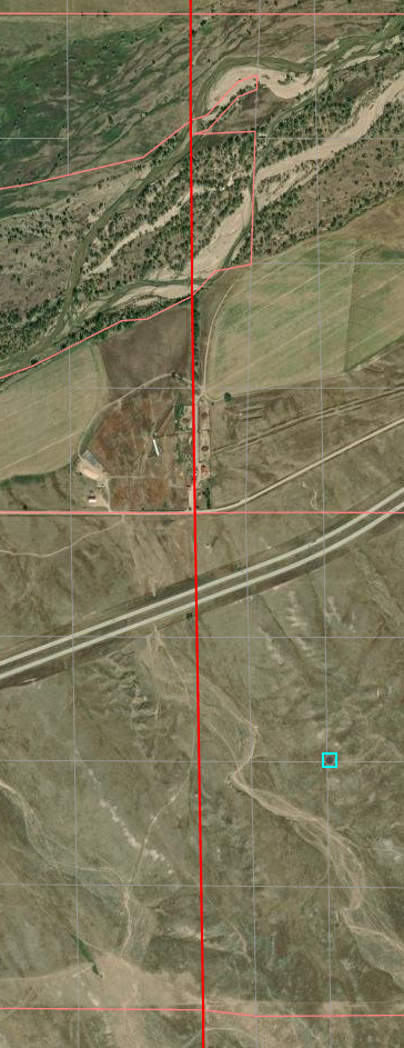
The gravel road to the right is called “Trail Road”; the South Platte River is to right among those trees
The South Platte Station site is just beyond trees to left- the first station of my journey.
I-80 to Cheyenne passes over and actually cuts off NE to the right just beyond the small speck of green signs up the road in the center
The South Platte River flows east. Travelling west is heading upstream.
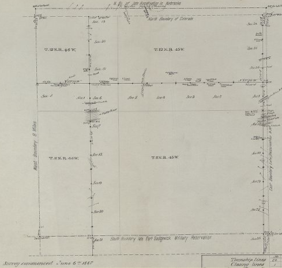
Station locations are given as Township/Range/Section/Quadrant/Sub-quadrant as well as lat/long.
Often the specific location is “best guess”.
The original trail was a military road to Fort Bridger in western Wyoming with the intent of avoiding the Oregon Trail to the north. The road was completed late 1858 and opened to both military and civilian use. By 1859, Denver’s Rocky Mountain News (one of my favorite newspapers until it died in 2009) was printing guides to the Overland Trail for travellers.
Indian attacks along the Oregon Trail and a gold rush near Denver caused Ben Holladay to change the route of the Central Overland, California and Pikes Peak Express Company south to follow the South Platte River gaining access to the growing business along Colorado’s Front Range towns, then north through Virginia Dale and along southern Wyoming to Fort Bridger and eventually Salt Lake City.
The trail was recognized by the army as one difficult due to lack of water, grass and fuel but improvements were made as the stage line expanded its facilities and the nation’s second telegraph line was constructed along the route.
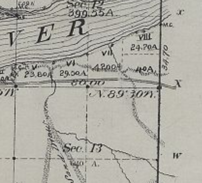
South Platte Station:
12N42WS07SENE
41.02317824562662, -102.14820513259885
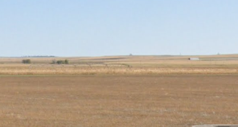
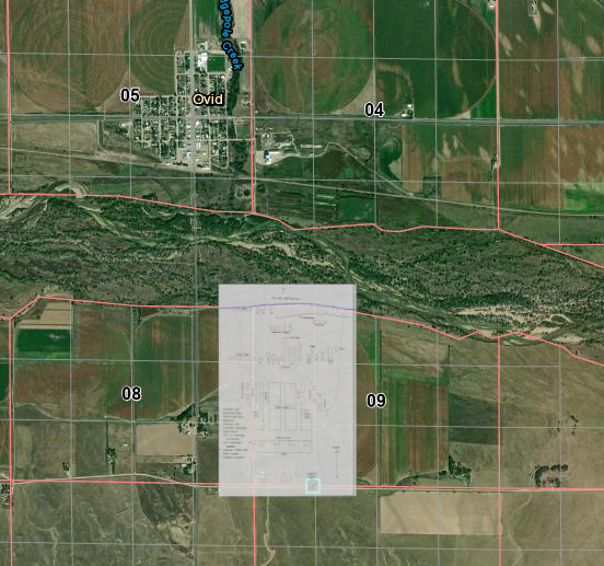
The last station in Nebraska following the South Platte River; less than 5 miles from the Colorado border.
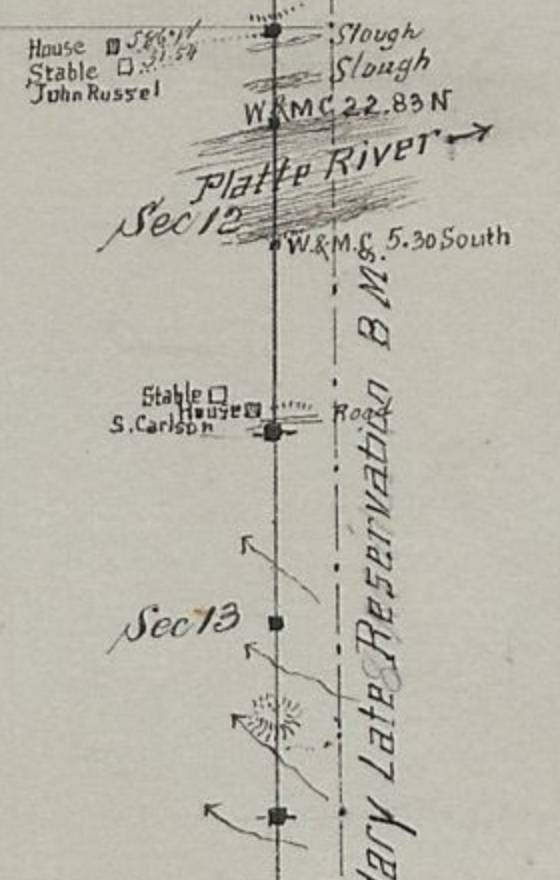
Comparing the 1871 maps to the later ones, the site has long since been plowed under and it was located near what is now the center pivot of an irrigation system – it is not surprising there are no remains.
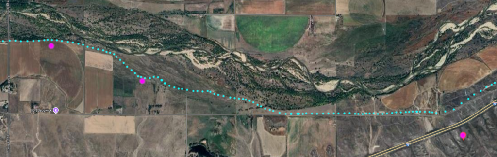
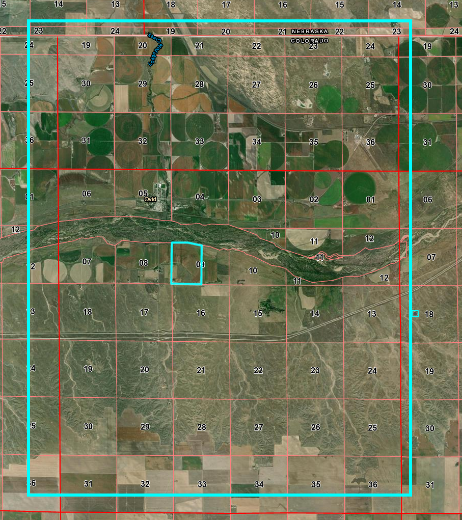
The modern map to the right shows the junction of I-76 cutting south towards Denver from I-80 heading towards Cheyenne.
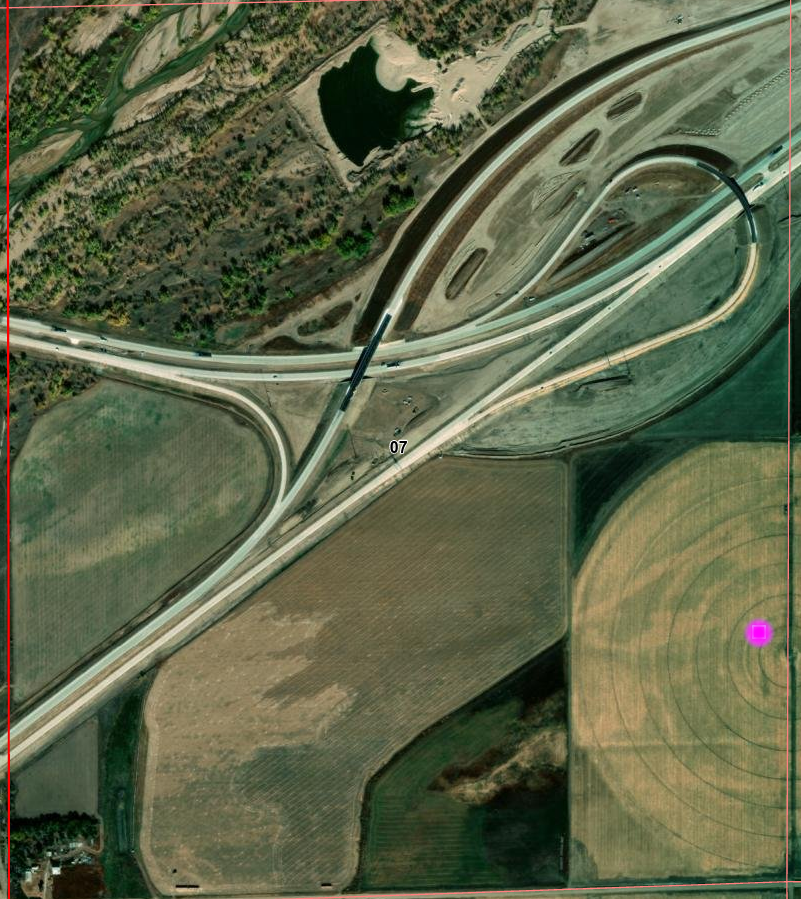
I-80 to Cheyenne/I-76 to Denver junction
station location indicated.
There is little to no information about this station. Aside from the obvious historical marker, it is only mentioned on some lists of Pony Express stations but not all, it is also mentioned in Frank Root’s memoirs – but neither provide any information other than its existence.
Being between Diamond Springs which was a major junction – splitting between the Oregon Trail and the South Platte trail – and Julesburg, itself a major division station, the South Platte station was most likely nothing more than a minor swing station constructed of sod and logs and placed for convenience. Much traffic passed this way as Julesburg – the next station west, was a major supply point for both those travellers headed along the Overland route and those who avoided Ash Hollow and used the Upper California Crossing to head back north to Ft Laramie and the original Oregon Trail after refreshing supplies.
There is a historical marker due north of the site along US138, north of the river and expressway
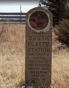
Highway marker at top; measured 1.5 mile south
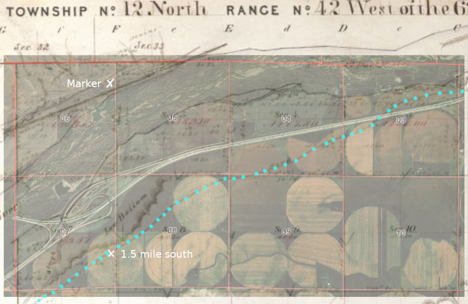
Stage road is south of I-80/I-76 here
each division is a section – 1 mile square
center of image; this side of small trees
(roughly 1/5 mile out)
Julesburg Station
and Fort Sedgwick
I no more than start the journey, than take a break …
Julesburg was such an important station with a complex history that it – along with nearby Ft Sedgwick – deserves a page dedicated to both these places.
First, many words about old Julesburg’s most famous resident …
Jack Slade
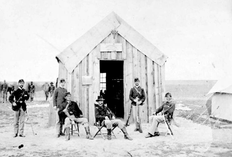
The infamous Jack Slade – perhaps with a reputation not fully deserved – was a division superintendent in the early days and a major part of the history of Julesburg.
“On the eve of the Civil War, on the sole street of Julesburg in the northeastern corner of what would become Colorado, two antagonists faced off for the first time. One was long-haired Jules Beni, the namesake hamlet’s hulking, swaggering French-Canadian boss. Old Jules was suspected of tampering with the mails and stealing horses from the Central Overland stagecoach line and its famous offshoot, the Pony Express. His younger, shorter opponent was the red-haired company agent who had arrived to replace him.“
Dan Rottenberg
One of the best-known desperadoes the West ever produced was Joseph A. Slade, agent of the Overland stage line on the central or mountain division, about 1860, and hence in charge of large responsibilities in a strip of country more than six hundred miles in extent, which possessed all the ingredients for trouble in plenty.
There was such magic in that name, SLADE! Day or night, now, I stood always ready to drop any subject in hand, to listen to something new about Slade and his ghastly exploits. Even before we got to Overland City, we had begun to hear about Slade and his “division” (for he was a “division-agent”) on the Overland; and from the hour we had left Overland City we had heard drivers and conductors talk about only three things — “Californy,” the Nevada silver mines, and this desperado Slade.
Mark Twain – Roughing It
I ended up writing so much about Jack Slade instead of the stage station, I added an addendum as a separate page.
Slade is also discussed along with the Virginia Dale station – named for his wife, Virginia.
For more on Jack Slade including the story told by his biographer, Dan Rottenberg, see this
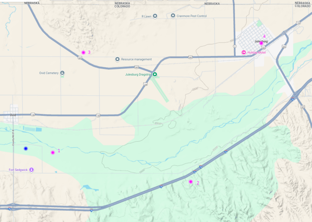
Julesburg Station (Julesburg 1)
11N45WS10 (based on historical marker)
40.94222411272488, -102.36182779279535
In 1856, U.S. Army Lieutenant Francis Bryan found an Indian trail on the south side of the South Platte River with an easily crossed ford to the north bank. With increasing travel westward, it was a place that allowed the avoidance of Ash Hollow where emigrants had a hard time traversing the 300 foot hill at a 25-degree angle.
Originally referred to as the Upper California Crossing (the lower crossing being about 20 miles downstream, just west of present-day Brule, Nebraska), Jules Beni set up a trading post on the south side of the river in about 1857. As traffic at the crossing increased and people began to settle around the trading post, some half-dozen buildings were built including the necessities – a saloon providing billiards and the “vilest of liquor at two bits a glass” as well as a restaurant.
Julesburg became a focal point for several trails – a crossing point to the Oregon and Bozeman trails to the north as well as the South Platte route to points west. Travellers would avoid the problems of Ash Hollow along the North Platte in Nebraska, swing south to Julesburg where supplies were often available, then cross the South Platte heading north to re-join the original California/Oregon Trail.
The settlement became the largest along the 350-mile stretch between Fort Kearny and the Pikes Peak gold diggings west of what was to become Denver. Seeing financial opportunities, Beni expanded his establishment to include a warehouse, blacksmith shop, and stable. The settlement became known as Julesburg after its proprietor. Julesburg was a gathering place for gamblers, horse thieves and desperadoes, all under the control of Jules Beni. Alone on the vast prairie, Julesburg was a wild town of of wild times, loose women, and the mining of travelers.
When the stage lines first came through in 1858, Julesburg was the natural place to establish a major station and in 1860, it became a home stop on the Pony Express. After the Pony Express failed in 1861, Ben Holladay made Julesburg a division station for the Overland Stage with Jules Beni the station agent.
Holladay tried to call the place Overland City but that name didn’t catch on. This was the first of four towns of the same name at four different places all within a few miles of each other. They are referred to as “Julesburg 1-4” for clarity even by local residents but the number was never included in the name.
The 1860 federal census was the first of the Nebraska Territory which included the area north of the 40th parallel (the present Nebraska/Kansas border) – extending west along a line just south of present-day Boulder, CO over to the Continental Divide. Within the Platte River district were counted only 173 residents with Julesburg being the largest settlement. There were 7 station keepers, 10 traders, 5 stage drivers, and 2 express riders but less than 10 families with children.
“At Julesburg – in early staging days one of the most important points along the Platte – were erected the largest buildings of the kind between Fort Kearney and Denver. They were built of cedar logs, hauled from near Cottonwood Springs by oxen, a distance of 105 miles.” By 1865, Old Julesburg had 12 buildings, including a station, telegraph office, blacksmith shop, warehouse and shed for coaches, stable, and a store for travellers. It was a home-stage station, the end of a Supervisory Division, and with a river crossing, the junction of the Oregon and Overland Trails. It also was the southern terminus of the Bozeman Trail.“
“From Old Julesburg a branch line went up the South Platte River to Denver. The coaches ran semi-weekly on a seven day schedule during summer, but weekly in the winter. Each stage could carry eight passengers; cost was $100 from Leavenworth to Denver, board included. The stage stopped every 10- 15 mi to change the four-mule-team or for the passengers to eat. The passengers had to sleep enroute.
The express charge for letters was 25 cents in addition to 3 cents U.S. postage, for newspapers 10 cents, and 20-40 cents a pound for express. When the branch line was established along the South Platte, route stations were built at frequent intervals (generally 12-15 mi apart) including stables capable of holding 2 four-mule teams. Ranches and trading posts also were established and housed the stage stock, drivers, and other employees.“
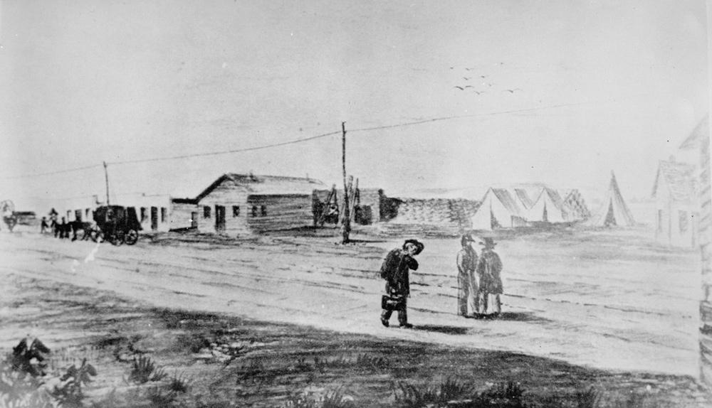
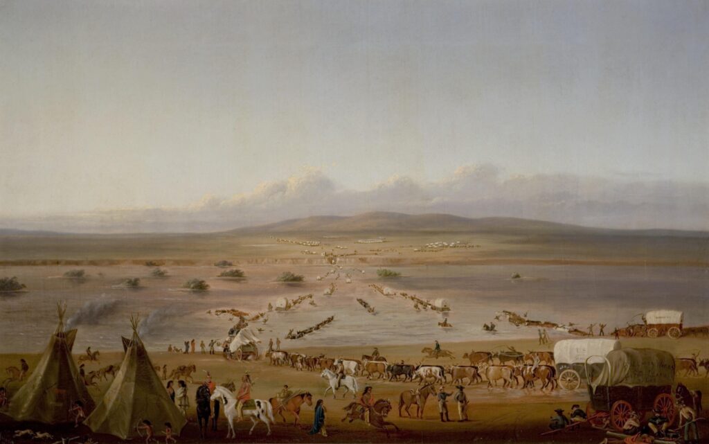
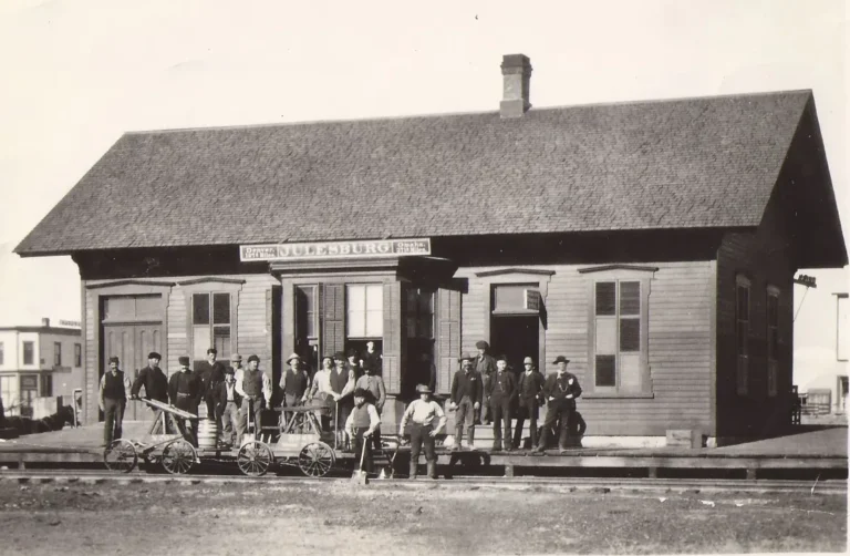
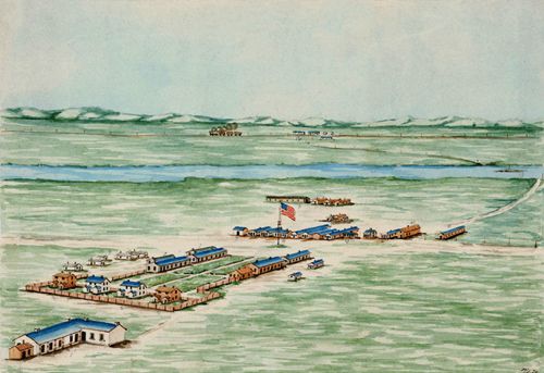
this sketch is the only known illustration.
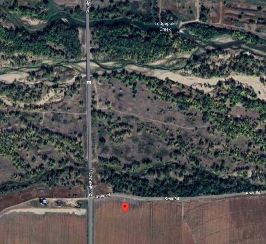
A stone monument was placed in 1931 near the site of the Old Julesburg stage station (1859) about one mile east of the mouth of Lodgepole Creek, on County Road 28 about three miles southeast of the present town.
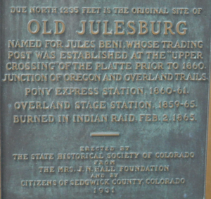
Historical marker on County Road 28
40.93882324995625, -102.36179969448717
11N45WS10
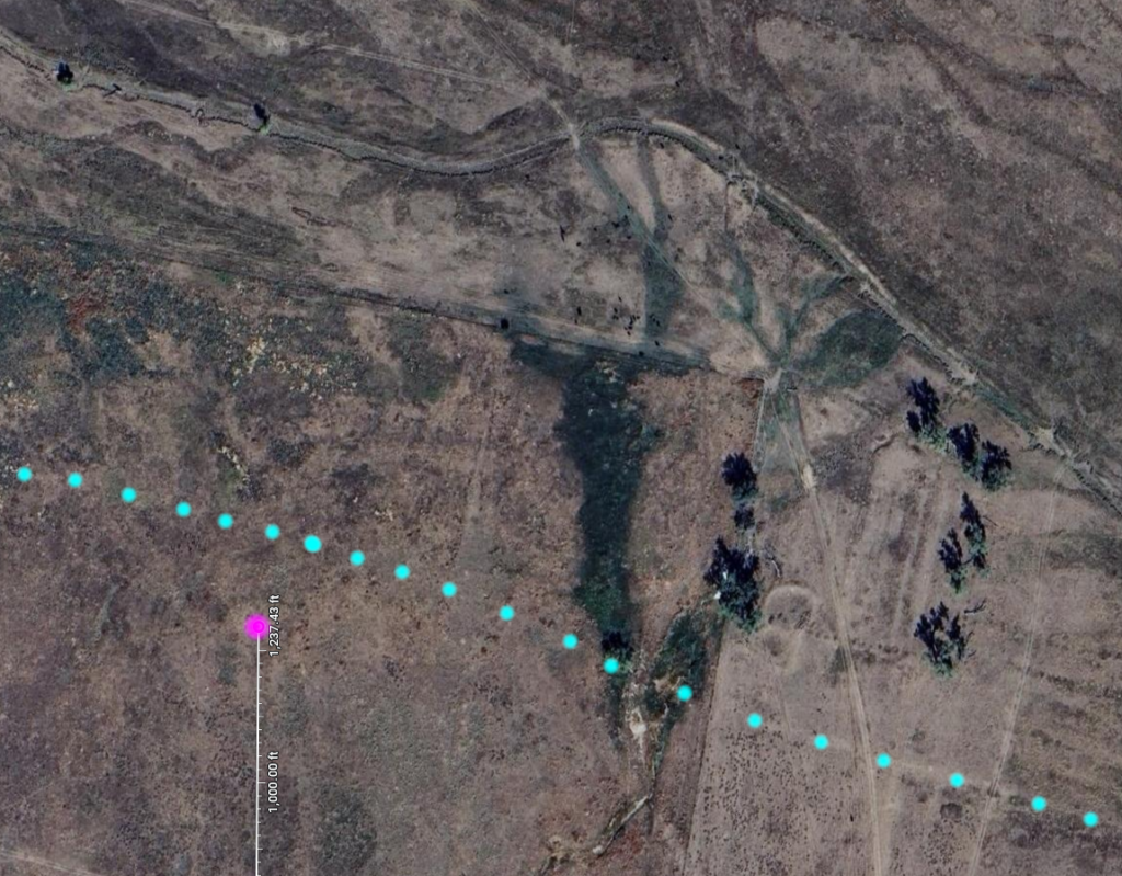
apparent traces of the stage road at approx location of old Julesburg
agrees with 1871 maps
This upper trace of the road extends 3/5 of a mile west and
becomes the modern “River Road” along which the fort was located
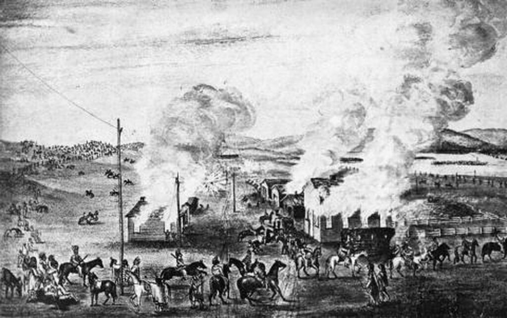
Between January and February of 1865, the Overland Trail was repeatedly attacked by Indians. They burned twelve ranches, destroyed 100 tons of hay, and attacked a large 20 team wagon train. Over 1000 Arapaho, Sioux, and Cheyenne attacked and destroyed all the buildings at Julesburg and took down the telegraph line all the way to Valley station. The burning of Julesburg station was the greatest financial loss of any station on the stage line. Holladay reported to Congress losses of $35,000 for buildings, $1500 for hay, $78,000 for 3500 sacks of corn, provisions for $2000, for a total of about $115,000.
1865, Jan. 7
At about 7: 00 A.M. 1, 500 Cheyenne, Sioux, and Arapaho Indians attacked Old Julesburg. They enticed the soldiers under Captain O’Brien out of Camp Rankin and killed 5 civilians and 15 soldiers of the 7th Iowa Cavalry, took over the stage station, destroyed the mail, and took $30,000 in money. All stations on the main line and every ranche except Moore’s Ranche on the road between Julesburg and Valley Station ultimately were burned.
1865, Feb. 2
Old Julesburg frame home station and eating house, warehouse and granary, dwellings, boarding house, express offices, blacksmith and repair shop, large barn, store, telegraph office, stable, corral and supplies were burned by 1, 500 to 2,500 Indians; a large quantity of supplies was taken; part of the telegraph line was torn down; and about 1,500 cattle were stolen between Old Julesburg and Washington Ranche. After the raid on Julesburg, the Indians departed northward along Lodgepole Creek, and destroyed the telegraph line as they went.
The town was rebuilt a few miles east of the fort (Julesburg 2) – outside the boundaries of the military reservation it is said, so that liquor and women could be sold to soldiers posted at the fort.
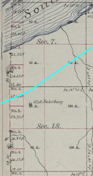
Julesburg 2
11N44WS18NE
40.93505740584426, -102.29900907030085
About a year after the destruction of the original Julesburg in February 1865, the town was rebuilt – but not on the original site. Moving three miles down river put the town outside the military reservation where whiskey could not be sold; the site of Julesburg 2 was on the edge but just outside the fort boundary. Soldiers could come and buy all the liquor and other pleasures they desired.
Julesburg 2 was planned to be a substantial town. Enthusiastic organizers, knowing the Union Pacific Railroad would be coming along soon, planned a town a mile long and half-mile wide with 13 streets running east-west and 13 streets running north-south.. They left a 58-foot wide path for the railroad tracks. Room was allowed for a county courthouse and, hoping to establish the state capital here, set aside a larger area for the state capital building thinking that if Julesburg would have the only railroad in Colorado at the time of statehood, it would become the capital (not considering the money was in the mountains west of fledgling Denver).
Dream big …
By July, 1866, it was reported the town had a two-story hotel nearly completed, a store, and a billiard room. There were also three ford crossings on the river and later a ferry.
However, by 1867, Julesburg 2 was still only a little town of three completed buildings, all rude frame shanties, by the time the railroad end-of-track reached what would become the third Julesburg on the north side of the river. After the railroad arrived, the entire town was packed up, moved across the river, and located next to the rails (Julesburg 3). The not-for-long remnants of second Julesburg served as a station for wagon trains even after third Julesburg was established. Nothing now remains, not even foundations.
1866, Feb. 7
Second Julesburg was laid out about a year after Old Julesburg was burned. on February 2, 1865. Second Julesburg was established just east of the boundary of Fort Sedgwick (in order that whiskey could be sold to the soldiers) and 2 mi east of Old Julesburg. The town extended 1 mi along the river, was 1/2 mi-wide, and had 150 people and 50 houses at its maximum. In February 1866, Second Julesburg contained “one frame store, one frame house, one log house for a blacksmith shop (last two not completed yet) and 2 houses· now lived in by settlers.“
The stage road is indicated on these maps.
The pinpoint location suggested on the 1873 map below would only represent part of the city, being planned out as a full half-section. The trail ran about ½ mile to the north which might suggest the actual location of the structures in town – such as it was – might lie under I-76.
Trail inside the formal military reservation boundary
Showing Julesburg 2 with I-76 in CYN
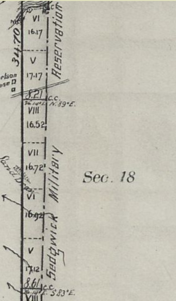
Detail of the reservation boundary showing the stage road
11N44WS18
the RED square is 1 mile on a side – one full section
The town was platted as ½ x 1 mile in size
Fort Sedgwick eastern boundary in CYN
I-76 diagonally across top
Locations of Ft Sedgwick, Julesburg 1 and Julesburg 2
Overland Route in CYN dots; I-76 cuts diagonally across the right bottom
Ft Sedgwick historical marker in PUR to left
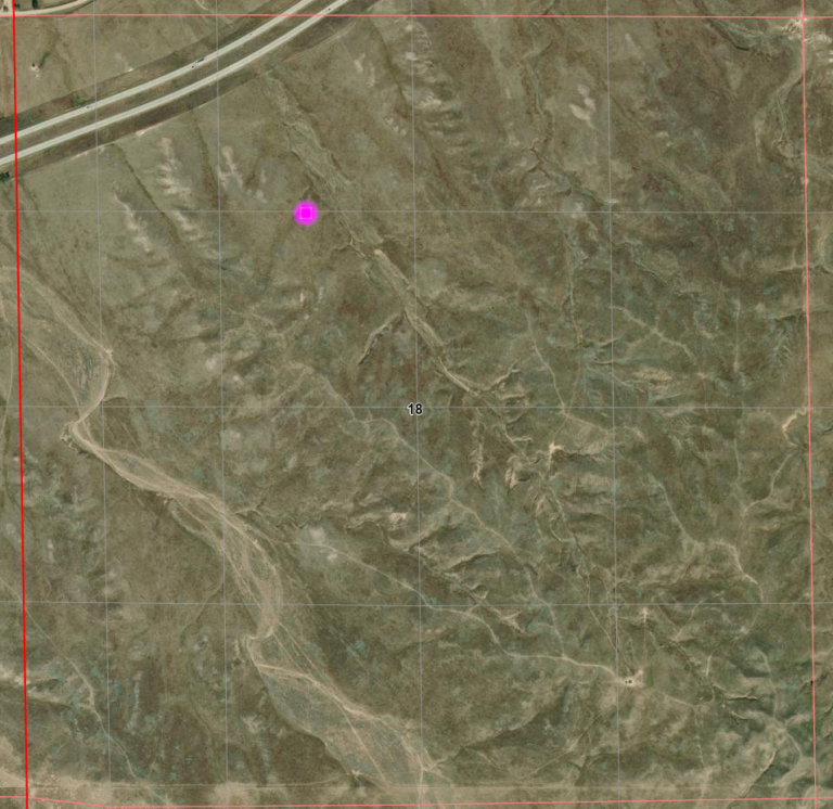
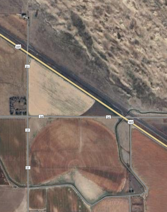
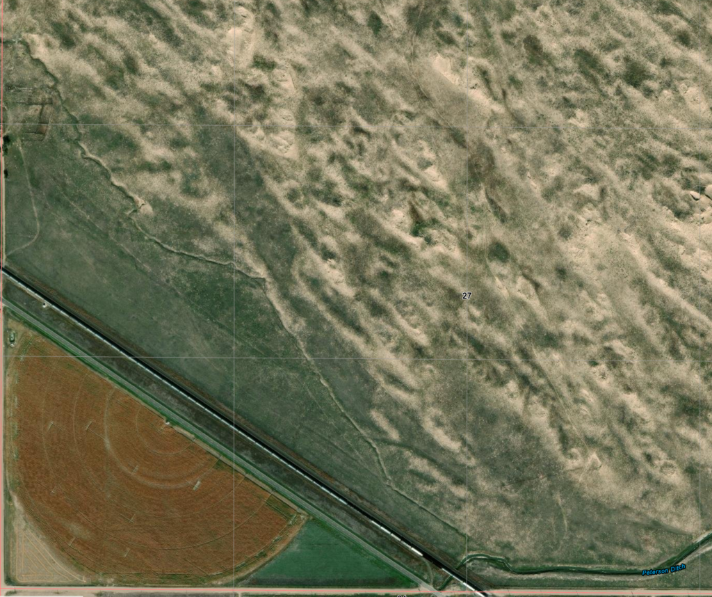
Julesburg 3
12N45wS27SW
40.986128264622636, -102.36038787229205
Opportunity opened a door when the railroad arrived in June 1867. Even though on the north side of the river, the Overland Stage had been taken over by Wells-Fargo, stage traffic was dying with the advance of the railroad, and money was to be made at end-of-track. Julesburg 2 was packed up and re-located next to the rails to become Julesburg 3. The new Julesburg started out with forty men and one woman, all living in four tents, with an eating house under construction.
Being at end-of-track, it only took a few weeks until the town grew to several thousand inhabitants with over 1000 buildings – mostly dedicated to the “various joys of life” but including a large warehouse and telegraph office operated by Wells-Fargo. Railroad men, soldiers, gamblers, “painted ladies”, and other odds and ends of various people, all contributed to a growing reputation as the “wickedest town of the west“. Saloons, gambling houses, and “prostitution parlors” were thriving businesses prompting both men and women to go about fully armed.
As end-of-track moved on, it was inevitable that those businesses serving the needs of the construction workers and their friends moved on as well. The town slowly faded from its bawdy days but remained an important shipping point – under the new name of Weir – until those needs also faded away and Weir became first simply a siding on the railroad and finally no more than a name on a map; nothing remains at the location once considered “the wickedest town in the west” to suggest it ever existed there.
Julesburg III – 1866
40.986128264622636, -102.36038787229205
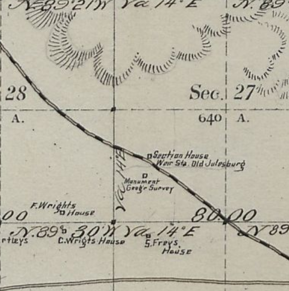
This map – from 1884 – indicates that “old Julesburg” was located at a railroad section house even now labelled as “Weir”
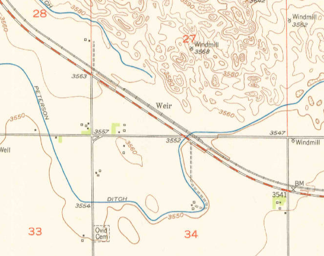
once a town of 5000 people and 1000 buildings
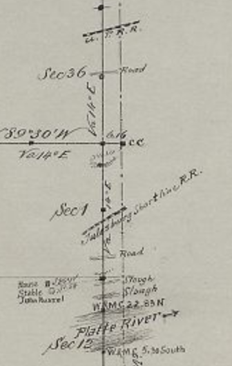
On an 1872 map of the boundaries of the Fort Sedgwick reservation, there are two railroads indicated: the UPRR and the Julesburg Shortline RR. The Julesburg Shortline is indicated on both sides of T11NR45W at sections 1 and 6. There is no information in between; it is simply a map of the boundary. I’ve found no information about such a railroad as the Julesburg Shortline, but as this is an official map, I doubt it was made up by the artist.
There is also an 1872 sketch showing the general layout of Ft Sedgwick shortly after de-commissioning which indicates a “Julesburg” along the UPRR which is in the same location as the “Julesburg Shortline” on the east side of Lodgepole Creek. This sketch also indicates “Old Julesburg” which corresponds to Julesburg 1.
Perhaps there was a small, short-lived station to service the fort which was informally known as Julesburg. The indicated tank is where the town of Ovid formed towards the turn of the century on the north bank of the South Platte just above what is labeled here as Crow Creek.
Mysteries abound …

The fort was active between 1864 and 1871; Old Julesburg was destroyed in 1865
A railroad – also UPRR – still exists in this location.
The town is Ovid
Julesburg 4
12N44WS28
40.98616186495653, -102.26197247320312
To complete the story – well after the time of stagecoaches – the Union Pacific Railroad built a branch line to Denver in 1881 a few miles east of Julesburg 3 and named the facilities Denver Junction. Julesburg 3 had been fading away and renamed Weir, most residents moved to Denver Junction. This lasted for a few years but another town with the same name was creating problems for mail sorting and delivery.
So the Post Office requested an increase in postage, new facilities, and additional funding for labor-saving devices.
No they didn’t, but the Post office did request a name change.
this station was replaced in 1930
This Denver Junction not being the first to use the name, a new name was needed. Local sentiment was in favor of maintaining the connection to Jules Beni – residents of Julesburg 3 outnumbering those of Denver Junction -so the town was incorporated in summer 1886 as yet another Julesburg, this – the present town – being Julesburg 4.
Fort Sedgwick
11N45WS09SWNW
40.946544281063574, -102.38122158380403 – approx location of flagpole
Camp Rankin, then Fort Rankin, then better known Fort Sedgwick – was located near the stage station at Julesburg 1. It has been said that Ft Sedgwick was the inspiration for the abandoned fort in Dances With Wolves although the movie presentation does not reflect the reality of the actual fort – though perhaps the early days of Camp Rankin would be a better representation.
Camp Rankin was established in 1864 with a few sod huts about 1 mile from the Julesburg stage station in order to provide protection to the US Mail and telegraph lines as Indian raids became increasingly common. Both the fort and settlement were attacked in January 1865; several soldiers were killed and the town looted.
A small band of Cheyenne attacked a stage coach and wagon train in early January, 1865. When news of the raid reached the camp, 37 troopers were sent in pursuit. The Indians pulled back into the hills and the soldiers followed. Oops! Suddenly finding themselves almost surrounded by over 1,000 warriors, the soldiers managed to fight their way back to the camp and regrouped, using two cannon to keep the Indians away. Meanwhile, some of the Indians moved into Julesburg, looting the town. By the end, five civilians and fifteen soldiers were killed.
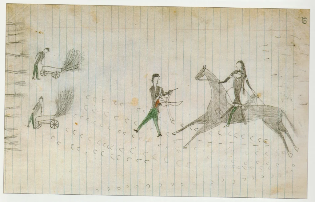
a wounded soldier trying to escape
In February, the Indians attacked again; they failed against the fort but this time, the settlement was totally destroyed. By 1866 – after the destruction of the original Julesburg – the camp had turned into a full-fledged military installation.
Various documents from the time indicate a lifestyle of boredom and terror led to a life at the post of a “saga of fraud and corruption, bravery and daring-do…triumph and tragedy…where conditions were considered unlivable, pleasures were few and the nearest bath was the South Platte River“.
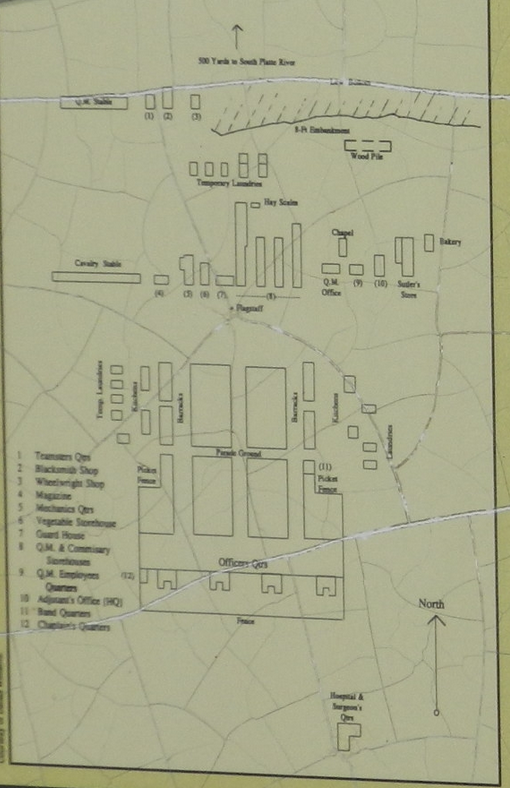
The fort was inspected in September 1866. The report stated:
“The general character of post buildings was found to be bad, and is believed to be a fruitful source of discontent, desertions. One post inspected had lost 25 men by desertion in one month, with their cavalry horses, accoutrements, Spencer carbines, complete, and many instances of this kind were reported to me. In fact, no humane farmer east would think of sheltering his horses or cattle in such uncomfortable and wretched structures, huts, willow-hurdles, adobe shanties, as compose many of our posts in the new States and Territories now“
The cost of wood was between $75 and $100 per cord at Fort Sedgwick, where there is not a tree for 50 miles .
The post was abandoned in May 1871 and the buildings were dismantled. The soldiers at the cemetery were reburied at the Fort McPherson Natl Cemetery in Nebraska.
The “Julesburg” on the railroad is now known as Ovid
The present town of Julesburg is about 7 miles east of the “Julesburg” shown here
The fort was active between 1864 and 1871 – there is no record of a “Julesburg” being at the upper location noted
County Rd 28 – from 385 just off I-76 at modern Julesburg is a close approximation of the trail from Julesburg 4 to the Sedgwick site (now an irrigated field). The stage road on the above map is about ½ mile north of Rd28 at the road into Ovid.
encompassing almost all of T11NR45W, all of T12NR45W in Colorado,
extending about ¼ section west and north slightly into Nebraska
The military boundaries of Ft Sedgwick measured 7 miles by 8 miles, taking the almost the entirety of T11NR45W and T12N45W (½ mile above the lower sections) with a mild extension into R44W and ½ mile into R46W. This had a bearing on where Julesburg 2 was located – to be “off the reservation”. I-76 runs E/W through the middle of the former military reservation with the fort itself being located roughly 1.5 mile north of the expressway.
A comparison to older maps indicates that “River Road” is likely the old trail
Ruins of Ft Sedgwick appear on maps as late as 1887
Present day County Road 28 passes through the building (hospital) at lower left
40.93899605297376, -102.37856490730093
looking out over the grounds of Ft Sedgwick to the right of the trail.
The stables would have been front center; the river is in the trees
The four Julesburgs
map is about 7 miles EW and 3 miles NS
Next: The journey resumes …