Coming south down off Bridger Pass, the stage comes to Muddy Creek and heads west for a bit following the creek. The modern road across the pass closely follows the stage route but diverges a bit as the road comes to Muddy Creek. Turning off Bridger Pass Road, the stage road follows the north bank of Muddy Creek to the crossing near Sulpher Springs station.
Detailed Map: Bridger Pass to Duck Lake
Large file; high resolution – will load in separate window
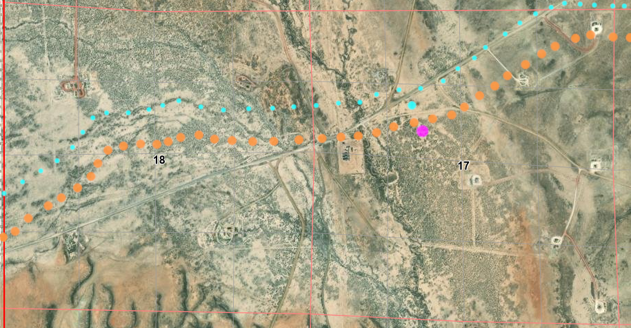
ORG dots are traces from 1870s surveys; PUR dots are traces from 1970s maps
PUR dots overlay ORG dots where trails coincide
“Now” road and stage road
Unfortunately, access to this section is closed off.
Unknown Grave
17N90WS02SWSW
41.470472149979265, -107.50546431236958
According to USGS topo maps as recently as 1983, there is a grave alongside the Muddy Creek road. I’ve found no information of who, what, or when … and the grave site no longer shows up on the later maps – and is not located on the oldest maps (nor are other graves with one exception). The location is highlighted on the detailed map of this section.

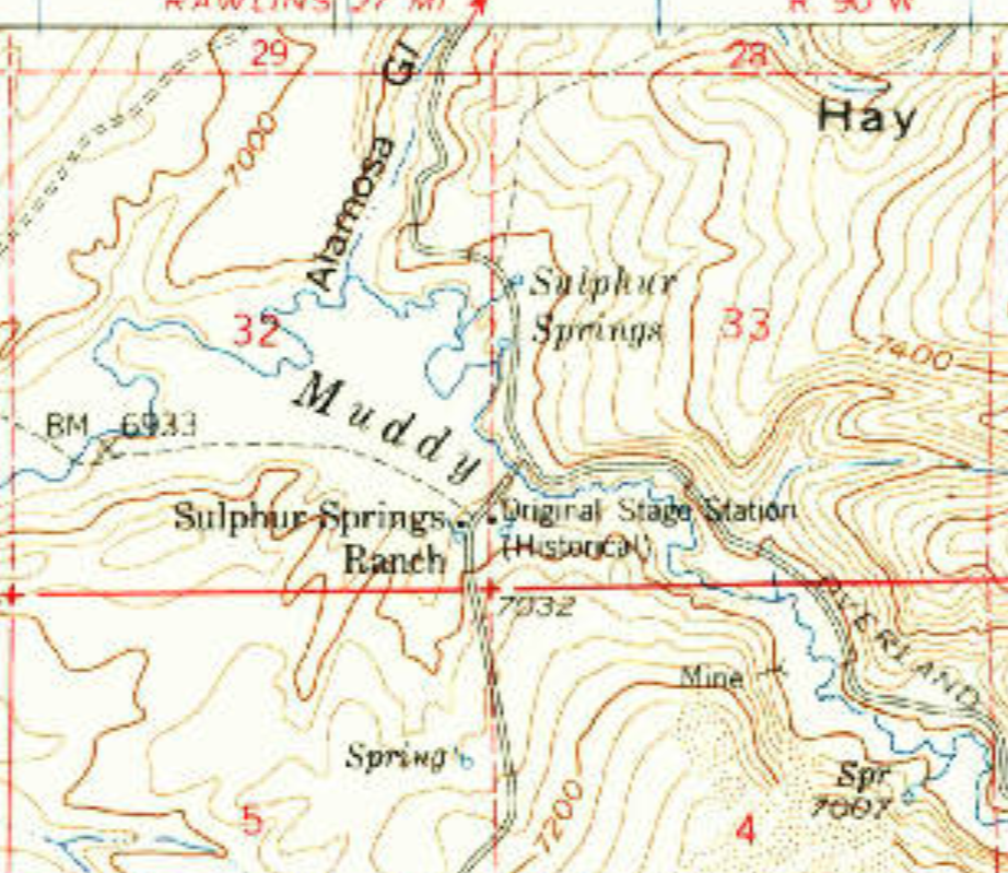
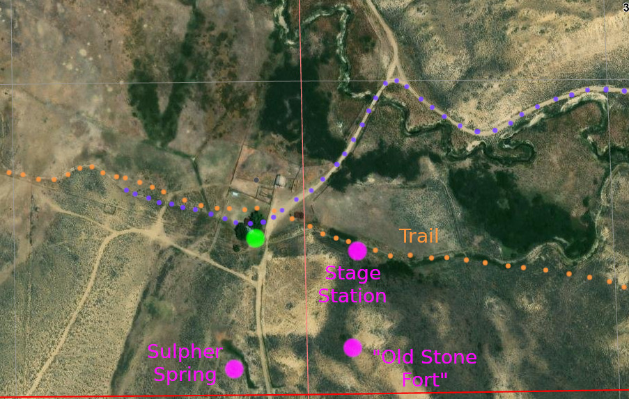
Sulphur Springs Station
18N90WS32SWSW 1884
41.48616189611912, -107.54788036091902
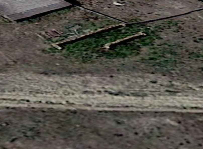
Locked gates prevent access to the Sulphur Springs home station, which is located on private land.
The most defensible station between the North Platte crossing and LaClede was the Sulphur Springs Station. Named for nearby springs which smelled of sulphur, the station itself was built of logs a bit south of Muddy Creek. The station was attacked several times between 1863 and 1865, but the Indians were only able to steal the livestock without breaching the station’s defenses. It helped that troops from the First Kansas Volunteers and the 11th Ohio Cavalry provided lookouts atop the knoll behind the station night and day. Old maps (1870s – past time of Overland Stage) note an “old stone fort” at the site
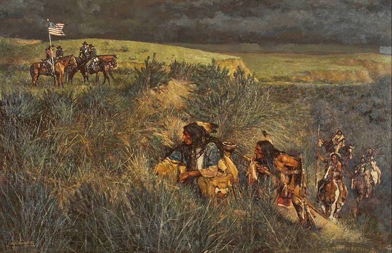
After Jack Slade was fired from the Overland company, Robert Spotswood, Slade’s replacement as the new Division Agent, personally hauled mail in an army wagon in June 1865 east from Sulphur Springs to Fort Halleck. The danger of attack was high enough that he decided to hold the mail back for a week at Virginia Dale and Sulphur Springs stations; the stage employees gathering at these two defensible locations. Many stations were destroyed and abandoned during this time, but the Virginia Dale and Sulphur Springs stations survived.
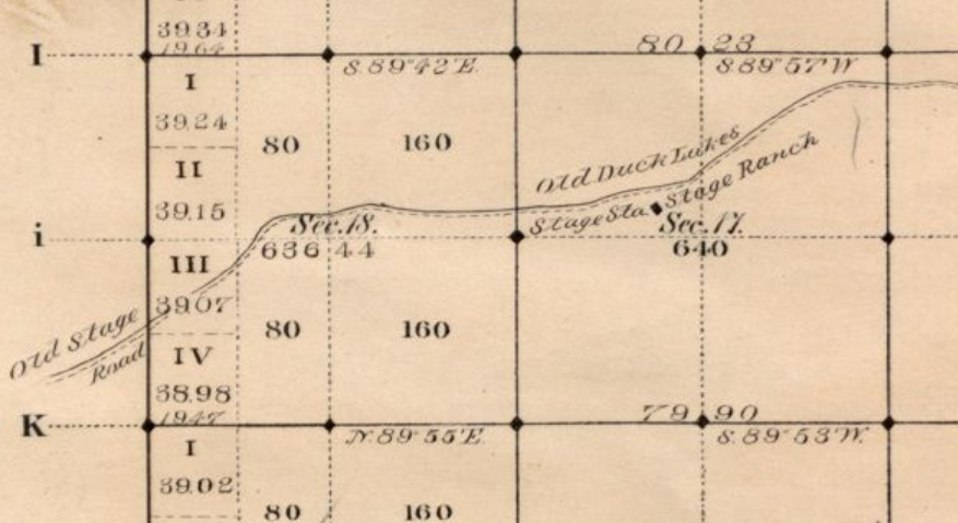
MAG/ORG – 1870s map
GRN/PUR – 1983 map
While the location on modern maps agrees with the 1883 maps, it would appear Muddy Creek has shifted a bit north over years. The old maps show the crossing of Muddy Creek to be a bit east of the site indicated on the newer maps although the trail stays along the north bank before crossing. This is still an active ranch and there is enough evidence of activity west of the Sulphur Springs station that is difficult to determine if the stage road even still exists – but it is likely that the original road follows one of the many paths that show on the aerial views, particularly one that seems to line up with the old map.
If so – it’s close to the proper place – those would be traces of Overland Road in front
Beginning in 17N91WS01, there is a trail that does agree with the old maps – but again, the modern path of Muddy Creek has changed. It would take some careful work to follow the correct path on the ground.
The faint upper diagonal trace more closely follows the old map than does the more prominent road
A section of Muddy Creek appears on the left
Leaving Sulphur Springs, the Overland Road enters into harsh land of the Bitter Creek country:
“One bullwacker, crossing this area many times during the 1860’s wrote of his experiences in Bitter Creek Country saying that it was ‘the horror of overland teamsters, where all possible ill of western travel are united.” All the drivers of the Overland Stage line along this route spoke of it in anything but pleasant terms. For sixty miles on Bitter Creek, the soil “is a mass of clay or sand and alkali–a horrible and irreclaimable desert!” At an average elevation of over 7000 feet, “the tropic heat of the day was succeeded by the arctic cold after sundown with amazing suddenness.“
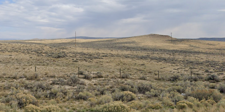
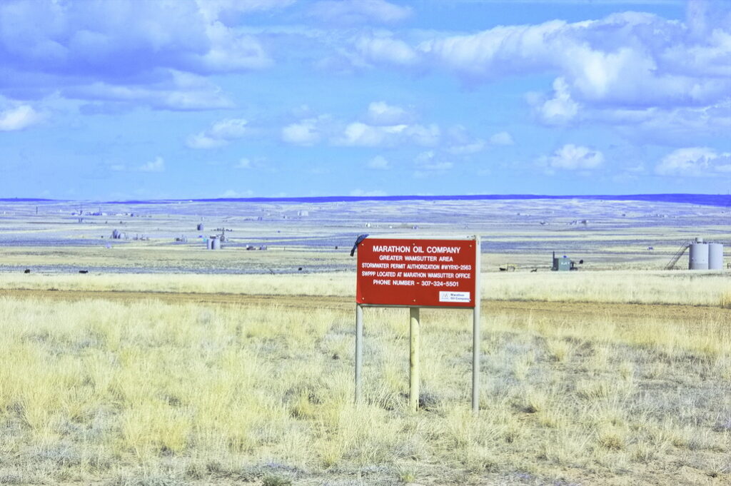
From the Sulphur Springs Station, the road continued along the north bank of Muddy Creek until coming to Washakie Station. There are still no settlements in this region; only scattered ranches and occasional transient mining and oil/gas extraction sites. A pretty good region for “adventures” and not much else.
So – there I explore …
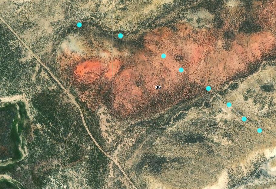
Washakie Station
17N92WS06NESW
41.48018487088328, -107.69306090636948
The Washakie swing station was located along Muddy Creek about 3-4 miles east of the trail crossing at WY789. A foundation and some lower walls of one building remain. Many miles of relatively intact Overland Trail remains run in both directions from the Washakie Station, but, like the Sage Creek site, the entire section between WY789 east to Sulpher Springs is closed off to public access.
At one time, the stationmaster here set up quaker cannon using stovepipe with a big “US” painted on the sides to thwart Indian attacks. There were two companies of the 11th Kansas cavalry headquartered here to protect the trail to Fort Bridger with between five and fifteen soldiers posted to the stations at Duck Lake, Dug Springs, LaClede, Big Pond, Black Butte, Almond, Salt Wells, and Rock Springs. During this time the stages only ran 3 times a week.
CYN dots agree with 1870s map
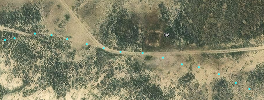
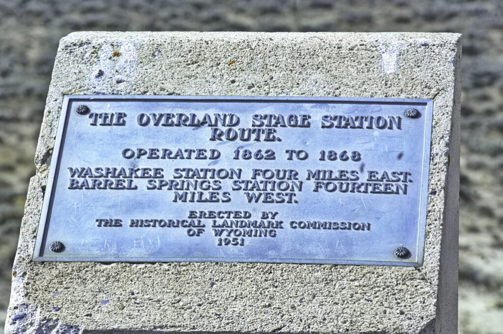
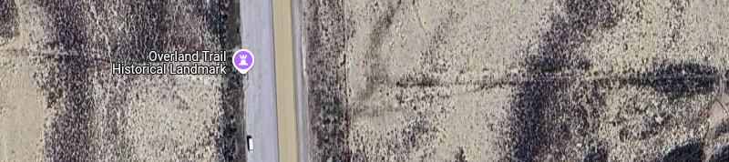
A historic marker turnout is located along Highway 789 at the Overland Trail crossing west of Washakie Station. The station is about two miles east of WY789 and 20 miles south of I-80 at the Creston Junction exit.
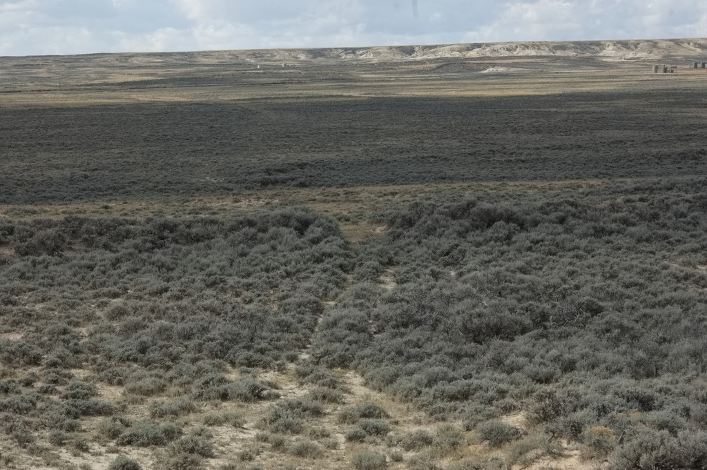
The trail is discernible on aerial photos dead center on this photo
not so much on the ground
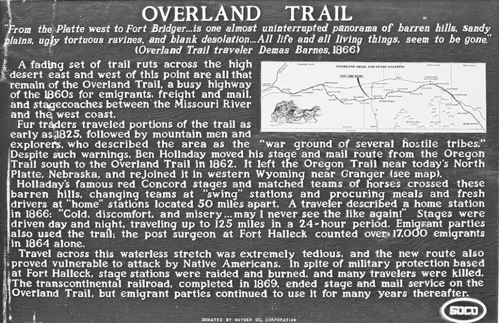
“From the Platte west to Fort Bridger … is one almost uninterrupted panorama of barren hills, sandy plains, ugly tortuous ravines, and blank desolation … All life and all living things, seem to be gone.“
“Cold, discomfort, and misery … may I never see the like again!“
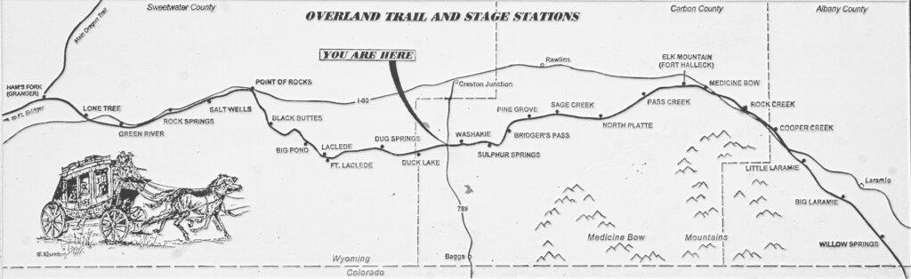
Duck Lake Station
17N93WS17NWSE
41.44961847475085, -107.90234450375816
Nothing remains of this station.
The site of Duck Lake Station is about thirteen miles west of Washakie. In its time, Duck Lake was a basic one-room swing station. There is no readily available information about this site beyond its existence. Even the evidence of the following image no longer exists.
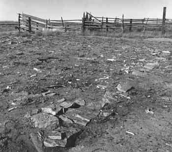
Not even this much left now

The Duck Lake swing station was destroyed by well field construction. No trace of this station remains.
Looking at the old vs new map, a trace on the left side of the new seems to match the old. Given the old survey township/range boundaries are fairly accurate but the interior details may not be so much so, I shifted the older map a bit to line up the trace and repeated tracing the old trail in CYN with the following result.
Old wagon ruts can become paths for water and may now appear more as water traces than old roads.
Were the old surveys “off”? The warp in the RED line at top is the result of a survey correction.
Or was the trace dotted with CYN a water trace of old that the trail followed?
The ORG dots and MAG station location are mapped with the old and new township/range boundaries superimposed.
I suspect the ORG dots should be shifted north … but they are traced from the 1870s map with aligned township/range boundaries
In any case, all surface signs have since been obliterated by oil field activity
Next stop is Dug Springs …