Detailed map: Fort Bridger to Quaking Aspen
Detailed map: Quaking Aspen to Castle Rock
Detailed map: Castle Rock to Weber Station
The maps are large files and high resolution; they take time to load but in a separate window.
This is the last page of my Overland Stage story.
The region between Muddy Creek Station through Piedmont to Bear River may be accessed from I-80 via Exit 24 (Leroy/Piedmont Rd/WY173) from the east or Exit 5 (Evanston/WY15) from the west. Exit 3 (Overhurst Rd/I80BR) heading S will turn into Yellow Creek Rd which passes near the Needles Station.
The ease of mapping the actual route becomes more difficult west of Ft Bridger. All the major trails: Mormon, California, Pony Express, Overland, UPRR – excepting the Oregon Trail – passed by here; all using slightly different paths. The California Trail – the original Overland Route along the Sweetwater River to the north before the route was moved south – joined with the newer Overland Trail just east of Granger; modern maps stopped indicating “Overland Trail”; they all became “Emigrant Trail”. There are several different emigrant trails converging around Ft Bridger, yet they often disagree with the 1870s maps – probably as the area was surveyed after the railroad arrived and the region became “developed”.
The Pony Express did not use “roads” although these trails were “developed” from use. The Overland Stage did use roads and improved the existing trails where necessary as well as converting the Pony Express stations for their own use (Holladay bought the eastern side of the Pony Express company to Salt Lake City). After the railroad first came through in 1867, the major “town” (perhaps 20 houses) was Piedmont – a coaling and supply station – and the trails now followed the RR. The old maps weren’t surveyed until after the railroad was complete. The railroad re-aligned its rails early in the 20th century leaving Piedmont high and dry, but Piedmont remained the town of the area for a while. Not much left of it now. The presence of many roads now in the area emphasize that change and “modern” use.
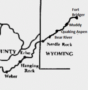
Leaving Fort Bridger, the Pony Express/Overland Stage route-trail runs south of Bridger Butte along the old Mormon Trail. It then climbed to the top Bigelow Bench, past Bigelow Springs, then crossed the bench until it reached Gravel Hill.
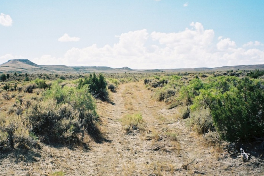
top of Bigelow Bench
Richard Burton journal:
August 23, 1860: 8:30 am to 12:15 pm: 25 miles: Road runs up the valley of Black ‘s Fork . After 12 miles, Fort Bridger, in N . lat.41°18 ‘ 12”, and W . long. 110° 32’ 23”, on Black ‘s Fork of Green River. Commands Indian trade, fuel, corn ; little grass. Post – office, sutler’s store, grocery, and other conveniences. Thence rough and rolling ground to Muddy Creek Hill ; steep and stony descent. Over a fertile bottom to Big Muddy and Little Muddy Creek, which empties into Black ‘s Fork below Fort Bridger . At Muddy Creek Station there is a Canadian, provisions, excellent milk ; no stores
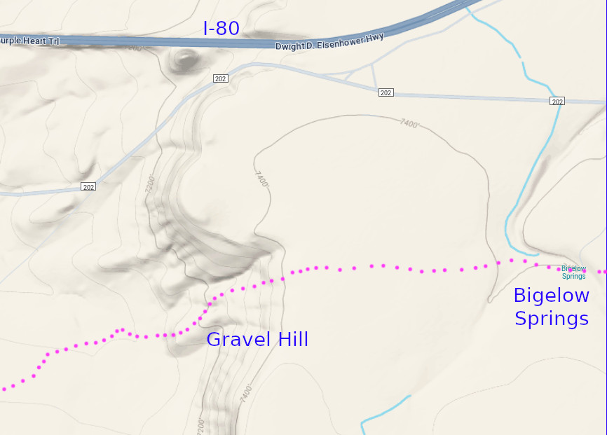
The descent from “Gravel Hill” was one of the steepest and most difficult on the trail; on par with the Devils Washboard grade in Colorado. Richard Burton in his memoirs, “The Look of the West, 1860“, about his trip to California by stage, described “Gravel Hill” as a “descent that appears little removed from an angle of 35 degrees, and suggests the propriety of walking down”.
A small stream known as Musselman Creek runs along the base of “Gravel Hill” where a blacksmith shop was established to repair any damage caused by the descent. Nothing is mentioned about any damage occurring on the ascent. Remnants of the blacksmith shop are not readily apparent.
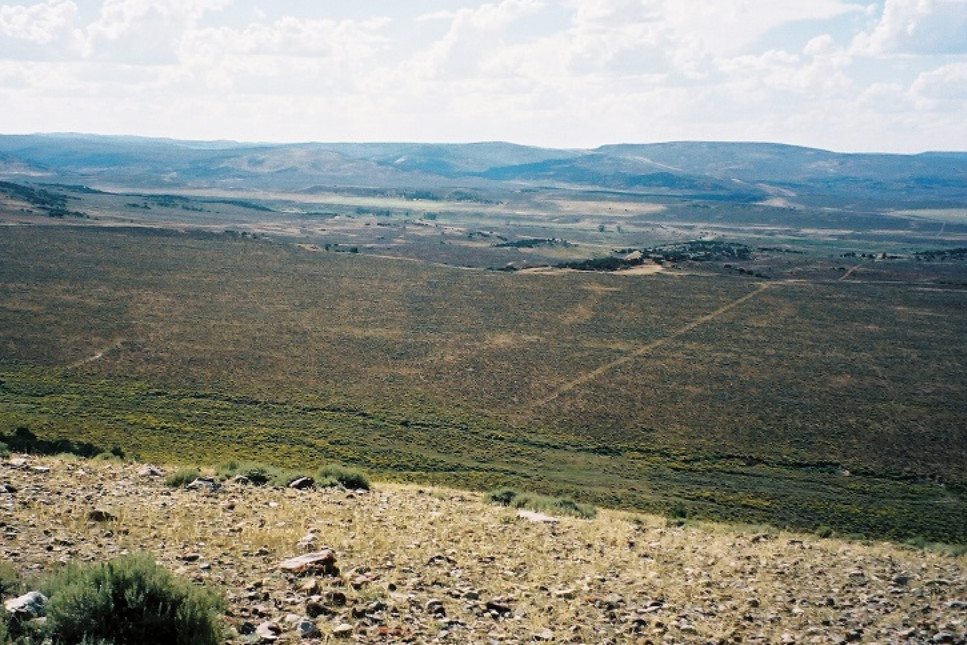
From “Gravel Hill” the trail continued another two miles or so to Muddy Creek Station.
Muddy Creek Station
15N117WS15SWSW
41.27370768471203, -110.60225268343348
Muddy Creek Station was the first station west of Fort Bridger. Originally a Pony Express station, the station keeper was Moses Byrne who not only built Muddy Creek Station but also had a hand in building all the Pony Express and Overland Stage stations between Almond and the Utah border.
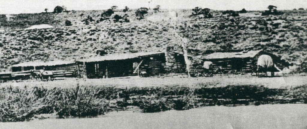
Byrne remained the station keeper at Muddy Creek; he built a toll bridge across the creek and traded horses with travellers until 1868 when the operation was turned over to his brother-in-law, Charles Guild. The Guild family still owns the property where the station stood.
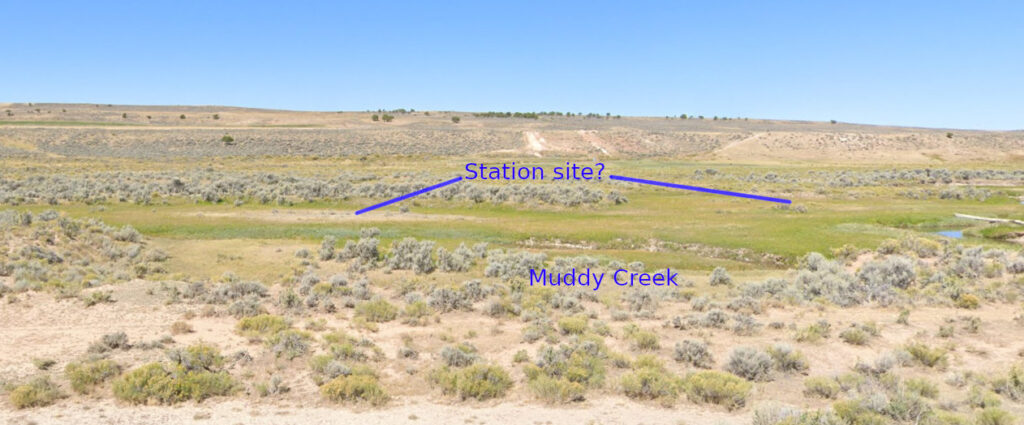
1866 photo appears to show station further back towards rise in background
and creek further back as well
The site is immediately west of what is now Piedmont Rd (WY173) – which was not the Overland Route.
A Mormon traveller, Joel Johnson, wrote on Sept. 27, 1860: “Started before breakfast, traveld about 8 or 9 miles to the Station on the Muddy near some Springs where we campt for the balance of the day and night, at this place we buried Sister Bennett an aged saint from England who died the day before.“
This was before the Overland Stage when Muddy Creek was a station on the Pony Express and along the Mormon Trail.
Catherine Bennett
15N117WS16SESE
41.27239260426101, -110.60483929636503 grave
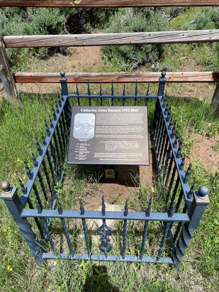
Catherine Jones Bennett was Mormon convert immigrating from her home in Wales to Salt Lake City. She died of unknown causes on Sept 26, 1860 aged 67 along the Mormon Trail at Muddy Creek. Her grave was unknown for over a century; it was finally discovered and marked in 1998 several hundred feet from the Muddy Creek Station site.


As a point of possible interest, Spring Valley Cemetery is located at 41.25306626810925, -110.67823205146442
Some records *suggest* this might be along one of the many trails in the area of the 1850s/1870s era. I have no information but it is marked on the detailed map <Fort Bridger to Quaking Aspen>. It appears there are publicly-accessible roads to the site; I have not confirmed this myself.
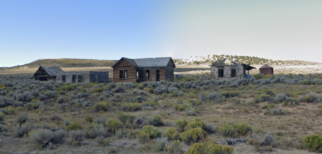
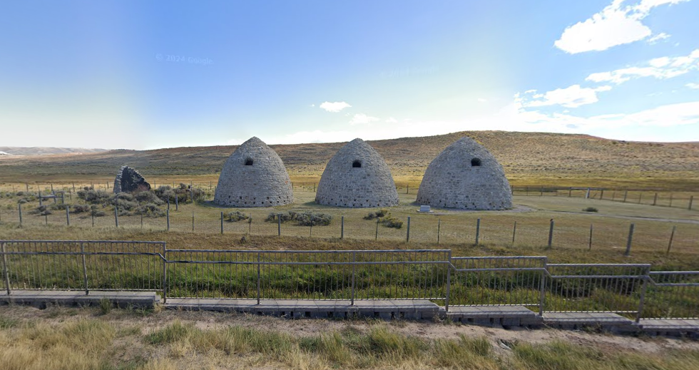
A bit south of the Muddy Creek Station is the ghost-town of Piedmont. Piedmont was a railroad town established in 1868 and began as a “Hell on Wheels” tent city. Moses Byrne of Muddy Creek Station built a house and five charcoal kilns used to produce charcoal. This charcoal was used in smelters across the west. Each kiln processed 20 cords at a time and the kilns were fired 3 times per month. The wood used to produce the charcoal was transported by canals built in the area from the Uintah Mountains 20 miles away.
Due to its location with plenty of water, timber, and coal, Piedmont became a “helper” station – supporting locomotives intended to help trains over the nearby steep grades. At one time, the town supported four saloons. It is reported that both Butch Cassidy and Calamity Jane spent time in Piedmont. Piedmont faded away when the railroad relocated its line in 1910 and the demand for charcoal decreased. The population drifted off and by 1940, the town had been fully deserted.
Both the former town site and remaining kilns are immediately off Piedmont Road (aka Uintah County Road 171)
Richard Burton journal:
August 23, 1860: 12:00 noon to 5:30 pm: 20 miles: Rough country. The road winds along the ridge to Quaking-Asp Hill, 7900 (8400 ?) feet above sea level. Steep descent; rough and broken ground. After 18 miles, Sulphur Creek Valley ; stagnant stream , flowing after rain ; ford bad and muddy. Station in the fertile valley of Bear River, which turns northward and flows into the east side of the lake; wood, grass, and water. Poor accommodations at Bear River Station [the original Bear River Station, not Bear River City]
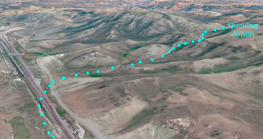
Quaking Aspen Station
14N118WS17NESW but close to dead center
41.192689888335615, -110.74730714202752
Not much information is available about the Quaking Aspen Springs Station, a location that is so remote today that it is only accessible by driving on minimal maintenance “roads” with high-clearance four-wheel-drive vehicles. Likely a simple swing station, archeologists have found a number of period items near the site along what is now known as Sawbuck Road. (The later maps show the route along what is now Talking Wind Road but I chose to use the information from the 1870s map)
From various sources, I would not attempt to drive much of this section alone – if at all. The remnants of the Overland Road have eroded into something not much more than a cow path – likely not suitable for a full-size pickup, even if 4×4 with high clearance. Perhaps a properly equipped Jeep, better yet, a dirt bike or horseback … or lots and lots of $$$ for a tow, if one was available and willing.
Before the railroad of course
Bear River City (aka Beartown)
14N119WS28SWSW
41.158814728092274, -110.84838075704002
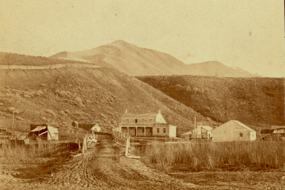
This was not originally an Overland Stage Station, being established as Bear River City when the railroad was built nearby in 1867 – but it bears mentioning as the Wells-Fargo station was moved here from the original site.
The Bear River City station was in the heart of town, another end-of-track town on the Transcontinental RR. The town was short-lived but had quite a reputation in its time. The original Overland Station was further (west) along Bear River; the station was moved when the railroad came through in the late 1860s – after Holladay sold off the line to Wells-Fargo.


“The liveliest city, if not the wickedest city in America“
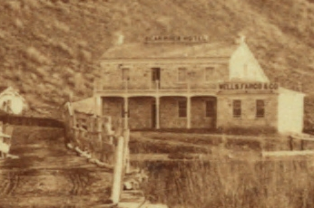
Bear River Station
14N119WS30NENW
41.168299204338965, -110.8794930557838
This was the site of the Pony Express and original Overland Stage station. Little information exists about this western-most station in Wyoming. The U.S. mail contract and other sources identify the Bear River Station but not the exact location (the old survey maps do indicate a location). A Mormon named Myers managed the station operations there. The station was moved to Bear River City when the railroad pushed through in 1867.
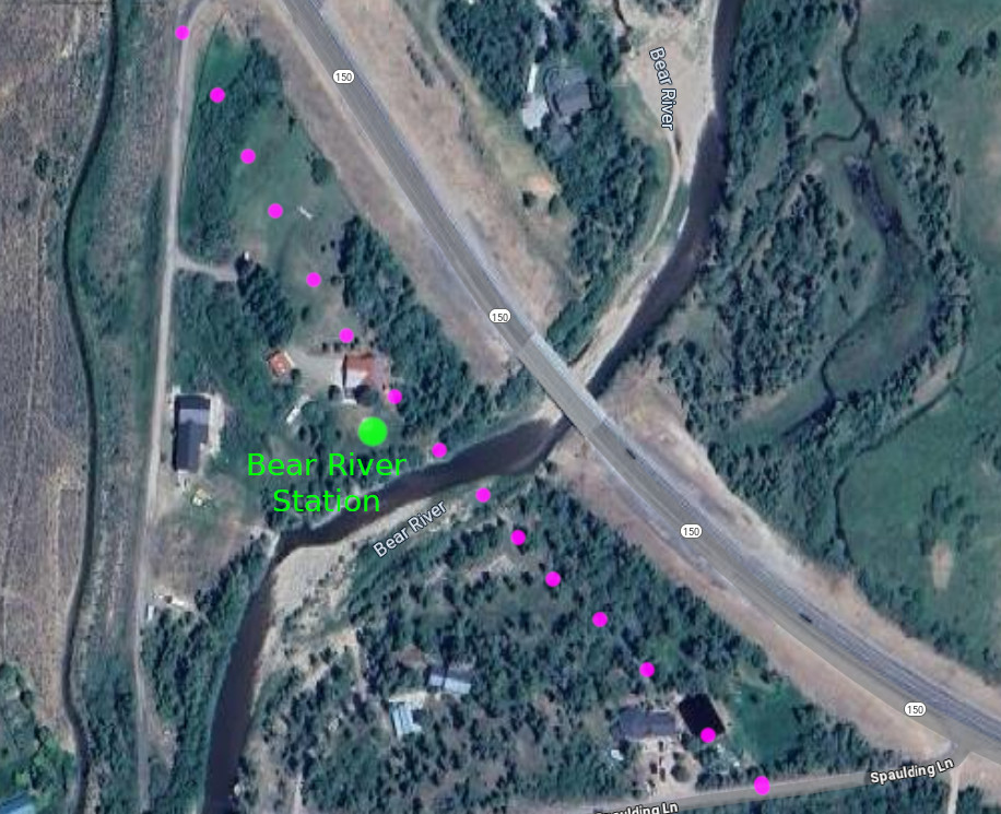
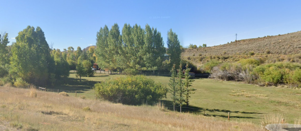
probably at the location of the house within the trees
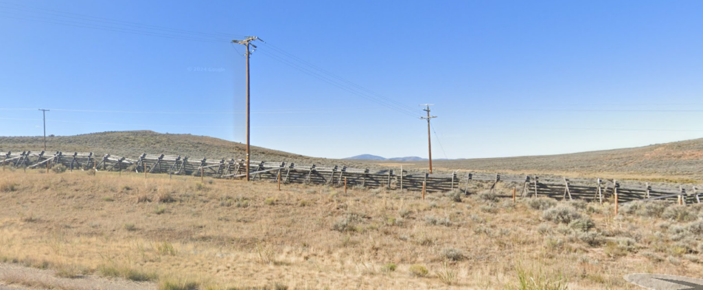
then headed west towards the distant peaks in the center mostly following Coyote Creek
Access from here to Needles in Utah is restricted for the most part; there are no through publicly accessible roads
The telegraph line was built along the Overland Road up what is now called Stagecoach Hollow following Coyote Creek to the rock formation on the Utah/Wyoming border known as the Needles. The Needles Station was located along Yellow Creek only a few hundred feet inside Utah. The station is identified as Needle Rock in the 1861 mail contract. The 1869 survey shows the station location at Porters Ranch.
The survey base lines change in Utah and the maps do not line up as expected. Neither the Utah nor Wyoming maps of the era properly match the location of the Needles, being about 600 ft north as compared to the newer maps and satellite images. Other than that shift, traces of the old road line up properly between old and new. Allowing for that shift and the offset due to differing survey base lines, the exact location of the station is claimed to be unknown but presumably at or near what is labeled on the old survey maps as Porters Ranch. Tracking what appear to be remnants of the old roads on the satellite images compared to the location of Porters Ranch on the old maps, I place the station location at a bit less than 1000ft inside Utah and just less than ¼ mile east of Yellow Creek Road (which more or less straddles the Utah/Wyoming border) at the RED marker – on private property of course. There are reports that remnants of the foundation and debris remain.
Although public roads pass nearby, the site is well-protected by the local landowners; trespassers are not tolerated. It may be possible to get permission to visit the site however.
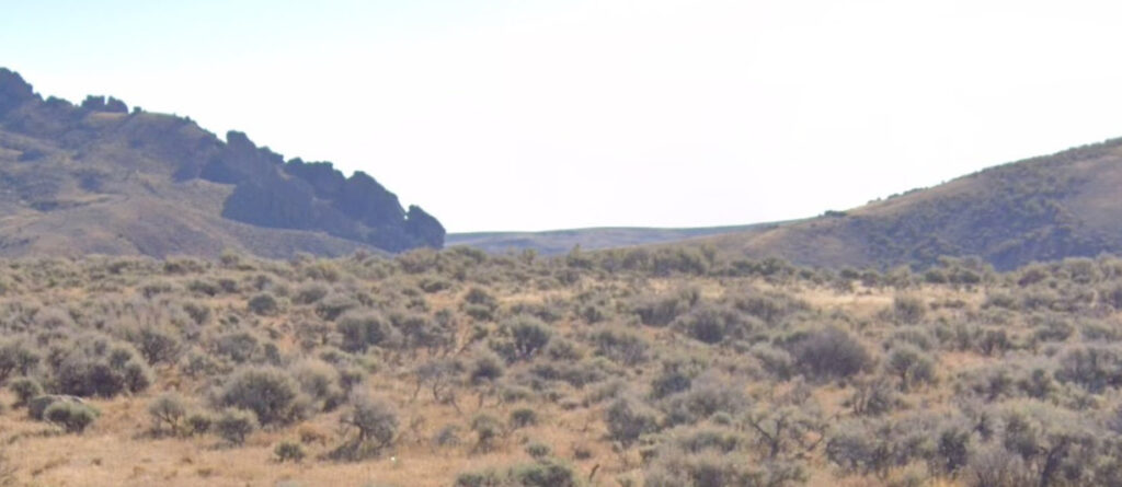
The Overland Road passed through the gap to the right (south) of the formation
Richard Burton’s journal:
August 24, 1860: 8:15 am to 2:30 pm: 36 miles: Road runs by Needle Rocks ; falls into the Valley of Egan’s Creek . “ Cache Cave” on the right hand. Three miles below the Cave is Red Fork in Echo Kanyon ; unfinished station at the entrance. Rough road ; steep ascents and descents along Red Creek Station on Weber River, which falls into Salt Lake south of Bear River
Needle Rock Station
5N8ES16SWSW (roughly equivalent to WY 14N121WS27SENW)
41.16193372850897, -111.05020917216005

The location indicated also agrees with the 1870s map

The use of the road would have compressed the soil so that tracks are still discernible
They also agree with the 1870s map … as does the vertical track which matches a road on the old map
The station may have been to the left – if this even is the proper location
Little is known about this station besides its identification as Needle Rock in the 1861 mail contract. It was named for a prominent rock formation near the Utah/Wyoming border. The Pony Express and Overland Stage route was a common one; it was used by the Donner party in 1846, the Mormons in 1847, and General Johnston’s army in the Mormon war of 1858. The transcontinental telegraph followed the stage line in 1861.
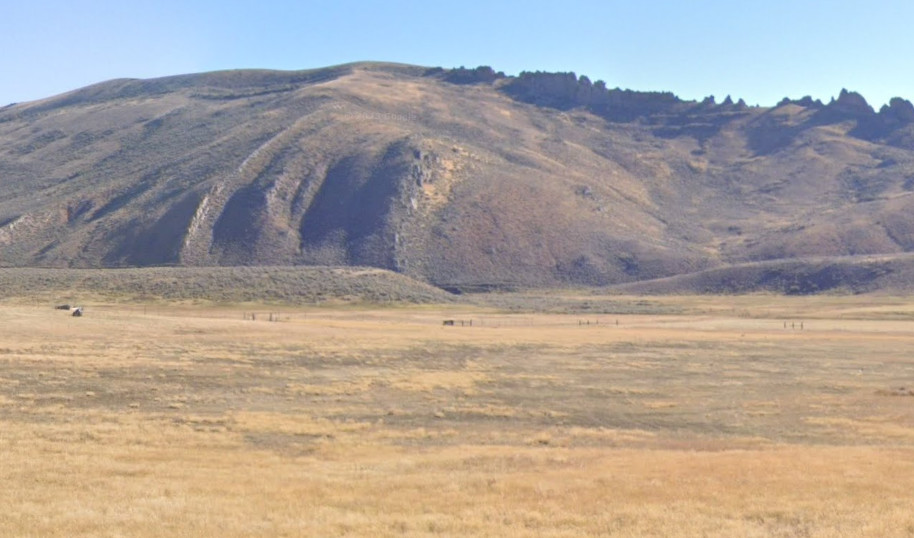

The next point of interest along this route was Cache Cave which was not a stage station – although it may have served as a Pony Express relay station. One of the few places I have cause to doubt the old map – maybe – is that the old map shows the trail transversing a sharp grade – twice … rather than following the more logical trail along the drainage and passing by Cache Cave – a well-noted resting place. Richard Burton’s notes state Cache Cave was on the right as he travelled west. This is indicated on the detailed map.
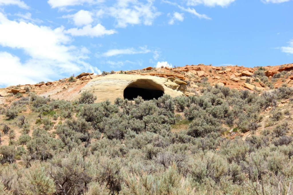

The cave was once used as a church by the Saints. Numerous passers-by have inscribed their names on the walls inside the cave although weather and time are causing the names carved into the soft sandstone to fade away.
One of the earlier descriptions from 1847:
“We encamped at the foot of a ledge of rocks on the right.” [The cave] “fronting to the south and a little inclined from the perpendicular. The open resembles very much the doors attached to an outdoor cellar, being about eight feet high and 12 or 14 feet wide. . . . We went into this cave about 30 feet where the entrance became quite small, and so we did not feel disposed to penetrate it any further. On the outer side of the roof were several swallows nests.”
As with the Needle Rock site, this cave is on private land, well-protected, and trespassers not well tolerated. The cave was also known as Reddens Cave after its discoverer in 1847. It may be possible to obtain permission to visit – given one can contact the owners on a good day. This site was on the Mormon Trail and Pony Express route before the Overland Stage operation.
The next stage station after Needle Rock was Castle Rock at the head of Echo Canyon.
The trail through Echo Canyon was well-known; the Mormon Trail, the Hastings cut-off of the California Trail, the Pony Express, the Overland Stage, the Transcontinental Railroad, the Lincoln Highway, US30, and now I-80 all pass through the 25 mile long canyon.
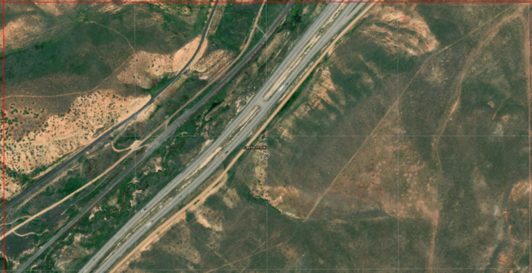
Castle Rock
4N7ES06NWNE
41.114059473634974, -111.20141025898879
5N7ES32NWSW
41.12440885439125, -111.18746189551166
Two locations: before and after the Transcontinental Railroad.
As the trail entered the head of canyon, it came upon a Pony Express relay station called “Head of the Echo Canyon” or more commonly “Frenchie’s Station”. Later a swing station on the Overland Road, it was named for a nearby rock formation known as “Castle Rock”. “Frenchie” was the station keeper at this swing station.

Same section: then and now
Richard Burton noted in 1860:
“Echo Kanyon has a total length of twenty-five to thirty miles, and runs in a south-easterly direction to the Weber river. Near the head it is from half to three quarters of a mile wide, but its irregularity is such that no average breadth can be assigned to it.”
“In front, the eye runs down the bright red line of Echo Canyon. Twin lines of bluffs, a succession of buttresses all fretted and honeycombed, a double row of steeples slipped from perpendicularity, frowned at each other across the gorge. The most formidable section of the canyon was surmounted on the west by high perpendicular ledges of rock immediately overlooking the road, with cliffs on the east very high and difficult of ascent. An American artist might extract from such scenery a system of architecture as original and as national as Egypt ever borrowed from her sandstone ledges or the North of Europe from the depths of her fir forests.”
This station is mentioned in the 1861 mail contract as Castle Rock and/or Frenchies. Castle Rock refers to a sandstone geological formation near the head of the canyon. A man named Frenchie served as the station keeper at a log structure. Though the Pony Express ended when the telegraph lines were established, the site remained a stage station until 1867 when the railroad came through. At that time, the log building was moved up canyon. If records are correct, the original station site was about 1.5 miles down canyon and is now between tracks of the UPRR..
Several families homesteaded the land around the new station site and began a town called Castle Rock with the intent of setting up trading posts for travellers through the canyon.. The small community soon boasted a railroad depot, section house for railroad workers, store, water windmill, and schoolhouse. The town lasted past the establishment of highway US30 with an active school lasting until 1937.
Now the site of a junkyard, nothing remains of the stage station although structures of the “modern” town still stand … on private property.


view from the gate
compare rock formations to above 1868 photo

This was also the stage road
“Truck convoys” on the interstate are not a new thing
Hanging Rock, or Halfway Station, was located about halfway down Echo Canyon. It was also know as Daniels’ Station named after the station keeper. The site is now labeled “Emory” on modern maps.
A man named Daniels served as station keeper at Halfway Station, listed as the third Utah station in the 1861 mail contract. Local people also knew the station as Daniels and Emory. In the early days of the Pony Express, rustlers were known to steal the express horses and then later sell them back to the company. The rustling ended when the horses began to be branded with the XP (Express) brand. Nothing remains of the site today. It was approximately seven miles from the Head of Echo Canyon Station, about halfway down Echo Canyon.
This photo of Halfway Station is identified by the rock structures above and behind. The similarity is much more evident “live” on-site.
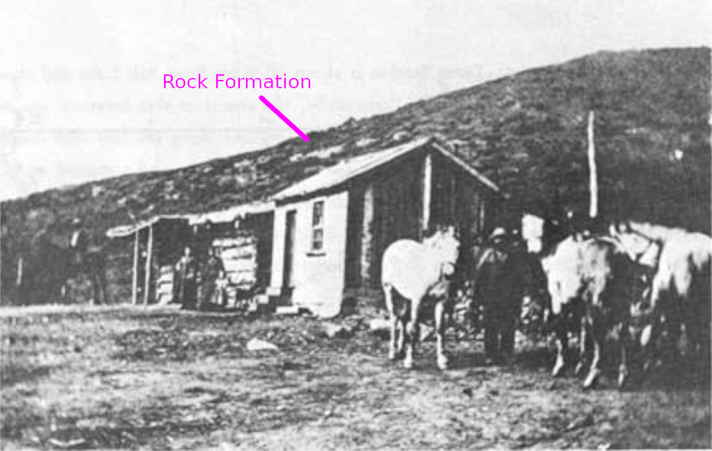
later determined to be Halfway Station in Echo Canyon
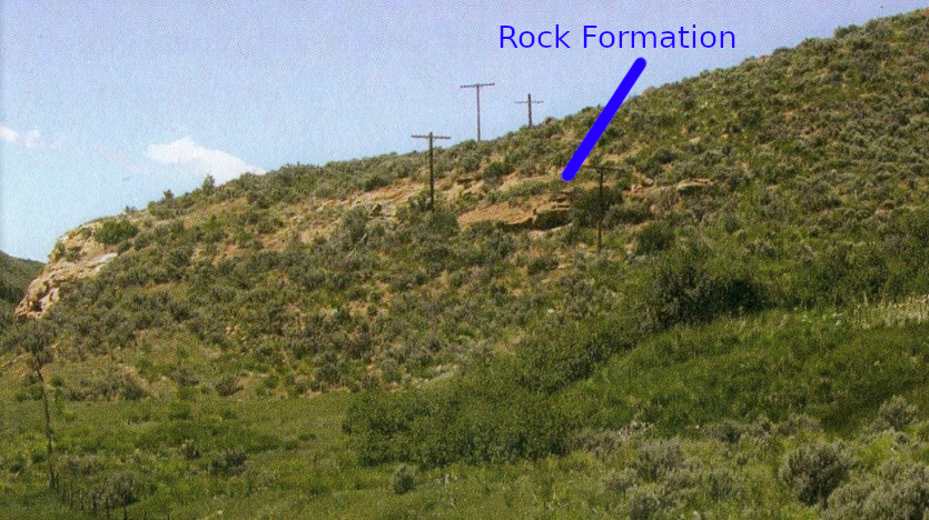
But there are two locations suggested for this station – both within a ¼ mile of each other

given changes to transportation routes … who knows anymore? The rock formation is on the left side of the photo though
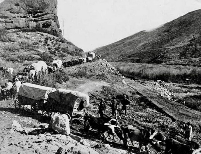
new railroad grade to left
and there you are, waiting to go upcanyon …
Weber Station
3N4ES24SESE
40.97268854677067, -111.43856115757713
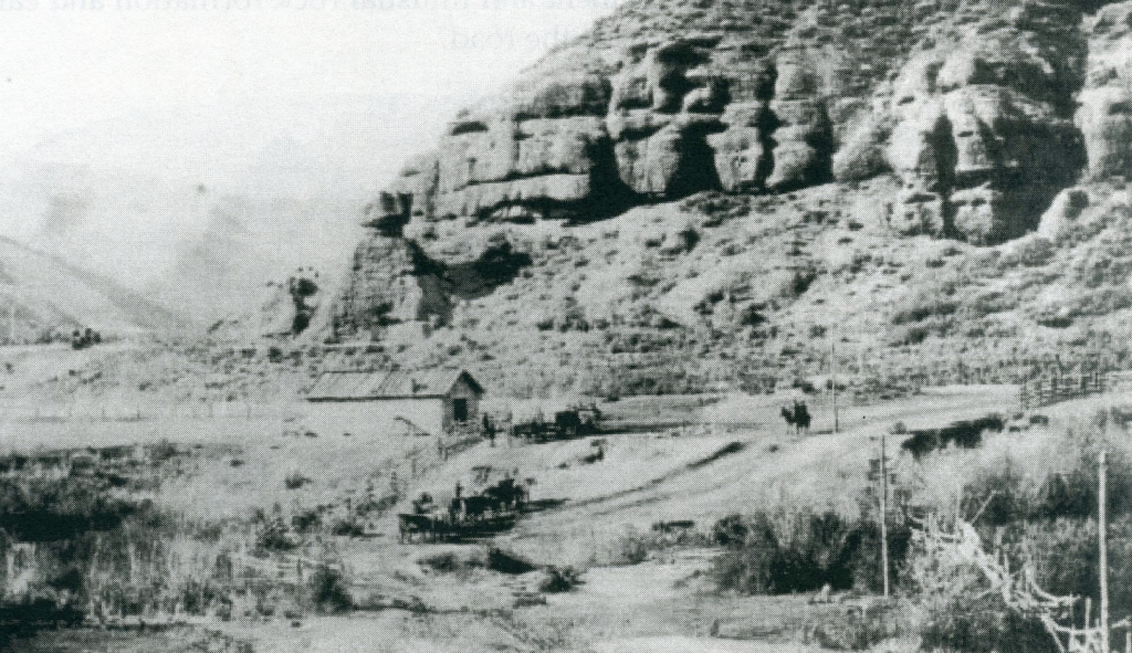
The station site is at the mouth of Echo Canyon near the confluence of Echo Creek with the Weber River. Between the construction of the Transcontinental Railroad (and later changes to the railroad route) along with the construction of US30 and I-80 – which involved destroying some of the over-hanging rock formations – nothing is left; the actual site is likely under some part of the various construction projects in the area.
Although the route through Echo Canyon had been used by the Hastings Cut-off of the California Trail in 1846 and the Mormon Trail in 1847, the first settler at the mouth of the canyon was James Bromley in 1854. He was later hired by Russell, Majors, and Waddell as division superintendent for the section of the line between Pacific Springs, Wyoming, and Salt Lake City, Utah. His ranch became the location for the Pony Express, then the Overland Stage station. His division covered the route between Pacific Springs, WY (along the Pony Express and original Overland Route) through to Salt Lake City, the western terminus of Holladay’s Overland Mail contract.
The area soon attracted others; by the time of the Pony Express, a small village had grown here at the mouth of the canyon where the Echo River joined the Weber Rivers. In addition to the stone home station house and outbuildings, the growing settlement had a general store, two grocers, an inn and saloon, a blacksmithy, jail, and eventually a hotel.
“…we debauched upon Weber River Station. It lies at the mouth of the ravine almost under the shadow of the lofty red bluffs, called ‘The Obelisks,’ and the green and sunny landscape contrasting with the sterile grandeur behind, is exceedingly pleasing…. The station was tolerably comfortable, and the welcome addition of potatoes and onions to our fare was not to be despised.”
In 1868, the Union Pacific Railroad bought the station and surrounding property to establish Echo City slightly north of the canyon mouth. The station was demolished in 1931 for safety reasons. Echo City still exists today, though it is almost a ghost town, with about 50 people living there. Over the years, the location was known by various names, including Bromley’s, Pulpit Rock, Hanging Rock, and Echo City.


Richard Burton noted that the station keepers were Mormons:
“The station was tolerably comfortable, and the welcome addition of potatoes and onions to our usual fare was not to be despised.”
Beyond Weber Station
Detailed map: Weber to Dixie Springs
Dixie Springs Station
2N3ES01NENW
40.93911952452354, -111.56006936415264 … maybe
I did not explore the region between I-84 and Salt Lake City but I add this as material to point in the Overland Road’s direction west. From Weber Station, the road followed the east bank of the Weber River for about 5 miles until a crossing of the Weber at Forney’s Bridge at the settlement of what was then known as “Henneforville” (settled 1859), now Henefer. Although not mentioned on the original mail contract, it was the site of the Pony Express’ “Brimville Emergency Station” for use in case of high water. It is probable the stage may have stopped here, being an established settlement of sorts, but the few records available suggest its use was minimal – the next station was Dixie Springs, about 6 miles up East Canyon at Dixie Springs – of which there are no remains at a somewhat disputed location.
The Donner Party went up this route in 1846.
“The station in Dixie Hollow was also commonly known as Dixie Creek and East Canyon. The name listed in the contract was Wheaton Springs. The exact location has been a matter of considerable debate. Joe Nardone agrees with Mormon Trail authority Lamar Barrett that the station sat directly in the mouth of the draw, at a site marked by a pile of rocks. David and Susan Jabusch found no artifacts of any type during their initial and thorough survey. According to members of the Bertagnole family, who have been on the land for generations, the right location is a short distance to the south where a catch basin for watering livestock and a small grove of trees are found today. Construction of the small reservoir obliterated any evidence of a station at that spot. The U.S. Geological Survey, after consultation with prominent Utah historians, placed Dixie Station at the Bertagnole site.“
But I end my journey and tale back here at the junction of I-80 and I-84 at Echo, Utah on the far eastern outskirts of Salt Lake City.

Eastbound and down – heading towards Cheyenne
