The Laramie Plains
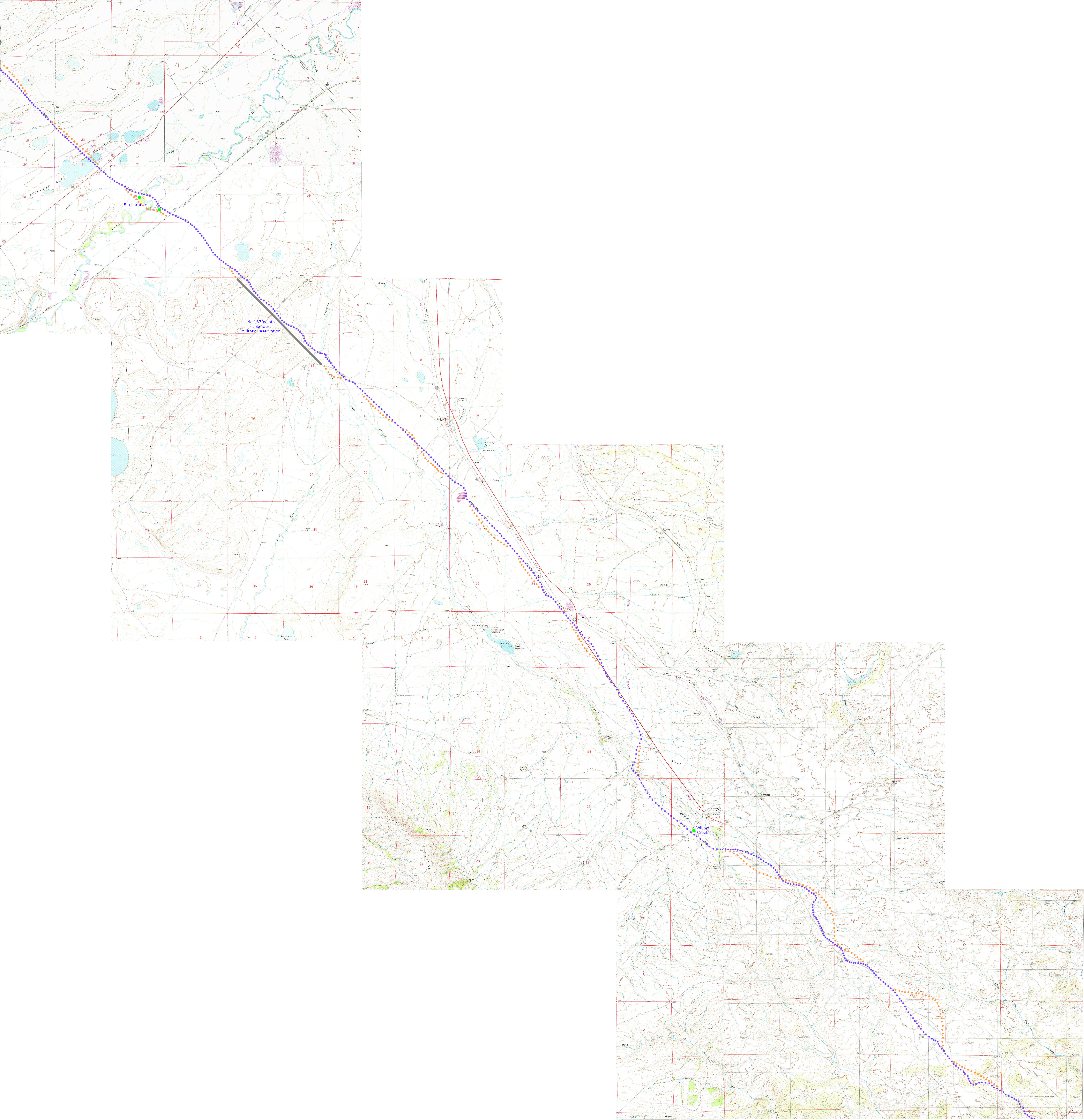
Detailed map: Virginia Dale to Big Laramie
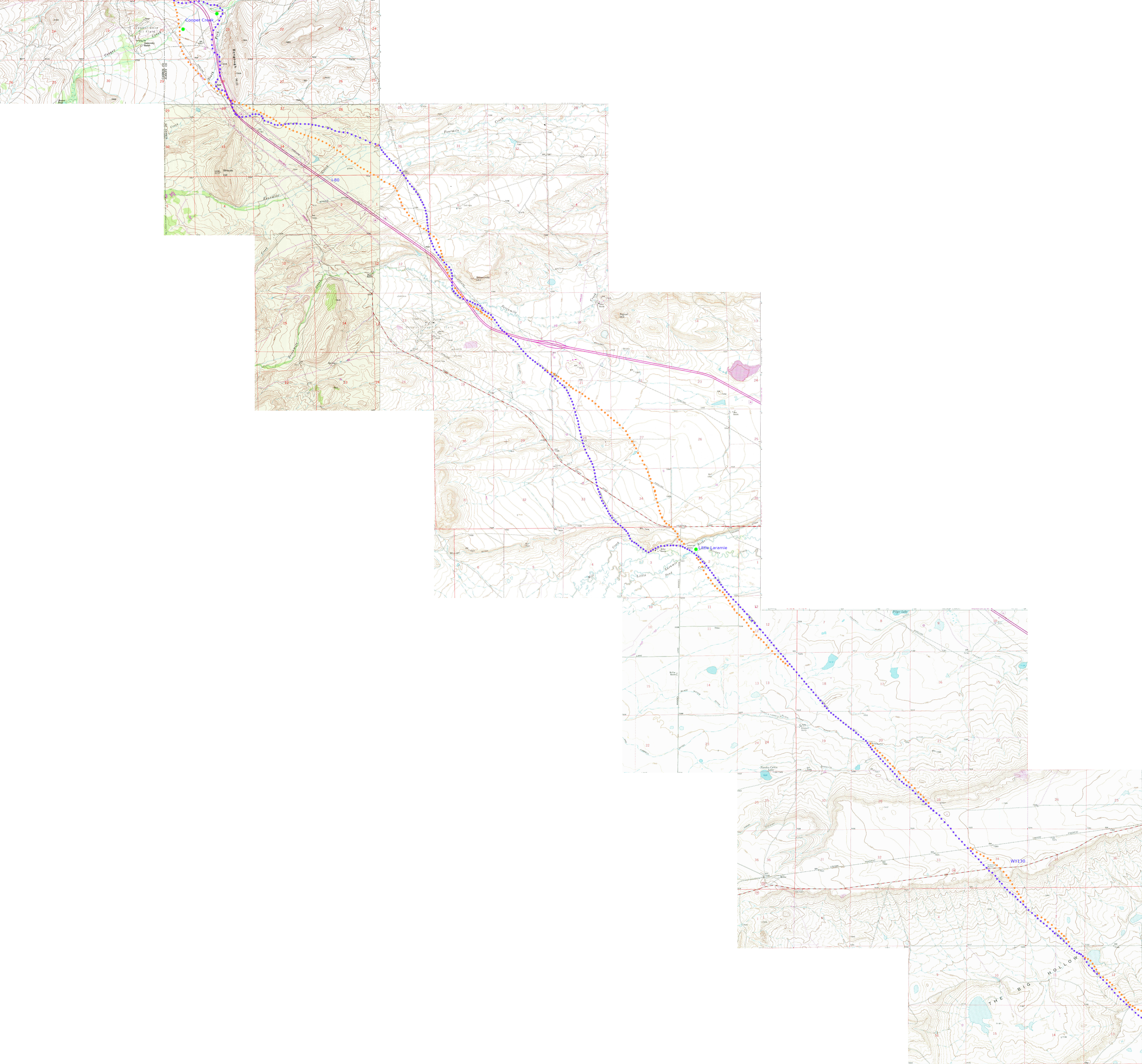
Detailed map: Big Laramie to Cooper Creek
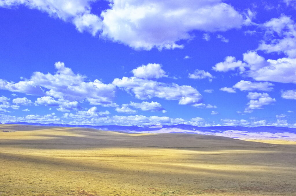
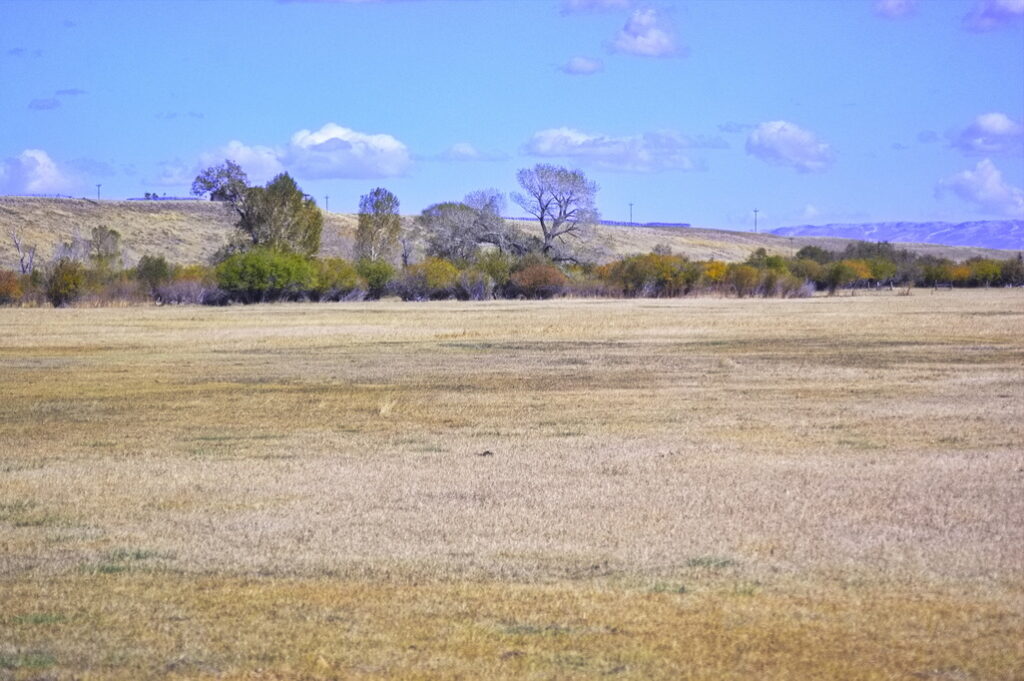
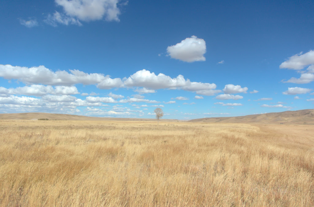
The border of Colorado and Wyoming on US287 crosses near the top of a mild pass. Descending down into Wyoming, one enters the Laramie Plains – a vast arid, lightly populated valley at about 8000 ft. A cold climate with short growing season, the valley is full of grazing lands and hay fields; scattered here and there with the remains of failed homesteads.
Indians did not occupy the land but Arapaho, Cheyenne, Sioux, Shoshone, Crow, and Utes all hunted here – sometimes buffalo, sometimes each other.
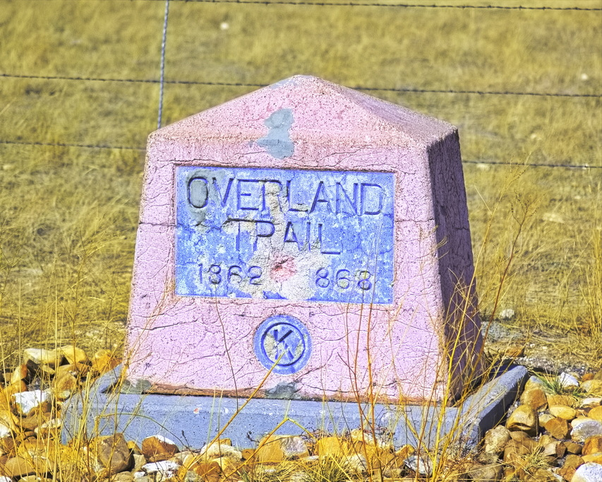
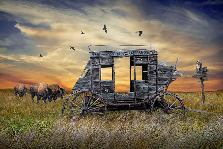
The Pony Express, the Overland Stage, the Transcontinental Telegraph, the Transcontinental Railroad, the Lincoln Highway, US30, now I-80 all pass through this region.
Essentially a straight NW/SE route
Note on the maps:
I have prepared very detailed maps of the Overland Route compared to 1970s/80s USGS Topo maps (for some reason, the USGS maps later than about 1982 do not show the detail those issued only a few years earlier do). They are large files with high resolution. Links will be provided; to include them on the contents page would slow page loading to the point of intolerable.
The route is indicated on the two (once or twice, three) sets of maps that I examined – the late 1970s/early 80s USGS topo maps and the original land surveys of the 1870s. Both were based on township/range/section boundaries. Comparing the two, it is obvious there were adjustments made to the boundaries of each in some places although, for the most part, both sets lined up well. I did a best fit without searching the interim corrections; there are 157 township maps – missing only one – in the 1870s series between South Platte Station in Nebraska to Echo Station in Utah. There are 86 USGS 1970s series of topo maps.
By overlaying the two sets by township/range, I was able to compare the routes – and in most cases, they closely agreed. In others, there were significant differences. Two sections I was not able to compare: the first within what became the Fort Sanders Military District – in the area leading to Big Laramie Station. The fort was established in 1866 – the year Ben Holladay sold the Overland Stage to Wells-Fargo – but the survey maps were drawn 10-20 years afterwards and did not include those military lands. The survey map for the fort proper was done in the mid 1880s, after the railroad had run a spur along the Laramie River. It is likely there were no significant objects in that area – the stages headed in basically a straight line between Willow Creek and Big Laramie.
The other was a missing 1870s survey map in Wyoming west of Ft Bridger. Based on the data on either side, it appears that the trails of both maps were closely related – not always true.
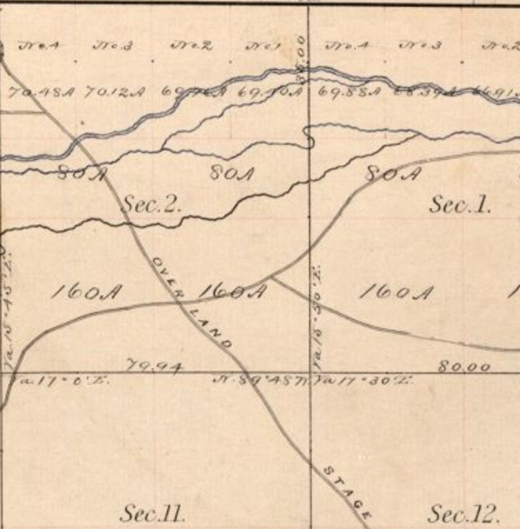
Purple (PUR) dots are the route indicated on 1970s maps; the orange (ORG) dots indicate the route given on the 1870s maps. In places with no ORG dots, the trails overlaid each other unless noted. Happened this way because the modern maps lined up better and I put the modern trail dots down first.
Cherokee Trail in many places
Detailed maps through the Laramie Plains: Laramie Plains A Laramie Plains B
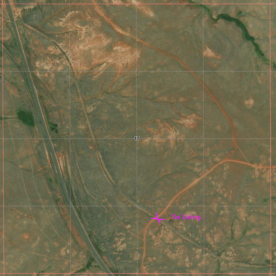
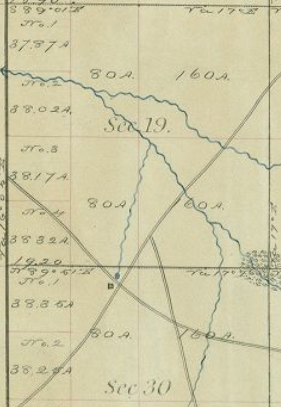
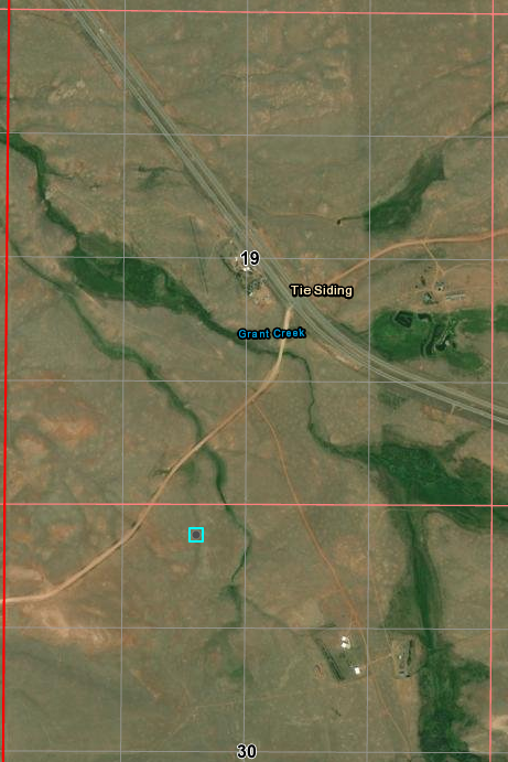
Tie Siding
The first station in Wyoming heading west was Willow Springs – very near today’s Tie Siding. The name Tie Siding actually referred to a siding on the Transcontinental Railroad close to a mile NE of today’s tourist stop near the spot on the railroad labeled Hermosa where ties were gathered for the construction of that railroad.
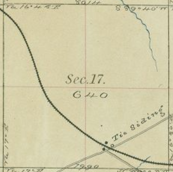
In the mid-1880s, the new Tie Siding area came close to being developed; the developer moved on to Laramie instead.
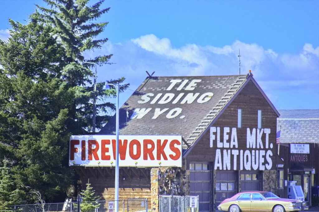
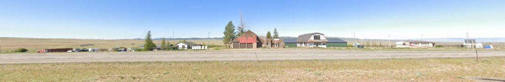
The community of Tie Siding – about 1 mile SW of the railroad – is too small to be a census-designated place and consists of a flea market post office, and not much else. Everything here is “new”.
Willow Springs would be out on the flats about 1 mile distant off to the left
Tie Siding the railroad would be about 1 mile behind to the right
Willow Springs
13N72WS30NWNE
41.073857484728, -105.51326003528752
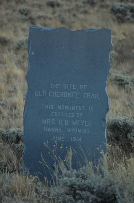
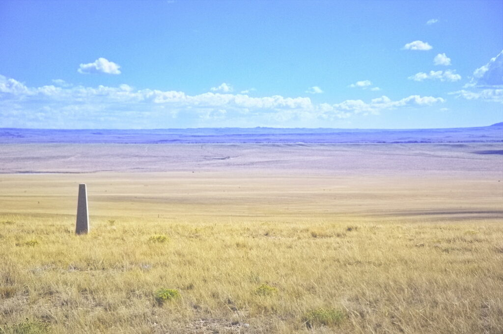
About a mile and a half north of Virginia Dale, the stage crossed into Dakota Territory. The first station was Willow Springs, a swing station originally called Dirty Woman. A nearby “creek” still has that name. Located near a small grove of trees and a spring, the station consisted of a log structure and corral. The station was a target for many Indian raids – it was burned and rebuilt several times. There are no remains but a debris field about 1 mile SW of Tie Siding helps suggest the site.
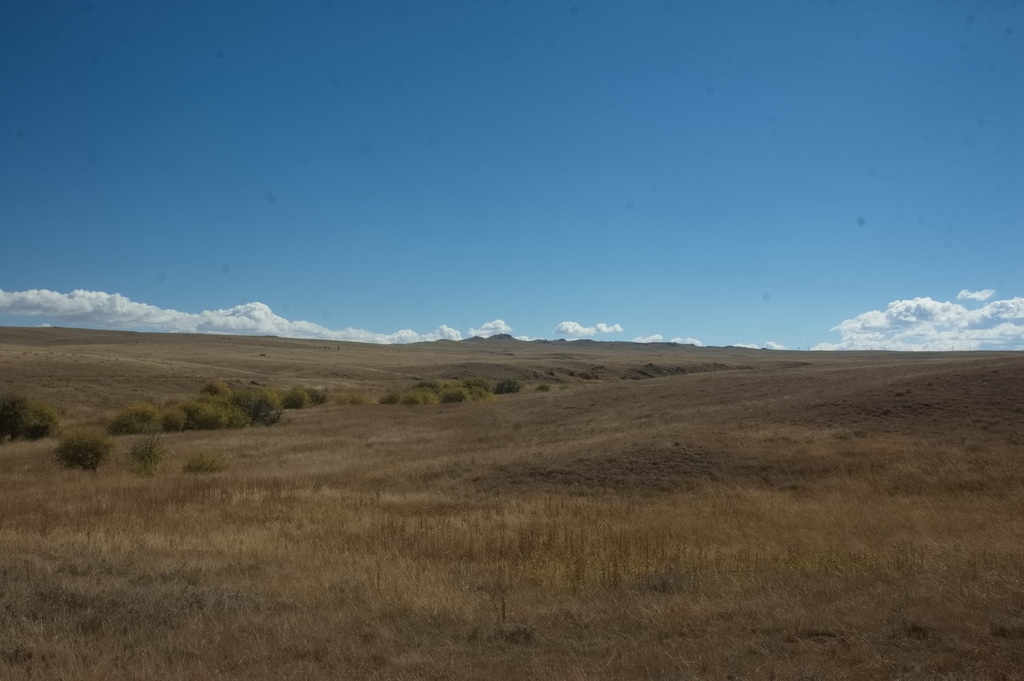
Willow Creek is along the bushes
Equivalent “then and now” maps per township/section/range
The busiest period in Willow Springs’ history was when large numbers of workers for the new Transcontinental Railroad cut logs for railroad ties to the SW of the station during the years 1866 to 1868 – after Overland sold out to Wells-Fargo – and hauled them to Tie Siding on the railroad about a mile east along the road past the station. The present “town” of Tie Siding is simply a curiosity for tourists a few miles north of the Colorado/Wyoming border on US287.
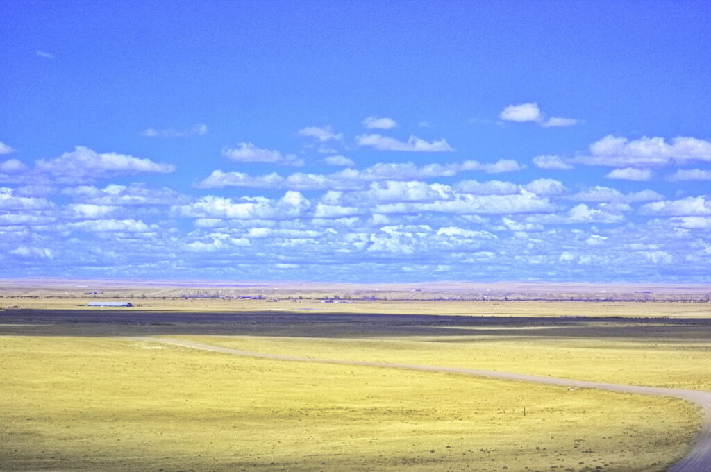
Leaving the Willow Springs station, the trail went pretty much in a straight, northwest line, crossing the Laramie Plains, heading about 15 miles NW of Willow Springs to the home station of Big Laramie.
Big Laramie
15N74WS28
41.23740574939082, -105.6954095566971 East Side
41.24037841117845, -105.70258976618855 West Side
Big Laramie was a home station located on the banks of the Laramie River. There is/was some dispute as to which side of the river the station was actually located; some suggest both sides. There is a structure on the west side on what was the modern Richardson Overland Trail Ranch that is claimed to be of the station; evidence suggests it was built in 1862.
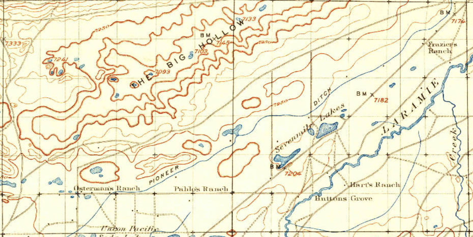
Immediately across on the east side is the Hart ranch. Also built in the 1860s, this is the station location given on the 1970s USGS topo maps but during the nomination process for inclusion on the National Register of Historic Places, the location was stated as being the west bank location. The maps show a divergence in the trail here. ORG dots are from the 1873 map.
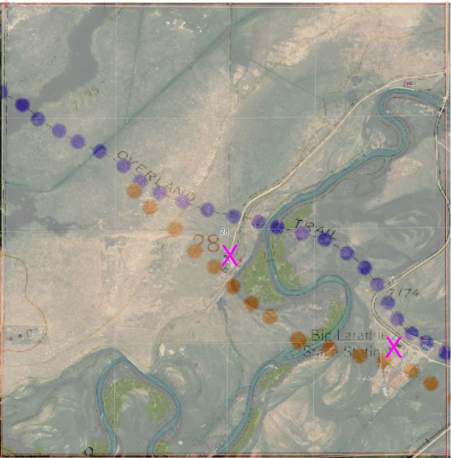
PUR dots – 1973 map ORG dots – 1873 map
Either station location is plausible for either route
note how the river course has moved over the years
Big Laramie Station was noted by travellers as having a “privy”. Travel on the open plains left few alternatives; a closed privy was a luxury. The station was also noted as having a good fresh water spring, a rarity in this country. A blacksmith shop and the large log station still exist at the west side location.
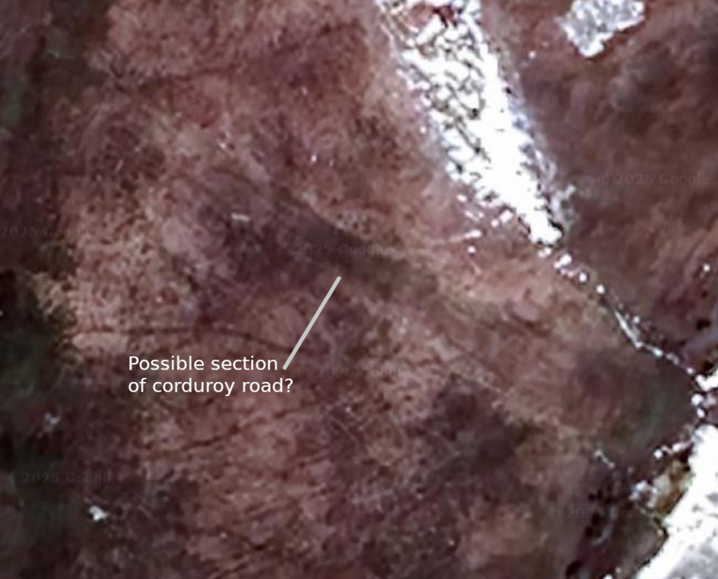
This was an easy crossing point. The banks are low and the bottom is gravel. The land surrounding the river is marshy so a corduroy road was built – for the most part, since subsided into the mud although there is a short section claimed to still be visible. There is a county road that now crosses the river downstream a ways; at one time, this was a toll bridge although this was after the time of the stage.
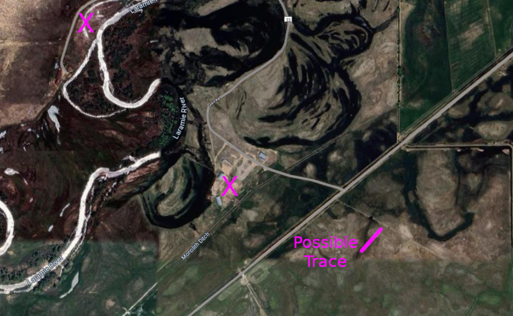
Both possible station locations are marked
The “possible trace” more closely aligns with the 1873 map, but could be either – or neither
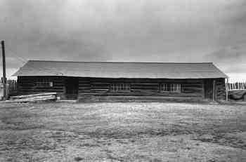
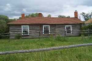
Supposed station structures from the west side
After leaving the Big Laramie Station, the stages and wagons crossed an area on the prairie called “The Big Hollow.” It was a depression in the plains where the collected water – if any – was alkaline. It was reported that animals that drank the water died. When dry, large alkali deposits would tun to dust that all that passed breathed in.
but nothing on the west side
The Overland Route is not evident here either except perhaps the crossing at Hart’s
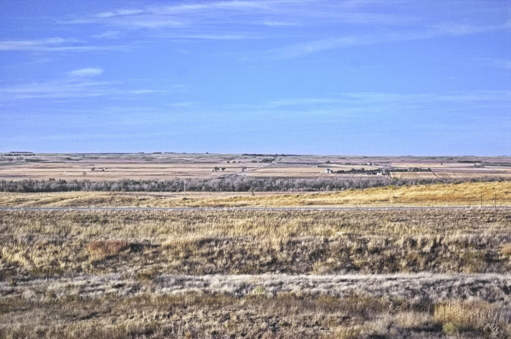
From here, it was pretty much a straight run across the plains to the Little Laramie Station. Fences have blocked most access; hay fields and livestock grazing have for the most part obliterated traces of the Overland road so tracking the route through here would be a frustrating process.
Even now, the trail between Big and Little Laramie stations is sparsely populated/
Although some tried …
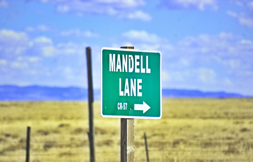
Little Laramie Station
16N76WS02
41.384709210213664, -105.89044376549165
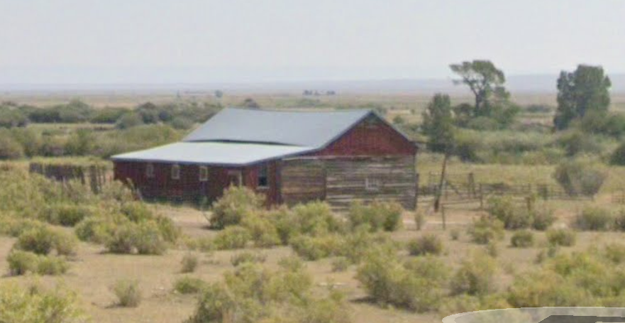
The Little Laramie Station was a swing station built of logs near the Little Laramie River. It had a blacksmith shop but was burned out by Indians in 1865. Fresh meat was offered for sale by a rancher in the area.
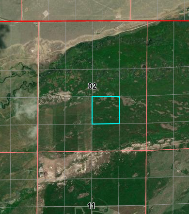
It is possible the highlighted portion be moved west by one
SW of the intersection of Mandel Lane and Lawrence Road
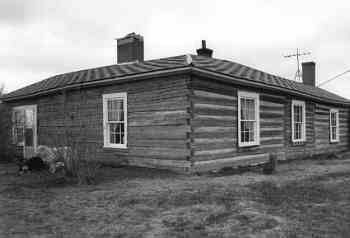
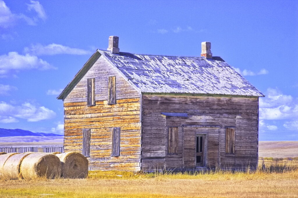
This barn could be of the era but would more likely be the rancher’s than the station’s. More likely yet, it’s a newer structure.
It’s the only structure for miles around.
Looking SE along the trail towards Colorado
There’s another barely visible speck of a marker just to the left of center
but no hint of the trail itself
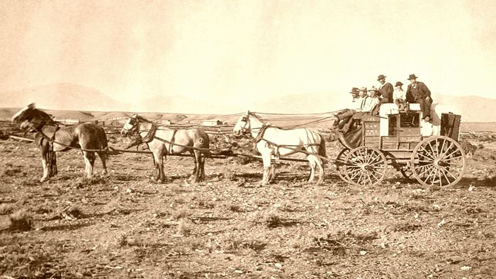
“With few exceptions, the drivers were warm-hearted, kind, and obliging. Many of them were capable of filling other and more important positions. The most of them were sober, especially while on duty, but nearly all were so fond of an occasional “eye-opener” that it was unnecessary ever to give them a second invitation to “take a smile.” Now and then one would be found who could speak two or three languages and quote Shakespeare and passages from the Scriptures.“
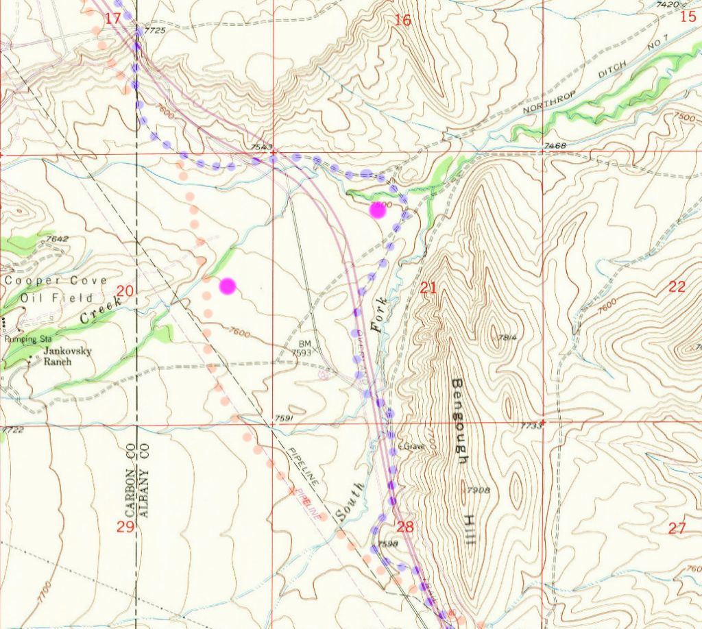
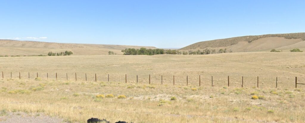
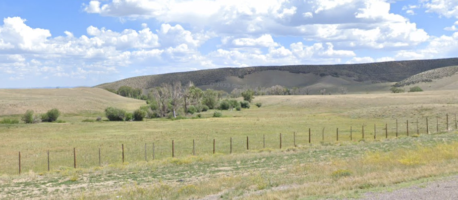
Cooper Creek Station
18N77WS21N 1983
41.52342081182951, -106.05216415080531 PUR route
18N77WS20E 1871
41.51939899479051, -106.06550053416771 ORG route
Located right off I-80, it is said ruts of the Overland Trail still exist in the median strip, just west of here. The station was stated by period sources as being located right on the present Albany-Carbon County line along Cooper Creek but neither proposed location is “on” the modern county line. Like the other stations, it was sacked and pillaged several times.
There is a discrepancy in the location: some maps show the crossing of Cooper Creek in a small valley immediately to the north side of I-80, the 1871 map shows the crossing about 1 mile east on the south side of the highway. The 1871 map (ORG dots) shows the location closer to the county line. The PUR dots follow the modern map indication of the trail
It was noted in 1863 that a bullet-ridden stage coach sat near the station.
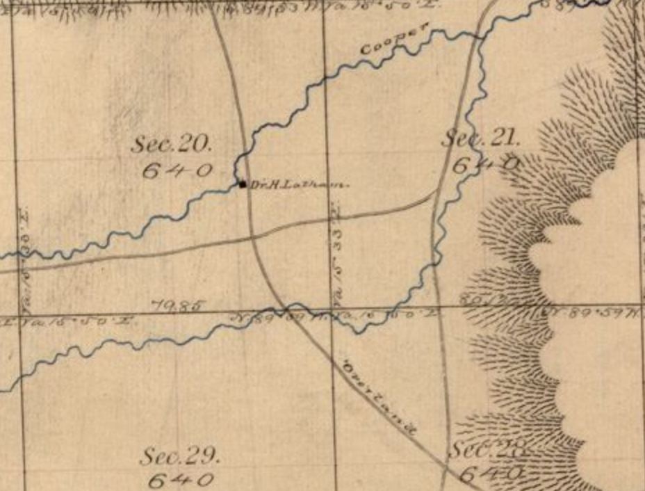

The 1983 location of Cooper Creek Station
Next: Cooper Creek to Pass Creek