The nature of the route changed after Fort Bridger. The stage followed other well-established trails: This was part of the Hastings cut-off on the California Trail, the Donner Party passed this way. The Mormon Trail (1847) came through here, as did Johnston's army during the Mormon War of 1857/58. The Pony Express passed through here in 1860 as did the Transcontinental Railroad in 1867.
The modern highways bypassed the section between Fort Bridger and the head of Echo Canyon though.
The passage through Echo Canyon had been forced by nature - there wasn't a feasible alternate route - there still isn't today.
Weber Station was at the mouth of Echo Canyon, where I-84 splits off from I-80 and heads NW to Ogden while I-80 continues on to Salt Lake City. I add a small section showing the Overland Road beyond Weber Station; it followed what is now I-84 and the Weber River a short distance to Henefer then cut SW along what is now a secondary Utah highway, UT65 through the mountains on its own path to Salt Lake. This was the route of the Donner Party some 15 years before the Overland Stage started operations.
The maps are large files and high resolution; they take time to load but in a separate window. This is the last page of my Overland Stage story.
The region between Muddy Creek Station through Piedmont to Bear River may be accessed from I-80 via Exit 24 (Leroy/Piedmont Rd/WY173) from the east or Exit 5 (Evanston/WY15) from the west. Exit 3 (Overhurst Rd/I80BR) heading S will turn into Yellow Creek Rd which passes near the Needles Station.
The ease of mapping the actual route becomes more difficult west of Ft Bridger. All the major trails: Mormon, California, Pony Express, Overland, UPRR - excepting the Oregon Trail - passed by here; all using slightly different paths. The California Trail – the original Overland Route along the Sweetwater River to the north before the route was moved south – joined with the newer Overland Trail just east of Granger; modern maps stopped indicating “Overland Trail”; they all became “Emigrant Trail”. There are several different emigrant trails converging around Ft Bridger, yet they often disagree with the 1870s maps - probably as the area was surveyed after the railroad arrived and the region became "developed".
The Pony Express did not use “roads” although these trails were "developed" from use. The Overland Stage did use roads and improved the existing trails where necessary as well as converting the Pony Express stations for their own use (Holladay bought the eastern side of the Pony Express company to Salt Lake City). After the railroad first came through in 1867, the major “town” (perhaps 20 houses) was Piedmont - a coaling and supply station - and the trails now followed the RR. The old maps weren't surveyed until after the railroad was complete. The railroad re-aligned its rails early in the 20th century leaving Piedmont high and dry, but Piedmont remained the town of the area for a while. Not much left of it now. The presence of many roads now in the area emphasize that change and "modern" use.
Trail into Utah
Leaving Fort Bridger, the Pony Express/Overland Stage route-trail runs south of Bridger Butte along the old Mormon Trail. It then climbed to the top Bigelow Bench, past Bigelow Springs, then crossed the bench until it reached Gravel Hill.
West from Fort Bridger top of Bigelow Bench
Richard Burton journal: August 23, 1860: 8:30 am to 12:15 pm: 25 miles: Road runs up the valley of Black 's Fork . After 12 miles, Fort Bridger, in N . lat.41°18 ' 12'', and W . long. 110° 32' 23'', on Black 's Fork of Green River. Commands Indian trade, fuel, corn ; little grass. Post - office, sutler's store, grocery, and other conveniences. Thence rough and rolling ground to Muddy Creek Hill ; steep and stony descent. Over a fertile bottom to Big Muddy and Little Muddy Creek, which empties into Black 's Fork below Fort Bridger . At Muddy Creek Station there is a Canadian, provisions, excellent milk ; no stores
The descent from “Gravel Hill” was one of the steepest and most difficult on the trail; on par with the Devils Washboard grade in Colorado. Richard Burton in his memoirs, "The Look of the West, 1860", about his trip to California by stage, described “Gravel Hill” as a “descent that appears little removed from an angle of 35 degrees, and suggests the propriety of walking down”.
A small stream known as Musselman Creek runs along the base of “Gravel Hill” where a blacksmith shop was established to repair any damage caused by the descent. Nothing is mentioned about any damage occurring on the ascent. Remnants of the blacksmith shop are not readily apparent.
The top of Gravel Hill looking west towards Muddy Creek Station
From “Gravel Hill” the trail continued another two miles or so to Muddy Creek Station.
Muddy Creek Station was the first station west of Fort Bridger. Originally a Pony Express station, the station keeper was Moses Byrne who not only built Muddy Creek Station but also had a hand in building all the Pony Express and Overland Stage stations between Almond and the Utah border.
Muddy Creek Station 1866
Byrne remained the station keeper at Muddy Creek; he built a toll bridge across the creek and traded horses with travellers until 1868 when the operation was turned over to his brother-in-law, Charles Guild. The Guild family still owns the property where the station stood.
Muddy Creek Station site per 1884 map 1866 photo appears to show station further back towards rise in background and creek further back as well
The site is immediately west of what is now Piedmont Rd (WY173) - which was not the Overland Route.
A Mormon traveller, Joel Johnson, wrote on Sept. 27, 1860: "Started before breakfast, traveld about 8 or 9 miles to the Station on the Muddy near some Springs where we campt for the balance of the day and night, at this place we buried Sister Bennett an aged saint from England who died the day before."
This was before the Overland Stage when Muddy Creek was a station on the Pony Express and along the Mormon Trail.
Catherine Jones Bennett was Mormon convert immigrating from her home in Wales to Salt Lake City. She died of unknown causes on Sept 26, 1860 aged 67 along the Mormon Trail at Muddy Creek. Her grave was unknown for over a century; it was finally discovered and marked in 1998 several hundred feet from the Muddy Creek Station site.
Catherine Bennett and family
As a point of possible interest, Spring Valley Cemetery is located at 41.25306626810925, -110.67823205146442 Some records *suggest* this might be along one of the many trails in the area of the 1850s/1870s era. I have no information but it is marked on the detailed map <Fort Bridger to Quaking Aspen>. It appears there are publicly-accessible roads to the site; I have not confirmed this myself.
A bit south of the Muddy Creek Station is the ghost-town of Piedmont. Piedmont was a railroad town established in 1868 and began as a “Hell on Wheels” tent city. Moses Byrne of Muddy Creek Station built a house and five charcoal kilns used to produce charcoal. This charcoal was used in smelters across the west. Each kiln processed 20 cords at a time and the kilns were fired 3 times per month. The wood used to produce the charcoal was transported by canals built in the area from the Uintah Mountains 20 miles away.
Due to its location with plenty of water, timber, and coal, Piedmont became a "helper" station - supporting locomotives intended to help trains over the nearby steep grades. At one time, the town supported four saloons. It is reported that both Butch Cassidy and Calamity Jane spent time in Piedmont. Piedmont faded away when the railroad relocated its line in 1910 and the demand for charcoal decreased. The population drifted off and by 1940, the town had been fully deserted.
Both the former town site and remaining kilns are immediately off Piedmont Road (aka Uintah County Road 171)
Piedmont
Piedmont Kilns
Richard Burton journal: August 23, 1860: 12:00 noon to 5:30 pm: 20 miles: Rough country. The road winds along the ridge to Quaking-Asp Hill, 7900 (8400 ?) feet above sea level. Steep descent; rough and broken ground. After 18 miles, Sulphur Creek Valley ; stagnant stream , flowing after rain ; ford bad and muddy. Station in the fertile valley of Bear River, which turns northward and flows into the east side of the lake; wood, grass, and water. Poor accommodations at Bear River Station [the original Bear River Station, not Bear River City]
Quaking Aspen Station
14N118WS17NESW but close to dead center 41.192689888335615, -110.74730714202752
Not much information is available about the Quaking Aspen Springs Station, a location that is so remote today that it is only accessible by driving on minimal maintenance "roads" with high-clearance four-wheel-drive vehicles. Likely a simple swing station, archeologists have found a number of period items near the site along what is now known as Sawbuck Road. (The later maps show the route along what is now Talking Wind Road but I chose to use the information from the 1870s map)
From various sources, I would not attempt to drive much of this section alone - if at all. The remnants of the Overland Road have eroded into something not much more than a cow path - likely not suitable for a full-size pickup, even if 4x4 with high clearance. Perhaps a properly equipped Jeep, better yet, a dirt bike or horseback ... or lots and lots of $$$ for a tow, if one was available and willing.
The Overland Road coming west from Quaking Aspen Station Before the railroad of course
This was not originally an Overland Stage Station, being established as Bear River City when the railroad was built nearby in 1867 - but it bears mentioning as the Wells-Fargo station was moved here from the original site.
The Bear River City station was in the heart of town, another end-of-track town on the Transcontinental RR. The town was short-lived but had quite a reputation in its time. The original Overland Station was further (west) along Bear River; the station was moved when the railroad came through in the late 1860s - after Holladay sold off the line to Wells-Fargo.
"The liveliest city, if not the wickedest city in America"
Ben Hampton's Bear River Hotel and Stage Station
Bear River Hotel and Wells Fargo & Co Stage Station
This was the site of the Pony Express and original Overland Stage station. Little information exists about this western-most station in Wyoming. The U.S. mail contract and other sources identify the Bear River Station but not the exact location (the old survey maps do indicate a location). A Mormon named Myers managed the station operations there. The station was moved to Bear River City when the railroad pushed through in 1867.
Overland Road and station per old map
Bear River Station site somewhere on this bench probably at the location of the house within the trees
The Overland Road wrapped around the small hill to the left just beyond the snow fence then headed west towards the distant peaks in the center mostly following Coyote Creek Access from here to Needles in Utah is restricted for the most part; there are no through publicly accessible roads
The telegraph line was built along the Overland Road up what is now called Stagecoach Hollow following Coyote Creek to the rock formation on the Utah/Wyoming border known as the Needles. The Needles Station was located along Yellow Creek only a few hundred feet inside Utah. The station is identified as Needle Rock in the 1861 mail contract. The 1869 survey shows the station location at Porters Ranch.
The survey base lines change in Utah and the maps do not line up as expected. Neither the Utah nor Wyoming maps of the era properly match the location of the Needles, being about 600 ft north as compared to the newer maps and satellite images. Other than that shift, traces of the old road line up properly between old and new. Allowing for that shift and the offset due to differing survey base lines, the exact location of the station is claimed to be unknown but presumably at or near what is labeled on the old survey maps as Porters Ranch. Tracking what appear to be remnants of the old roads on the satellite images compared to the location of Porters Ranch on the old maps, I place the station location at a bit less than 1000ft inside Utah and just less than ¼ mile east of Yellow Creek Road (which more or less straddles the Utah/Wyoming border) at the RED marker - on private property of course. There are reports that remnants of the foundation and debris remain.
Although public roads pass nearby, the site is well-protected by the local landowners; trespassers are not tolerated. It may be possible to get permission to visit the site however.
The Needles formation from Yellow Creek Road The Overland Road passed through the gap to the right (south) of the formation
Richard Burton's journal: August 24, 1860: 8:15 am to 2:30 pm: 36 miles: Road runs by Needle Rocks ; falls into the Valley of Egan's Creek . “ Cache Cave" on the right hand. Three miles below the Cave is Red Fork in Echo Kanyon ; unfinished station at the entrance. Rough road ; steep ascents and descents along Red Creek Station on Weber River, which falls into Salt Lake south of Bear River
Needle Rock Station
5N8ES16SWSW (roughly equivalent to WY 14N121WS27SENW) 41.16193372850897, -111.05020917216005
Without contradictory information, it makes sense that the station would be near both the creek crossing and road intersection. The location indicated also agrees with the 1870s map
A faint hint of the road may be imagined coming across the cultivated field The use of the road would have compressed the soil so that tracks are still discernible They also agree with the 1870s map ... as does the vertical track which matches a road on the old map The station may have been to the left - if this even is the proper location
Little is known about this station besides its identification as Needle Rock in the 1861 mail contract. It was named for a prominent rock formation near the Utah/Wyoming border. The Pony Express and Overland Stage route was a common one; it was used by the Donner party in 1846, the Mormons in 1847, and General Johnston’s army in the Mormon war of 1858. The transcontinental telegraph followed the stage line in 1861.
The station site was possibly at the base of the small bluff in left-center
Heading west from Needle Rock Station, the road followed along the base of the low bluff
The next point of interest along this route was Cache Cave which was not a stage station - although it may have served as a Pony Express relay station. One of the few places I have cause to doubt the old map - maybe - is that the old map shows the trail transversing a sharp grade - twice ... rather than following the more logical trail along the drainage and passing by Cache Cave - a well-noted resting place. Richard Burton's notes state Cache Cave was on the right as he travelled west. This is indicated on the detailed map.
Cache Cave photo by Scott Esplin
The cave was once used as a church by the Saints. Numerous passers-by have inscribed their names on the walls inside the cave although weather and time are causing the names carved into the soft sandstone to fade away.
One of the earlier descriptions from 1847: “We encamped at the foot of a ledge of rocks on the right.” [The cave] “fronting to the south and a little inclined from the perpendicular. The open resembles very much the doors attached to an outdoor cellar, being about eight feet high and 12 or 14 feet wide. . . . We went into this cave about 30 feet where the entrance became quite small, and so we did not feel disposed to penetrate it any further. On the outer side of the roof were several swallows nests.”
As with the Needle Rock site, this cave is on private land, well-protected, and trespassers not well tolerated. The cave was also known as Reddens Cave after its discoverer in 1847. It may be possible to obtain permission to visit - given one can contact the owners on a good day. This site was on the Mormon Trail and Pony Express route before the Overland Stage operation.
The next stage station after Needle Rock was Castle Rock at the head of Echo Canyon.
The trail through Echo Canyon was well-known; the Mormon Trail, the Hastings cut-off of the California Trail, the Pony Express, the Overland Stage, the Transcontinental Railroad, the Lincoln Highway, US30, and now I-80 all pass through the 25 mile long canyon.
Two locations: before and after the Transcontinental Railroad.
As the trail entered the head of canyon, it came upon a Pony Express relay station called “Head of the Echo Canyon” or more commonly “Frenchie’s Station”. Later a swing station on the Overland Road, it was named for a nearby rock formation known as "Castle Rock". "Frenchie" was the station keeper at this swing station.
Same section: then and now
Richard Burton noted in 1860: “Echo Kanyon has a total length of twenty-five to thirty miles, and runs in a south-easterly direction to the Weber river. Near the head it is from half to three quarters of a mile wide, but its irregularity is such that no average breadth can be assigned to it.”
“In front, the eye runs down the bright red line of Echo Canyon. Twin lines of bluffs, a succession of buttresses all fretted and honeycombed, a double row of steeples slipped from perpendicularity, frowned at each other across the gorge. The most formidable section of the canyon was surmounted on the west by high perpendicular ledges of rock immediately overlooking the road, with cliffs on the east very high and difficult of ascent. An American artist might extract from such scenery a system of architecture as original and as national as Egypt ever borrowed from her sandstone ledges or the North of Europe from the depths of her fir forests.”
This station is mentioned in the 1861 mail contract as Castle Rock and/or Frenchies. Castle Rock refers to a sandstone geological formation near the head of the canyon. A man named Frenchie served as the station keeper at a log structure. Though the Pony Express ended when the telegraph lines were established, the site remained a stage station until 1867 when the railroad came through. At that time, the log building was moved up canyon. If records are correct, the original station site was about 1.5 miles down canyon and is now between tracks of the UPRR..
Several families homesteaded the land around the new station site and began a town called Castle Rock with the intent of setting up trading posts for travellers through the canyon.. The small community soon boasted a railroad depot, section house for railroad workers, store, water windmill, and schoolhouse. The town lasted past the establishment of highway US30 with an active school lasting until 1937.
Now the site of a junkyard, nothing remains of the stage station although structures of the "modern" town still stand ... on private property.
New Castle Rock - 1868
Former town of Castle Rock on since abandoned US30 - gas station to left view from the gate compare rock formations to above 1868 photo
Travels down Echo Canyon This was also the stage road "Truck convoys" on the interstate are not a new thing
Hanging Rock, or Halfway Station, was located about halfway down Echo Canyon. It was also know as Daniels’ Station named after the station keeper. The site is now labeled "Emory" on modern maps.
A man named Daniels served as station keeper at Halfway Station, listed as the third Utah station in the 1861 mail contract. Local people also knew the station as Daniels and Emory. In the early days of the Pony Express, rustlers were known to steal the express horses and then later sell them back to the company. The rustling ended when the horses began to be branded with the XP (Express) brand. Nothing remains of the site today. It was approximately seven miles from the Head of Echo Canyon Station, about halfway down Echo Canyon.
This photo of Halfway Station is identified by the rock structures above and behind. The similarity is much more evident "live" on-site.
Undated and mislabeled as "Government Creek Telegraph Station" later determined to be Halfway Station in Echo Canyon
It is more suggestive in person ...
But there are two locations suggested for this station - both within a ¼ mile of each other
Both suggested locations but the 1860s picture seems to line up to the left X given changes to transportation routes ... who knows anymore? The rock formation is on the left side of the photo though
Echo Canyon 1867 new railroad grade to left and there you are, waiting to go upcanyon ...
The station site is at the mouth of Echo Canyon near the confluence of Echo Creek with the Weber River. Between the construction of the Transcontinental Railroad (and later changes to the railroad route) along with the construction of US30 and I-80 - which involved destroying some of the over-hanging rock formations - nothing is left; the actual site is likely under some part of the various construction projects in the area.
Although the route through Echo Canyon had been used by the Hastings Cut-off of the California Trail in 1846 and the Mormon Trail in 1847, the first settler at the mouth of the canyon was James Bromley in 1854. He was later hired by Russell, Majors, and Waddell as division superintendent for the section of the line between Pacific Springs, Wyoming, and Salt Lake City, Utah. His ranch became the location for the Pony Express, then the Overland Stage station. His division covered the route between Pacific Springs, WY (along the Pony Express and original Overland Route) through to Salt Lake City, the western terminus of Holladay's Overland Mail contract.
The area soon attracted others; by the time of the Pony Express, a small village had grown here at the mouth of the canyon where the Echo River joined the Weber Rivers. In addition to the stone home station house and outbuildings, the growing settlement had a general store, two grocers, an inn and saloon, a blacksmithy, jail, and eventually a hotel.
"…we debauched upon Weber River Station. It lies at the mouth of the ravine almost under the shadow of the lofty red bluffs, called ‘The Obelisks,’ and the green and sunny landscape contrasting with the sterile grandeur behind, is exceedingly pleasing…. The station was tolerably comfortable, and the welcome addition of potatoes and onions to our fare was not to be despised."
In 1868, the Union Pacific Railroad bought the station and surrounding property to establish Echo City slightly north of the canyon mouth. The station was demolished in 1931 for safety reasons. Echo City still exists today, though it is almost a ghost town, with about 50 people living there. Over the years, the location was known by various names, including Bromley’s, Pulpit Rock, Hanging Rock, and Echo City.
Weber Station location at the intersection of I-80 & I-84, in Utah
Weber Station 1860
Richard Burton noted that the station keepers were Mormons: “The station was tolerably comfortable, and the welcome addition of potatoes and onions to our usual fare was not to be despised.”
Dixie Springs Station 2N3ES01NENW 40.93911952452354, -111.56006936415264 ... maybe
I did not explore the region between I-84 and Salt Lake City but I add this as material to point in the Overland Road's direction west. From Weber Station, the road followed the east bank of the Weber River for about 5 miles until a crossing of the Weber at Forney's Bridge at the settlement of what was then known as "Henneforville" (settled 1859), now Henefer. Although not mentioned on the original mail contract, it was the site of the Pony Express' "Brimville Emergency Station" for use in case of high water. It is probable the stage may have stopped here, being an established settlement of sorts, but the few records available suggest its use was minimal - the next station was Dixie Springs, about 6 miles up East Canyon at Dixie Springs - of which there are no remains at a somewhat disputed location.
The Donner Party went up this route in 1846.
"The station in Dixie Hollow was also commonly known as Dixie Creek and East Canyon. The name listed in the contract was Wheaton Springs. The exact location has been a matter of considerable debate. Joe Nardone agrees with Mormon Trail authority Lamar Barrett that the station sat directly in the mouth of the draw, at a site marked by a pile of rocks. David and Susan Jabusch found no artifacts of any type during their initial and thorough survey. According to members of the Bertagnole family, who have been on the land for generations, the right location is a short distance to the south where a catch basin for watering livestock and a small grove of trees are found today. Construction of the small reservoir obliterated any evidence of a station at that spot. The U.S. Geological Survey, after consultation with prominent Utah historians, placed Dixie Station at the Bertagnole site."
Dixie Springs Station site from UT65 per USGS
But I end my journey and tale back here at the junction of I-80 and I-84 at Echo, Utah on the far eastern outskirts of Salt Lake City.
Southbound on I-84 at the mouth of Echo Canyon Eastbound and down - heading towards Cheyenne
“Bitter Creek is too miserable a stream to have a name. Tho’ I don’t know [how] Emigrants would get across this desert country without it.”
The 80 miles or so from Duck Lake Station until the Green River Station - and Green River itself - offered little comfort and much danger to passers-through and the Overland employees who lived here. The Overland Central Route ended somewhat past the Rock Springs Station where it re-joined the original Northern Road and the California/Oregon Trails. The country was still desolate; none of the towns of today existed before the railroad came through in 1868. Even "Little America" did not yet exist. :)
These four sections take the story through and past the Bitter Creek country and on to Fort Bridger - the trading post and "meeting of the trails" established by the mountain man Jim Bridger in 1844.
Coming up next: Fort Bridger to Weber Station ... and the end of this tale.
In this mapping, a third source of information suggested the route between Almond and Salt Wells followed the MAG dots. These traces faded away before the probable location of the Salt Wells Station
Remnants of the old Overland Road are in the midst of civilization from here to Green River. From Almond Station, the Overland Trail essentially follows what is now I-80. The trail remained in use even after the Transcontinental Railroad was completed and Wells-Fargo sold off the line to local companies. Later, parts of the trail became parts of the Lincoln Highway, then US 30. Sections of it remain parts of the I-80 service roads, stray ruts along the right-of-way, or under I-80 itself.
Access west to the Overland Trail is blocked off to motor vehicles at Almond ...
Walking trail to cemetery just west of Almond Station
... but there is a walking trail west to a small cemetery maintained as part of the historical site.
Jack Slade makes another appearance in this tale of the Overland Stage; the graves here are attributed - but not proven - to a robbery he (maybe) committed.
Bitter Creek west of Almond
Most places, the trail was clear but I had to get to it from the west My tire tracks on the road
There were a few places I couldn't follow the trail
Salt Wells Station
I found it hard to locate the actual site for this station. Comparing the 1800s map with the 1983 map show widely different paths for the road in the vicinity of Salt Wells. Following the road west from Almond, both maps are fairly close in agreement until the vicinity of Thayer Junction on the RR - which itself has been relocated a bit - straightening out curves, grades, and such.
After this point, the older map shows the "Old Stage Road" closely in line with the railroad as it was (keeping in mind the Stage line existed before the railroad) while the newer map shows the Overland Road more closely following the bluffs along the south bank of Bitter Creek. There is a large divergence where both Black Butte Creek and Salt Wells Creek come out of the hills; again, the older map showing the stage road along the RR and Bitter Creek, the newer map showing "Approximate Route" closer to the bluffs - pulling away from Bitter Creek which now mostly parallels the RR.
The Salt Wells RR station is marked
Information available suggest the station was near the confluence of Salt Wells Creek with Bitter Creek. Other evidence suggests the station was near the junction of what today is Salt Wells Ranch Road with Overland Road. The modern map shows the Overland Road near that point, but neither map suggest a road past that point. On the other hand, the older map indicates a "Stone Building" at yet a third point, possibly near a feasible Overland Road not apparent on either map.
This was a site under consideration for location of the Salt Wells Station but I think this is newer
Neither map indicate a station location, both map roads converge near the junction of the two creeks. Early information suggesting the railroad followed the stage trail, my thought is that the older map is correct on the Overland Road route and that the stage station site is near the convergence of Salt Wells Creek with Bitter Creek ... as it was at the time. Bitter Creek at this time is closer in nature to a ditch paralleling the railroad. I do acknowledge I may be flat out incorrect. This also implies that the photos I took of the supposed site are incorrect.
Considered locations for Salt Wells Station site
19N103W
41.65496838561467, -108.9864906190434 not likely Salt Wells Station (probably RR) on 1873 map
41.633915255995156, -109.02661076934272 near confluence of Salt and Bitter creeks
41.64883012286639, -108.97285533661955 near intersection of Salt Wells Ranch Rd and Overland Trail Rd
41.64538228816016, -108.99340088931915 possible "Stone Building" on old map
41.64288426709467, -108.99939386827178 more likely "Stone Building" on old map
19N103WS10- near center 41.63638809288189, -109.01820847004032 could be foundations. My favored location
Tracking down these possible sites is a bit of interest to me. Below is an image where I've combined several maps: the 1877 survey map, the 1908 "resurvey" map, USGS topo maps from 1968 and 1978, 2024 township/range aerial images, as well as Google Maps 2019 and 2025 images.
None were decisive.
Which trail is the Overland Road?
This is a section of the detailed maps of the route between Almond and Rock Springs focused on the Salt Wells region. The only artifact common to all is the railroad which still follows the original Transcontinental Railroad route.
The trail gets lost among the changes in the area - man-made and natural - since the time of the Overland Stage
The BLU lines represent the river courses given by the 1877 survey. What is now named "Salt Wells Creek" was then known as "South Fork of Bitter Creek" (as late as 1908; possibly longer)
As usual, ORG dots are the Overland Road as defined by the 1877 survey map, PUR dots follow the USGS "approximate" route. The four GRN dots represent locations of: ruins at the base of a hill at the modern intersection of Overland Trail and Salt Wells Ranch RD; the Salt Wells RR station/section house (no longer in existence); a "stone building" noted on the 1877 map; and a set of ruins located on modern aerial images. The first is not the stage station but either of the other two could be - or neither with the actual station located elsewhere (in the vicinity).
I thought this was the station site when I was there It fit some sources but I'm no longer convinced this is correct
Remnants of Salt Wells RR facility - station? Section house? Unclear By 1877 map, the Overland Road is adjacent
Location of "Stone Building" from 1877 map. The image on left is close-up of likely location. Possible stage station location?
Intersection of Bitter and Salt Wells Creeks. Possible artifacts. I tend to favor the right-most location but some sources suggest the station was near the tracks and the UPRR removed the building for use elsewhere, possibly the Salt Wells RR facilities
The 1870s map indicates the Overland Road "Old Stage Road" parallels the RR on the north side. This same map sequence does show Almond Station ("old stage station" at Point of Rocks) and Overland Trail westward from there. The detailed map follows this course.
Note labelling of "Old Stage Road" north of an along Union Pacific tracks I now believe the right-most dot is the correct location I could be wrong ...
The Salt Wells swing station was located about 14 miles west of Almond and still on the banks of Bitter Creek. The creek water is not drinkable so three wells were dug to supply water for the station. The station master charged travellers for water from the wells (although such was included in the price of the ticket); after discovering the creek water was so salty, they paid or went without.
It is reported the Salt Wells swing station is located near the point where Salt Wells Creek flows into Bitter Creek but is unclear whether that is the present confluence of the at-the-time confluence. It is claimed that remains of the foundation are present with evidence suggesting the station had a flagstone floor and a complex roof structure - which is not explained. The station was torn down for use by the Union Pacific in 1868. The closest known structures on the UPRR were those at "Salt Wells" - not the Salt Wells of the stage line.
From I-80 service road The suspected site of Salt Wells Station would be center just beyond RR tracks By 1877 map, Overland Road was just this side of the railroad
Stage travel in Wyoming
That's the Overland Road - between I-80 and the RR tracks
That brownish track is the Overland Road, just off I-80 east of Rock Springs
The Overland Road is buried under or travels alongside the railroad from Salt Wells to just past Exit 111 on I-80 whereupon it runs in the narrow strip between I-80 and the Railroad. At the east exit of I-80 into Rock Springs, the trail follows the business loop - old US30 - across the north side of town forming a loop where the station site is located with a historical marker on Spring St on the south side of I-80. However, USGS maps indicate the station is located a bit west near a business complex off Winterhawk Dr.
Rock Springs Station - named for nearby springs of good fresh water - was construction of sandstone on the west side of Killpecker Creek. The town of Rock Springs did not exist at this time - not until the railroad came through.
Killpecker Creek was named for the effect on men due to high levels of saltpeter (potassium nitrate) in the water.
This was a larger than normal swing station, about 60 feet by 25 feet, with gun ports every ten or twelve feet, bandits and Indians being a constant threat. The roof was typical of swing stations, built of logs and brush overlaid with dirt. The main door faced the south with the corral close by. Within the building were six stalls for horses which were kept harnessed and ready for the incoming coach. There was a granary for supplies, and then the large room with the huge fireplace.
The first station attendants were native Scots - Archie and Duncan Blair - who had failed at prospecting in California. They moved to the Dakota Territory meaning to prospect around Jackson's Hole.
A marker has been placed in the city of Rock Springs near where Springs Drive passes under the I-80 underpass. The town of Rock Springs never relied on stage traffic; it developed for the nearby coal mines for the railroad. The coal mines are (or were) still active.
USGS 1983 map place the station at the left-most MAG dot; historical marker at right 1884 map places station at the GRN dot
A section of preserved Overland Trail ruts and interpretive signs are located NW of town proper at the Stagecoach Elementary School 41.60307625178793, -109.26421834881666
Leaving Rock Springs, the routes presented in the 1880s and 1980s maps diverge again. The older map shows the route heading west then veering a bit south to follow the base of bluffs west of what is now town (Rock Springs did not exist until the railroad arrived) while the 1980s map shows the route looping to the south immediately after leaving the station and following not too far from the path of I-80 along what is now Sweetwater Dr.
Northwest of the town itself, in the newer developments, is Stagecoach Elementary School which has preserved sections of the old trail. There has been sufficient development and trail riders that the actual route is now indiscernible from the multitude of other trails in the area.
Overland Road from old map
The two mapped trails converged near what is now Exit 101 on I-80. In general though, the old maps indicate the trail more closely follows the path now taken by I-80 while the newer maps indicate a trail more closely following Bitter Creek.
Just west of Rock Springs where the old and new map trails converge The "Old Lincoln Highway" was built on the Overland Road
Between Rock Springs and Green River Section of Lincoln Highway/Overland Road from I-80
Both mapped trails converge at the eastern side of the (now) town of Green River, crossing the Green River itself at the same location.
The Overland Road left the modern I-80 corridor at Green River.
If both the old and new maps are to be believed, the Green River home station was located on a site now occupied by a storage facility next to the Wyoming Game & Fish Regional Office on the south bank of the Green River ... as usual, recall there was no town of Green River or railroad at the time.
This station was headquarters for the Green River Division. There was no bridge over the river; stagecoaches had to ford the river or use the ferry. When the water was low, it was an easy crossing over a gravel river bed but during spring run-off when water was high, it cost $20.00 to use the ferry. There are no remnants or even signs the station existed at this site.
The Overland Road was heavily traveled at this point - aside from the Overland stage, travel back and forth from Utah and California along with traffic to the gold fields of South Pass passed through this location. The Oregon Trail also crossed the Green River here, heading off to the northwest. The town was laid out in 1867 - after Wells-Fargo took over the stage line - and by the time the railroad came through in 1868, the town of Green River held about 2000 people.
John Wesley Powell started his famous 1869 trip down the Green and Colorado Rivers from this point.
Leaving the station heading west, the trail roughly followed today's Riverview Dr to the entrance of what is now Telephone Canyon. The trail once again leaves the I-80 corridor, avoiding the rough country along the Green River.
Faint traces of the Overland Road are still visible in the deserts W of Green River between the Green River and Black's Fork.
Lone Tree Station
18N109WS11NWNE 41.56213337975896, -109.68330492130016 station 41.56232293659932, -109.68410429017317 cemetery
The Lone Tree swing station was named for a nearby large and solo pine tree. There was considerable railroad activity after the Overland/Wells-Fargo companies gave up operations in the area as the town of Bryan - less than 1 mile from the original stage station - was established in 1868 as a division point for the Union Pacific Railroad for a short time. By December 1868, the population of Bryan had increased to 5,000. It's not surprising remains of the stage station have disappeared.
Bryan, WY 41.570209369929955, -109.68175282298166
The Winter Town, UPRR (1867)
Bryan is located on Black's Fork on the line of the UPRR and will be the terminus of the Railroad for freight and passengers during the coming winter, and probably until the connection is made between the UPRR and the Central PRR. Bryan is the most accessible point to the Sweetwater mines, and will unquestionably be The Best Town for trade between Omaha and Salt Lake City. Large machine shops and a Round house will be built there immediately. Now is the time to purchase lots at the low valuation placed on them by the Railroad company.
Demise of the stage
Bryan contained a twelve-stall roundhouse, warehouses, and machine shops as well as restaurants, a boot maker, gunsmith, bank, and concert hall. As an "end of the tracks" town, Bryan thrived—a wild "hell-on-wheels" frontier community. Bryan also served as the major jumping off point for travel north to the Sweetwater Mining District and the gold mines around South Pass City eighty miles to the northeast. Within a few months, Bryan had a population of 5000 but Blacks Fork dried up to the point where there was insufficient water to fuel the engines so the UP shifted operations to the town of Green River and the population moved with it. By 1872, Bryan was a ghost town. There are few remains of Bryan left - and none of the original Overland station. There is a cemetery near the station site.
Bryan stage - 1872
About ¼ mile due east of the station site is an airmail navigation beacon arrow from the 1920s 41.562083547773554, -109.67807590330872
Lonetree/Bryan Site
From Lone Tree, the trail followed along Blacks Fork - the same path the Transcontinental Railroad selected, looping to the north along the river before turning back southward. Along this stretch, the Overland Central Stage Route could be said to end as it re-joined the original line - the California Trail - about 5 miles east of Hams Fork Station. One of the take-off points for the Oregon Trail for those skipping a stop at Fort Bridger is located here.
This station still exists - mostly. It is located along what was once US30. Now, no highway passes through, one has to turn off the main road to even get to town.
The area had been known for some time; it was the site of one of the "Mountain Man" rendezvous in 1834 which was recorded as being at the confluence of Hams Creek and Blacks Fork. The population has never been large though - once supported by stage operations, now supported by railroad operations.
While the trail normally crossed near the junction of Hams Creek and Blacks Fork, 18 miles beyond Lone Tree. The actual site crossed Ham’s Fork at various locations depending on current conditions. Usually, it was an easy crossing, described in 1847's "The Latter-Day Saints’ Emigrants’ Guide" as:
“Ham’s Fork, 3 rods wide, 2 feet deep. Rapid current, cold water, plenty of bunch grass and willows, and is a good campground.”
The condition of the river depended a great deal of when it was to be crossed. Several parties came to the crossing in 1849; some arrived early in the season when the river ran swift and high.
In early June 1849: “[T]raveled fourteen miles to Blacks Fork, followed up another four to Hams Fork where we ferried our things in a skiff of rough architecture two dollars per load. Had to swim our horses, river forty yards wide. Ferry kept by half-breed Indians and French. Traveled three miles and camped on Blacks Fork.”
Later in June 1849: “By measurement we ascertained that to ford it without damaging our goods in our wagon, it was necessary to elevate their beds a few inches; and further to aid in crossing we were obliged to use ropes, these being fastened to the forward axles, and carried to the opposite shore; while with others tied to the mules in the lead they were kept from being borne down stream by the rapid current. In all this we succeeded admirably, although at the outset we feared that we should be necessitated to ferry across as at Green River.”
By mid-July 1849: “[A]bout nine o’clock struck Ham’s Fork, a tributary of Black’s Fork, a beautiful little mountain brook, clear as crystal, rattling over a pebbly bed. Its banks were clothed with rich grasses and fringed with alder and willow.”
A ferry was established as an on-again, off-again operation. In 1850, the ferry owner was back and ran the ferry for about a month when water was high.
In early June 1850: “Thence to Hams Fork, a small stream sixty feet wide, very swift current. Too high to ford. We ferried our things in a wagon box and swum our horses and wagon. Here we came very, very near having one of our horses drowned by getting his feet entangled in the reins of his bridle. F swam in after him and came very near drowning himself.”
Yet later that month, a man named Silas Newcomb wrote:
"... the water was deeper and the grass had been “eaten down and passed on. . . . the water wet our wagon boxes, though not to injure anything in the wagons. … Here also was the lodge of the now idle ferryman who had a squaw and several half breeds around–he had a large number of horses and oxen, cows & calves. Soon after leaving Ham’s fork we rose a small hill, and found on the left of the road a grave ‘N. Tharp, died Aug. 6th, 1849.’”
During the Mormon War of 1857, the army established a post here and built a bridge at the crossing. It was short-lived and seldom used ... and no explanation as to where and why.
Richard Burton was a famous English world explorer of the day. In 1860, he travelled to California by the Overland Stage and wrote of Hams crossing:
The mail station and future Pony Express and telegraph station was in a small cove on the north side of the stream and was described well by British travel writer Richard Burton, who arrived there on Aug. 22, 1860. Like Greeley, Burton was traveling in a stagecoach.
“At mid-day we reached Hams Fork, the north-western influent of Green River, and there we found a station. There pleasant little stream is called by the Indians Turugempa, the “Blackfoot Water.” The station is kept by an Irishman and Scotchman—“Dawvid Lewis:’ it was a disgrace; the squalor and filth were worse almost than the two–Cold Springs and Rock Creek–which we called our horrors, and which had always seemed to be the ne plus ultra of western discomfort. The shanty was made of dry-stone piled up against a dwarf cliff to save back-wall, and ignored doors and windows. The flies–unequivocal sign of unclean living!–darkened the table and covered everything put upon it.”
David Lewis, a Scottish Mormon, managed station operations with his two wives and large family. He was actually a native of New York, but his two wives, sisters, were from Scotland.
In 1864, Horace Greeley ("Go west, young man") wrote:
“Eighteen miles [from the Green River] more of perfect desolation brought us to the next mail company’s station on Black’s Fork, at the junction of Ham’s Fork, two-large mill streams that rise in the mountains south and west of this point, and run together into Green River. They have scarcely any timber on their banks, but a sufficiency of bushes—bitter cottonwood, willow, choke-cherry, and some others new to me—with more grass than I have found this side of South Pass. On these streams live several old mountaineers, who have large herds of cattle which they are rapidly increasing by lucrative traffic with the emigrants, who are compelled to exchange their tired, gaunt oxen and steers for fresh ones on almost any terms”
This portion may be the original 1850 station Perhaps not ...
The Hams Fork crossing was also named South Bend after the station was established in 1850 for use by mail contractors going to Utah. It became a Pony Express Station in 1860, then later an Overland Stage home station. The site was renamed Granger after the first postmaster when the railroad came through in 1868.
Blacks Fork
Unknown date - in the day Possibly a William Henry Jackson photo of 1866
There is some evidence the original station was the crumbling section to the left US30 passes by in front
The station exists but has been restored by the National Park Service. There is some thought that the restoration was actually a replacement of the earlier building established by Ben Holladay in 1862. The noted western photographer William Henry Jackson worked for a few months as a teamster for Holladay and spent three weeks at the station in 1866.
Blacks Fork
Richard Burton again, from his journal:
August 22, 1860 - 2:00 pm to 5:15 pm: 20 miles: Ford Ham 's Fork . After 12 miles the road forks at the 2d striking of Ham 's Fork , both branches leading to Fort Bridger. Mail takes the left hand path. Then Black 's Fork, 20 x 2 , clear and pretty valley, with grass and fuel, cotton-wood and yellow currants. Cross the stream 3 times. After 12 miles, “ Church Butte.” Ford Smith 's Fork, 30 feet wide and shallow , a tributary of Black 's Fork. Station at Millersville on Smith 's Fork ; large store and good accommodation.
Church Butte is a soft sandstone and clay hillock standing alone to the south of the Oregon-California Trail as it heads southwest toward Fort Bridger. The 100ft tall butte was an important landmark on the route between Green River and Fort Bridger and is located about 10 ten miles southwest of Granger alongside a road that was once US30. A gas station once stood just across the road but the area is now deserted and just as desolate as it was in trail days, though at one time ...
The name Church Butte did not come into general use until the 1850s. Before that, emigrants (mostly Mormon at that time) made up their own names - if they even bothered - often comparing its knobs and eroded towers to imaginary castles and pyramids.
An 1853 description: “Just before arriving at Black’s Fork, [ford] No. 3, where we camped, we passed as splendid range of clay bluffs which, as we passed them, seemed covered with figures in almost all attitudes—nuns confessing to priests, and warriors fighting, and transforming and varying themselves as we changed our position.”
Richard Burton, 1860: "After twelve miles we passed Church Butte, one of many curious formations lying to the left or south of the road. This isolated mass of stiff clay has been cut and ground by wind and water into folds and hollow channels which from a distance perfectly simulate the pillars, groins, and massive buttresses of a ruinous Gothic cathedral. The foundation is level, except where masses have been swept down by the rain, and not a blade of grass grows upon any part. An architect of genius might profitably study this work of nature: upon that subject, however, I shall presently have more to say. The Butte is highly interesting in a geological point of view; it shows the elevation of the adjoining plains in past ages, before partial deluges and the rains of centuries had effected the great work of degradation."
One source suggests Church Buttes was a Pony Express relay station; another mentions Church Butte as a stage station without mentioning the Pony Express. It has been noted that the 1861 U. S. mail contract does not mention Church Butte as a station.
The road now passing by is at best a tertiary route, remote with little traffic, although once part of the only cross-country highway and later US30.
Along the Lincoln Highway
Looking east towards Granger Church Butte to right More or less the Overland Road
Along about 7 miles west of Church Butte was what is known as Name Rock. Not so much for the stage passengers but this section of the Overland Road was a major highway in its day, all roads heading for Fort Bridger, the nearest supply/repair station. Travellers stopped by this rock formation and carved their names.
Overland Trail near Name Rock
I did not stop to examine the area.
The modern road follows the north bank of Blacks Fork, albeit without the curves of the river - while the Overland Road stayed along the south bank until the crossing at Millersville.
The 1861 mail contract names Millersville as a station named for A. B. Miller, one of the partners of the Russell & Waddell freight line and popular stage driver. The station was built where the old emigrant trails crossed Smiths Fork, near its confluence with Blacks Fork. The location was originally settled in 1834 when "Uncle Jack" Robinson, a friend of Jim Bridger's, built his home there. Uncle Jack later established a trading post at the site. Later, a Mormon named Holmes ran the trading post and managed station operations. The Millersville Stage Station was also a Pony Express relay station.
Millersville The site is private property
Blacks Fork near the Millersville crossing
About 2 miles shy of Fort Bridger, the Oregon Trail cut off NW to Fort Hall. One would believe travellers on this route pulled into Fort Bridger for rest and supplies before taking off to the north but that would probably add a day or two to travel time.
At Millersville, the trail re-enters the I-80 corridor. The Overland trail followed closely to the southern bank of Blacks Fork; I-80 runs a bit north of the creek.
From Fort Bridger, the Overland Road went west then looped south away from the I-80 corridor heading for Salt Lake City. The Fort Bridger museum is about 2½ miles from I-80, Exit 34.
Built in 1844 by "mountain man" Jim Bridger as a trading post on the Oregon Trail.
Jim Bridger 1804 - 1877 photo circa 1876
Fort Bridger - 1850
Jim Bridger and Louis Vasquez (links to Wiki page) set up the location in 1843 as an emigrant supply stop along the Oregon Trail. It became a military fort in 1858. The history of Fort Bridger is intimately entwined with the history of western US settlement.
December 1843: "I have established a small fort, with a blacksmith shop and a supply of iron in the road of emigrants on Black Fork of Green River, which promises fairly."
Ft Bridger - 1860s
It was located about 500 miles from what would become Denver (1859) and 125 miles from Salt Lake (1847) at an altitude of 6600 feet. Surrounded by mountains and built on well-watered green pastures with Blacks Fork passing through, the fort occupied two acres surrounded by a stockade eight to ten feet high. A large log store was stocked with dry-goods, groceries, liquor, tobacco, and ammunition. Bridger's home was also built of logs within the stockade. A major transportation hub and vital supply point, Mormons, miners, emigrants, military (the site became a military post), mountain men, and Indians all could be found here.
Jim Bridger sold the fort to the Mormons in 1853, who subsequently burned it during the Utah War of 1857/58. It was then transformed into a military outpost in 1858 (until 1890) - keeping the name Fort Bridger - when it was a station on both the Pony Express and Overland Stage. During the Indian uprisings of the 1860s, it was a base for military operations along the mail route.
Fort Bridger remained an active military post until the late 1880's. When the military abandoned the post, several of the buildings were moved and became private homes, barns, and bunkhouses. In 1933 the state of Wyoming obtained the property. It is now a Wyoming Historical Landmark and Museum.
It was a cloudy, misty day when I travelled this stretch of the trail - it had rained the night before ... but "fools rush in ..."
Maybe in a horse-drawn stage - not in a lone 4x4 PU
still on the right path
"In vain the yells and curses of the teamsters doubled and redoubled, blasphemies that one might expect to inspire a mule with diabolical strength; in vain the fearful 'blacksnake' curled and popped over the animals' backs, sometimes gashing the skin, and sometimes raising welts the size of one's finger. For a few rods they would struggle on, dragging the heavy load through the clogging banks, and then stop, exhausted, sinking to their knees in the hot and ashy heaps. Then two of us would unite our teams and, with the help of all the rest, drag through to the next solid piece of ground, where for a few hundred yards the wind had removed the loose sand and soda and left bare the flinty and gravelly subsoil. Thus, by most exhausting labor, we accomplished ten or twelve miles a day. Half an hour or more of temperate coolness then gave us respite till soon after sundown, when the cold wind came down, as if in heavy volume, from the Snowy Range, and tropic heat was succeeded by arctic cold with amazing suddenness. On the 27th of August one of my mules fell twice, exhausted from the heat; that night ice formed in our buckets as thick as a pane of glass."
The Big Pond swing station was located along Bitter Creek about 12 miles NW of LaClede. Some remains of the station can be seen to the east of Bitter Creek Road next to the (usually) dry lake. It wasn't dry the day I explored.
The station was constructed of slabs of sandstone common to the area; some showing evidence of fossils. Based on remains, the station buildings were not clustered together. One building was built over a well and had a fireplace. As would be expected at a stage station, remnants of a corral are evident.
Remains of foundations and walls of at least two buildings are present. Immediately south of the stage station are the remains of an early twentieth century sheep shearing complex. The Big Pond station buildings were reused for sheep ranching following the end of the Overland Trail stagecoach operations. The day I was there was wet and muddy; I didn't wander around the mud much.
Puddles of water in the foreground
Even the nearby maintained mine access road was sloppy I got mud splashed up on my pretty truck ...
Changes over time break up the old road Like potholes in Michigan The old road went straight ahead.
The old road is barely discernible here
Bitter Creek has shifted around a bit in the past years ORG dots indicate trail on old maps and seem to fit ruts on the ground Bitter Creek ran somewhat north of its current position back when; the road was along the south bank of the creek Here, the creek has cut the trail
The Big Pond station saw its share of Indian problems, with five soldiers sent there in June 1865 from Company B, First Battalion, Nevada cavalry from their headquarters at the Washakie Station to protect the station inhabitants and livestock. On July 20, 1867, a group of 150 Indians descended upon the Big Pond station and burned it, but it was rebuilt.
The river has had some intense flows over the years - this gorge cuts the trail Must have been quite the flood to break up this much dirt
Bitter Creek Thirsty? There's your water.
The sun played peek-a-boo most of the day I was there. It had rained the night before which made poking too far off the main "roads" a questionable activity.
The Black Butte station could be considered this journey's return to civilization - at least nowadays. Located along Bitter Creek adjacent to the now-present UPRR (the former Transcontinental Railroad) and on the grounds of an active (or was at the time I visited) coal mine, the road along the station site is well maintained - it's a mine haul road; suitable (but not recommended) for passenger cars. The stage road was here several years before the railroad and in its time, just as desolate as the more easterly stations along Bitter Creek.
Located about fourteen miles NW of Big Pond, and about the same south of Almond, the station was named for a nearby large black colored butte west of the station. The waters of the creek were so alkali that the station cook added oatmeal to hide the taste. I can't imagine such was successful.
Black Butte Station - 1907
The site is fenced off but directly off a main road and only a few hundred feet of the railroad - the railroad that caused the demise of the stage line
Building the RR near Black Butte - 1868
The Transcontinental Railroad - the Union Pacific today near Black Butte station
It was near this station that emigrants discovered coal in the area and was used a fuel in their camp fires. Today the Black Butte station ruins are are on land owned by the Black Butte Coal Company. They've erected a fence around the ruins, and will conduct a guided tour. The foundation and wall remnants of the station itself and a small outbuilding still exist.
The roads near this site is/was an active mine haul road. Like lumber trucks, they have low tolerance for "not-us" vehicles ... and the right-of-way.
Overlapping the time of the stage operations (by then Wells-Fargo), the railroad built a station - Black Butte Station - at the entrance to a canyon (leading to the coal mines) about ¾ mile away from the still-active stage station alongside the tracks. A town of sorts developed there as coal operations and railroad facilities expanded; it served as a whistle stop station and refueling station for the locomotives. The town once had a population of more than 500 - a post office opened in 1890. The coal proved poor in quality compared to the mines around Rock Springs, the railroad had improved facilities elsewhere, and the town disappeared sometime after 1925. Nothing remains and there is surprisingly little information about the town.
Black Buttes RR Station - 1868 wagon train on the still-active Overland Road visible in distance to left
There are more remains of the stage station (right side of tracks) than the town that once existed here Overland Road off image to left
The grave is still evident but I've found no information about it. It was not readily accessible when I was there due to railroad operations at the time.
And so, on to Almond ...
It's a pretty nice road between Black Butte and Almond (Point-of-Rocks) Looking south towards Black Butte Station from Almond Station At this point, this road is the old stage road
The Overland Road rejoins the I-80 corridor at Point-of-Rocks. The station itself is right off an expressway exit and is maintained by the state of Wyoming in a state of arrested decay.
Fourteen miles NNW of Black Butte station, the Almond station is also located near Bitter Creek at the base of some spectacular sandstone formations. Unsurprisingly, the station was constructed from sandstone. Unlike Black Butte Station, there were nearby springs which supplied cold, pure water. Some reports suggest this was a home station; some state it as a swing station. It seems more likely this was a home station.
The Overland Road passed between the two structures
It is reported that in 1863, Jack Slade, the now ex-division superintendent of the Overland Stage, robbed the stage near Point of Rocks. Slade is rumored to have killed seven passengers who are now buried in a nearby cemetery. That allegation was never proven. Butch Cassidy also hid out in this vicinity after robbing a train.
When the Union Pacific Railroad reached this area in 1868, the Point of Rocks station became an important juncture point for freighting companies going to the South Pass gold mines. It was this freighting business that caused Point of Rocks to remain a viable town for many years. Today it has an exit on the interstate - presumably to allow access to the coal mines; the "town" has a population of 3.
The State of Wyoming owns the station ruins and cemetery which are on the National Register of Historic Places.
Construction train at Point-of-Rocks - 1868
Some reports suggest Almond (Point of Rocks) was a home station - which it likely was - but it was not a Pony Express station. After the stage lines faded away, it became a private residence until sold to the state of Wyoming in 1947.
Approximately 1.6 miles east of the Point of Rocks Stage Station on the east side of Bitter Creek are active sulphur springs (not to be confused with the Sulphur Springs home station on Muddy Creek in Carbon County). A large emigrant inscription register is located along the cliffs at these springs. They are difficult to get to as there are no readily available places to cross the railroad with a vehicle.
Almond Station looking east The Union Pacific Railroad - the original route of the Transcontinental RR and I-80 along with a short segment of what was US30/Lincoln Highway in the background Point-of-Rocks proper lies to the left just out of photo The Overland Road passed across the photo this side of the center building
Coming down off the route over Bridger Pass, the stage stopped at Sulpher Springs Station - one of the best defended stations along the line. After Sulphur Springs, travellers had to be prepared for the 80-mile stretch through the Bitter Creek division - alkali water, alkali dust, Indians, bandits, and the never-ending boredom of the bouncing, jarring ride.
Coming up next: Duck Lake Station to "Fort" LaClede
Detailed Map: Duck Lake to LaClede Large file; high resolution - will load in separate window ORG dots are traces from 1870s surveys; PUR dots are traces from 1970s maps PUR dots overlay ORG dots where trails coincide
Travellers entered the heart of the Bitter Creek country after leaving Duck Lake Station.
“Bitter Creek, which drains the country, is so impregnated with alkali that neither man nor beast can drink it without injury; and the wells at the stations are almost equally bad. The water if drunk in the usual quantities, produced violent nausea, and does not satisfy thirst. Even in coffee and tea, it is tasted, and the ‘square meals’ seem throughout as if alkali had been spilled profusely on everything”.
“Bitter Creek is too miserable a stream to have a name. Tho’ I don’t know [how] Emigrants would get across this desert country without it.”
Death On Bitter Creek
About 4 miles west of Duck Lake is a prominent red rock at the entrance to Barrel Springs Draw. Travellers sometimes stopped here and carved their names into the rock.
Red Rock 17N94WS21SENW 41.43289815903132, -107.99354783765516
Red Rock and Overland Road Unfortunately, photos didn't turn out
"For sixty miles on Bitter Creek, Wyoming, the soil is a mass of clay or sand and alkali--a horrible and irreclaimable desert, which has made the place a byword. For a few days our average elevation was 7000 feet above sea-level and the nights were extremely cold. On the 22d we reached Bridger's Pass, and next day entered on the Bitter Creek region--horror of overland teamsters--where all possible ills of western travel are united. At daybreak we rose, stiff with cold, to catch the only temperate hour there was for driving; but by nine A.M. the heat was most exhausting. The road was worked up into a bed of blinding white dust by the laborers on the railroad grade, and a gray mist of ash and earthy powder hung over the valley, which obscured the sun but did not lessen its heat. At intervals the 'Twenty-mile Desert,' the 'Red-sand Desert' and the 'White Desert' crossed our way, presenting beds of sand and soda, through which the half-choked men and animals toiled and struggled, in a dry air and under a scorching sun."
Passing through Barrel Draw, the road passed by Barrel Springs - a source of better water than Bitter Creek provided.
Barrel Springs, Bitter Creek, Overland Road per 1870s map, modern road to far right
I did not stop at this location; passed by about ½ mi south.
An example in mapping differences. The one on the left is a 1970 USGS map, updated in 1985. The map on the right is the same USGS, issued in 2012. I've found the USGS maps issued in the late 60s to early 80s have the most complete information ... but I have greater faith in roads plotted on the 1870s survey maps being the Overland Road - the actual road would have still existed and was probably still in use.
The Dug Springs swing station is located along a small dry wash. The buildings were built of flat slabs of local stone. As was typical of the swing stations, the floor was dirt and the roof of dirt-covered poles. The foundation and lower walls of one building are located within a fenced enclosure, which also contains a BLM interpretive sign. Civilization even in the boonies. The springs are visible along the east side of the station as two circular areas of wet earth. Several miles of intact Overland Trail ruts run through the site. The 1870s map refers to this as "Barrel Springs Stage Station", likely as the hand-dug wells probably used barrels as lining.
Modern aerial maps - showing the ruins - put the site in Section20 The two locations are roughly ½ mile apart Note from above, the "Barrel Springs" is in Section 21 Benchmark below location in MAG
17N95W - corner: S21/22/28.27 The right place
Section20SESE
Ruins of Dug Springs Station Section 20 closeup
Section21SWSW old map station location
Section 20 remains
After examining the old survey maps over the entire distance, I've rarely found them to be of this magnitude disagreement with modern satellite imagery.
On the other hand, could I convince myself that "something" exists within the marked rectangle that seems to be in the location indicated on the old map? Possibly a "rebuild"? Such straight lines don't commonly exist in nature. It would take a visit on the ground to determine such.
Section 21 closeup Possible artifact in near agreement with 1870s map I didn't know of this discrepancy when I was on-site
1870s survey team
Evidence on the ground suggests the old map is wrong ...
The water was cleaner when the springs were maintained
The trail along here is now known as "Eureka Headquarters Road"
The Dug Springs Stations was considered by some to be the most impressive of all the Bitter Creek stations. A pit was dug below the spring and a barrel was sunk into the ground to catch the water. The ruins are near Middle Barrel Springs Canyon.
The main road passes right by the station
But the Overland Road diverges from the modern road shortly past the station Dug Springs to LaClede The recent tire tracks are mine
In places, the road is maintained for mining efforts. In some places - Duck Lake the most notable - this "improvement" has destroyed traces of the Overland Road and stations.
Bitter Creek Sometimes the old trail is impassable due to nature, not man Standing on the trail at the edge; the trail goes/went straight ahead
The LaClede home station is located near the head of Bitter Creek. The remains of two large buildings are present within a fenced enclosure. For many years in the twentieth century, the LaClede home station was known as Fort LaClede, but this is incorrect. No known nineteenth century document describes LaClede as anything but a stage station and no known nineteenth century document refers to any site as Fort LaClede—as they do for Fort Bridger or Fort Halleck. Also, there are no known U.S. Army records for a military post on the Overland Trail between Fort Bridger and Fort Halleck. Soldiers were deployed intermittently at LaClede and many other stage stations during the 1860s, but this does not make these stations formal military outposts. “Fort LaClede” is now considered to be a twentieth century invention.
In spite of the above statement, the 1870s map puts the station at what is now labelled as Fort LaClede. There is no marking on the old map at what today is labelled "LaClede Stage Station". The 1870s map also refers to the Fort LaClede location as "Barrel Springs Station". This location matches that of Fort LaClede on modern maps.
Regardless of nomenclature, there are two sets of ruins remaining along Bitter Creek at the locations indicated on the modern map below.
There has been a bit of question regarding two sites with a bit less than 1.5 mi between them. Both - in different places - have been noted as the station site, however, the site northwest of Fort LaClede has been identified as the LaClede stage station. That site is now identified as the early twentieth century Boyer sheep ranch - and it doesn't appear as the stage station on the 1880s map.
1884 map
1978 map
The ruins actually straddle the section boundary
The LaClede Stage Station was originally built as a home station. Like the other stations, it was subject to Indian raids and highwaymen. On August 25, 1869 four men and a boy, all masked, stopped the stage just west of the LaClede Station and took $42,000 in gold bars and greenbacks. During the confusion of the holdup and getaway, the boy found himself lost. He eventually wandered into a near-by Union Pacific work camp where he confessed. Soon thereafter he joined the lawmen looking for the bandits, and the stolen gold. They lost the trail in lava rock, the money wasn't recovered.
"Overland Ambush" - Russell Smith
Although it was never officially a "fort" in military parlance, soldiers from the 11th Ohio Volunteer Cavalry were posted here. In June 1865, several soldiers skirmished with Indians a few miles east of the station. The soldiers were drawn into an ambush and were rescued by other soldiers, assisted by employees of the stage station. The designation of "Fort" was probably just a nickname.
The ruins of the Fort LaClede station are the most impressive along the Bitter Creek section. The station was one of the most defensible; it included barracks, a corral, gun tower, and telegraph office. Gun pits were built on surrounding hills. The corrals were large enough to hold a large number of horses. The telegraph line provided the only link - other than traffic - to the other isolated stage stations and forts.
The two buildings of the station were several feet apart, each constructed of a local sandstone formed from the mud of an ancient lake bed which long ago once covered this area. The walls of the station consist of a double row of rock. Like most defensible positions, this site has a good view of the surrounding country from all sides. The smaller of the two buildings appears to have been about ¼ the size of the larger building. Evidence suggest the Overland Road passed between the two buildings.
What are likely gunports are present in the remaining walls of the buildings. The openings are small and do not appear suitable for any type of windows. During winter weather, the openings were probably covered with whatever was handy to keep out the cold and wind.
A telegrapher stationed at the LaClede Station only known by initials H.E.R. reported an attack on the station. Summarizing from a letter to the April 25, 1868 copy of "The Telegrapher" (an image of the original letter here):
About 3PM in June 1867, "the Indians commenced "raiding" on the line of the Stage road". At the time, only five men and two women were present - including the telegrapher HER. Making preparations to defend themselves, they moved into the more substantial building.
“The first intimation we at the head of the Creek had of them was finding our “ranche” surrounded by about two hundred Sioux.”
The occupants were under-armed, having only three muzzle-loading muskets - two of which were broken, the third having no ammunition. The only available weapon was HER's Derringer with a good supply of ammunition. A Derringer is a small, short-range .41 caliber pistol.
The Sioux did not know this.
HER: “I sat at my instrument, reporting the movements of the enemy to Salt Lake ‘C’ office. The Indians did not attack us that P.M., but amused themselves burning poles; and my principal and oft-repeated report to ‘C’ was, ‘There goes another pole.’ The line finally opened, and that stopped any report West. I worked East for half an hour longer, when that circuit also opened.”
“As ‘Injuns’ were too thick for me just then, I did not go out on the line until after dark. Starting just after dark, I rode immediately under the line for about nine miles, when I found the break. They had cut down four poles, and carried off about one mile of wire. It took me two days to get that break fixed up, as I was without assistance.”
HER does not mention what happened to the horses nor whether any shots fired. The published account is simply a quick note which does not go into detail about why the war party didn't attack the station and was satisfied with only burning telegraph poles, cutting the lines, and taking off with a length of the “talking wire.”
"This is only a specimen of our experience all summer ... It is a very exciting experience, and can not be compared with life in the East..."
Stagecoaches ran year-round. A February (3?) 1867 New York Times article [behind paywall] described a stagecoach traveling blind through a blizzard. Without knowing it, the stage driver drove up onto the roof of the LaClede Station barn.
A description was written on July 28, 1865: “we crossed Bitter Creek, a nasty looking stream. The water looks green and is poison.... There is a stone house just this side with three rooms and a porch and a stone wall around the lot I saw one very nice looking lady here”.
Although the stage stations were built and maintained specifically for the benefit of the Overland Stage and Mail, emigrants could make use of these services.
Drove until one o-clock through an awful dust waste and came to the headwaters of the long sought but unknown stream to travelers, known as Bitter creek where we drove our stock four miles to grass and water, whilst McMahan, Doc Bernard and myself went to the ranch [Laclede station] nearby, sought and obtained a warm breakfast. The lady gave us cream in our coffee, butter and cornbread, pies and molasses three times passing bacon and last but not least, bountiful supply of Black-tail Deer steak, which was most excellent indeed. This however came very near being the cause of our excommunication from our regular mess at camp as our most worthy and accommodating cooks John Vaughne and Jerry Lewis gave us most emphatically to understand they would not by any means permit a repetition of the like again.
Station keepers were not always as generous to travellers as the woman at LaClede. An incident in 1866 had the Duck Lake station men trying to force a traveller to buy water from their well by hiding the bucket. In 1863, those at the Salt Wells station also tried to sell well water to travellers.
Detailed Map: Bridger Pass to Duck Lake Large file; high resolution - will load in separate window ORG dots are traces from 1870s surveys; PUR dots are traces from 1970s maps PUR dots overlay ORG dots where trails coincide
Coming south down off Bridger Pass, the stage comes to Muddy Creek and heads west for a bit following the creek. The modern road across the pass closely follows the stage route but diverges a bit as the road comes to Muddy Creek. Turning off Bridger Pass Road, the stage road follows the north bank of Muddy Creek to the crossing near Sulpher Springs station.
to Sulpher Springs Station "Now" road and stage road
Unfortunately, access to this section is closed off.
According to USGS topo maps as recently as 1983, there is a grave alongside the Muddy Creek road. I've found no information of who, what, or when ... and the grave site no longer shows up on the later maps - and is not located on the oldest maps (nor are other graves with one exception). The location is highlighted on the detailed map of this section.
Locked gates prevent access to the Sulphur Springs home station, which is located on private land.
The most defensible station between the North Platte crossing and LaClede was the Sulphur Springs Station. Named for nearby springs which smelled of sulphur, the station itself was built of logs a bit south of Muddy Creek. The station was attacked several times between 1863 and 1865, but the Indians were only able to steal the livestock without breaching the station's defenses. It helped that troops from the First Kansas Volunteers and the 11th Ohio Cavalry provided lookouts atop the knoll behind the station night and day. Old maps (1870s - past time of Overland Stage) note an "old stone fort" at the site.
After Jack Slade was fired from the Overland company, Robert Spotswood, Slade's replacement as the new Division Agent, personally hauled mail in an army wagon in June 1865 east from Sulphur Springs to Fort Halleck. The danger of attack was high enough that he decided to hold the mail back for a week at Virginia Dale and Sulphur Springs stations; the stage employees gathering at these two defensible locations. Many stations were destroyed and abandoned during this time, but the Virginia Dale and Sulphur Springs stations survived.
While the location on modern maps agrees with the 1883 maps, it would appear Muddy Creek has shifted a bit north over years. The old maps show the crossing of Muddy Creek to be a bit east of the site indicated on the newer maps although the trail stays along the north bank before crossing. This is still an active ranch and there is enough evidence of activity west of the Sulphur Springs station that is difficult to determine if the stage road even still exists - but it is likely that the original road follows one of the many paths that show on the aerial views, particularly one that seems to line up with the old map.
Google Earth - foundation of Sulpher Springs Station or newer structure? If so - it's close to the proper place - those would be traces of Overland Road in front
Beginning in 17N91WS01, there is a trail that does agree with the old maps - but again, the modern path of Muddy Creek has changed. It would take some careful work to follow the correct path on the ground.
17N91WS06 The faint upper diagonal trace more closely follows the old map than does the more prominent road A section of Muddy Creek appears on the left
Leaving Sulphur Springs, the Overland Road enters into harsh land of the Bitter Creek country:
"One bullwacker, crossing this area many times during the 1860's wrote of his experiences in Bitter Creek Country saying that it was 'the horror of overland teamsters, where all possible ill of western travel are united." All the drivers of the Overland Stage line along this route spoke of it in anything but pleasant terms. For sixty miles on Bitter Creek, the soil "is a mass of clay or sand and alkali--a horrible and irreclaimable desert!" At an average elevation of over 7000 feet, "the tropic heat of the day was succeeded by the arctic cold after sundown with amazing suddenness."
From the Sulphur Springs Station, the road continued along the north bank of Muddy Creek until coming to Washakie Station. There are still no settlements in this region - there are no settlements until Point-of-Rocks at Almond Station; only scattered ranches and occasional transient mining and oil/gas extraction sites. A pretty good region for "adventures" and not much else.
The Washakie swing station was located along Muddy Creek about 3-4 miles east of the trail crossing at WY789. A foundation and some lower walls of one building remain. Many miles of relatively intact Overland Trail remains run in both directions from the Washakie Station, but, like the Sage Creek site, the entire section between WY789 east to Sulpher Springs is closed off to public access.
At one time, the stationmaster here set up quaker cannon using stovepipe with a big "US" painted on the sides to thwart Indian attacks. There were two companies of the 11th Kansas cavalry headquartered here to protect the trail to Fort Bridger with between five and fifteen soldiers posted to the stations at Duck Lake, Dug Springs, LaClede, Big Pond, Black Butte, Almond, Salt Wells, and Rock Springs. During this time the stages only ran 3 times a week.
Washakie remnants next to "06" CYN dots agree with 1870s map
A historic marker turnout is located along Highway 789 at the Overland Trail crossing west of Washakie Station. The station is about four miles east of WY789 and about 18 miles south of I-80 at the Creston Junction exit.
Standing on the trail at WY789 looking east toward Washakie The trail is discernible on aerial photos dead center on this photo not so much on the ground
"From the Platte west to Fort Bridger ... is one almost uninterrupted panorama of barren hills, sandy plains, ugly tortuous ravines, and blank desolation ... All life and all living things, seem to be gone."
"Cold, discomfort, and misery ... may I never see the like again!"
The site of Duck Lake Station is about thirteen miles west of Washakie. In its time, Duck Lake was a basic one-room swing station. There is no readily available information about this site beyond its existence. Even the evidence of the following image no longer exists.
Remnants of Duck Lake Station Not even this much left now
ORG dots trace 1870s survey map; MAG dot is station location
The Duck Lake swing station was destroyed by well field construction. No trace of this station remains.
Looking at the old vs new map, a trace on the left side of the new seems to match the old. Given the old survey township/range boundaries are fairly accurate but the interior details may not be so much so, I shifted the older map a bit to line up the trace and repeated tracing the old trail in CYN with the following result.
Old wagon ruts can become paths for water and may now appear more as water traces than old roads. Were the old surveys "off"? The warp in the RED line at top is the result of a survey correction. Or was the trace dotted with CYN a water trace of old that the trail followed? The ORG dots and MAG station location are mapped with the old and new township/range boundaries superimposed. I suspect the ORG dots should be shifted north ... but they are traced from the 1870s map with aligned township/range boundaries
Overland Road variations in survey accuracy? ORG - old map CYN - ORG shifted north
In any case, all surface signs have since been obliterated by oil field activity
This sign is located on or close to the Duck Lake location
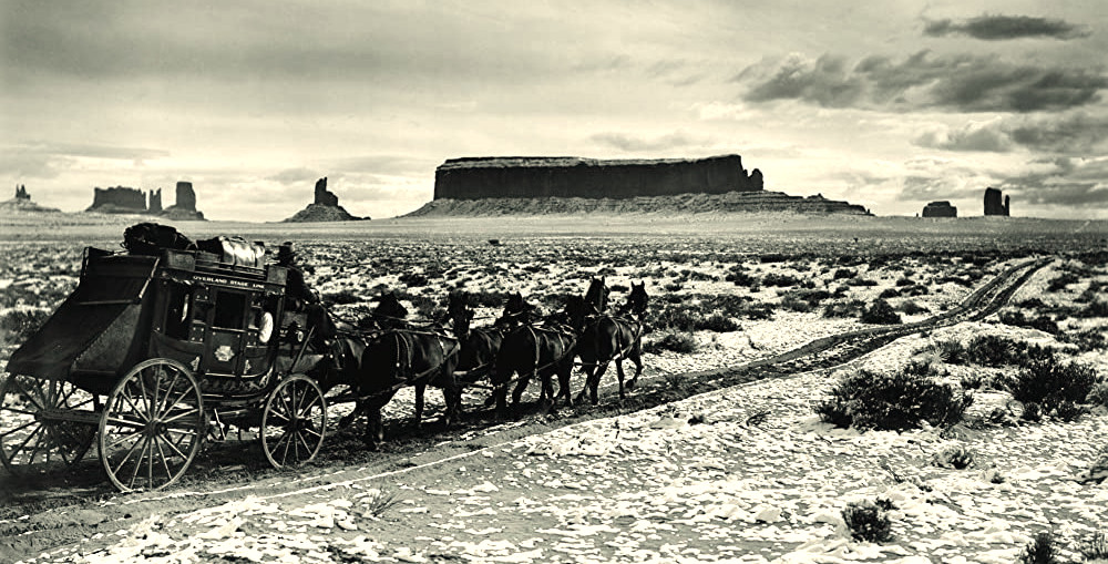
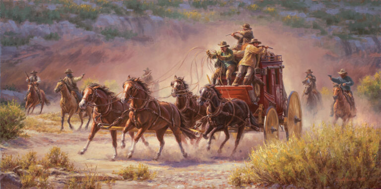
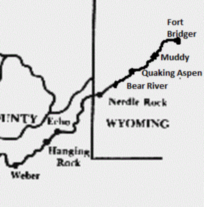
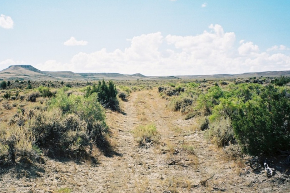
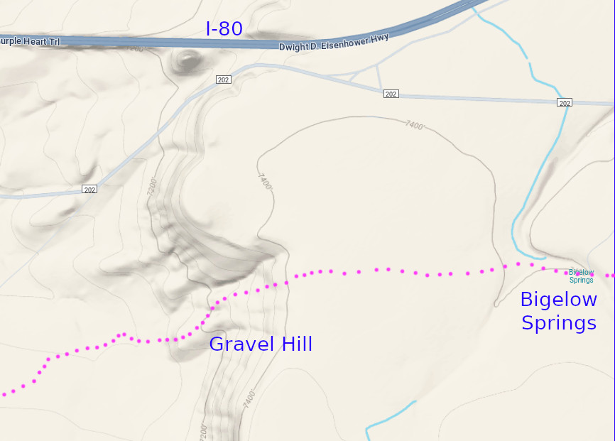
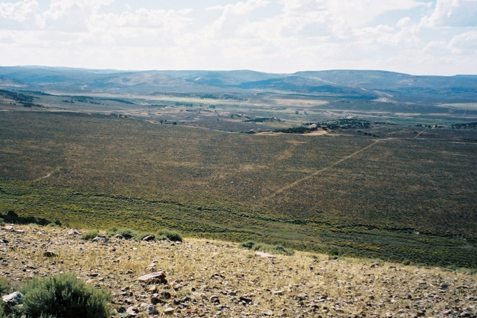
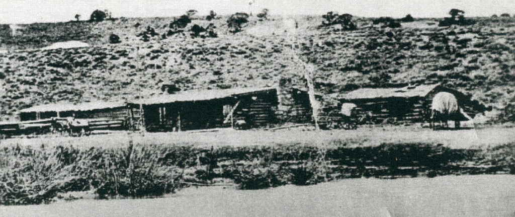
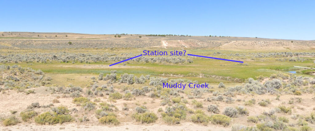
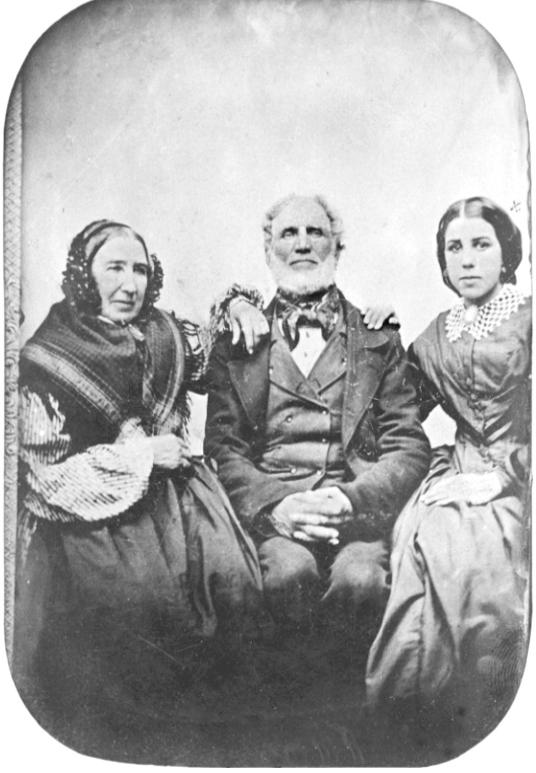
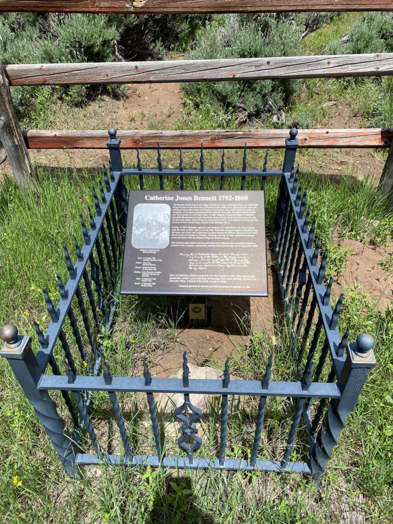
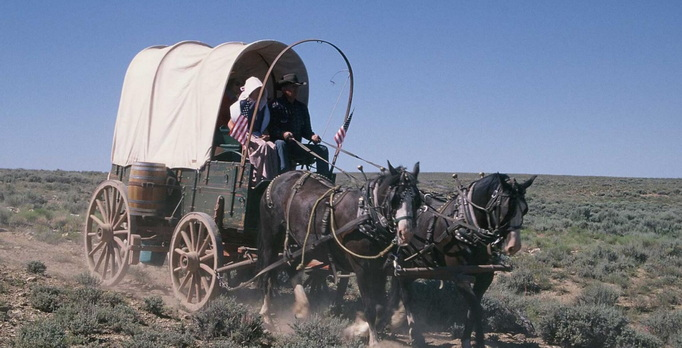
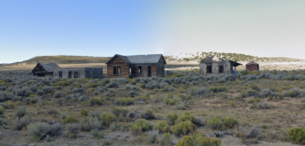
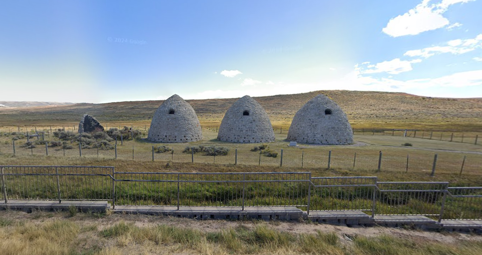
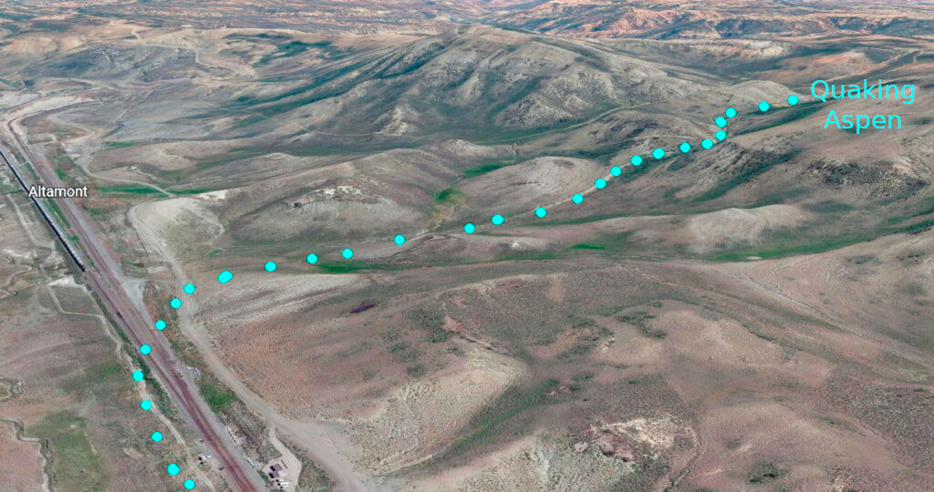
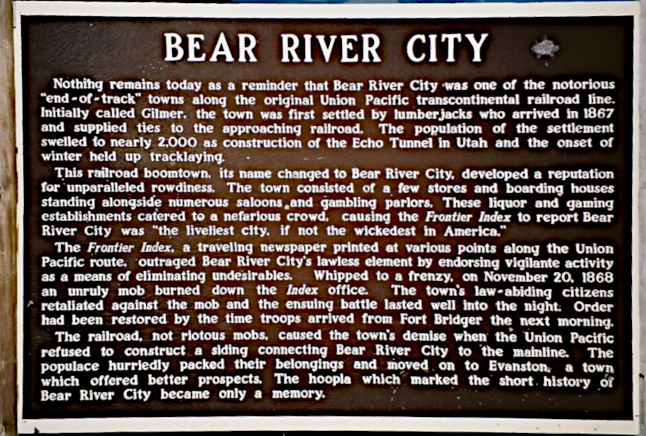
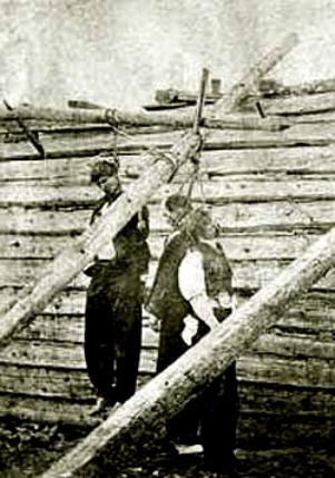
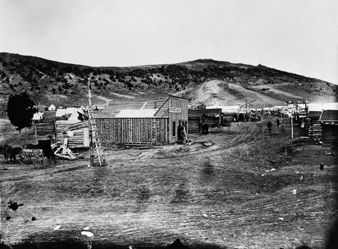
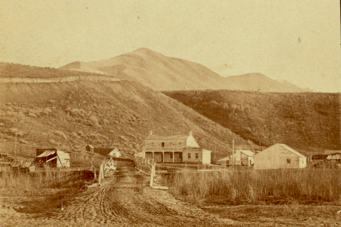
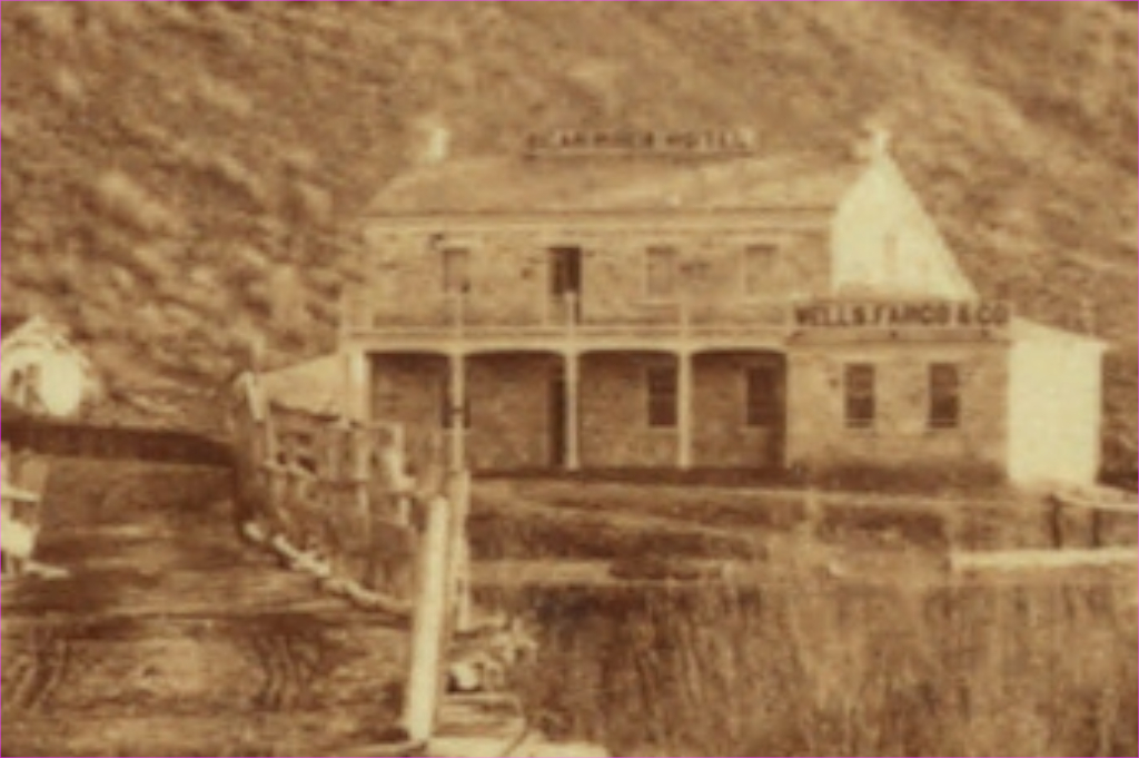
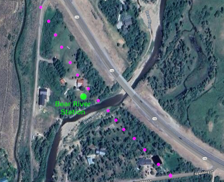
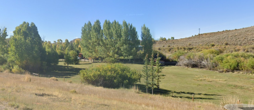
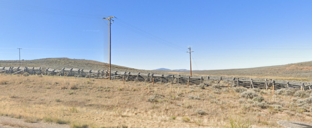
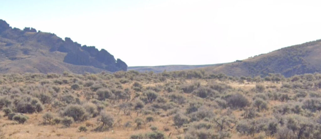
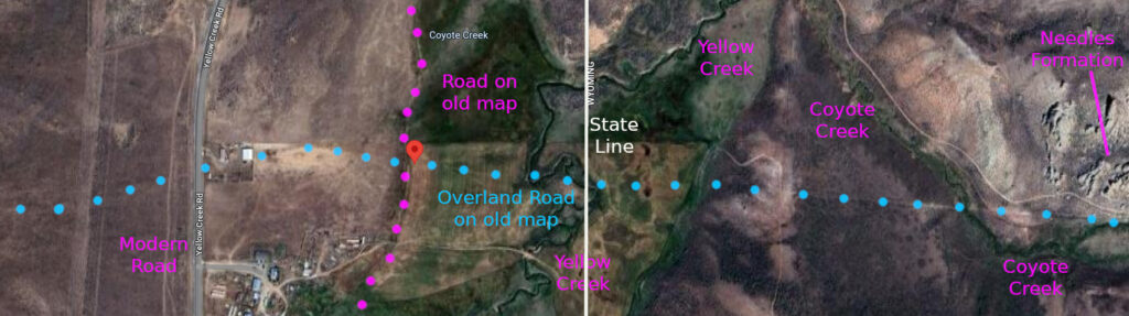
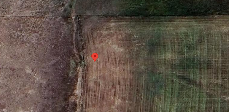
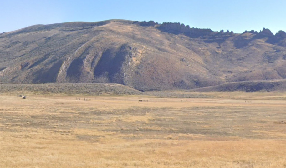
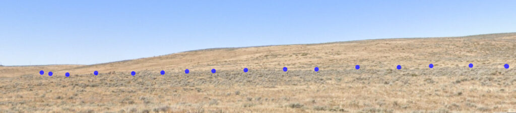
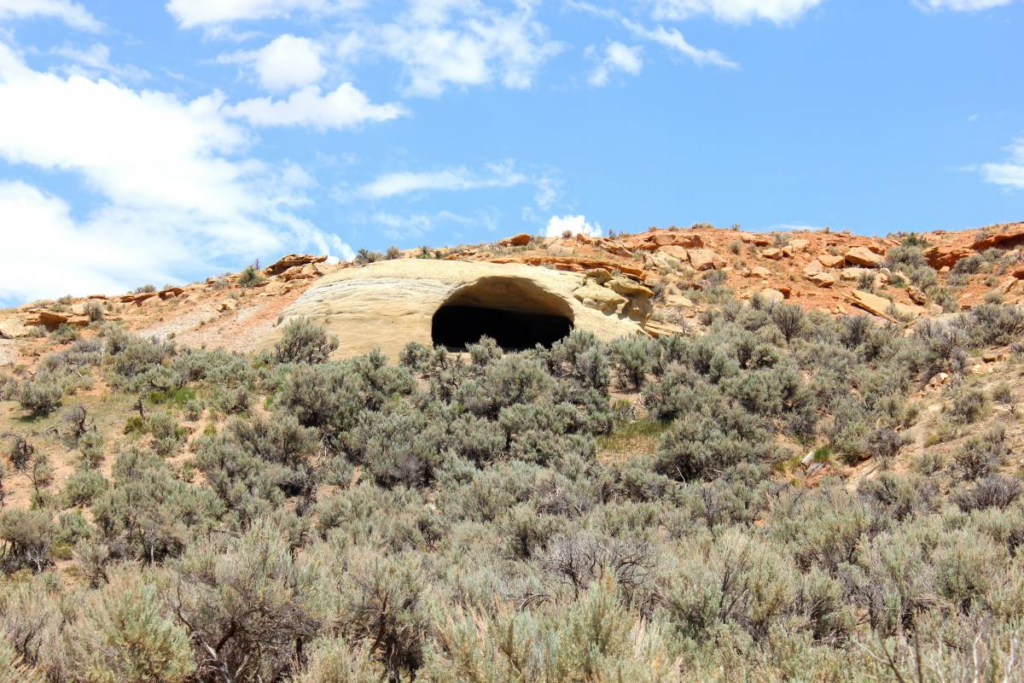
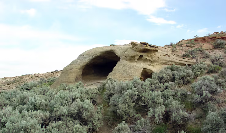
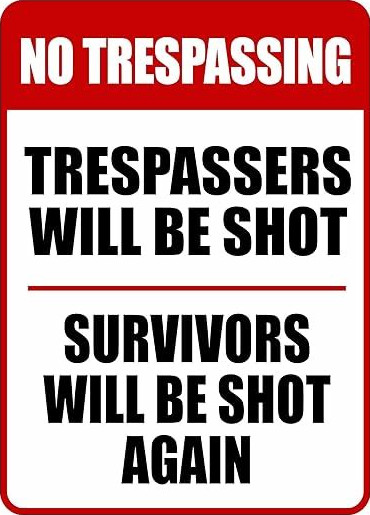
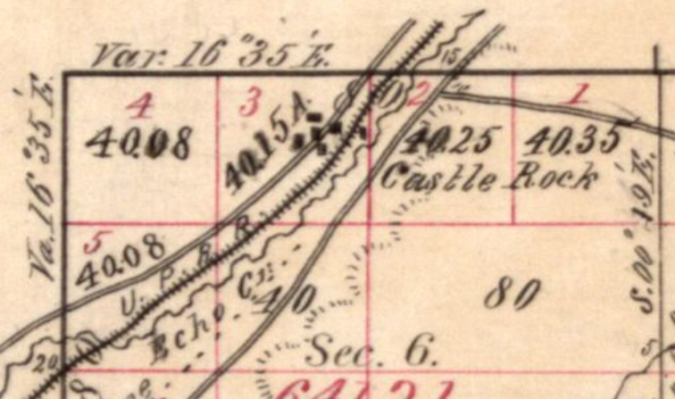
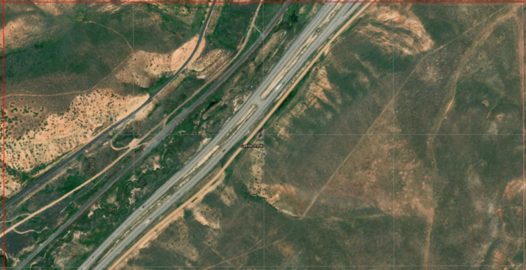
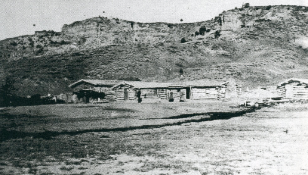
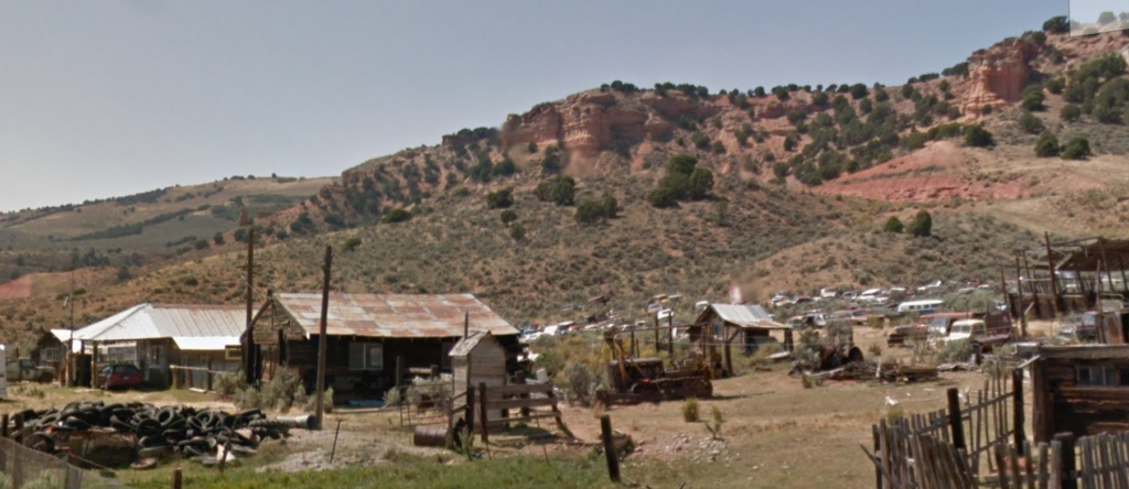
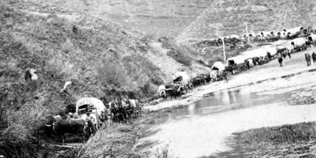
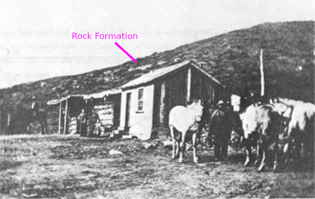
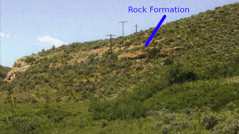
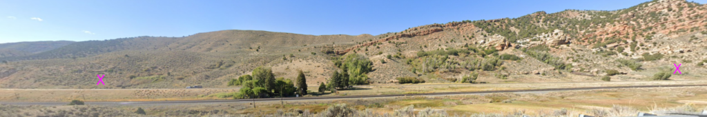
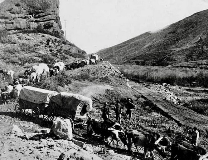
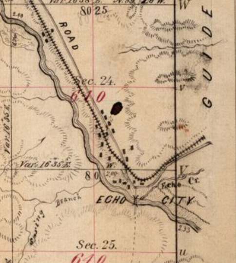
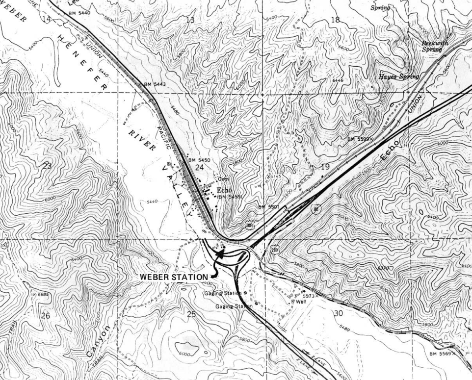
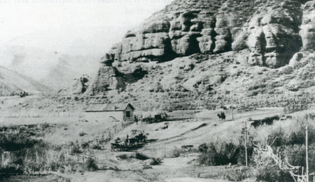
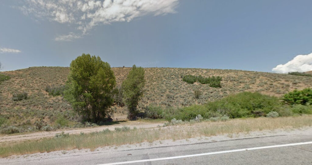
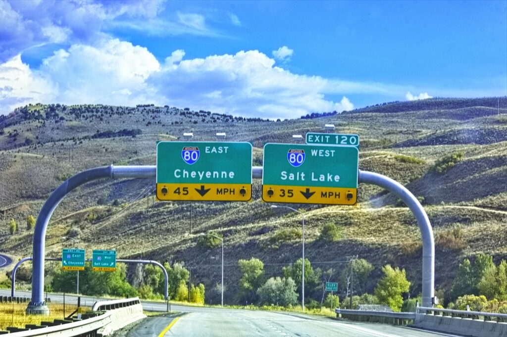
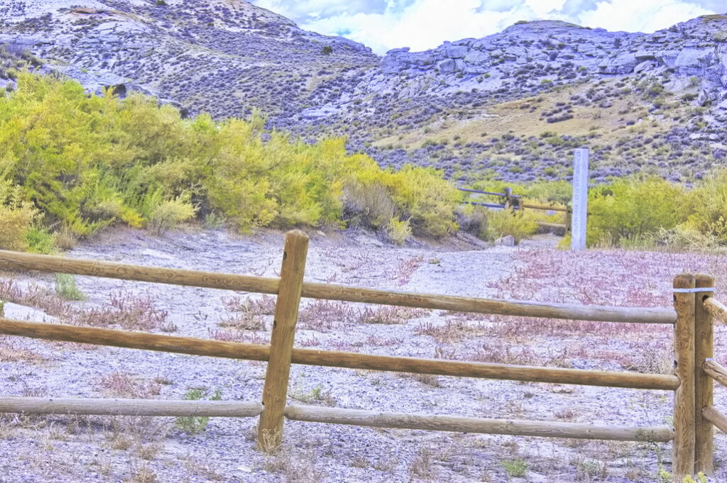
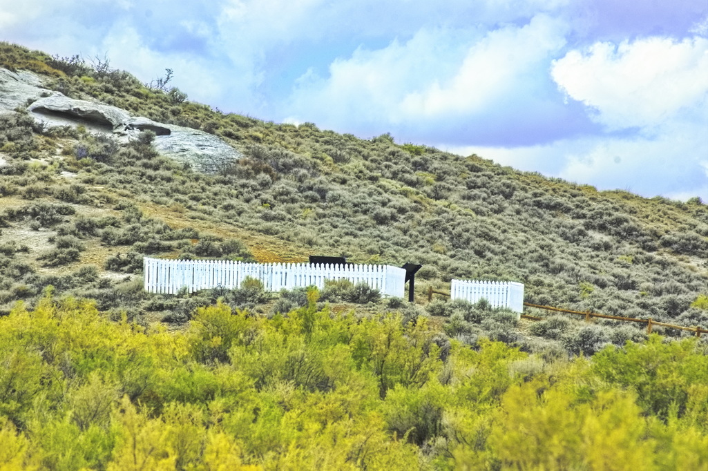
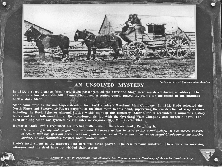
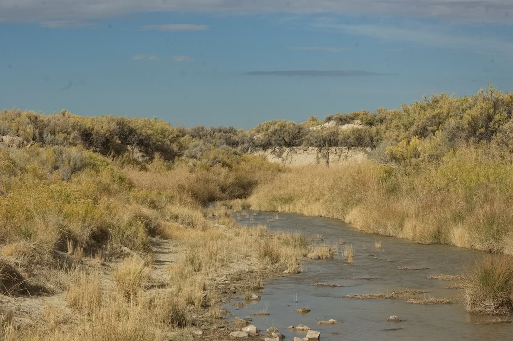
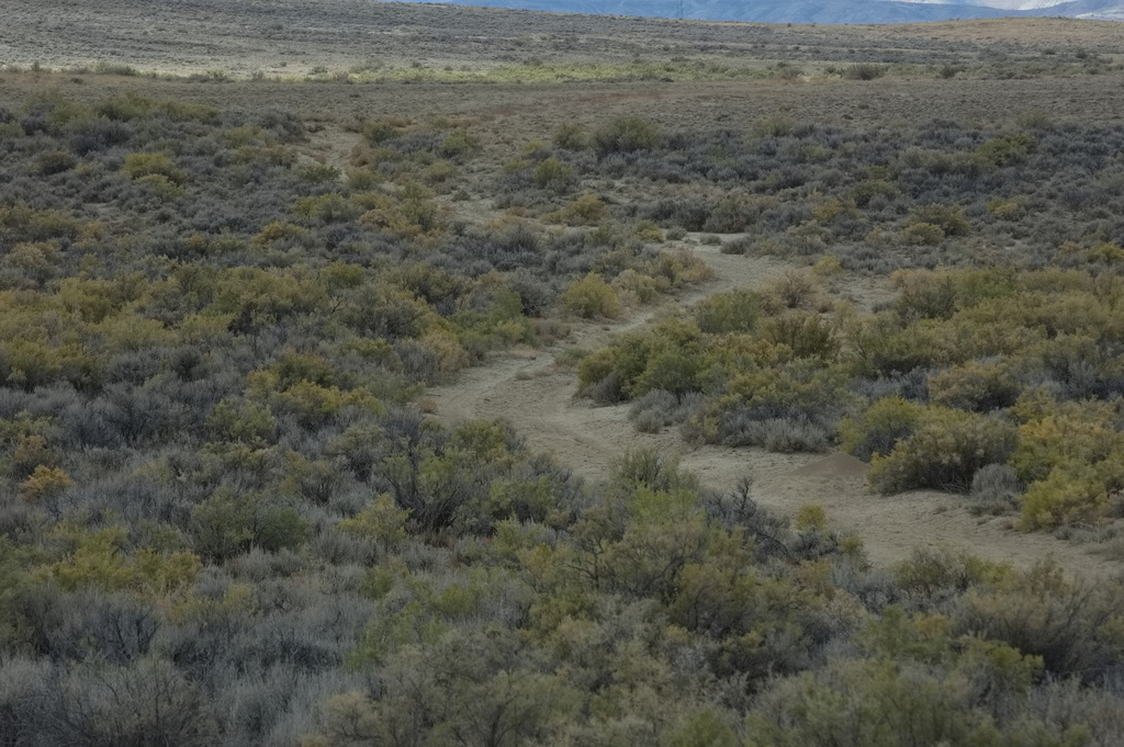
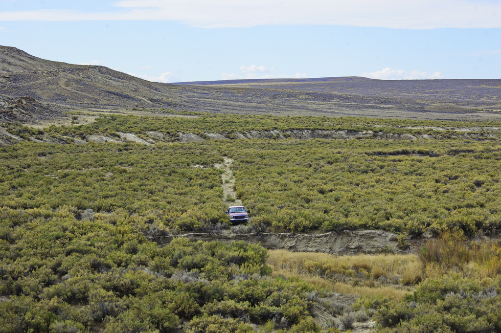
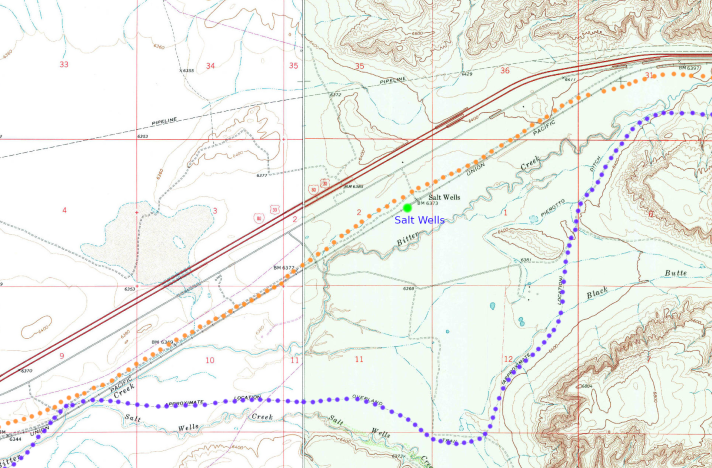
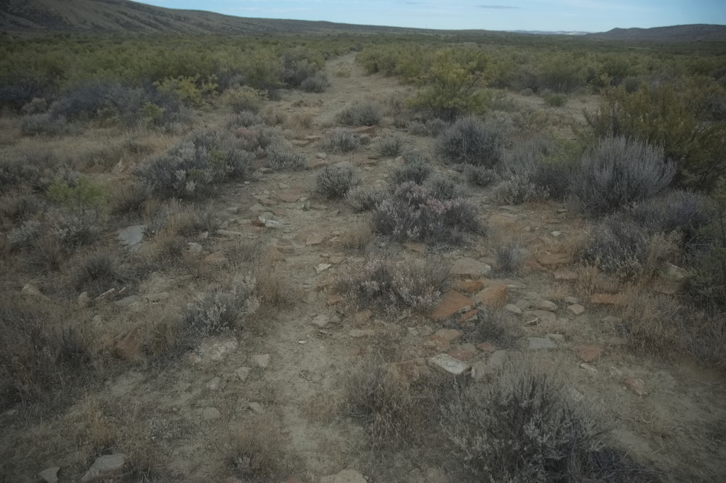
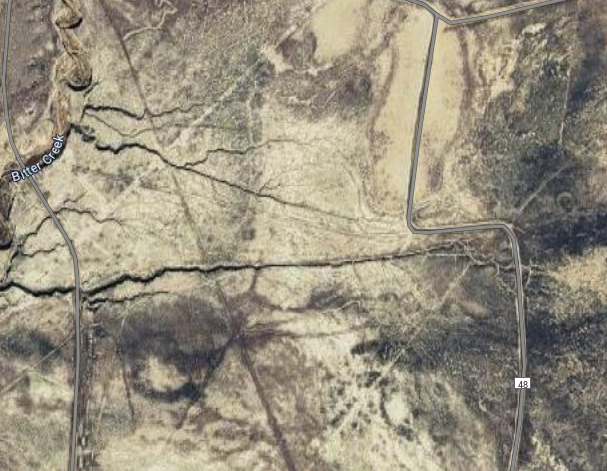
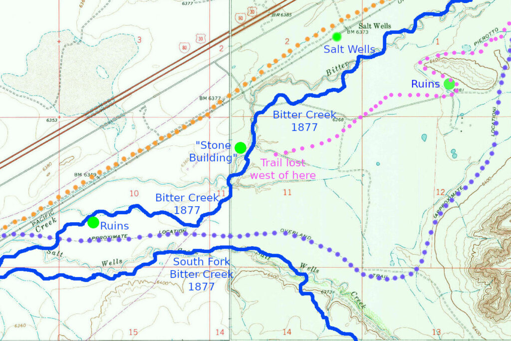
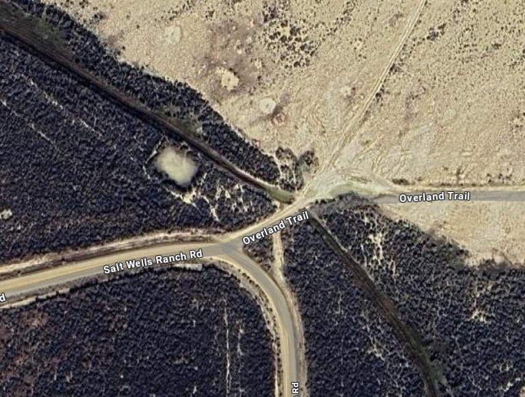
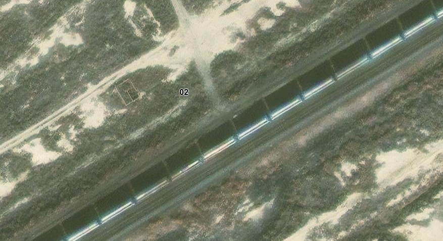
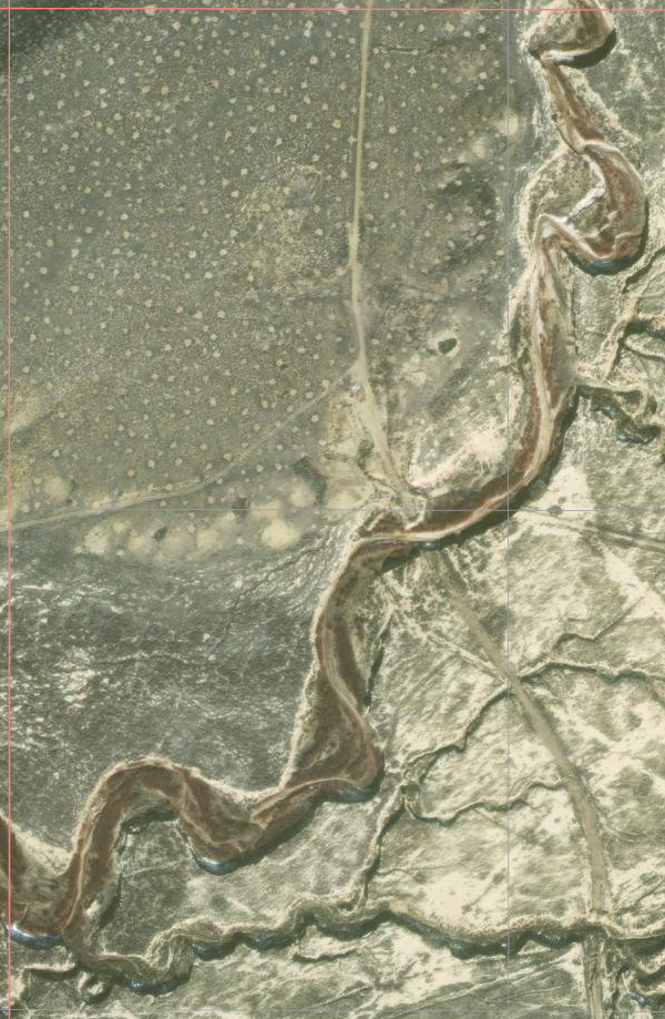
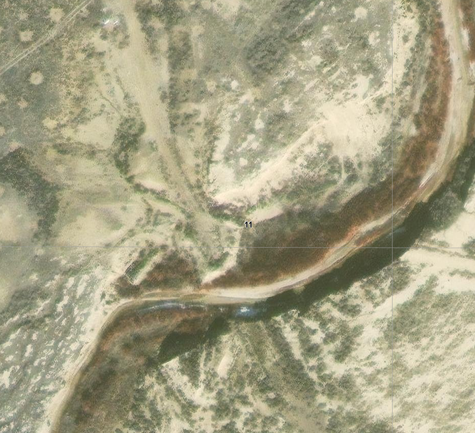
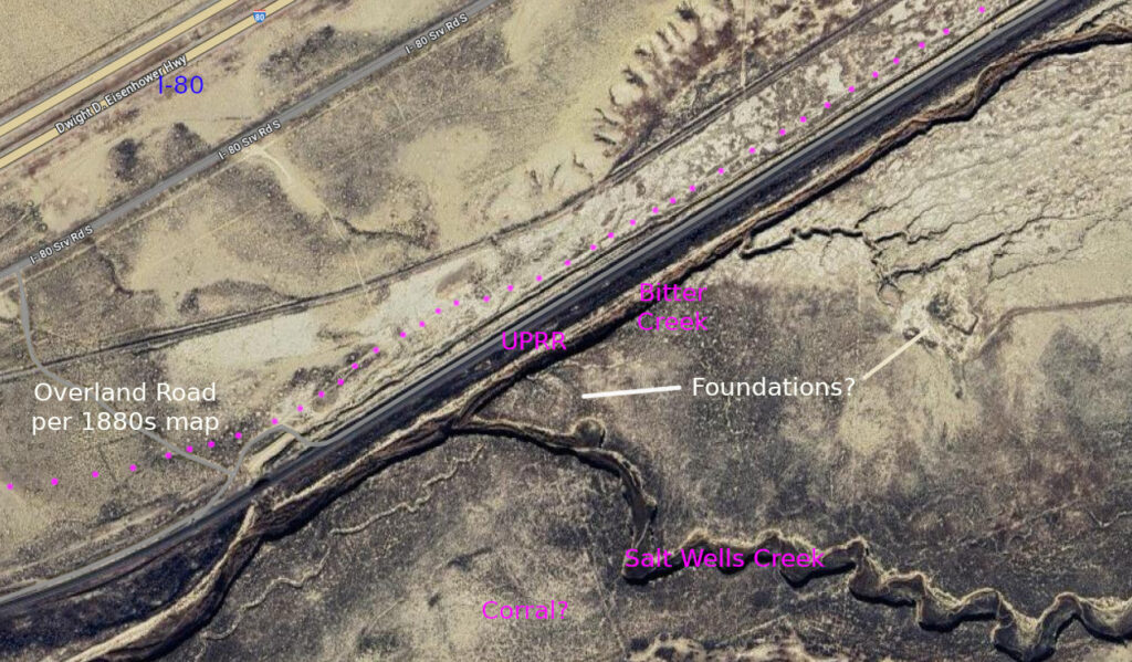
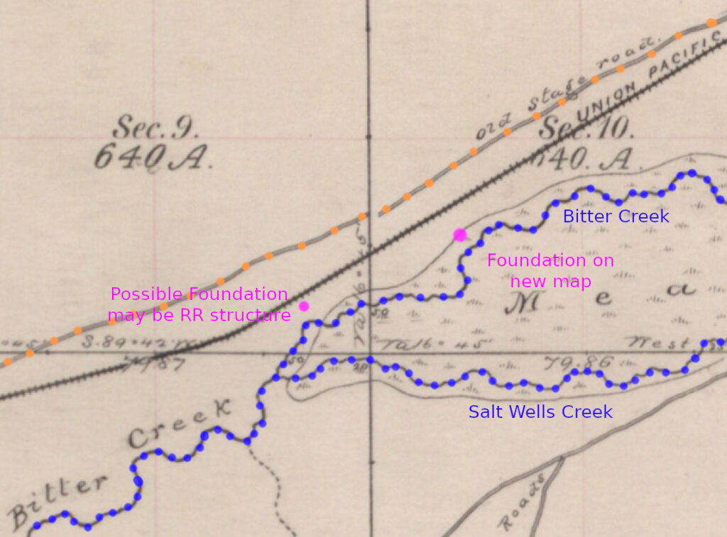

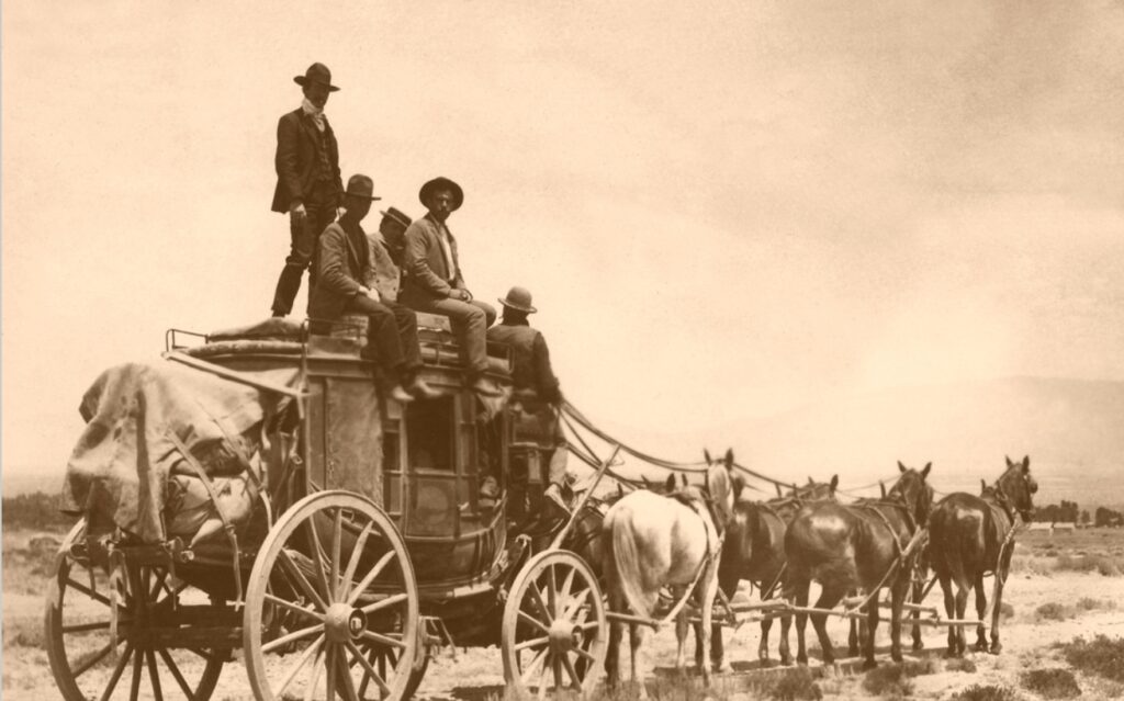
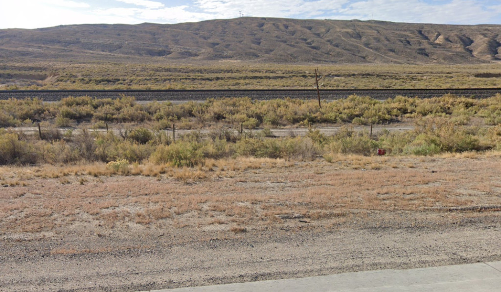
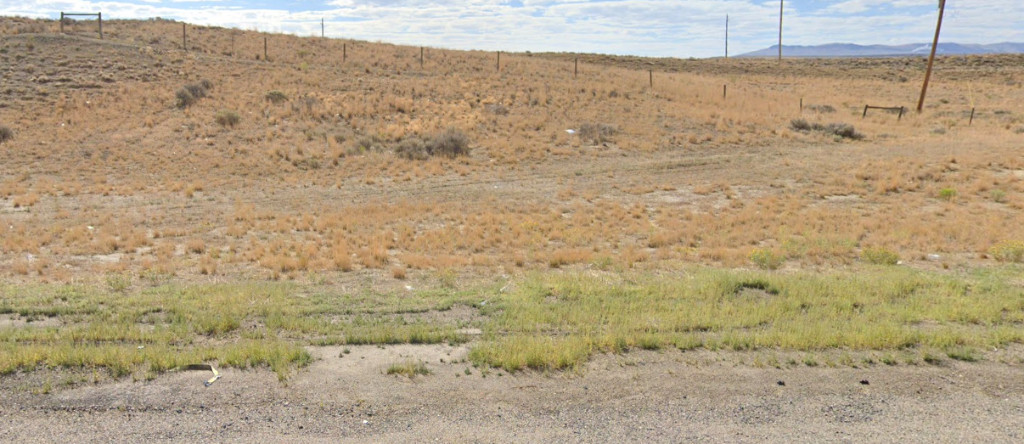
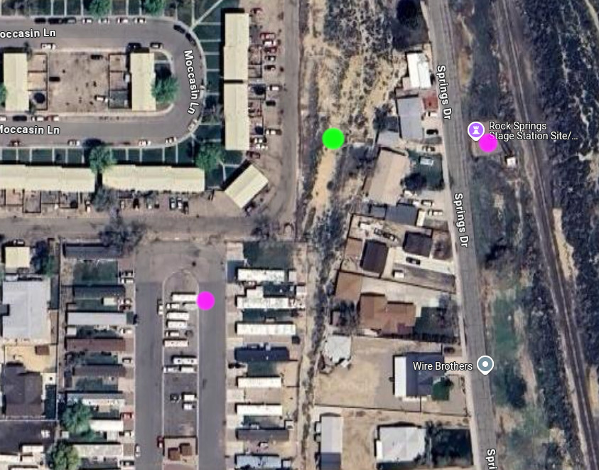
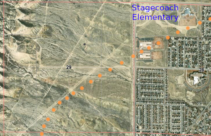
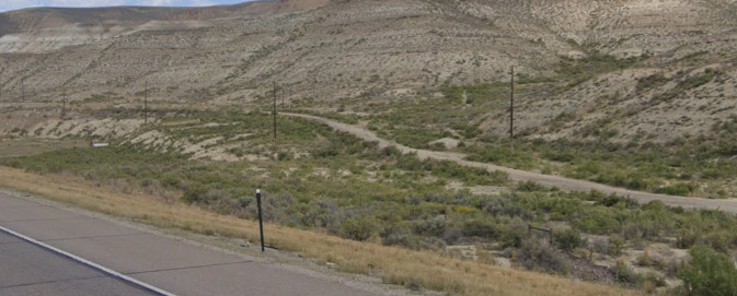
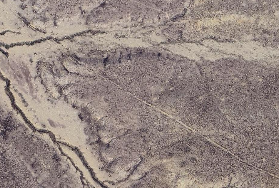
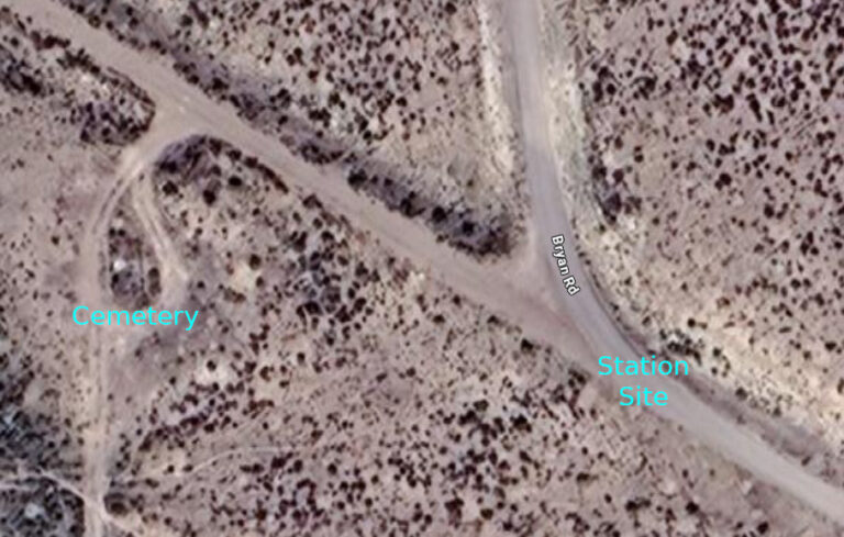
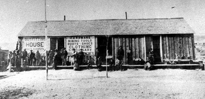
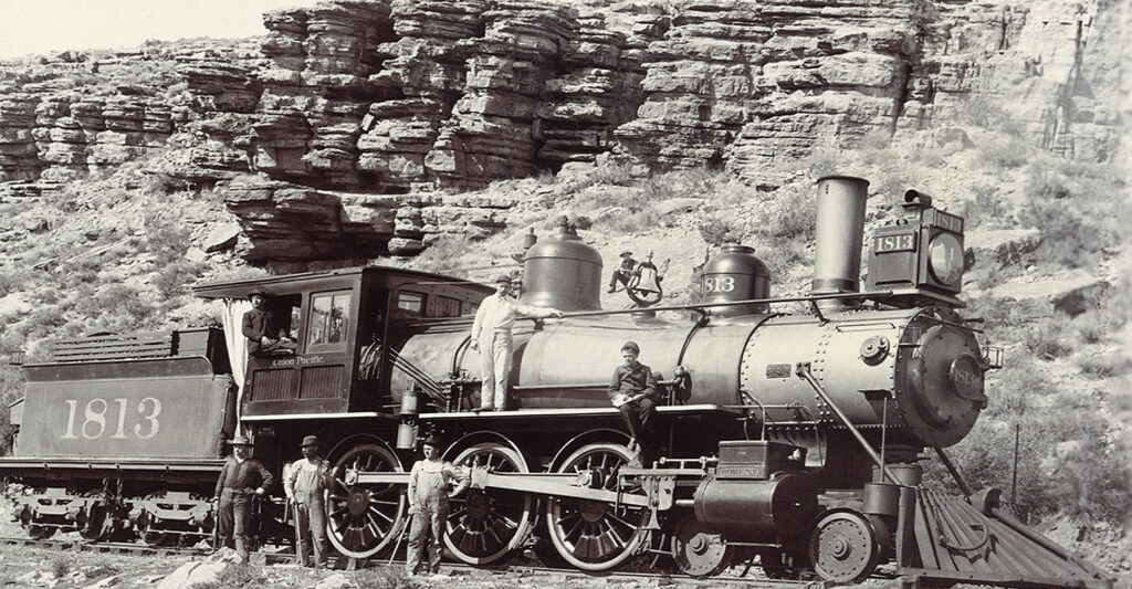
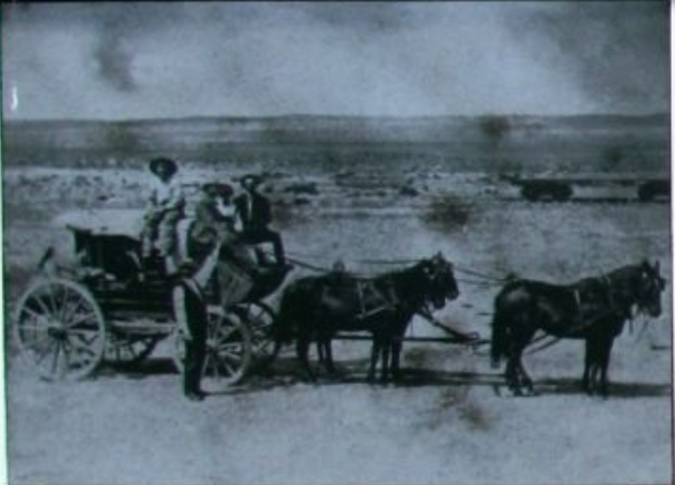
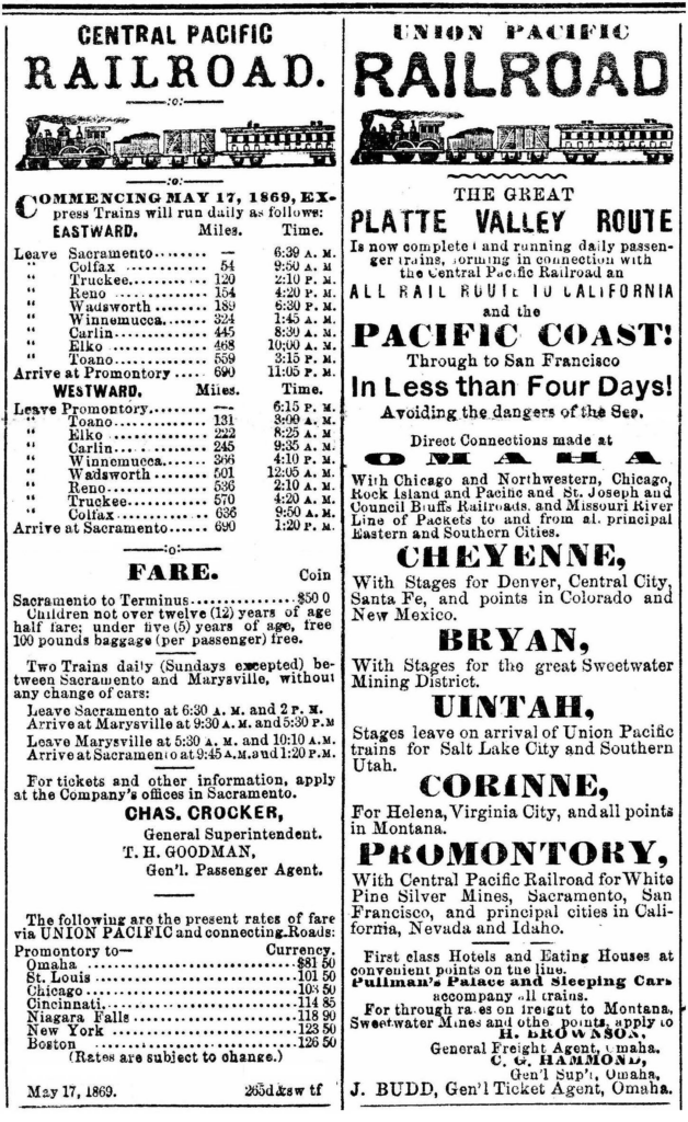
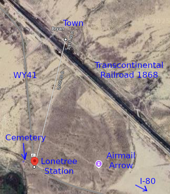
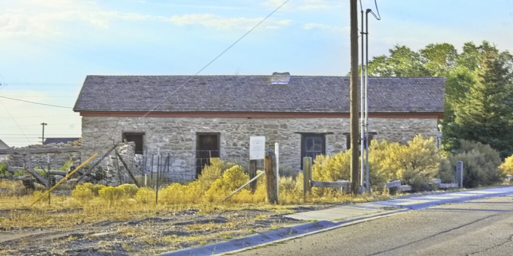
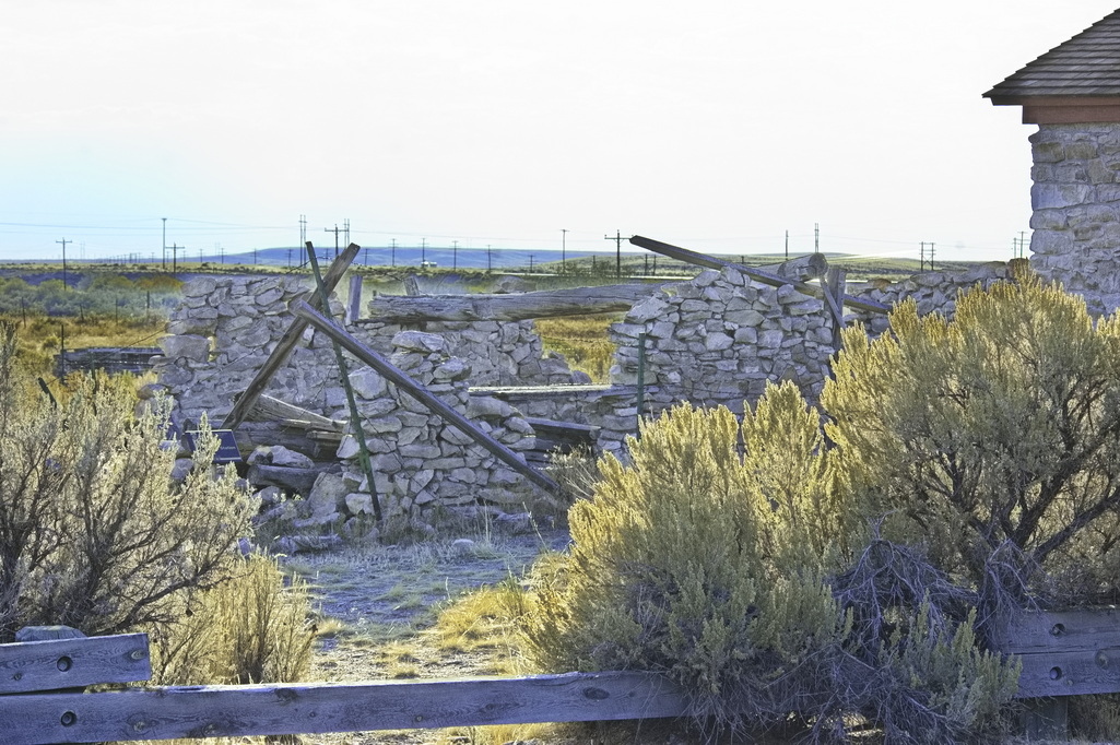
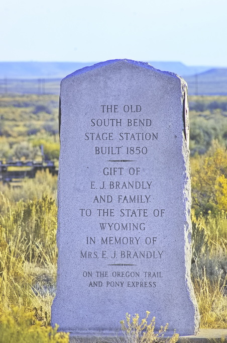
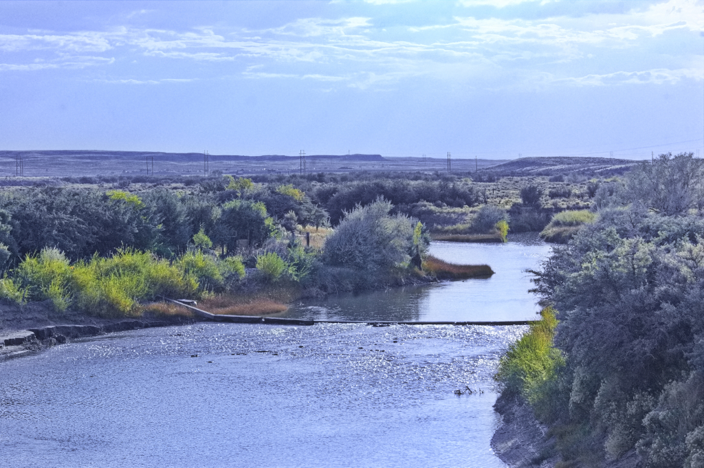
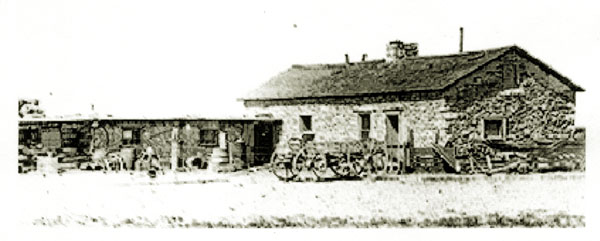
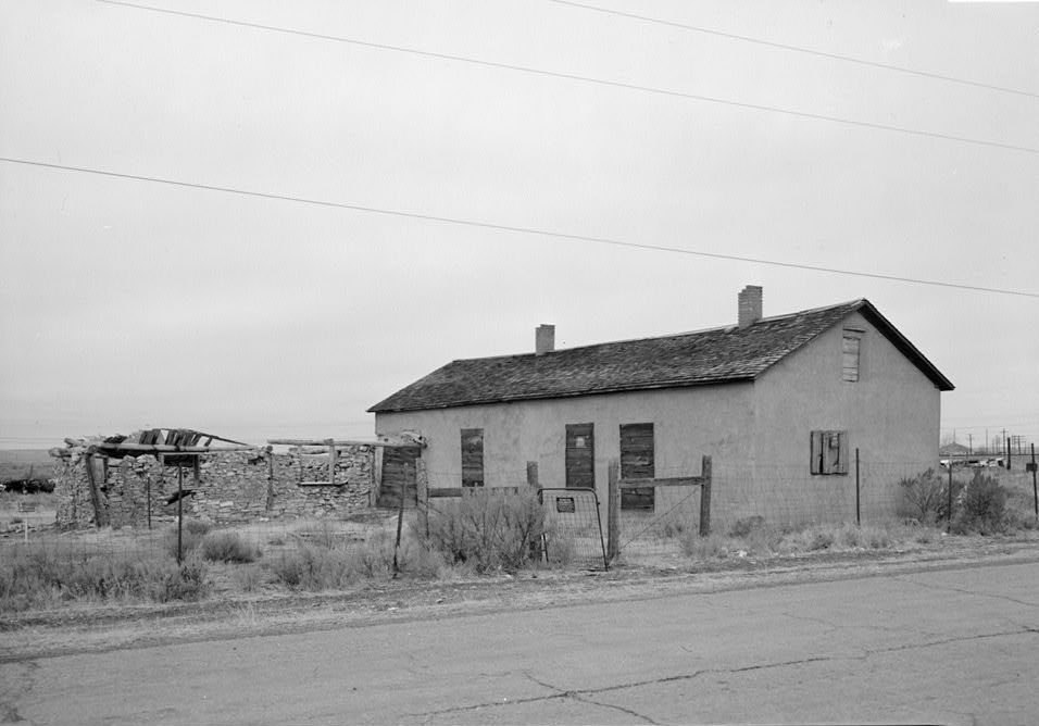
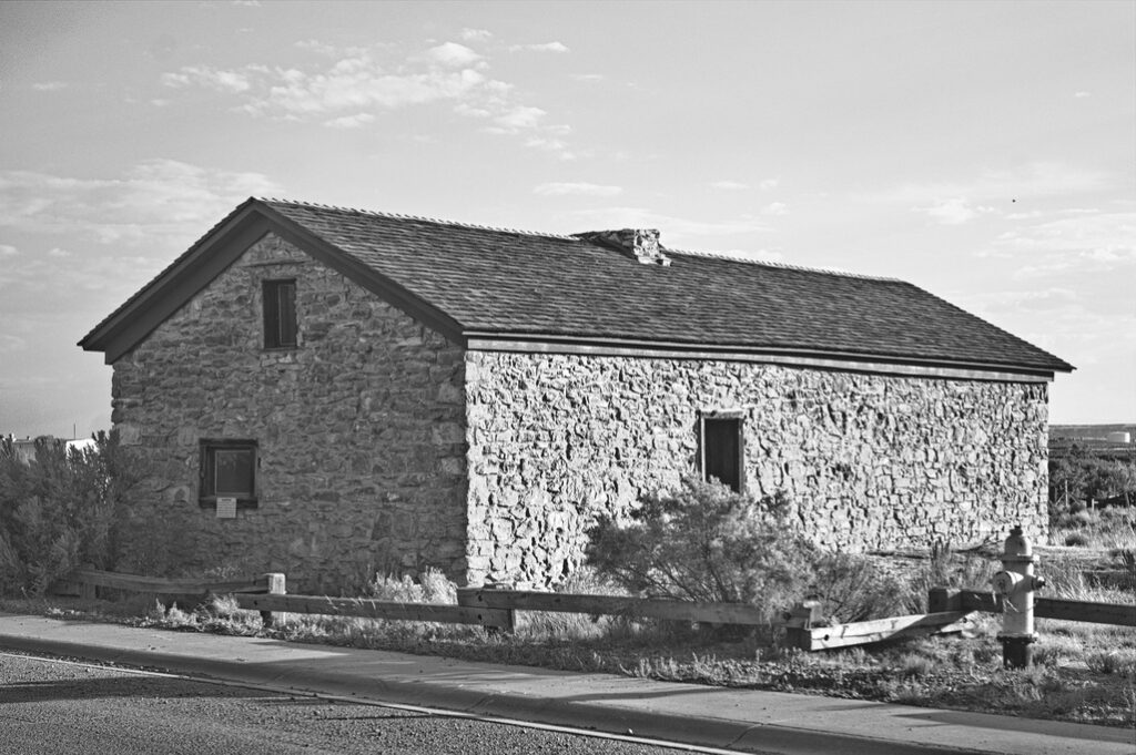
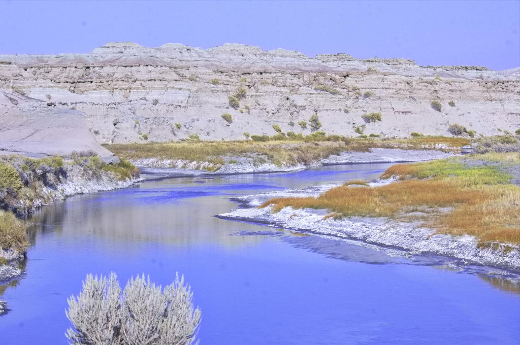
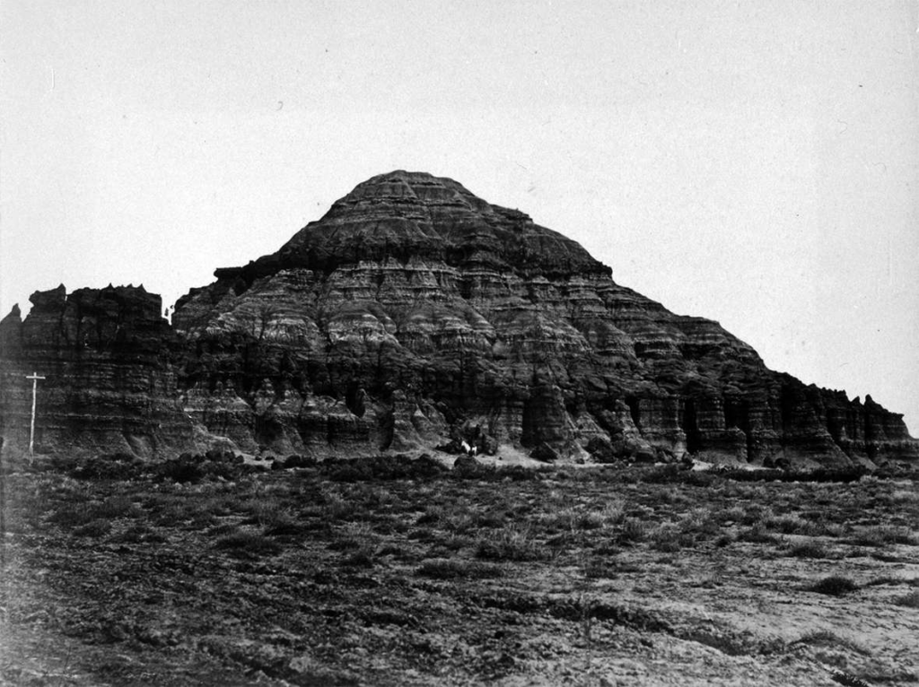
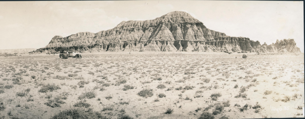
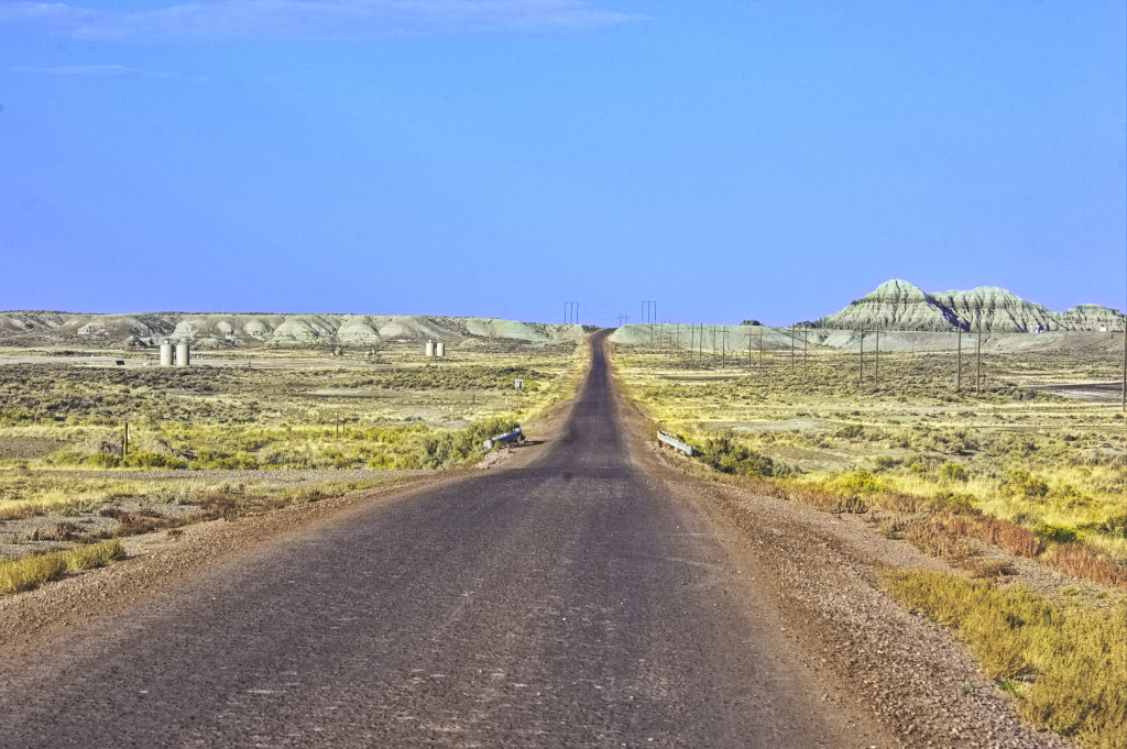
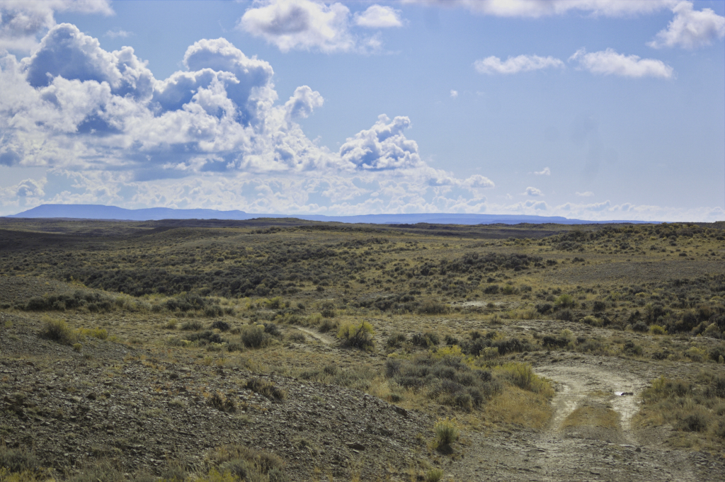

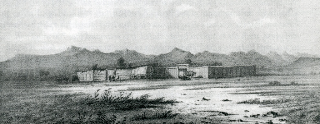
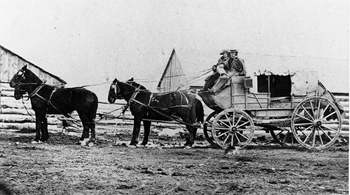
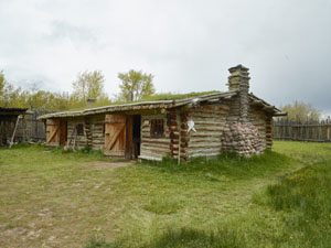
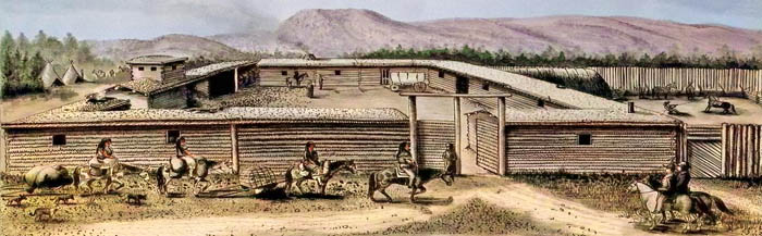
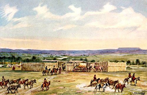

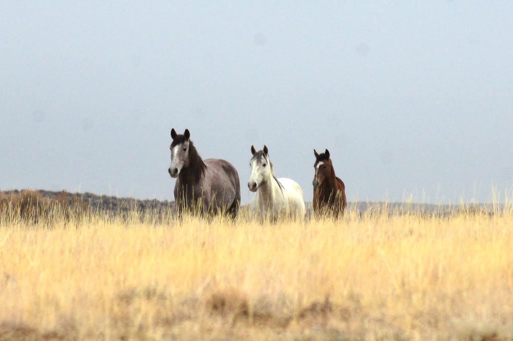
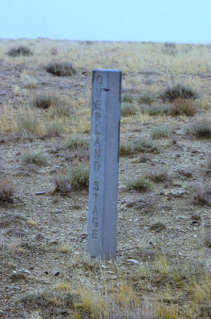
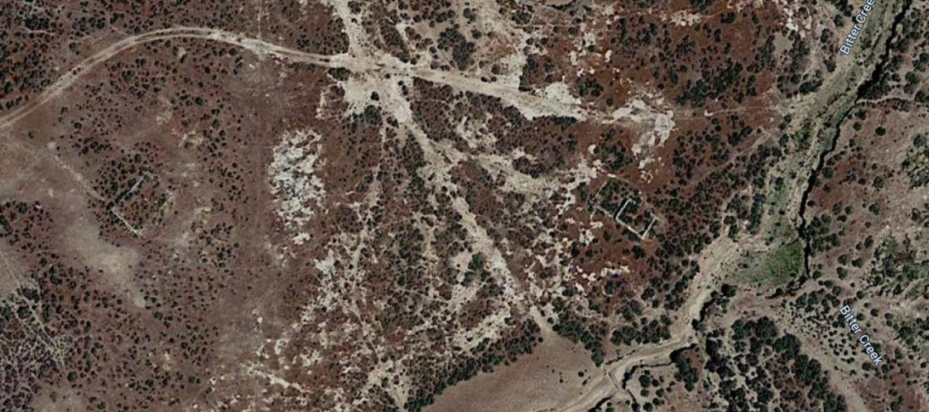
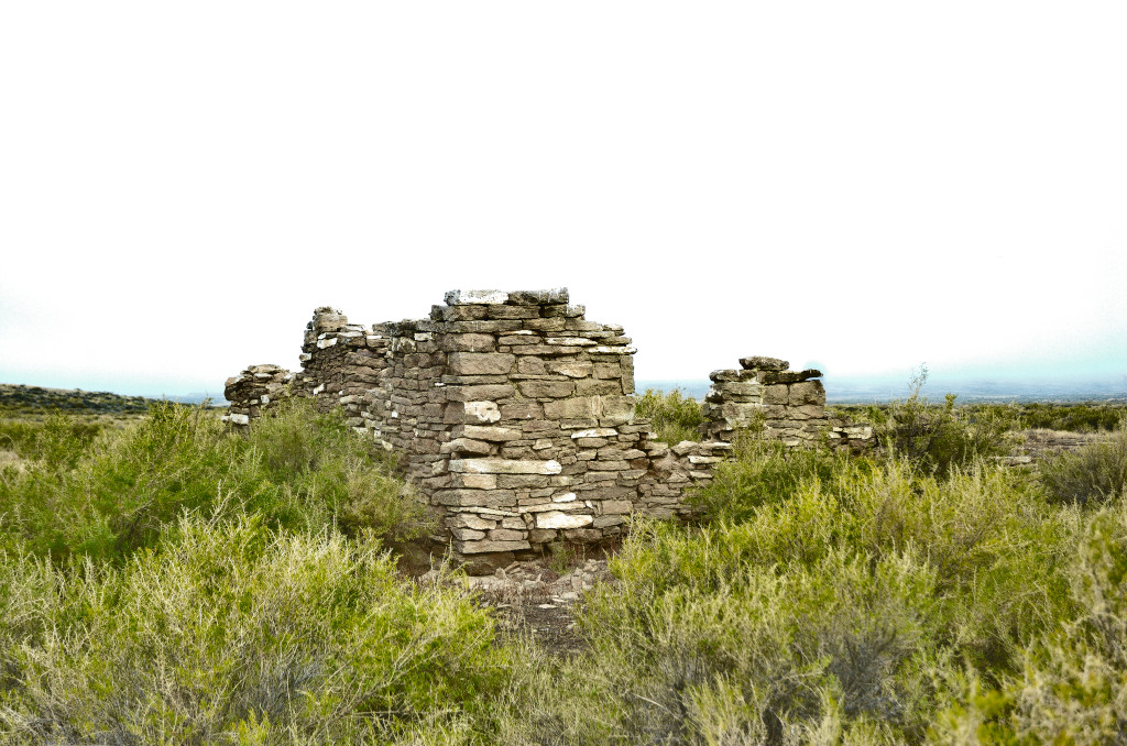
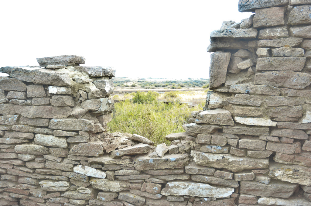
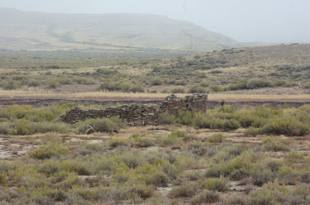
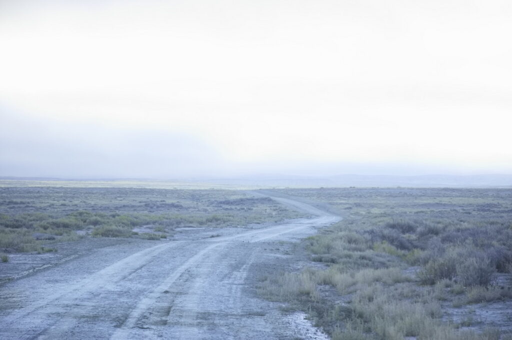
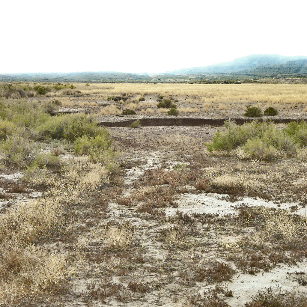
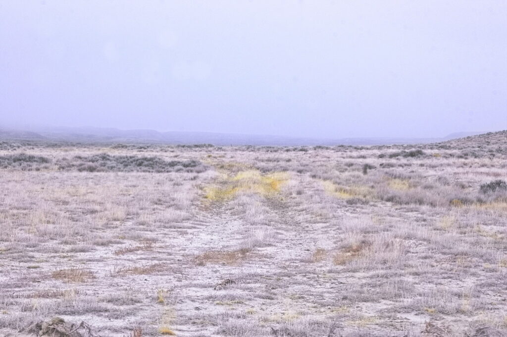
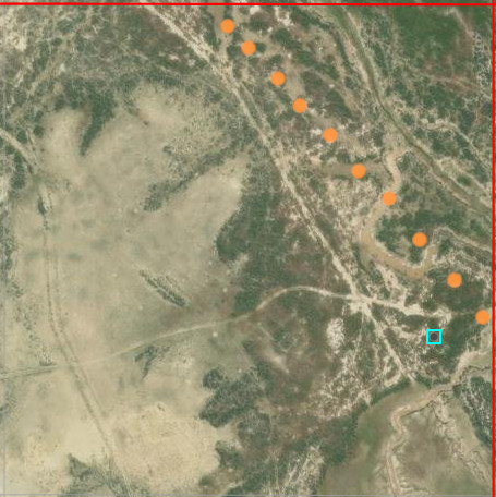
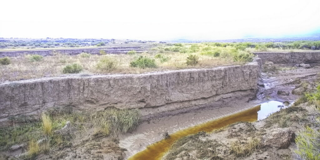
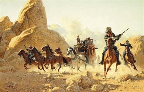
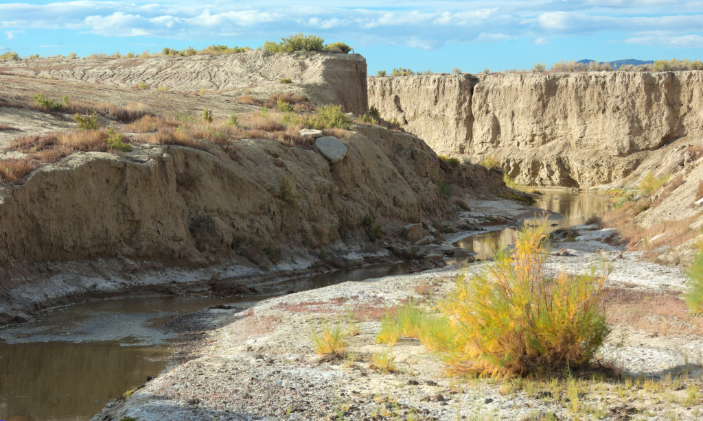
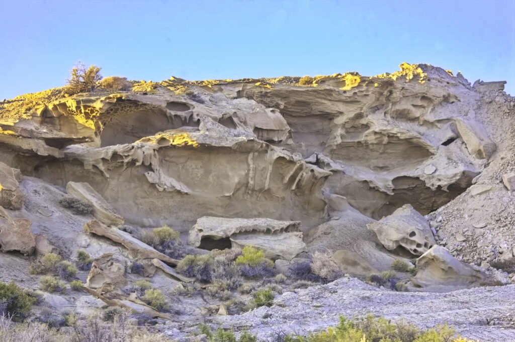
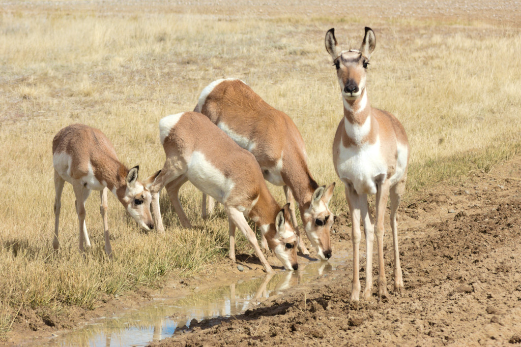
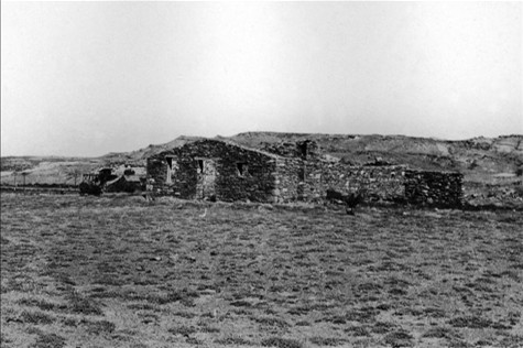
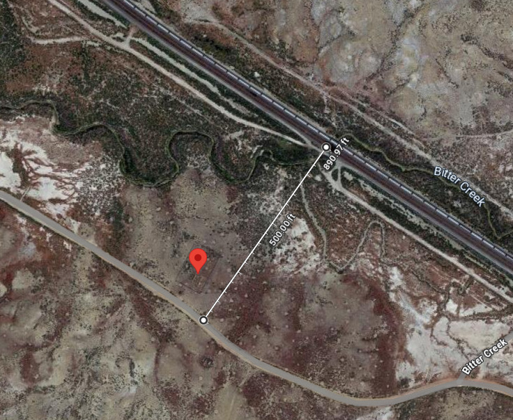
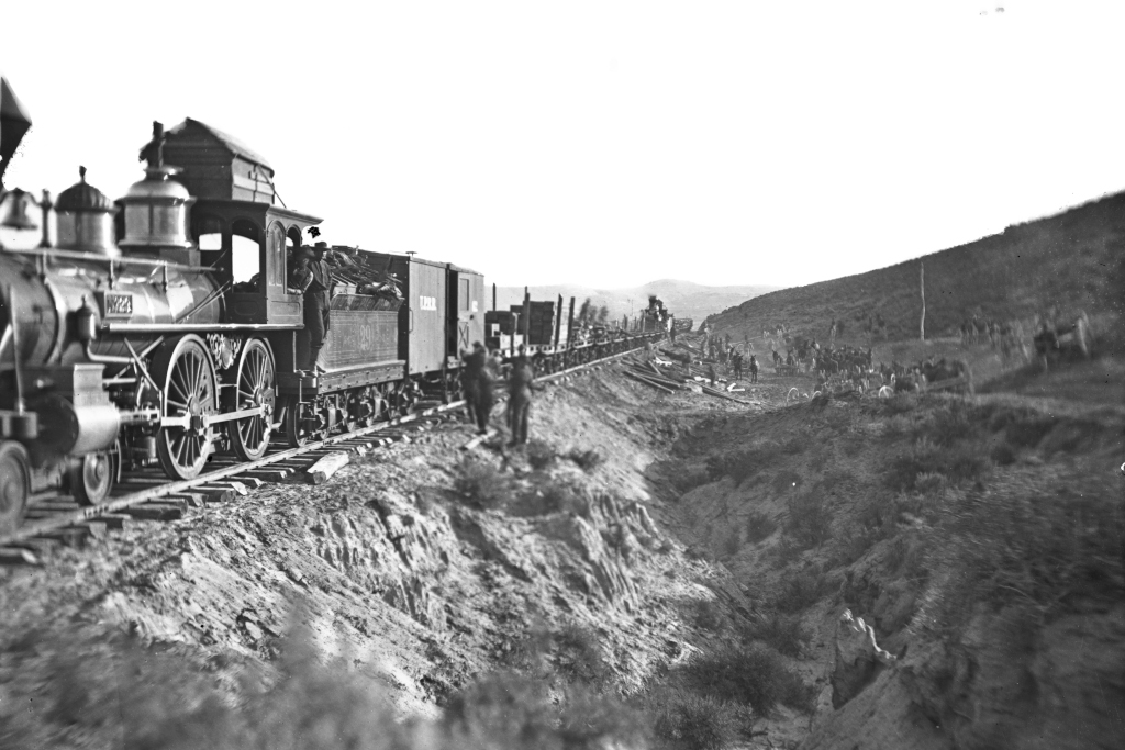
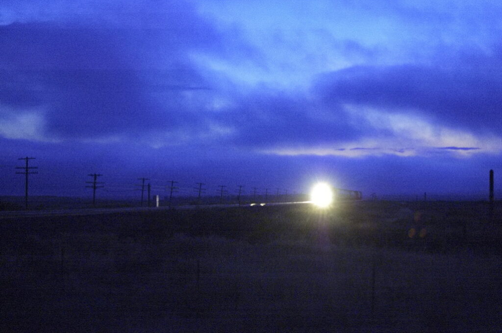
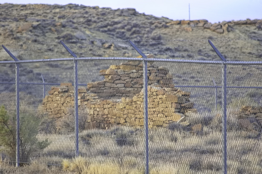
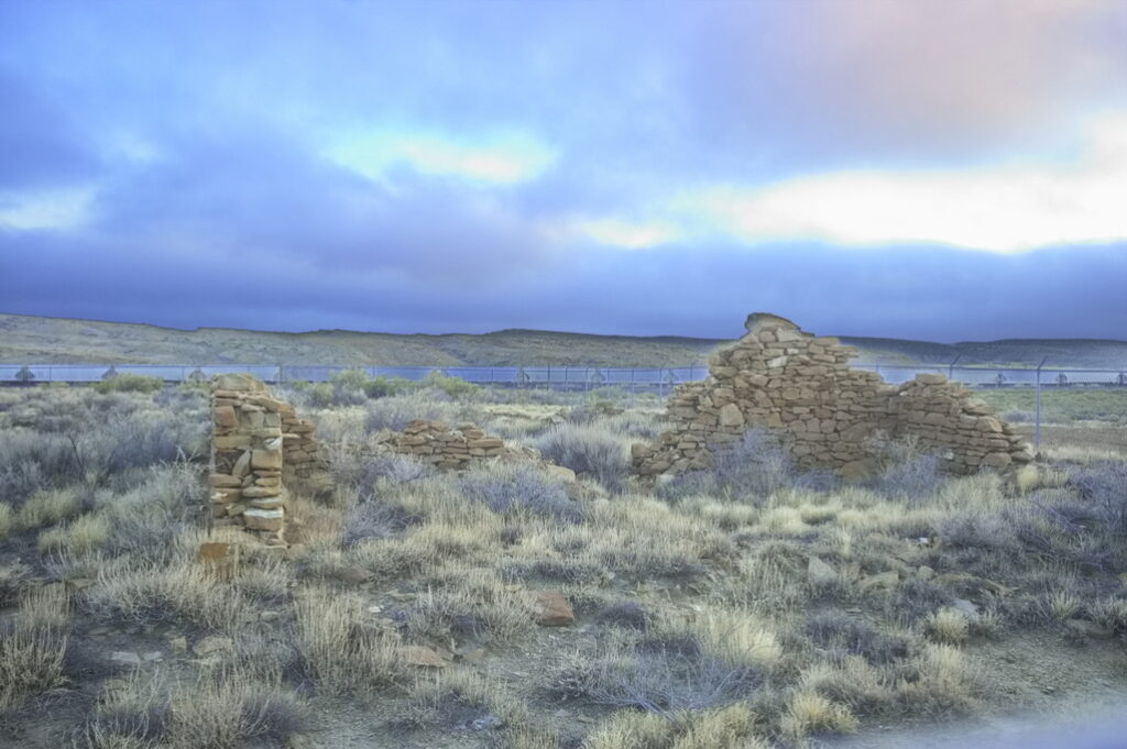
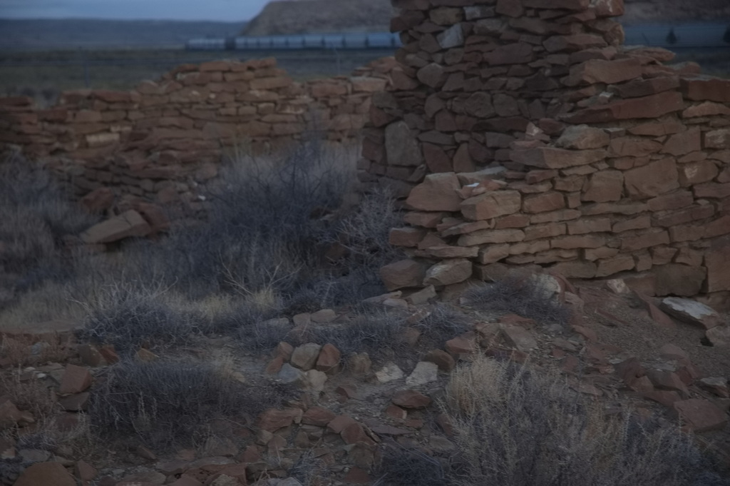
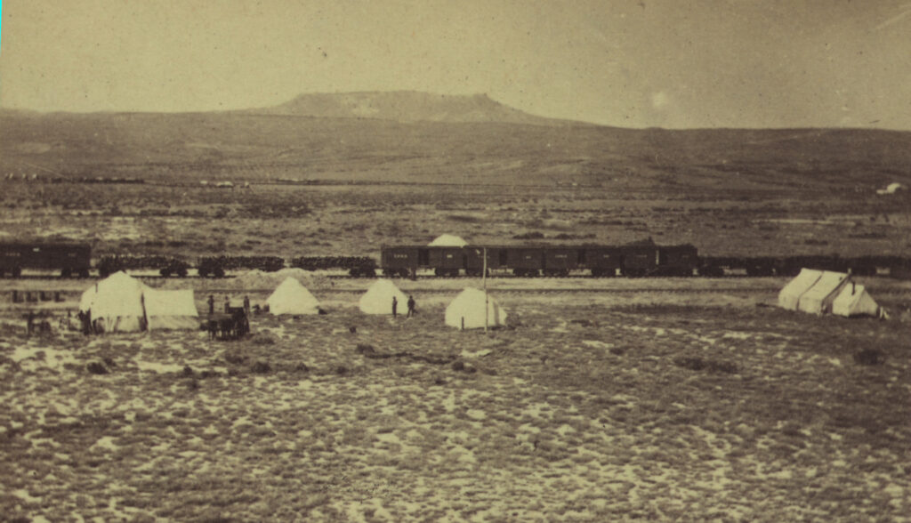
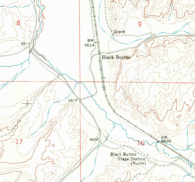
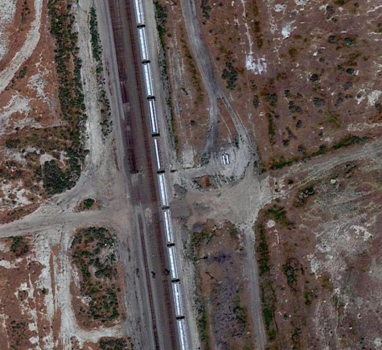
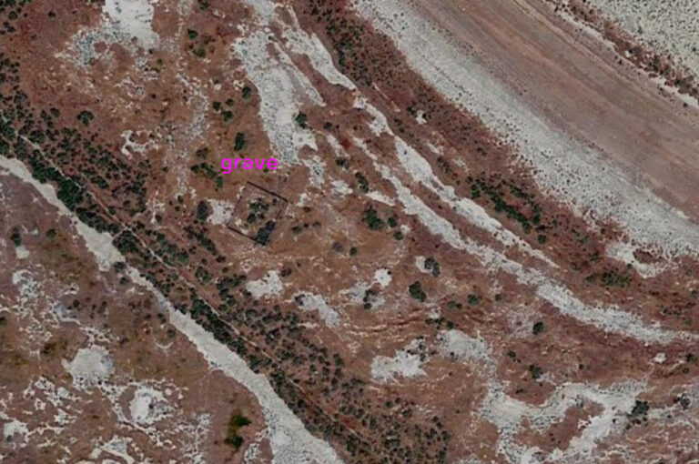
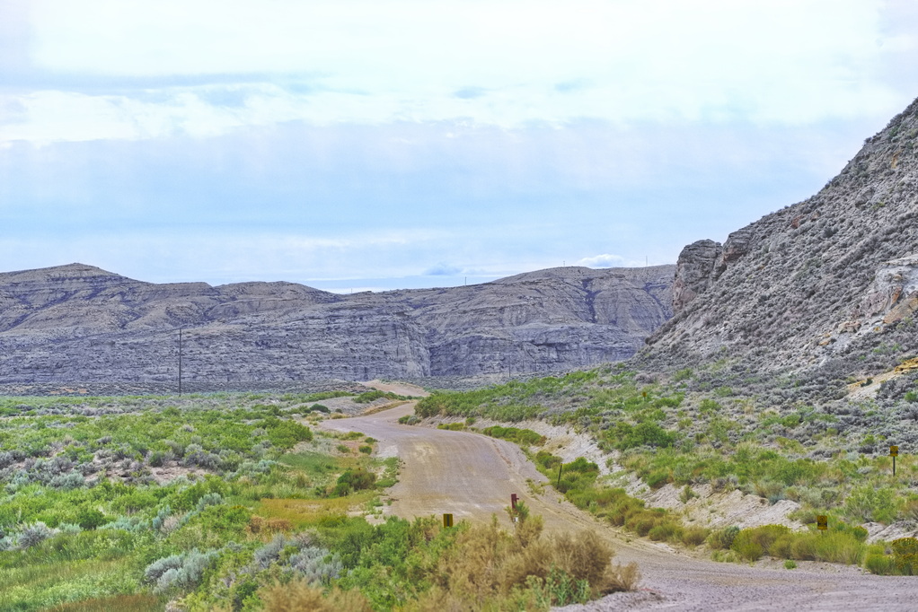
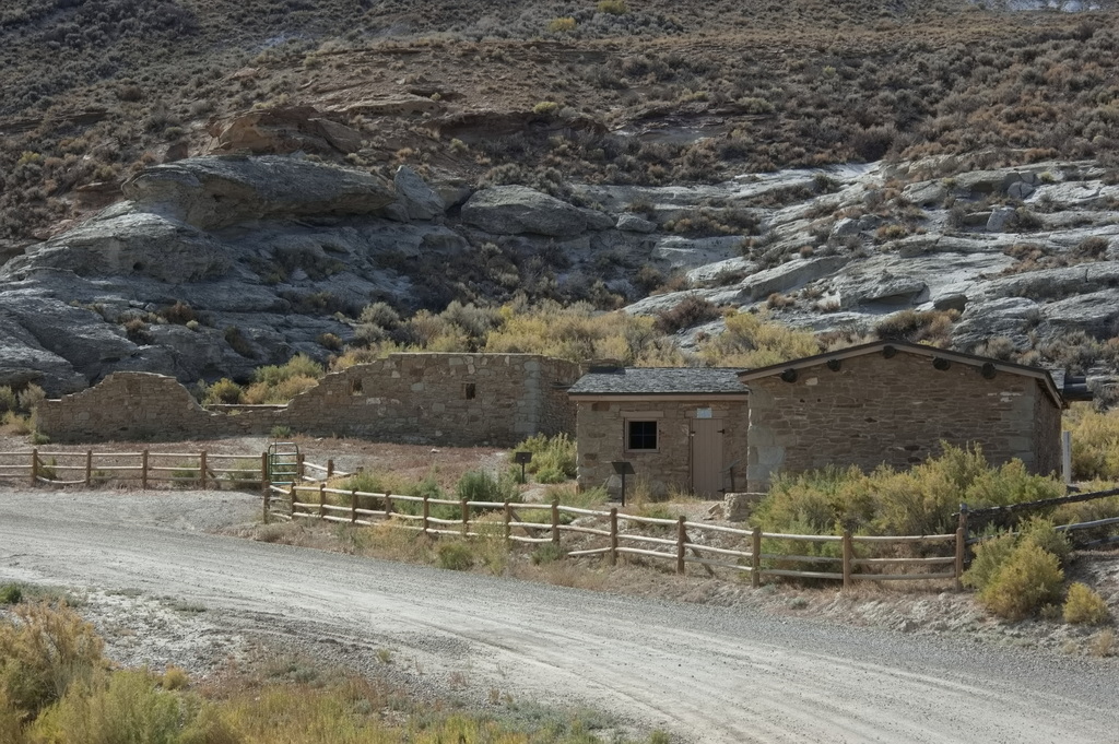
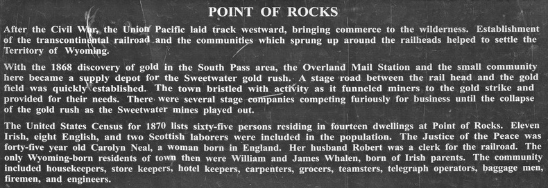
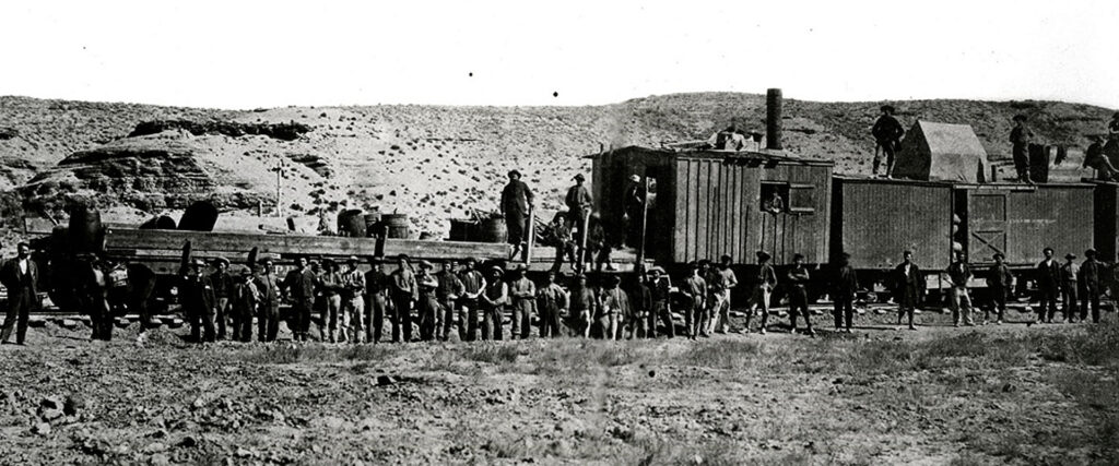
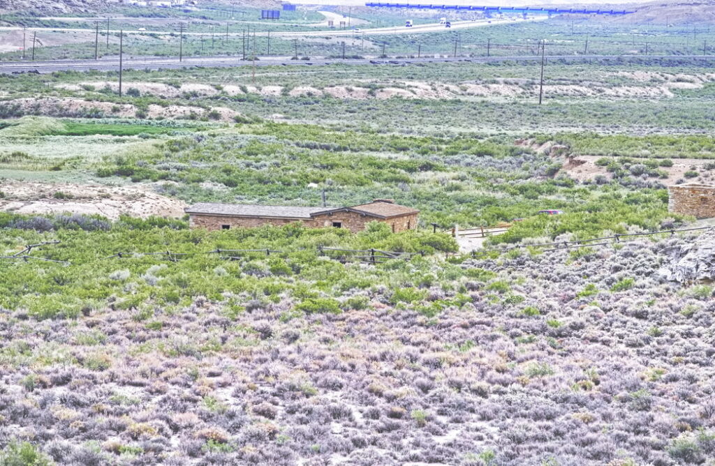
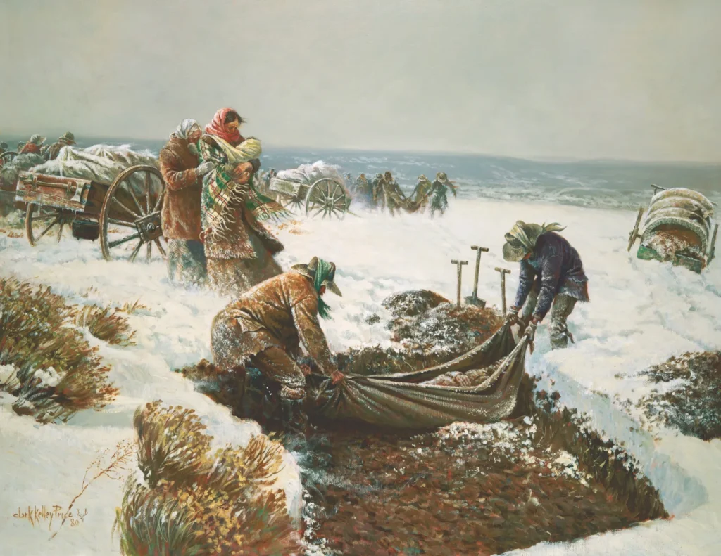
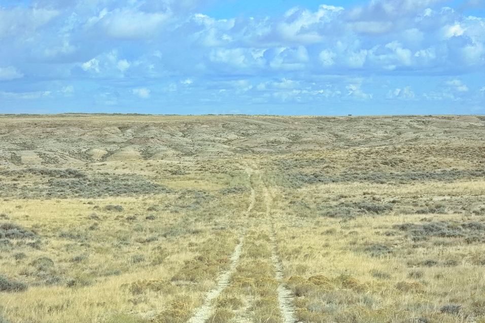
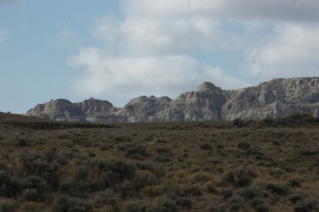
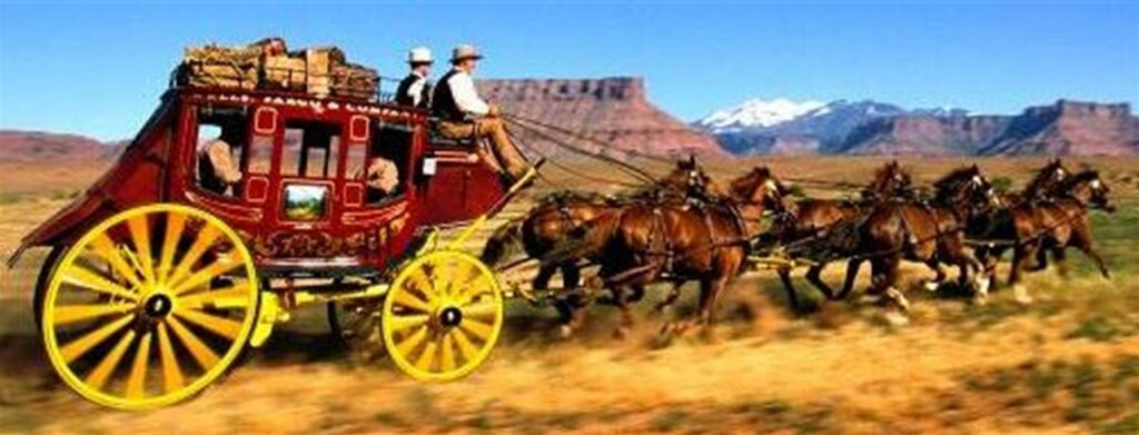
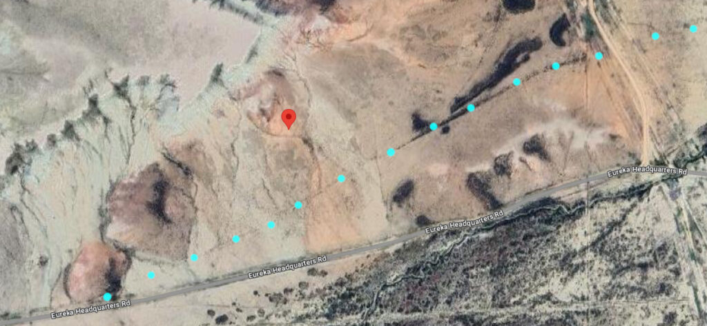
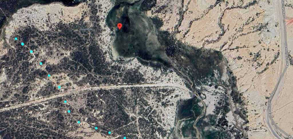
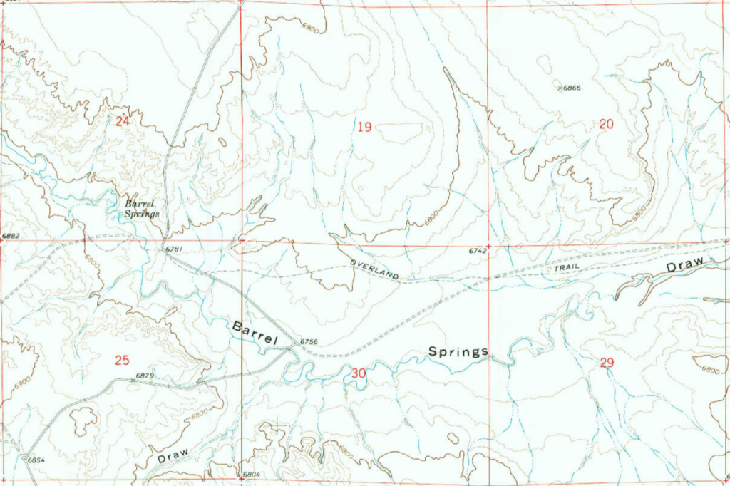
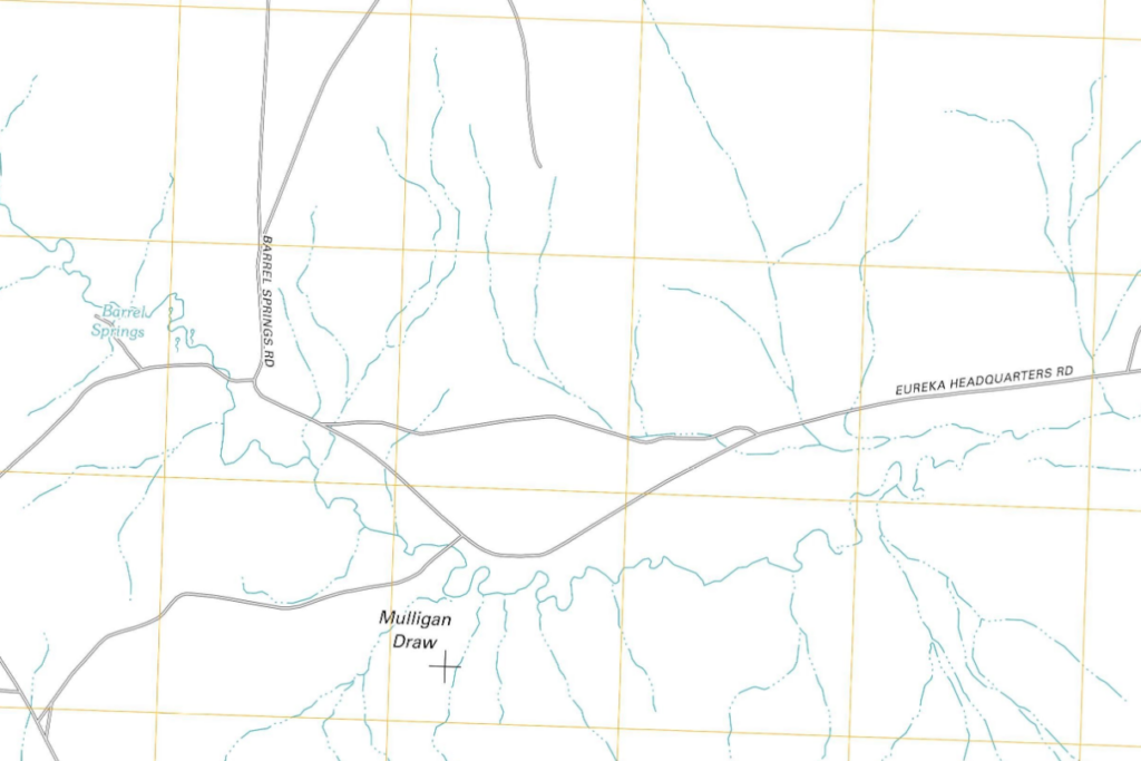
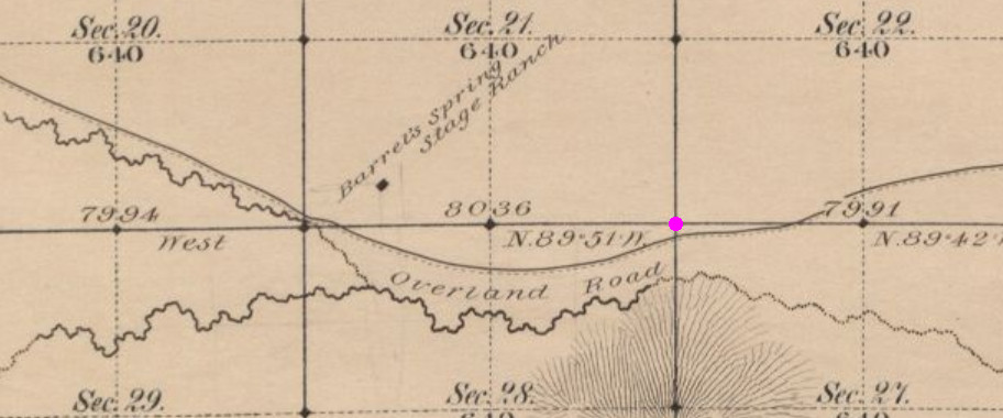
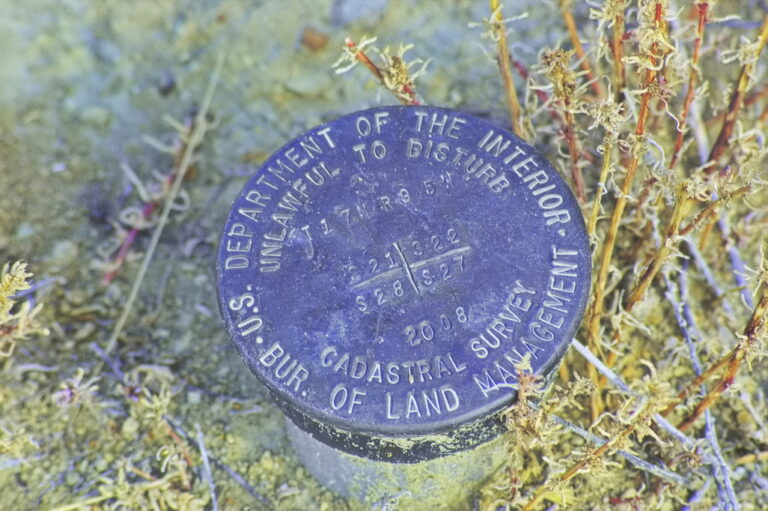
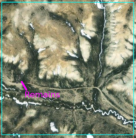
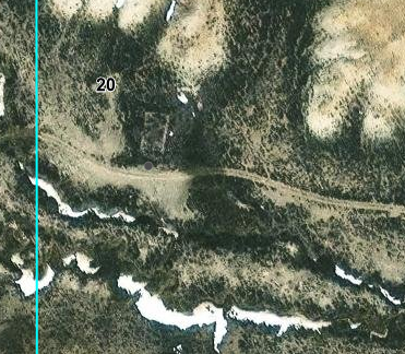
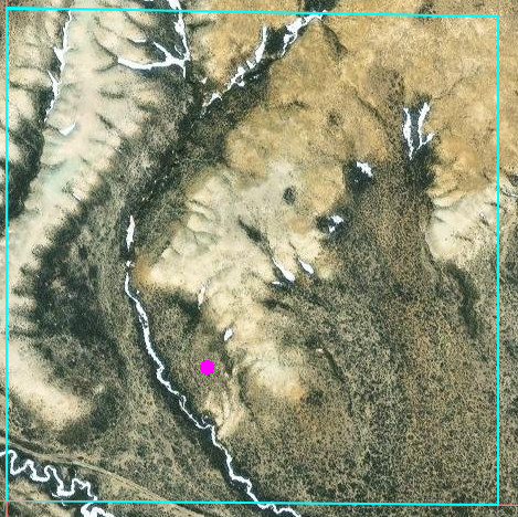
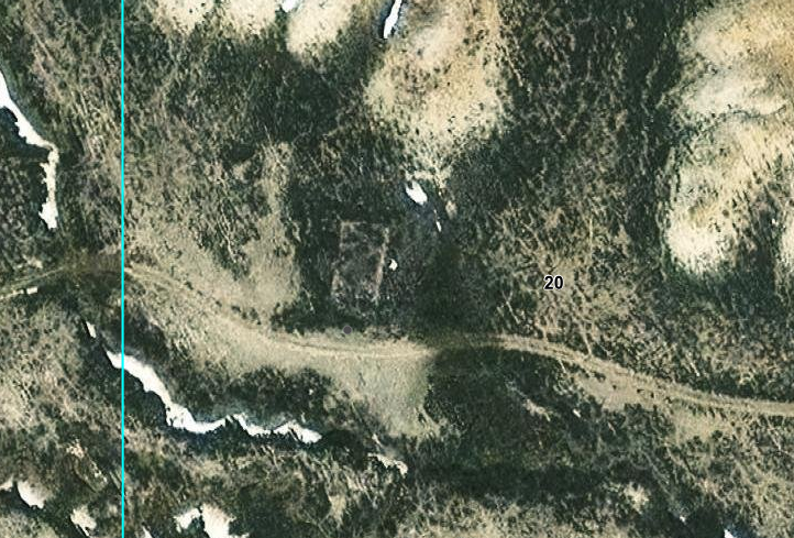
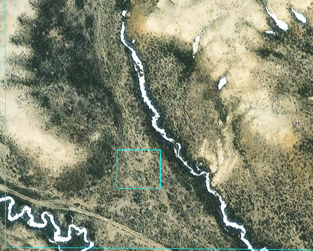
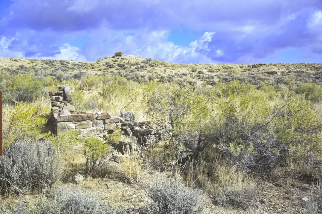
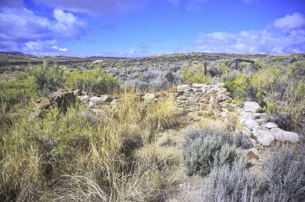
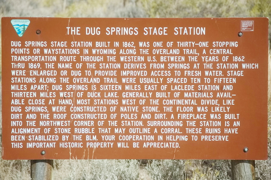
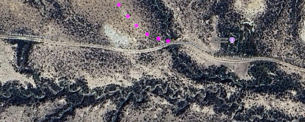
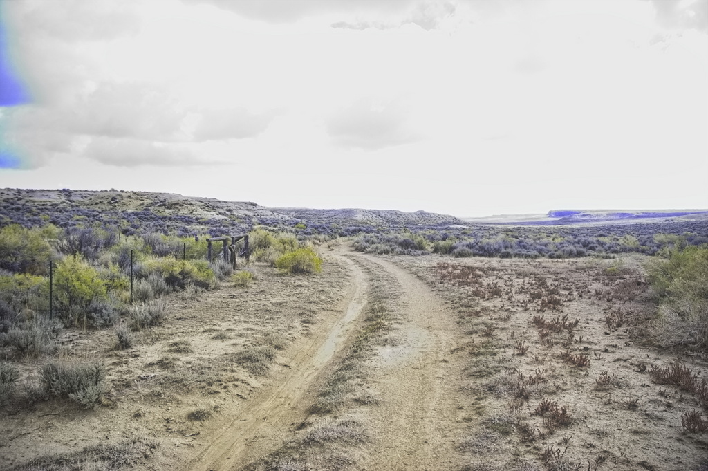
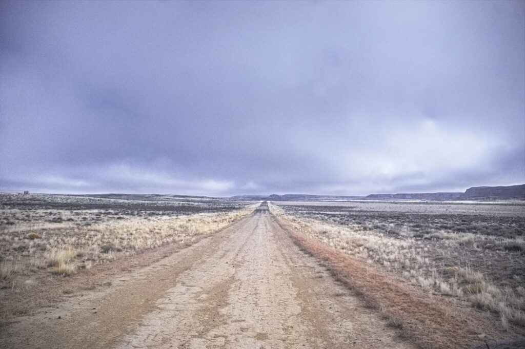
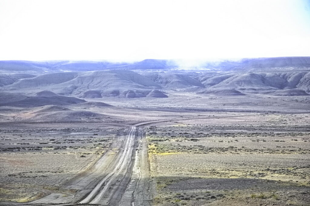
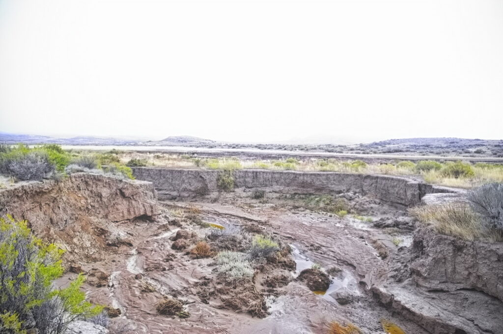
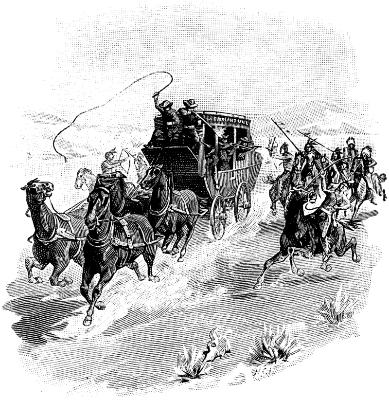
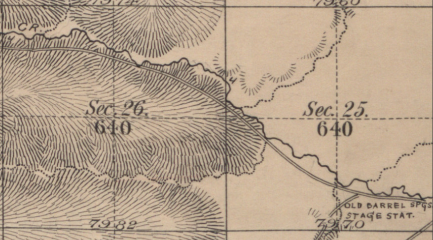
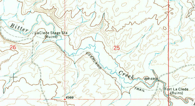
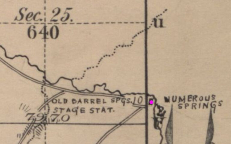
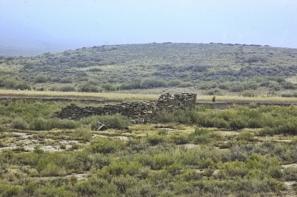
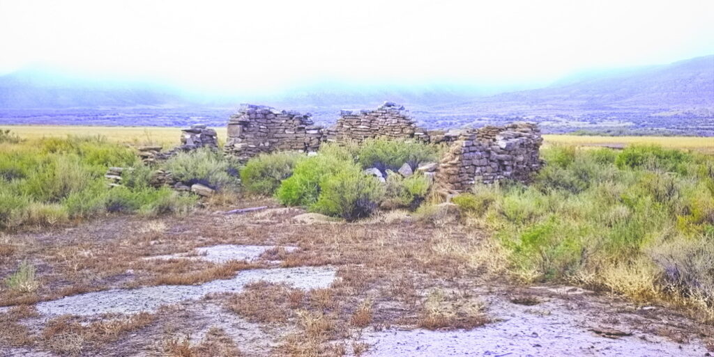

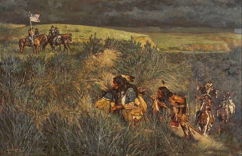
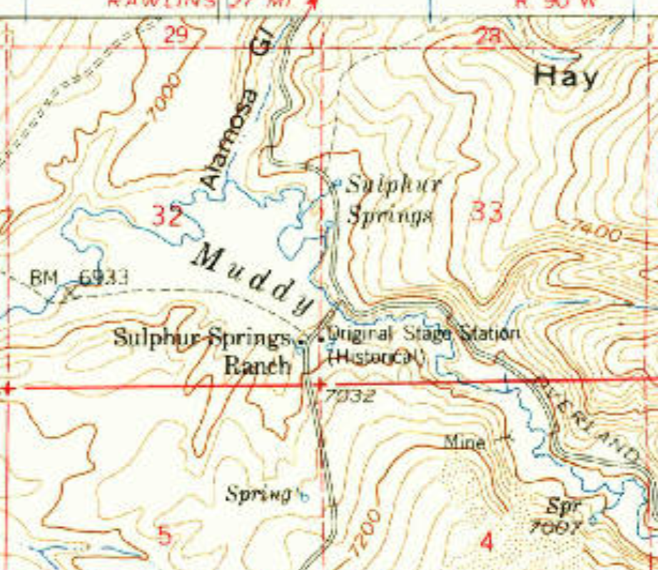
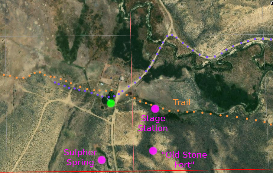
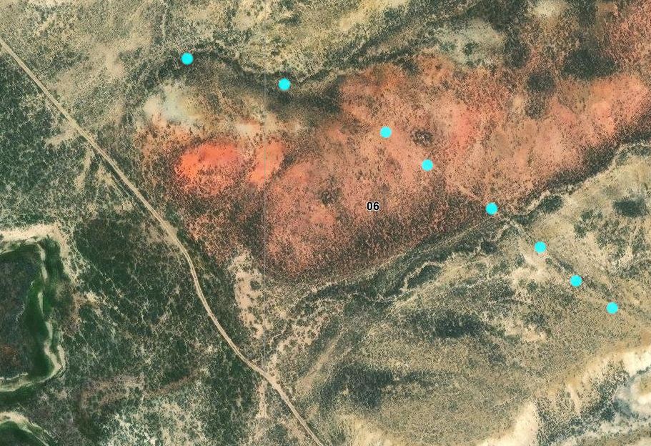
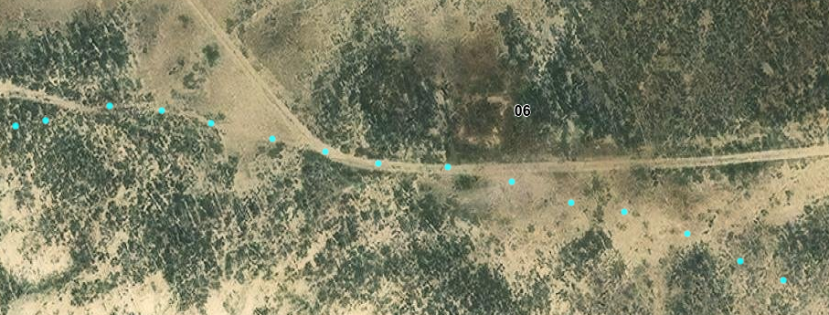
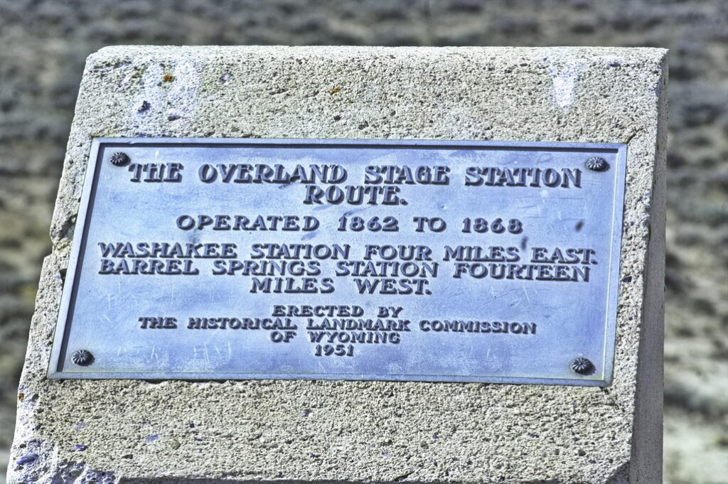
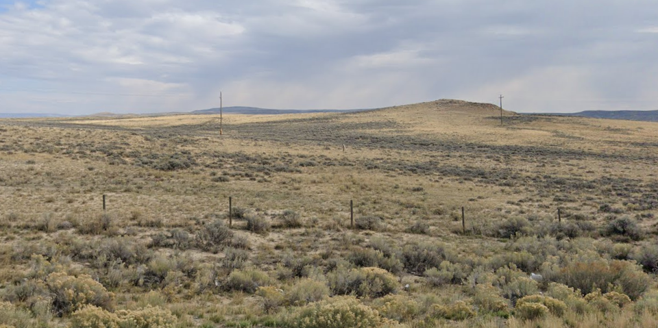
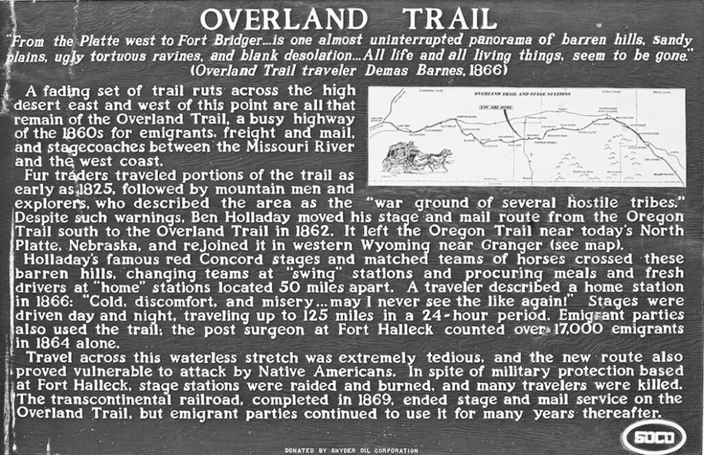
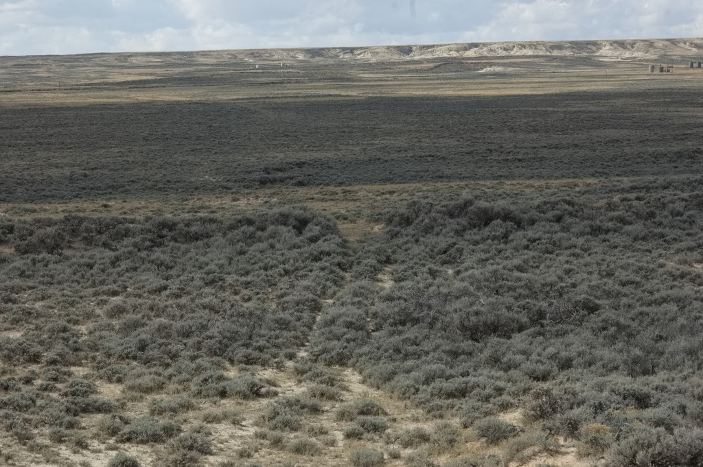
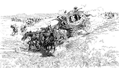
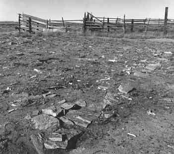
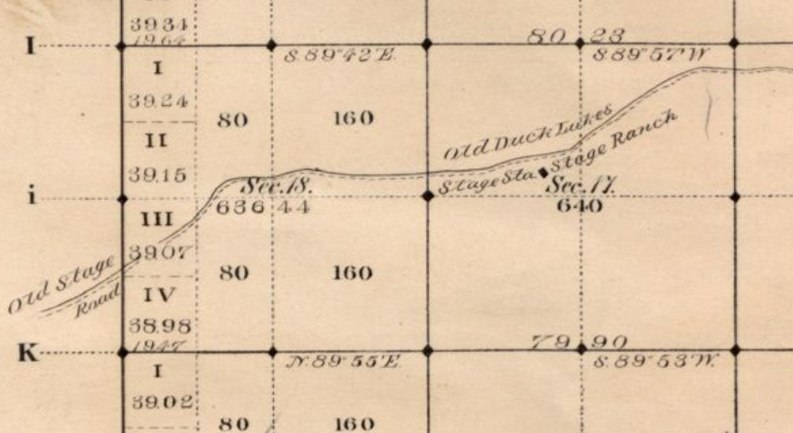

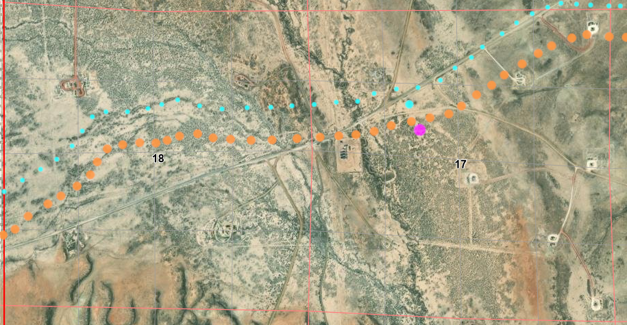