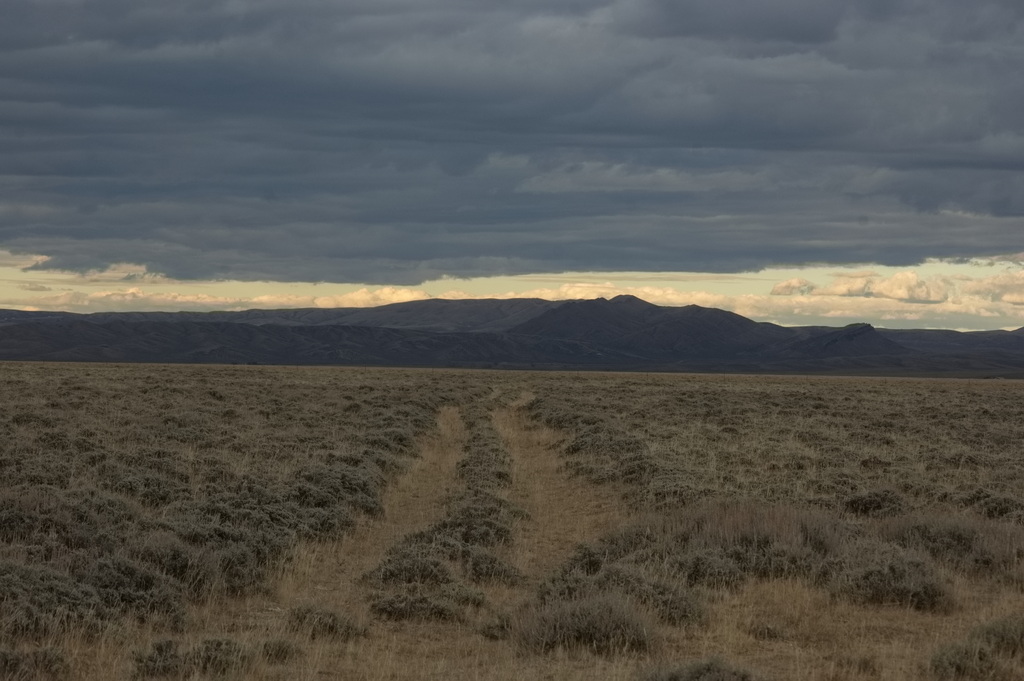
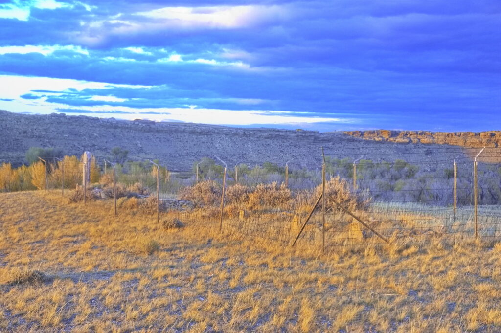
After leaving Rattlesnake Canyon at Pass Creek Station, the trail headed off across the beginnings of desert country. After a stretch of alkali dust came the oasis at the dreaded crossing of the North Platte, then the desolate lands subject to some of the worst Indian danger of the entire Wyoming portion of the trail - this "Central Route" being selected as less susceptible to Indian attack than the original route over South Pass to the north. The stations from Sage Creek west of the North Platte to Bridger Pass Station were often abandoned due to Indian raids; cavalry escorts from Fort Halleck in the east and Fort Bridger in the west were common along this stretch.
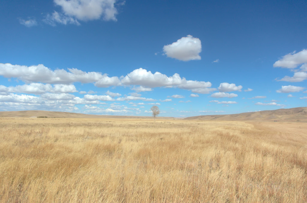
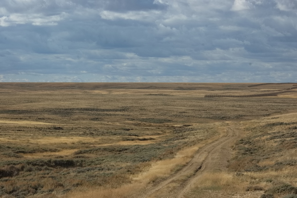
When not under danger from Indian attack or bandits, there was always the boredom of long stretches of rough, waterless, unchanging desert landscape to occupy oneself.
Coming up next: Bridger Pass Station to Duck Lake Station
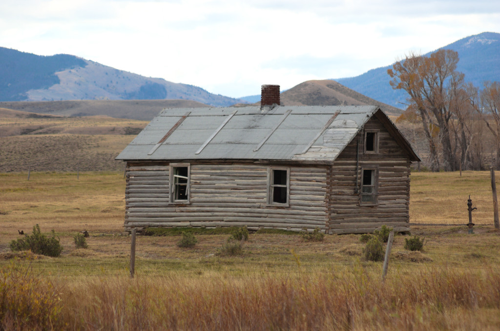
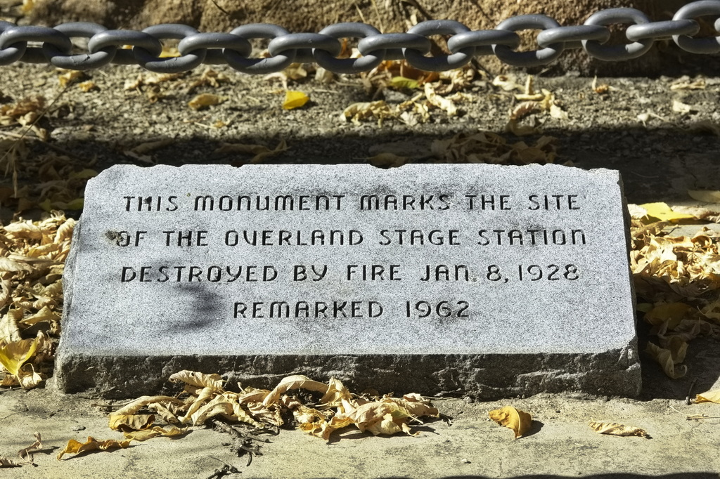
After Cooper Creek Station, the trail leaves the Laramie Plains and begins to enter rougher country. Passing through the modern villages of Arlington and Elk Mountain, this segment of the route passed through the grounds of Fort Halleck (now private property) and through Rattlesnake Pass, the mouth of Rattlesnake Canyon being a favorite place for ambush. Pass Creek Station was just outside the canyon but the course of Pass Creek has changed many times over the years; the actual location of the stage station is unknown.
Coming up next: Pass Creek to Bridger Pass - including the dreaded North Platte Crossing
Part 9 - Virginia Dale to Cooper Creek is now live.
After heading north a mile or so out of Virginia Dale, the stage line crests a ridge and enters into Dakota Territory. The far side of the hill drops down into the Laramie Plains; a vast valley of fine grasslands with no "civilization". There is no city of Laramie, no Fort Sanders, no railroad - nothing excepting a small handful of stage stations, scattered groups of Indians from various tribes, and ever-present bandits. The stations are lined up in almost a straight NW line 45 miles to the far edge of the valley just beyond the Cooper Creek station.
Trying to travel along the Overland Road - such as it is - from the Pass Creek crossing of Rattlesnake Rd was not was not worth the risk given conditions of many things - mostly due to being by myself late in the day considering the season with weather coming in. The time of year I was there, the weather could run from sunny and warm to cold and snowy - within a single day. It's a long way from even the boonies at some of these places. Cheaper to abandon the vehicle than tow it out if I got stuck - and I've been there, done that, and there're no T-shirts out there.
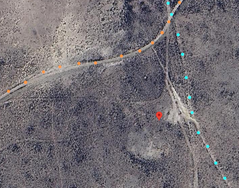
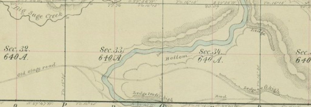
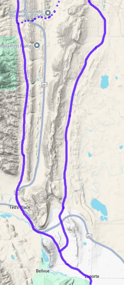
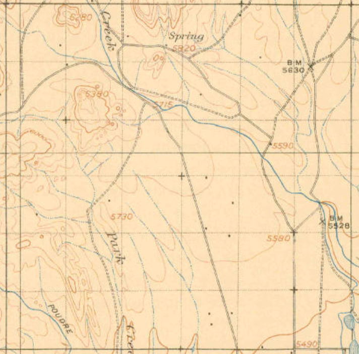
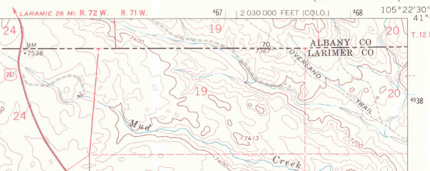
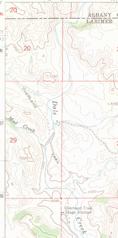
Detailed Map: Pass Creek to Bridger Station Note: These are large files and may take time to load; they load in a new window ORG dots are traces from 1870s survey maps; PUR dots are traces from 1970s maps PUR dots dominate where the two overlap
Trail ruts - been travelled since the 1860s though. I would have attempted it - but look at those clouds building up I'm too "experienced" for that type of adventure anymore.
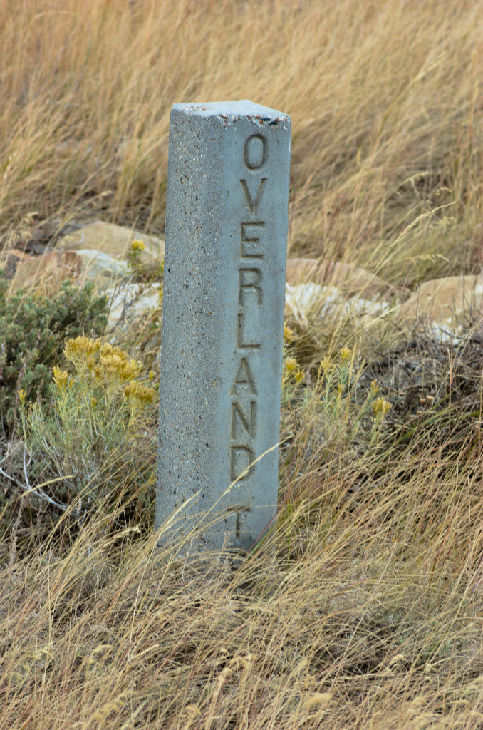
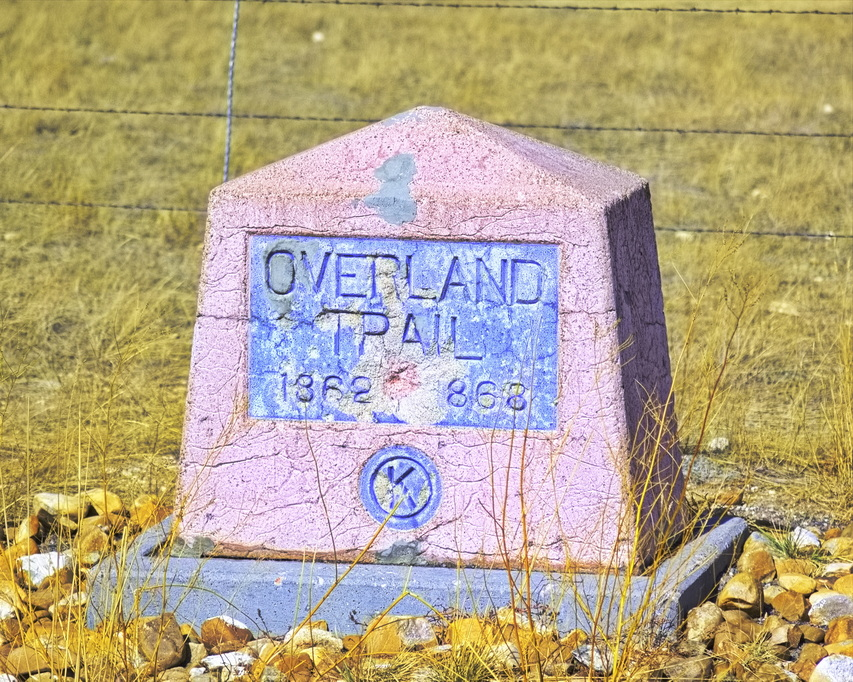
So sticking to what out there are main roads, I eventually crossed an actual paved highway. The trail crossing is marked by this stone:
Probably not worth risking ... and the weather doesn't look friendly to solo boonie-bouncing
I mention this site because it appears on some maps ... but it wasn't an Overland Stage station.
The site of Midway Station is located less than a mile west of modern WY130 along the Overland Route. There are no remains other than a couple of slight cellar depressions in the earth. The Overland road passes within yards of the site but evidence suggests this station was constructed perhaps in the late 1800s - well after the time of the Overland/Wells-Fargo stage lines - along an intersecting freight road running N-S between Saratoga and the UPRR at Walcott 10 miles north. Think of it as an 1890s truck stop.
Midway Station ORG: Overland Road CYN: Saratoga-Walcott Freight Road
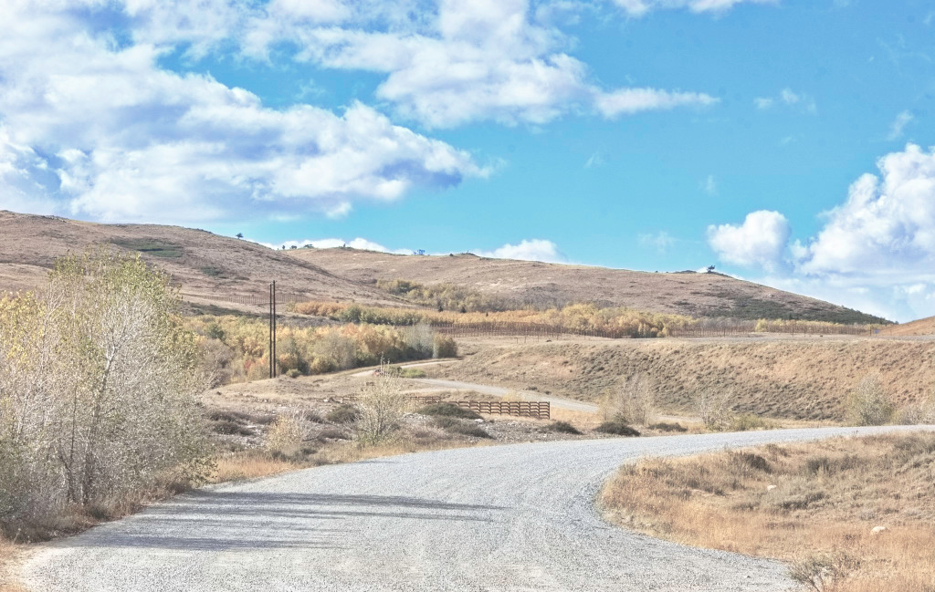
The road more travelled. This section didn't look as iffy but still a long, lonely walk out if need be ... and "need be" meant rain or snow. The clay in that soil turns into gumbo mud when wet. I took it anyway
Occasional signs of attempted homesteading appear every once in a while. Obviously 20th century, makes one wonder what tales of lost hopes and dreams ... and hardship come from this land.
I travel on. Even in a 4x4 pickup, travel wasn't much faster than riding the stagecoach would have been - in places, the stage might have been faster. Later, getting near sunset, the sun poked out for a while ...
Getting near sunset and ... "miles to go before I sleep" The trail is this area is still in use: ranchers & hunters mostly ... and a few crazy folk wandering around
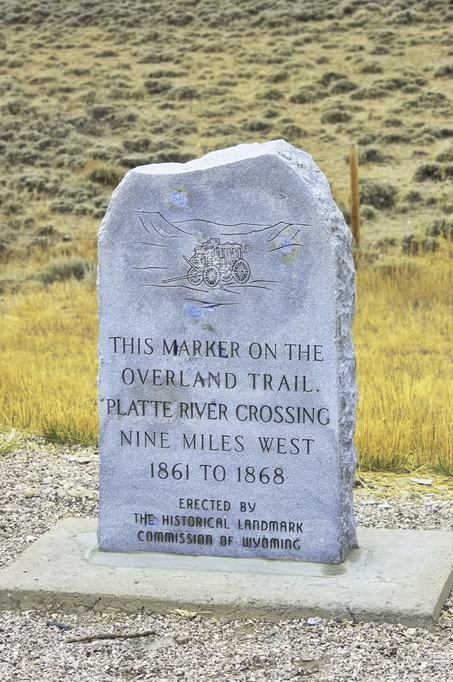
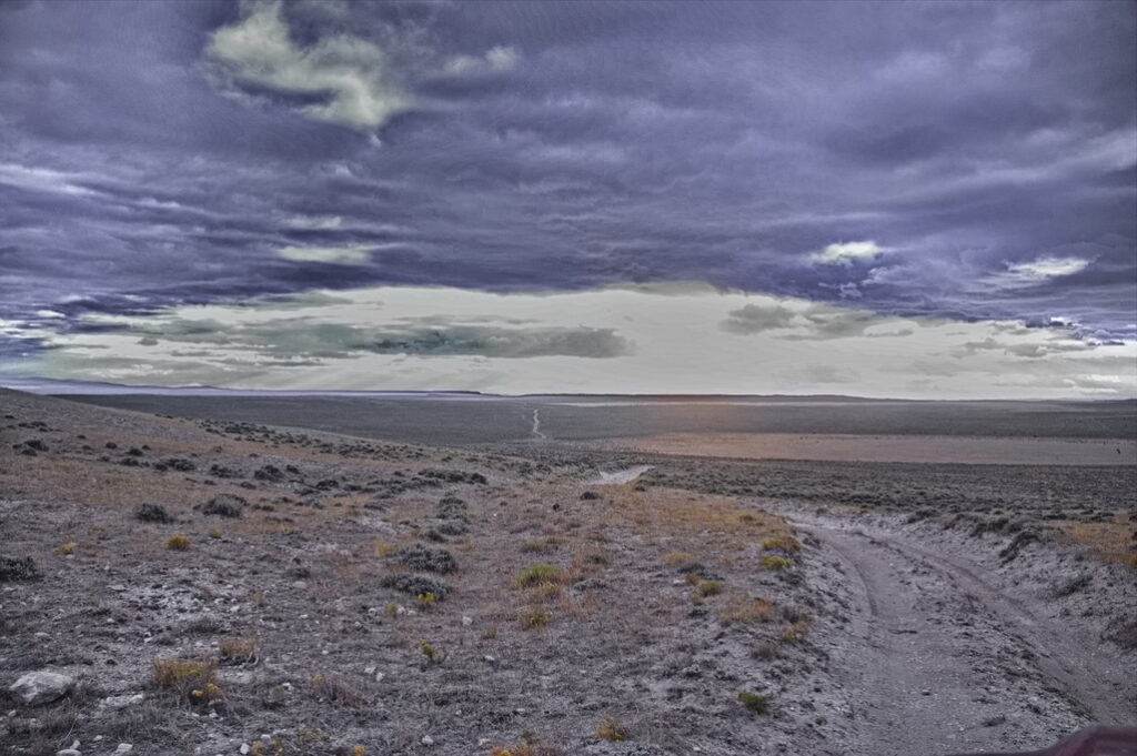
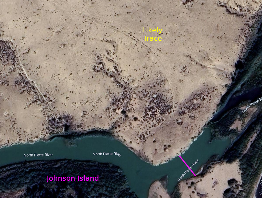
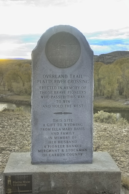
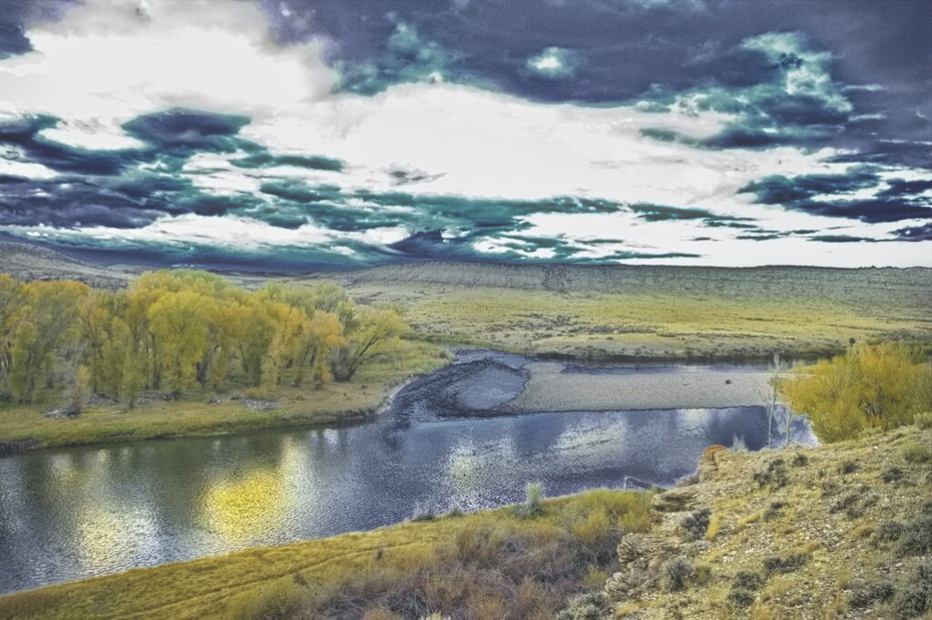
North Platte Crossing
19N85WS32SE 41.5734564696798, -106.96628173385372
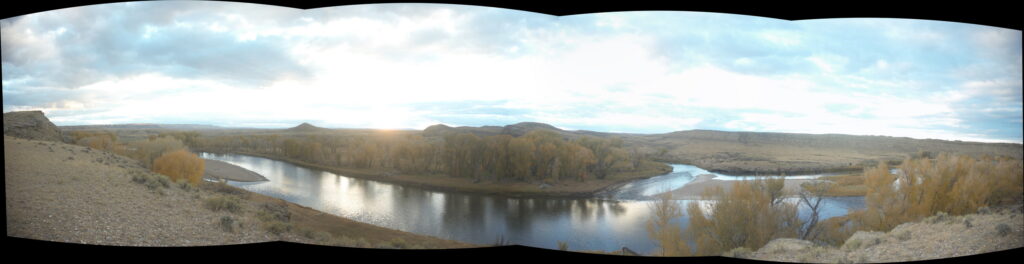
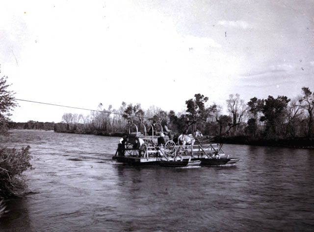
Not a station per se, but civilization of sorts. A ferry did operate here during portions of the stage days. The North Platte crossing was looked upon as an oasis in the dry, sandy sagebrush country at the same time it was viewed as a crossing to be looked upon with fear. It was not easy to ford and the ferry was not an assurance of safety. This gap in the high bluffs surrounding the area made this the only feasible crossing point.
From a bluff over-looking the crossing looking west Johnson Island dead center; the crossing was to the right.
The crossing of the North Platte River (just downstream [north] from Johnson's Island) was such an anticipated event that many travellers mentioned it in their diaries. Unfortunately, while the crossing itself was mentioned, little was said about the facilities which were on the east side. The North Platte was a welcome sight: large cottonwoods offering shade amongst the hot and dry sage county with cold clean water to drink.
It also caused an epic traffic jam as traffic - freight wagons, travellers, stagecoaches - all waited their turn to cross. Seems a good place for the set-up of traveller traps places for goods and services ... but no mention of anything more than a ferry.
Neither side readily accessible up and down the river except at this location
The ferry was described by a traveller in summer 1863. It was attached with ropes and pulleys to a cable strung across the river. The current of the river carried it across. By changing the ropes, the angle of the ferry to the river was shifted, allowing the current to pull the ferry back. The ferry was small, having room for only one wagon at a time; passengers and baggage needed to fit between the horses. Toll was high; $5.00 per wagon. Travellers searched for a place to ford the river to avoid the toll but the 200 ft cliffs elsewhere along the banks of the river prevented it. Time being of the essence and distances long and hard - it was better to wait one's turn and pay the ferryman.
The ferry wasn't a guarantee of safe crossing; on at least one occasion the ferry broke loose and capsized; several passengers drowned. The small size of the ferry created a traffic jam; traffic needed to line up while waiting for wagon trains ahead to complete the crossing. The ferry did not operate at night - one person tells of waiting all night, being up at dawn in order to be first in line at the ferry despite the fact that the day was Sunday - a "day of rest the world over".
The dangers and fear of the crossing were justified; not everyone made it.
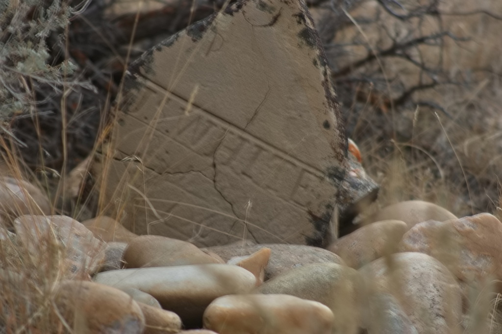
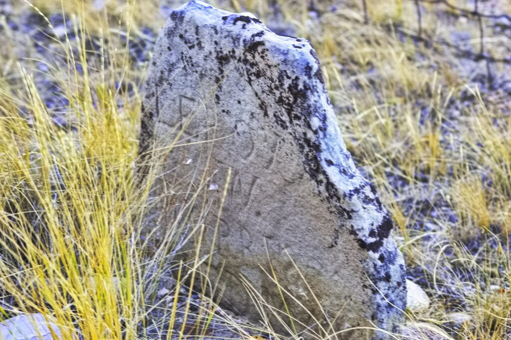
This cemetery is on a bluff over-looking the crossing; there are a handful of identifiable graves - an unknown number unidentifiable. The cemetery itself is a preserved historical site although the banks of the river at the crossing point itself is on ... what else? private land and inaccessible.
The crossing point itself was inaccessible to me.
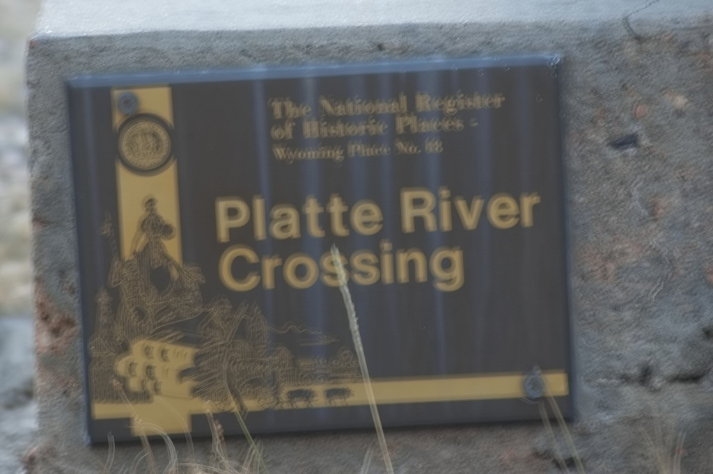
The North Platte Crossing is listed on the National Register of Historic Places; there are eight acres surrounding the site which are designated a State Historical Park and is owned by the state of Wyoming. Even so, it appears the 8 acres is surrounded by private property.
Or so I was told by the two gentlemen that drove up to me (as I was getting ready to leave anyway), told me I was trespassing, and to get the hell out. Politely of course, but ... meaningfully.
Handheld at dusk
So I up and got ...
The road out
Now I had to find a way across the river myself. It was much darker out than this picture suggests; this was the next crossing south.
The usable crossing - on my way to Sand Creek Station Dark and handheld photo with high ISO
I had planned on camping at the Sand Creek station site .... And found access is blocked from that side as well.
Once again proving to myself the folly of making plans. Or at least committing to them.
Driving down a very nicely maintained road at about 50mph in the middle of the night was not a clue.
Who the hell paints a gate a dark color? A single tube of steel across the road. The braking coefficient of a gravel road is not high. Got the gate open though ...
but thought it best to leave the few truck pieces behind and turn around; try a different approach. Getting late - not too many options.
Access is blocked from the N Platte River west to Sage Creek Rd; aka WY72/401. The road that would allow access is Bolton Rd - closed to public access.
After leaving the brief respite of trees and good water at the North Platte crossing, the stages encountered the greasewood, sage, and rabbitbush country along with the pervasive alkali dust - or mud - once again.
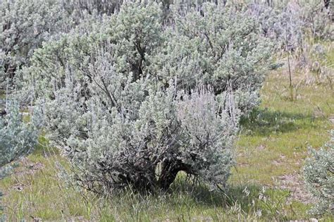
Sagebrush
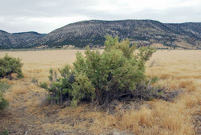
Greasewood
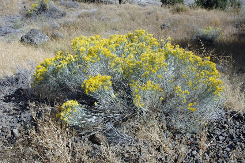
Rabbitbush
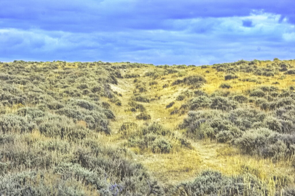
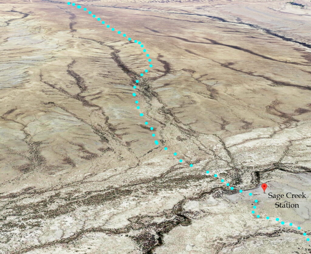
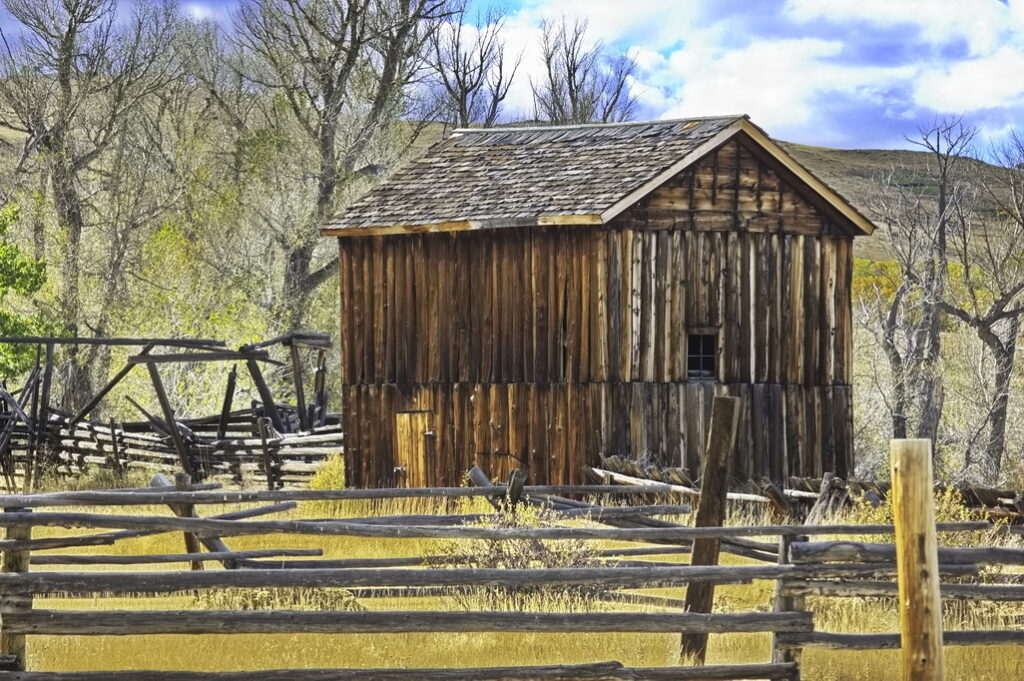
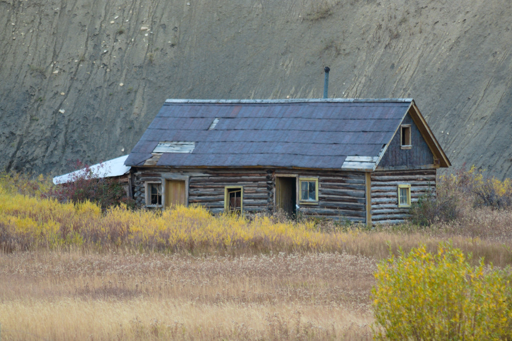
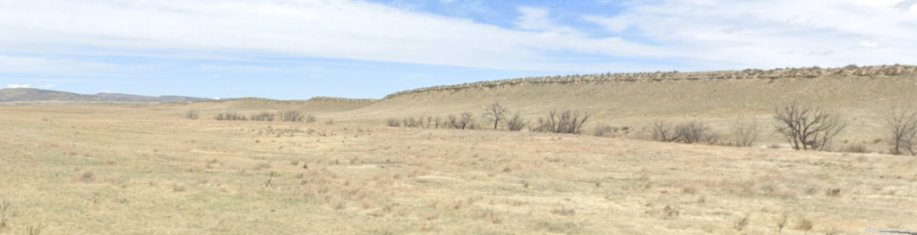
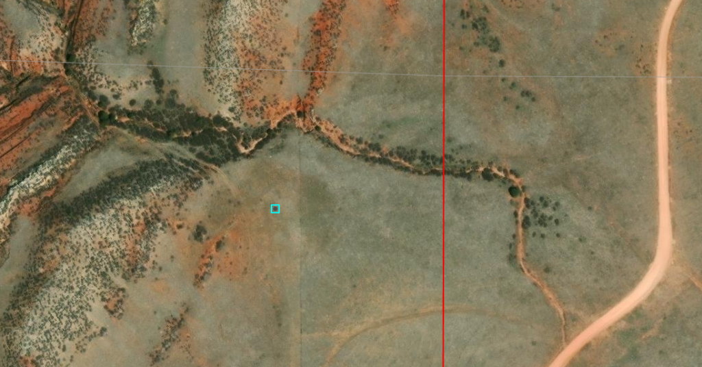
It was about 15 miles to the Sage Creek Station from the North Platte. Actually located on Miller Creek, the station was built of pine and aspen logs. It was a large station of 25 by 60 ft. The fireplace was adobe and the roof was sod. Although the station had good views all around, it also meant that it was easily visible to Indians as were the stages and wagons nearby. Later examination show the station was probably burned and rebuilt several times. Nothing remains except still-visible ruts ... not that they may be observed by the general public; the station site is located well into private land.
PNK indicates Bolton Road RED indicates the Overland Road BLU dots to left are on a public highway This entire section blocked to public access
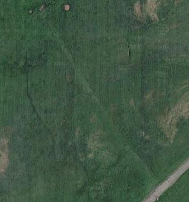
Tracks immediately west of assumed location of station Trail agrees with 1876 map
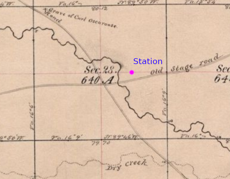
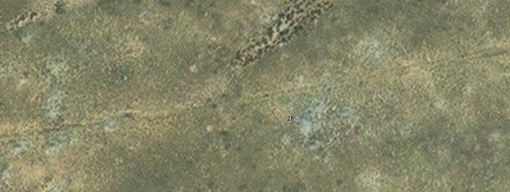
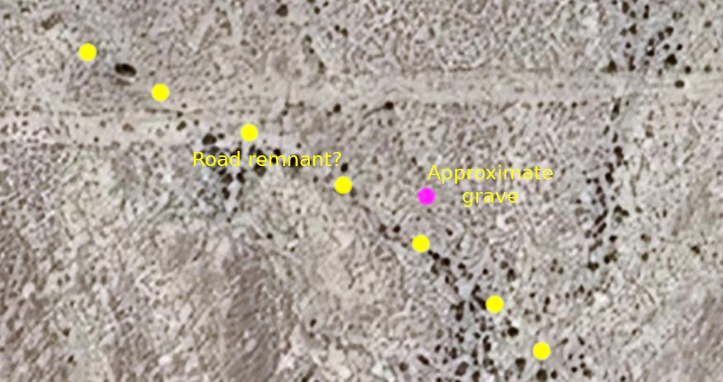
I found the presence of a grave on the 1876 map interesting. Based on this map, it appears to be about ½ mile from the creek crossing tucked in near the NW corner of Section 28. I can find no information about "Carl Oscaroose" and resolution of the aerial maps is not good enough to detect any sign of a grave on today's maps - nor is the road passing by the grave easily - if at all - detectable. RIP Carl.
The 1876 road next to the grave site marked on the map now has the appearance of being a wash. Dry country but when it rains, it floods and roads dig channels for water to flow through. These artifacts are probably less visible on the ground.
The horizontal traces align with the section boundary The database suggest it was last checked in 1972 The discontinuity appears to be within the latitude boundary between sections
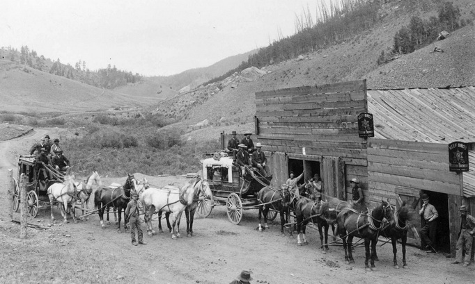
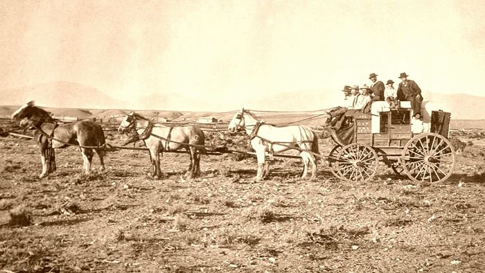
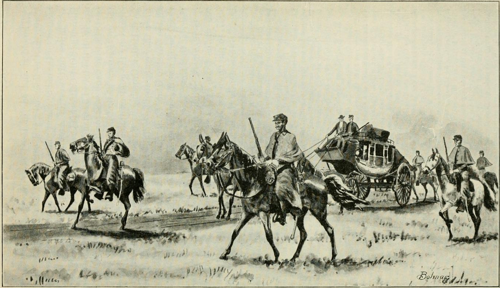
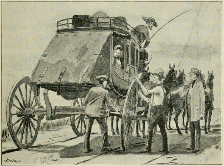
Nearly every driver I knew seemed more or less fascinated with his chosen occupation, sitting on a stage box, and when once in the business it appeared as if they never could retire from it. There evidently was some sort of a charm about stage-driving that they never could resist. Old drivers frequently told me that. Some were good for nothing else. Once in it, they appeared to be there for the better part of their lives. A driver would cover from two to three "stages" (25 to 35 miles), but occasionally one would go four of five "stages" (from 50 to 60 miles).
Bolton Road looking east from WY71 The road is blocked at the fence left of center; Sage Creek Station is about 3.5 miles away just to the right of the low dark bluff on the horizon This is not the stage road
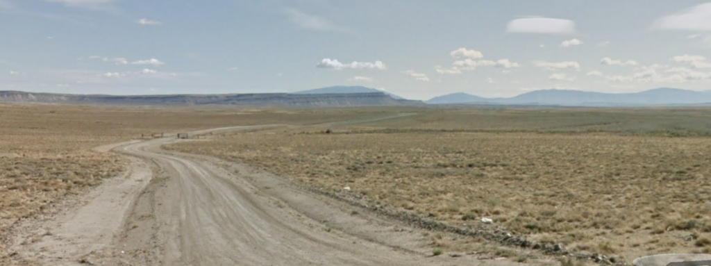
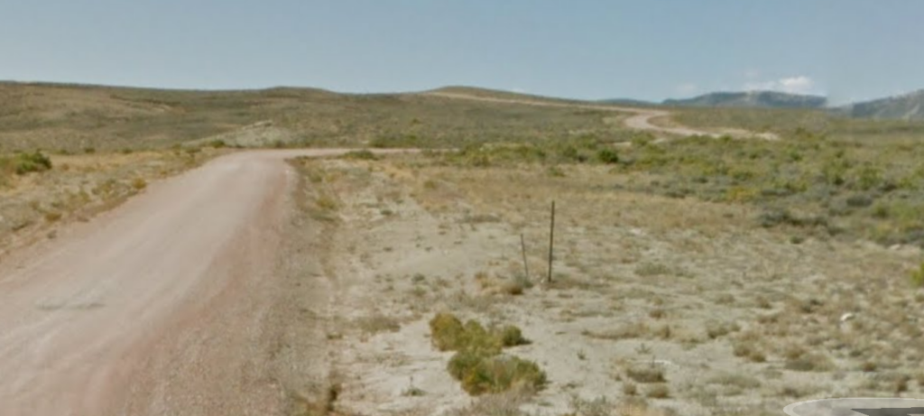
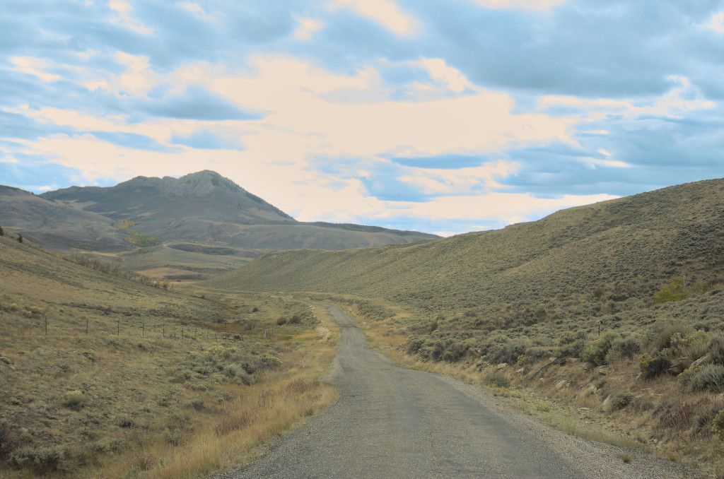
The next station west is Pine Grove; but first, after leaving the Sage Creek Station, lies another 2 or 3 hours of dry dusty alkali land where even the sage is hesitant to grow.
West-bound on Overland Road to Pine Grove Station
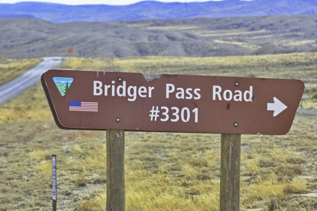
About 1.5 miles north of Bolton Road on WY71 is Bridger Pass Road
Bridger Pass Road from WY71 not the stage road
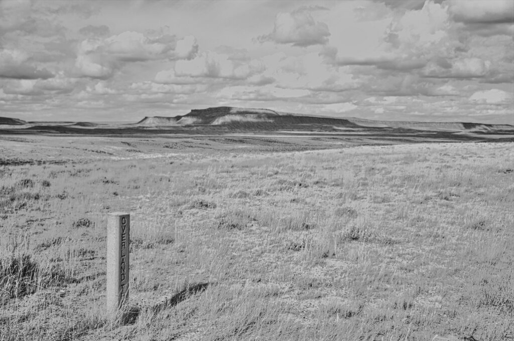
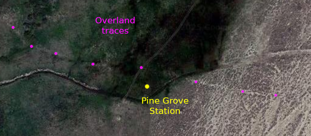
Pine Grove Station
18N88WS6NENE 41.56744747848063, -107.34447902278578 site 41.568603547517434, -107.34593799768953 cemetery
The Pine Grove Station wasn't misnamed; it actually was located in a grove of pine and aspen trees at the base of Miller Hill near the Continental Divide. After traveling a few hours from the Sage Creek station - and the same getting to Sage Creek from the North Platte, the shade and coolness of the trees was a welcome change. So was the fresh water.
Pine Grove was a home station consisting of a large building with a kitchen, dining room and sleeping quarters for women and separate bunkhouse for the men. The station also had stables and a blacksmith shop. Indians destroyed the station in the summer of 1865 and although it was rebuilt, there are no remains.
The site would be a hefty 2.5 mile hike from Bridger Pass Road though it appears there may be a back road into close vicinity of the site. Should I ever get back, time will be allocated to exploring this area. Small dirt bikes would be recommended over 4x4s. Passenger cars would be overly risky and likely more expensive than the vehicle's worth to extricate if troubles came up ... and I'm a firm believer in Murphy.
older "modern" maps show the Pine Grove site the aerial view shows tracks of what is likely the Overland Road
There were soldiers posted here; they built an underground bunker with rifle ports. During the 1865 attack, some of the Overland employees were able to fight their way through a Sioux war party and get to Sulphur Springs 20 miles away to the west. A dog at the station had warned the station master to the trouble. The Indians killed the dog with arrows and stuck the carcass onto the station walls with a pitchfork. The station site is on the National Register of Historic Places but the location is (now) redacted.
There's an interesting remnant at 41.561875310761465, -107.35051571820281 about ½ mile SW of the supposed site. New? Old? Worth checking out if in the area - it seems to be one of those places worth trying to get to once ... and never again.
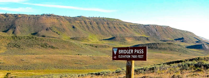
Bridger Pass is the Continental Divide; on the southern side of the Continental Divide Basin. This site is directly on an accessible road. There was no stage station here; the station was located a few miles west.
Wiki image
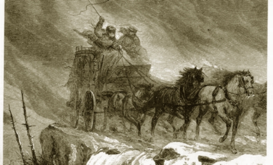
"... a crossing of the continent on the Overland in mid-winter was an experience not to be savored. In some instances, passengers would wear buffalo overcoats, on top of which would be buffalo robes. About their legs they would wear goat skin leggings."
In its time, the route over Bridger Pass was the second of two major highways crossing the country - the other being over South Pass about 100 miles north. The section of the Overland Road between Pine Grove and Sulphur Springs stations was considered one of the most dangerous due to on-going Indian attacks. The summer of 1865 was particularly bad; all stations between Sage Creek and Sulpher Springs were raided. Pine Grove and Bridger Pass stations were abandoned - the employees gathered at Sulphur Springs, that being a more easily defended station. Troops from the 11th Ohio Cavalry at Ft Halleck to the east were posted at stations along the line and provided escorts to the mail service. Troops of Nevada cavalry were dispatched from Ft Bridger to the west for the same duty.
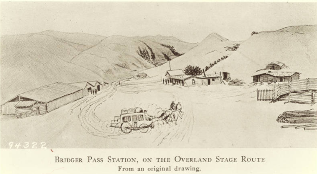
The Bridger Pass Station was located about 3 miles west of Bridger Pass (discovered in 1824 by Jim Bridger). Among other attacks, Indians raided the station in spring 1865, taking what supplies they could carry. Later, a Sioux party burned the log station. They stole the station cat, decapitated it, and left the body in the middle of the road. Along with the staff at Pine Grove, the station staff fought their way west to the Sulpher Springs Station.
Latham to Laporte was a 35 mile run, reduced to secondary status with the main line running south from Latham - continuing to follow the South Platte - to Denver then running back north along the foothills of the Front Range (a bit west of US287) to LaPorte, re-joining the original trail.
The run north from LaPorte was not the flat lands of the South Platte Route. Not quite mountains but one of the most difficult stretches of the entire route was located in this section. Like the other segments, it had its share of Indian attacks and threat from bandits.
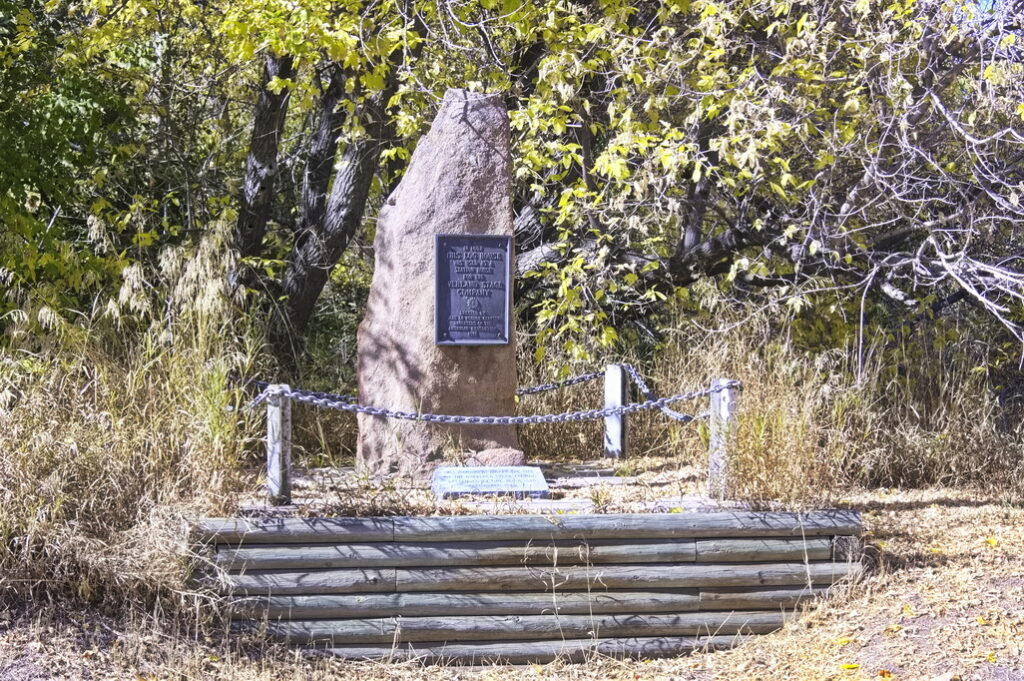
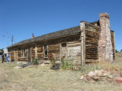
Virginia Dale - the only remaining complete station at its original location - and perhaps the most famous of all - was Jack Slade's headquarters. Only a mile or so below what was then the Dakota Territory, it was perhaps the most pleasing of locations.
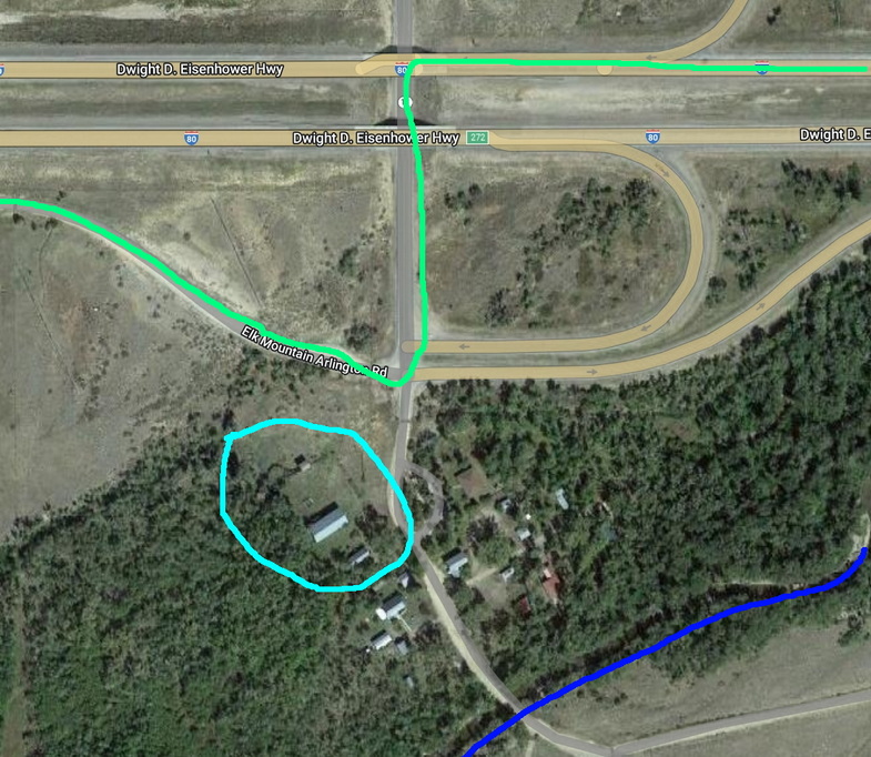
Just beyond the Cooper Creek station, the trail leaves the Laramie Plains and heads into rougher and more dangerous territory along the foothills of Elk Mountain. This stretch passes through Fort Halleck and Rattlesnake Pass to enter another stretch of fairly flat land beginning at Pass Creek. Beyond Pass Creek lies the North Platte River crossing. First though is the Rock Creek Station, now known as Arlington. Winters are rough around Arlington. Even today, semis are blown off the road on I-80 which passes within sight of the still-standing Overland stables of Rock Creek.
19N78WS30NWNW 41.59523477344985, -106.21031377332736 (the stables)
Equivalent map sections
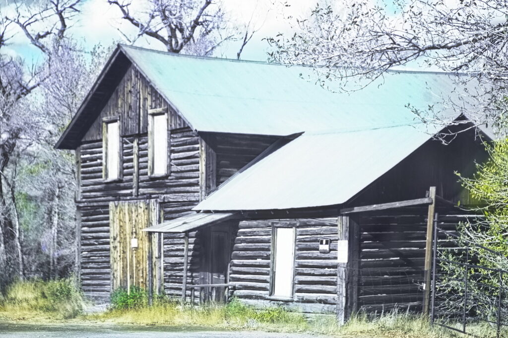
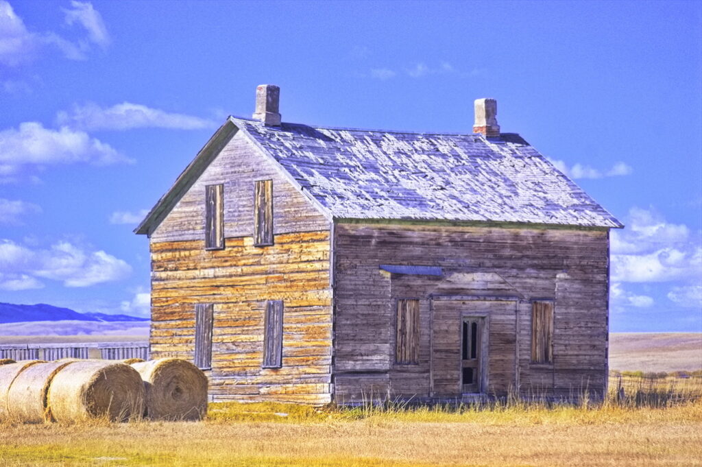
The Rock Creek Station, not known as Arlington until 1902, was built in 1860. By 1865, Rock Creek was more than just a station, it had become a small town, with not only the station but at least one store and several houses. One of the original buildings still standing on Main Street is a large two-story blockhouse. The lower level housed a blacksmith shop, with the upper floor serving over the years as a bunkhouse, saloon, dance hall, and a school. The creek itself was swift moving and deep; there was a toll bridge which charged 75¢ to cross.
The Rock Creek blockhouse
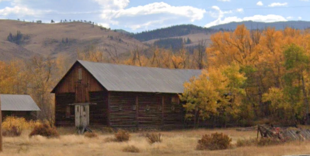
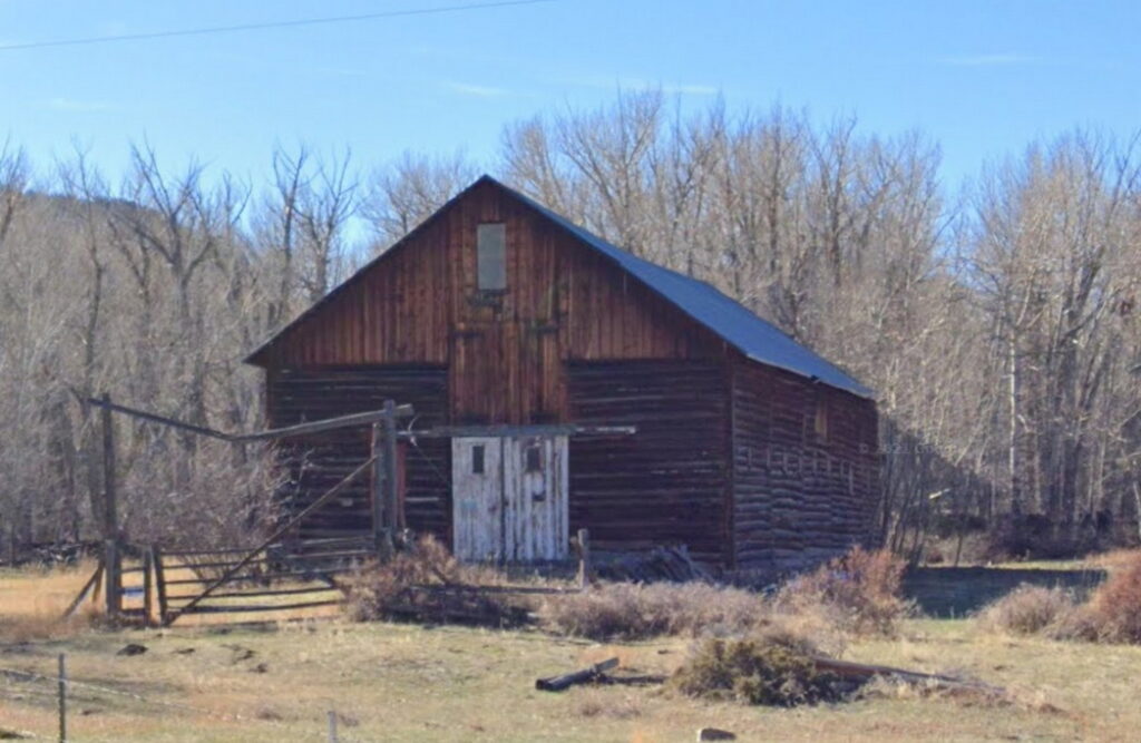
This barn sits right off I-80 and is said to be the original Overland stables for the Rock Creek station.
said to be the original Overland barn
This location is right off the expressway:
The Rock Creek Station is near where the Fletcher family was attacked by Cheyenne and Arapaho. They killed the mother, wounded the brother and father, and abducted the two little daughters. The on-going attacks on the Rock Creek facilities and wagons in the vicinity were well-documented by diaries and news articles of the time.
Leaving Rock Creek, heading west
Heading towards Elk Mountain
Along the way
Getting close to civilization when signs appear
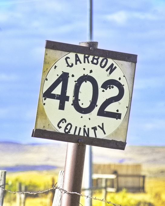
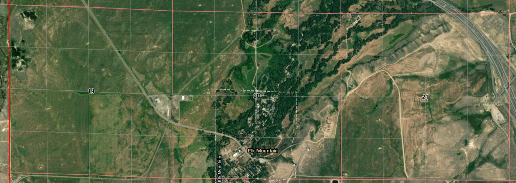
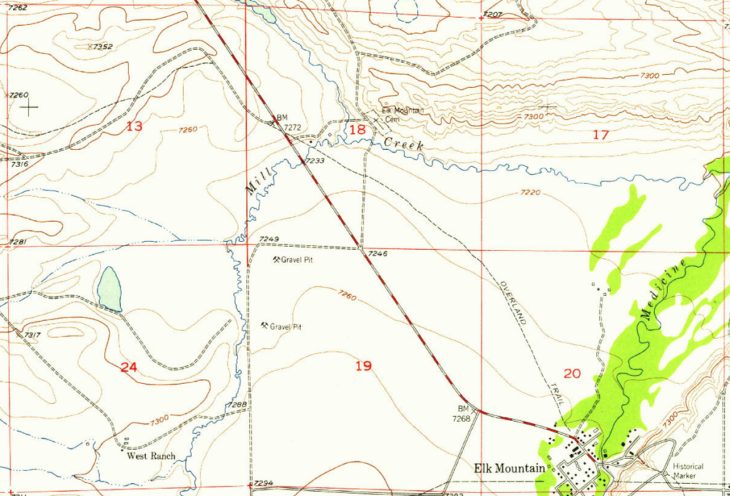
Elk Mountain
20N80WS20S 41.68692721341098, -106.41302068398345
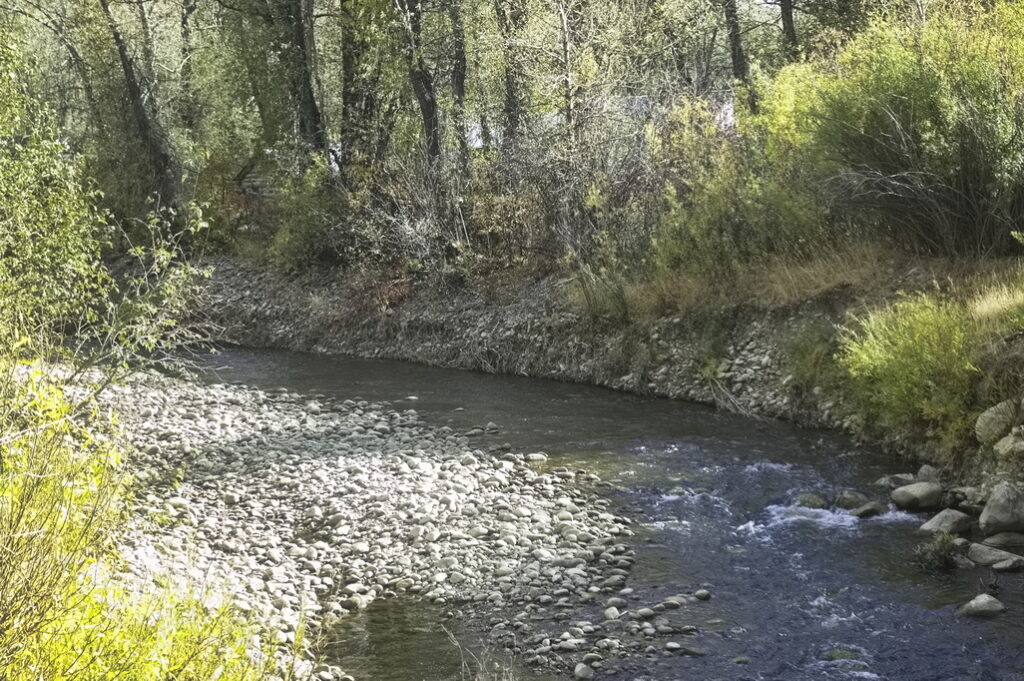
The Elk Mountain Station was built at the base of Elk Mountain at a crossing of the Medicine Bow River. The station structure was a long log building with stables for livestock on one end, a center section for hay and grain, and living quarters for the employees at the other end. The river banks supported lush foliage, ideal for covering a close approach by Indians. A blockhouse was built nearby for defense against the numerous attacks.
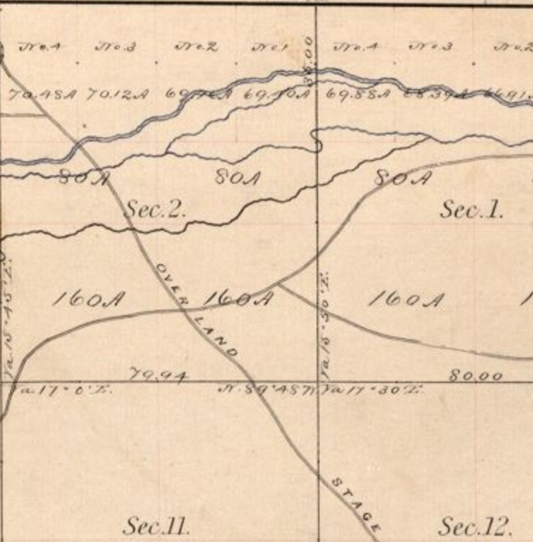
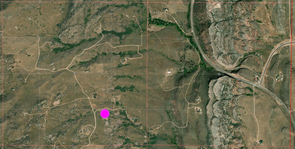
Note how the township boundaries (in RED) are twisted from the normal square This is from survey adjustments over the years and added much fun to comparing maps of 100 years separation
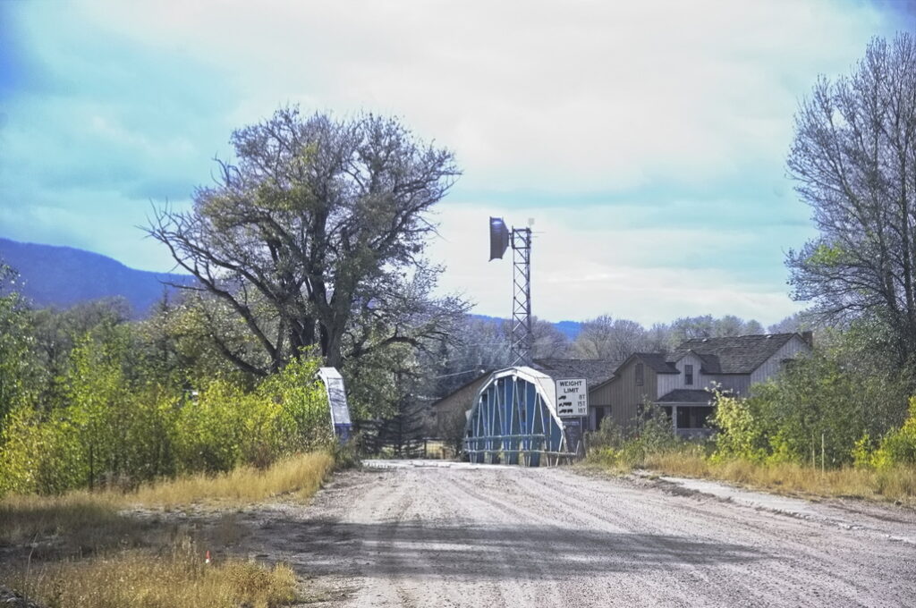
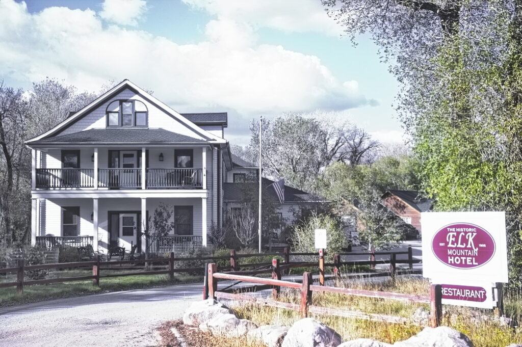
The bridge is at the original crossing. There is no toll. The building to the right is the Elk Mountain Hotel, built on the site of the station.
Medicine Bow River at the crossing This photo was taken in the dry season
I've not stopped by, but I hear the restaurant is pretty good. The hotel caters to hunters in the area
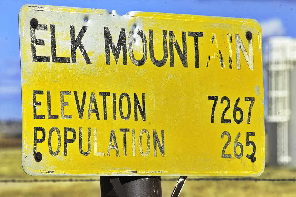
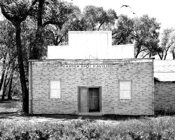
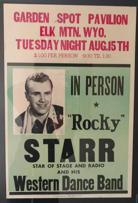
The town itself wasn't formally organized until 1909 when it served as a base for coal and timber interests in the area. Its claim to fame is the Famous Garden Spot Dance Pavilion. The Garden Spot, with its renowned bouncy dance floor, was originally a livery stable for travellers along the Overland Route. In 1905, the Grand View Hotel (now the Elk Mountain Hotel) was built in the field where the station was located, and in 1920, the nearby livery stable was converted to a dance hall. The unintended consequence of the way the dance floor was constructed - too much space between joists - was the floor bounced. "If you can't dance, just jump on and ride".
Looks dumpy but big names of the time played here
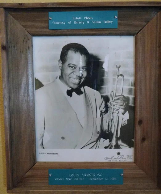
Until I-80 was constructed in the 1970s, the main route between Denver and Salt Lake was US30. In 1945, the owner of the dance hall convinced many of the big bands to take the 15-mile detour. For 10 years - 1948 to 1958 - many of the Big Bands and others - Louis Armstrong, Lawrence Welk, Hank Thompson, Jim Reeves, Tommy Dorsey, Merle Haggard - played to crowds of 600 - 800 people; the largest for shows by Hank Thompson and Harry James.
A saloon was across the street which led to excessive merriment among the crowd. One night a deputy used his pistol as a club on one of the drunks. The gun discharged and an innocent man was killed. The deputy left town shortly thereafter.
In 1954, the Union Pacific Railroad converted from coal to diesel and the coal mining towns began to die off. Television became popular and dance pavilions became less so. Performers such as Merle Haggard continued to play here into the 60s and 70s but crowds became smaller. The pavilion continued with local parties and weddings but the building was declared unsafe. Both the pavilion and saloon were torn down in the late 90s. I passed through before the buildings were gone, not realizing the significance of the deteriorated structures. The hotel however has been restored and is now a thriving business.
On to Fort Halleck and Pass Creek Station
1954 - no I-80
Trace aligns with route in Section 13 (upper left of previous map) - to Ft Halleck
slight trace immediately west of Elk Mountain in Section 20
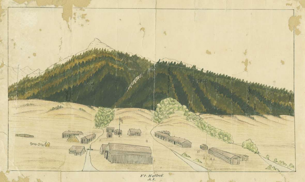
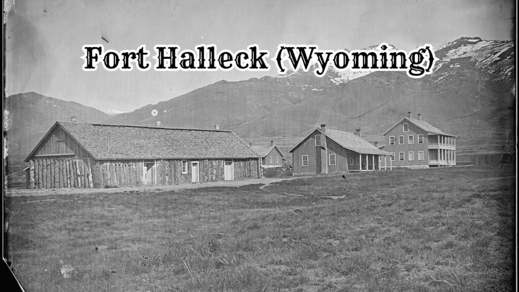
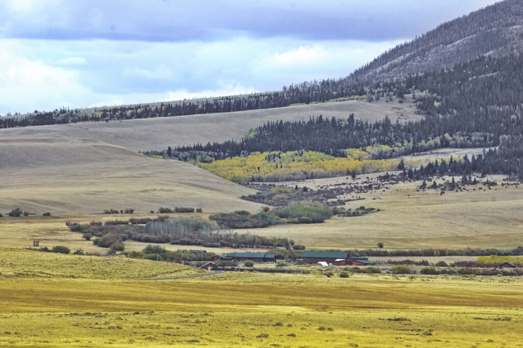
Fort Halleck was named after a Civil War general and was established at the base of Elk Mountain by the 11th Ohio Volunteer Cavalry in 1862 to protect the Overland Trail Stage Route.
Ft Halleck - 1862
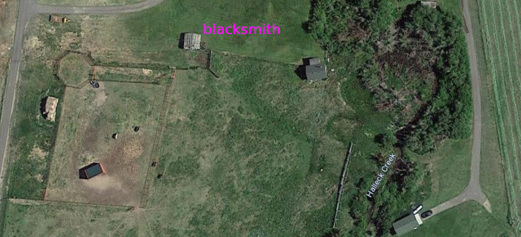
Jack Slade spent time managing the Ft Halleck station and sometimes driving the route himself from Virginia Dale. Nothing remains of the post except possibly the blacksmithy; the site is on private property.
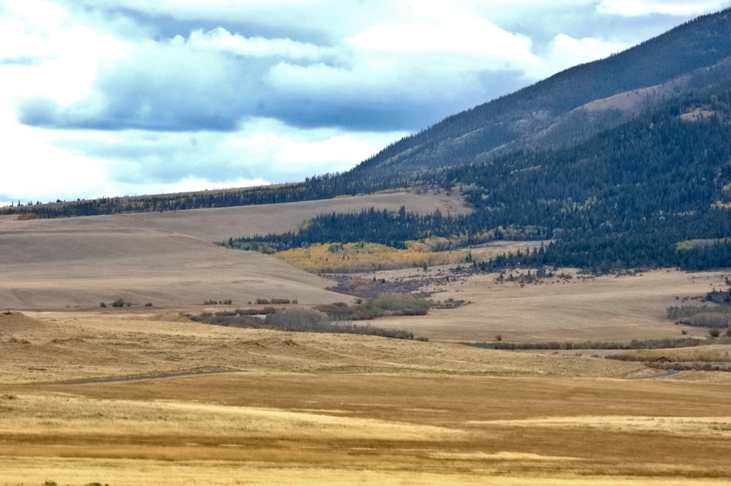
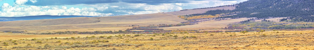
Fort Halleck country
The fort was established in 1862 to protect the Overland Trail Stage Line from on-going Indian attacks. The site sits on the north face of Elk Mountain among tall grass meadows at an elevation of 7300 feet. There was a nearby spring for water and close forests to supply wood for building, cooking, and heat. Meat was provided by large herds of elk, deer and antelope. The fort itself was large with stables capable of holding 200 horses, storehouses, two sets of company quarters, officers' quarters, a store, bake house, hospital, and jail.
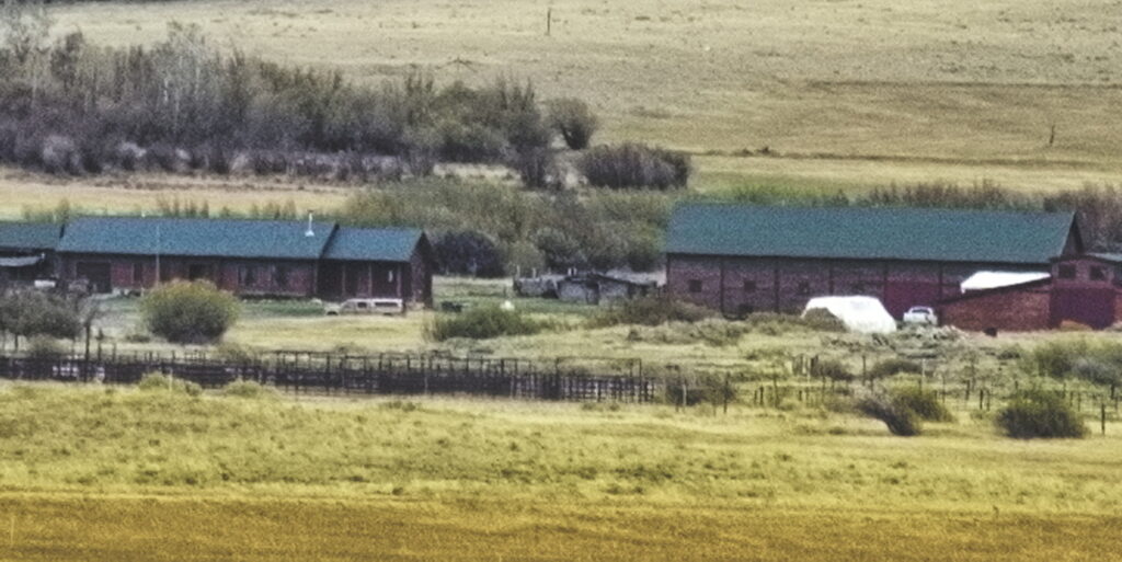
The ranch buildings sit on the fort site
Ft Halleck - old small building (shack) in center is only remaining structure - now private ranch; telephoto lenses have uses
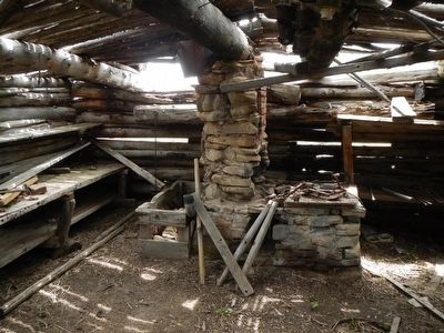
Fort Halleck blacksmith interior
The post surgeon kept very detailed records of the emigrants passing through the Fort Halleck station. In 1864 he recorded that there were over 4200 emigrant wagons, with a staggering number of 17,584 emigrants and an even more astonishing total of over 50,000 animals traveling the Overland Trail.
One traveller, Franklin Adams, kept a diary of his trip on the Overland Trail in 1865. He mentions that the soldiers from the 11th Ohio Cavalry stationed at Fort Halleck were paid $16.00 per month to fight the Indians. The stretch of trail from Fort Halleck to Sulpher Springs to the west was considered to be one of the most dangerous sections due to Indian attacks.
[A good book describing a soldiers life in eastern Wyoming during this period is "Tending the Talking Wire", the letters of Hervey Johnson of the 11th Ohio Cavalry, edited by William Unrau]
The talking wire
It is told that on one occasion when Jack Slade was in charge of the Mountain Division of the Overland Trail, he apparently went into the fort store and used the canned goods on the shelf for target practice. The second time he caused trouble at the fort, the commanding officer arrested him and refused to release him until Ben Holladay promised that he would be fired. Holladay kept his word and Jack was fired soon after.
The fort was abandoned in 1866, lasting just four years after being established, and by the next year it was described as "the most dreary place on the entire route". It appears the blacksmith shop is the only remaining evidence of the fort's existence. There is a marker erected in 1914 at the site of the fort cemetery.
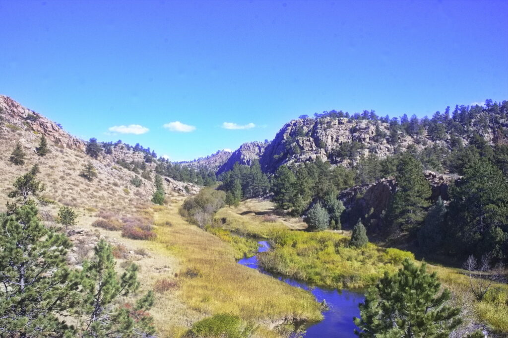
After leaving the fort, the route went through Rattlesnake Pass; the modern road more or less follows the same path.
The trail from the fort joined the modern road up this gulch through the fence line
Rattlesnake Canyon - narrow with steep hills to either side Not much room for the Overland Trail and "modern" road to vary much
A fair number of these along the way
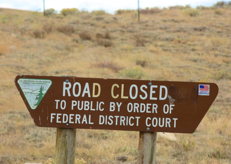
And a lot of these signs - public lands (BLM) closed to the public
Judging from the cars, looks like this was inhabited until the 40s Rough country to live in
Complete with outdoor running water
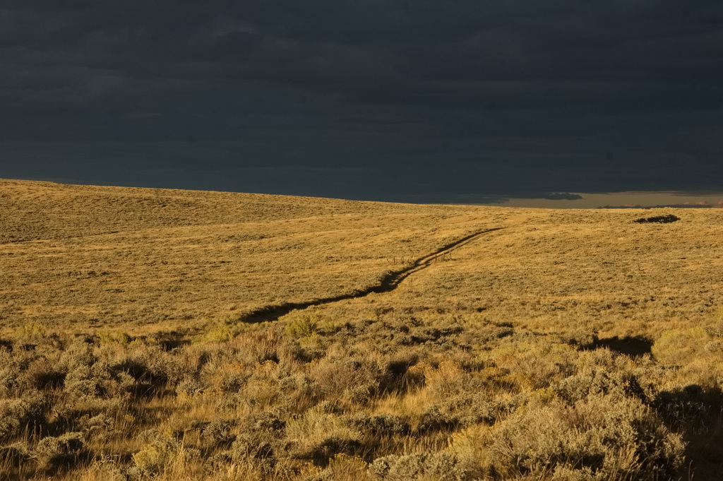
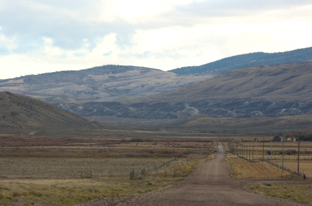
Rattlesnake Canyon Coming off Rattlesnake Pass heading west
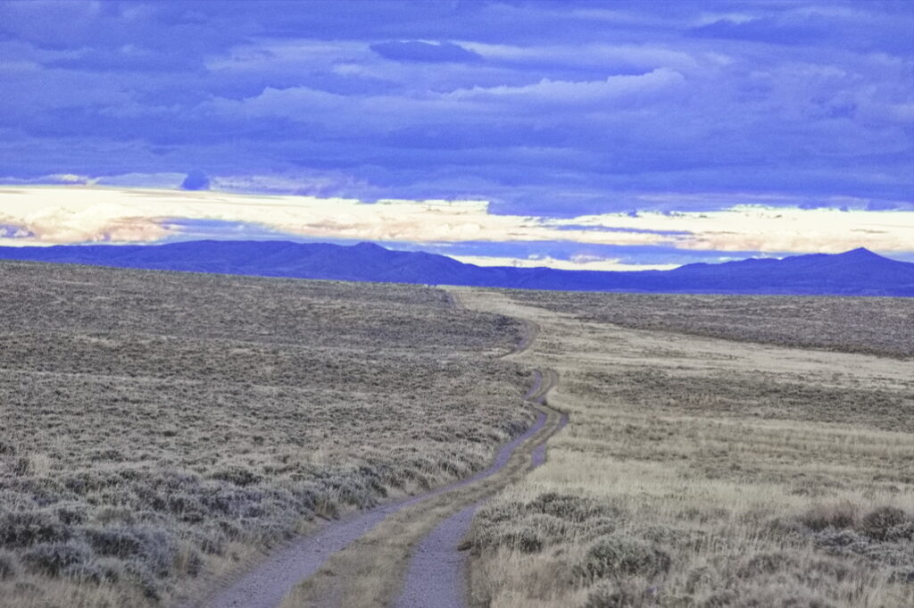
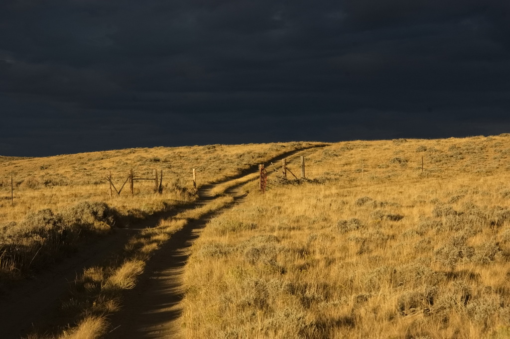
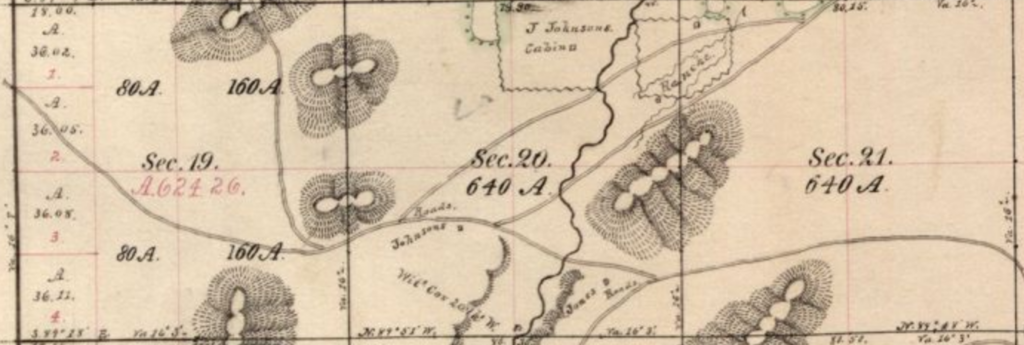
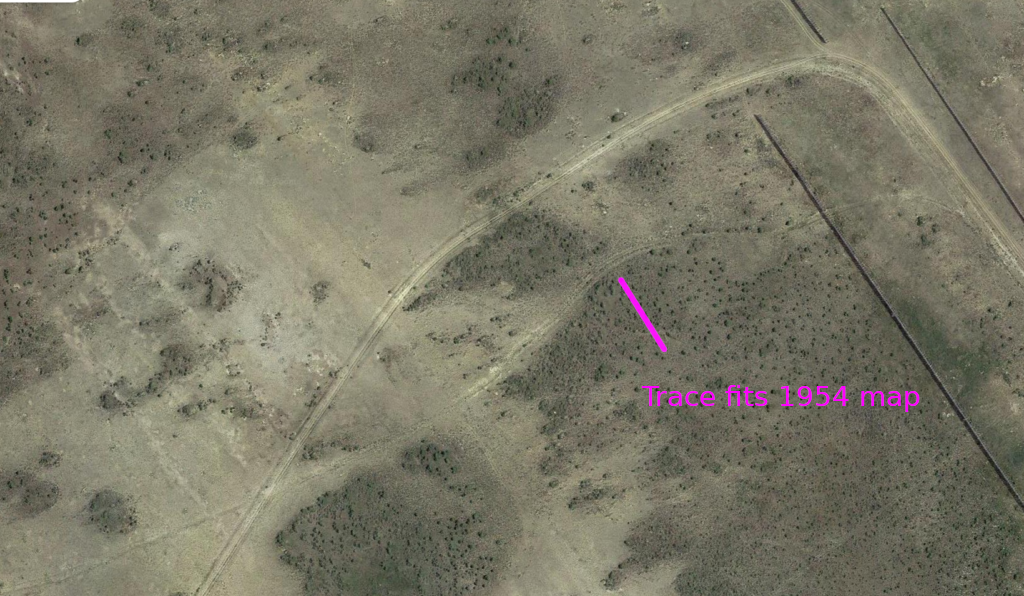
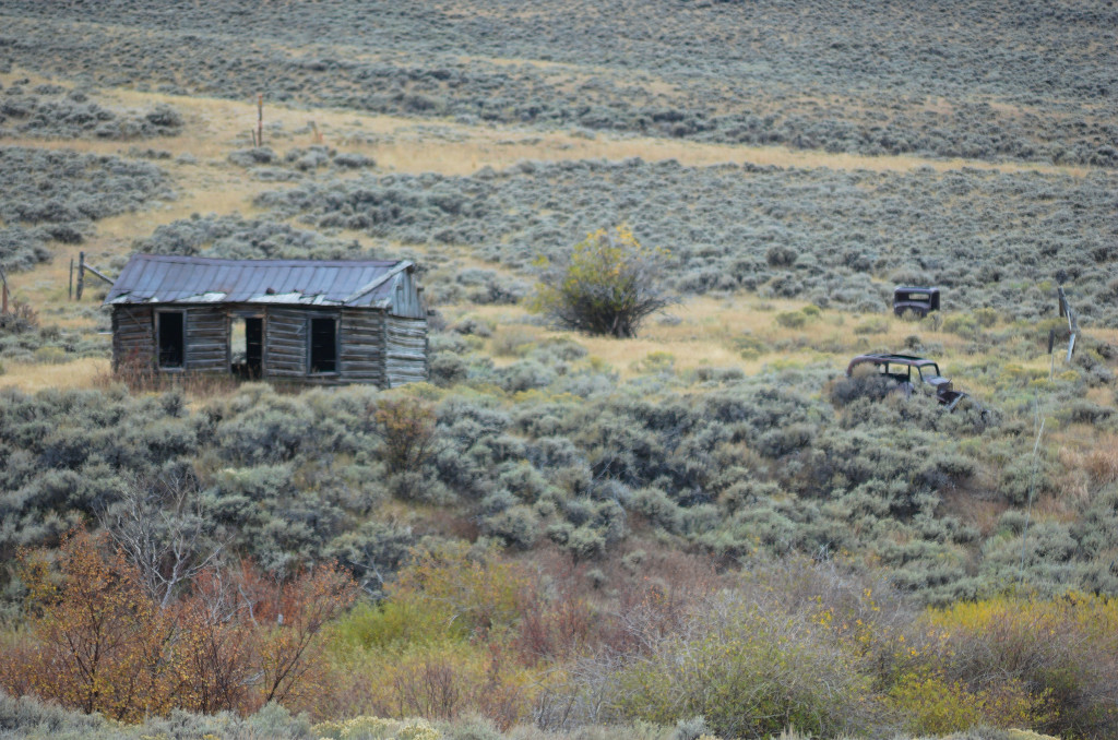
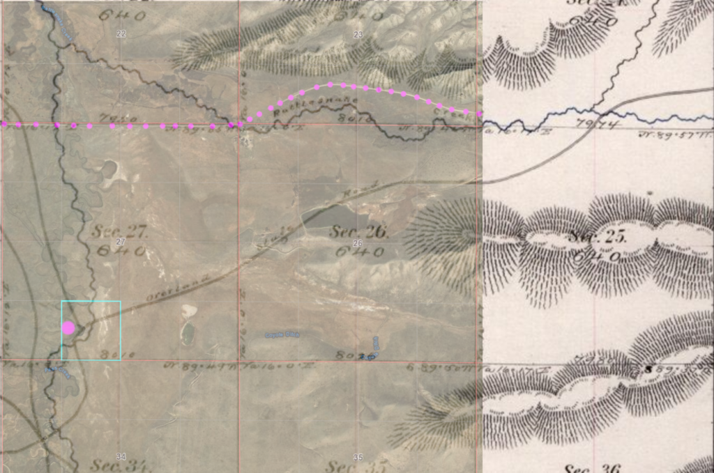
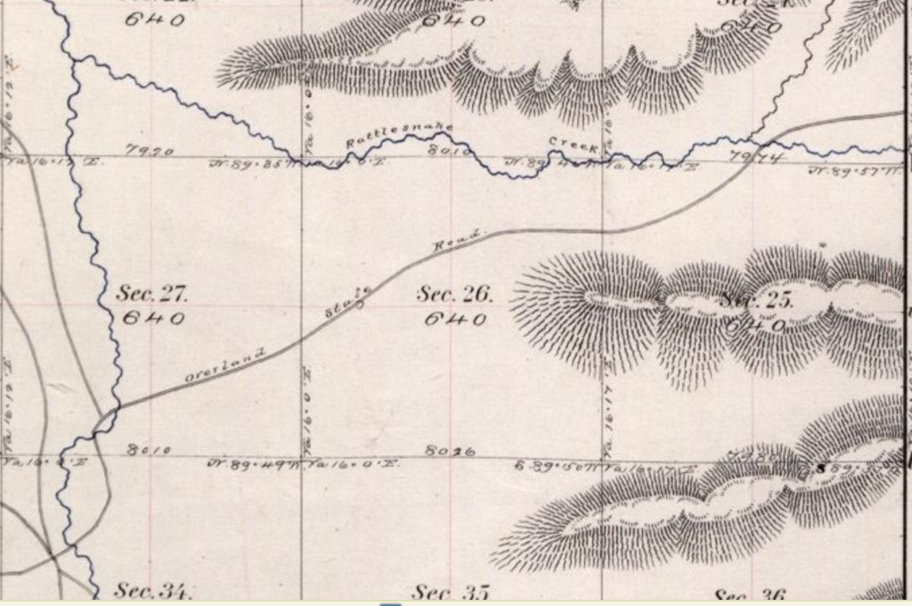
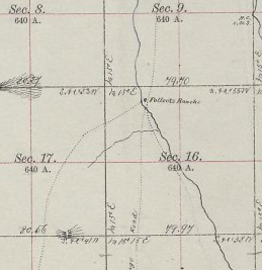
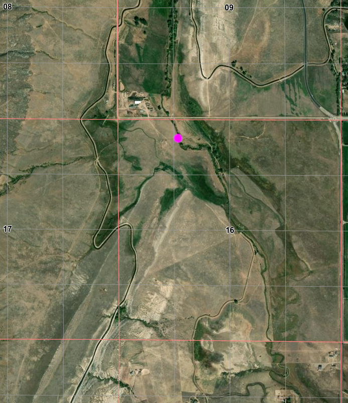
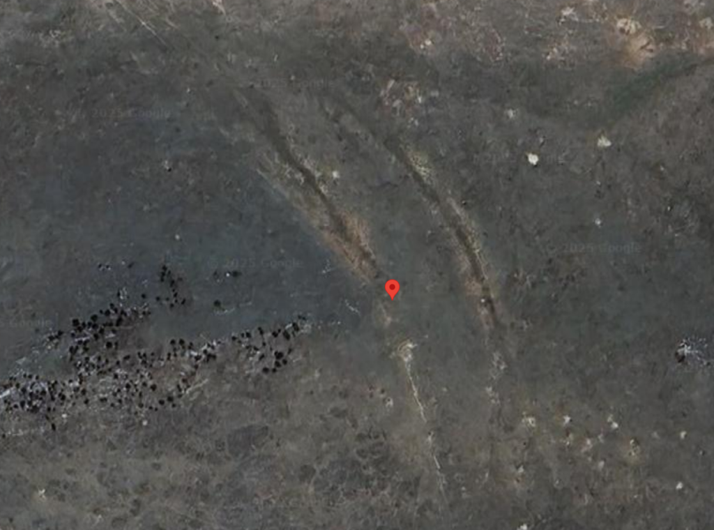
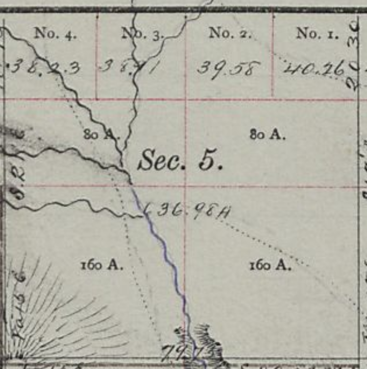
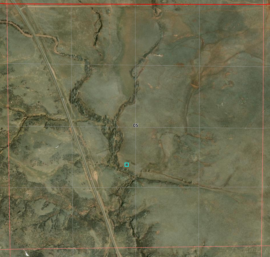
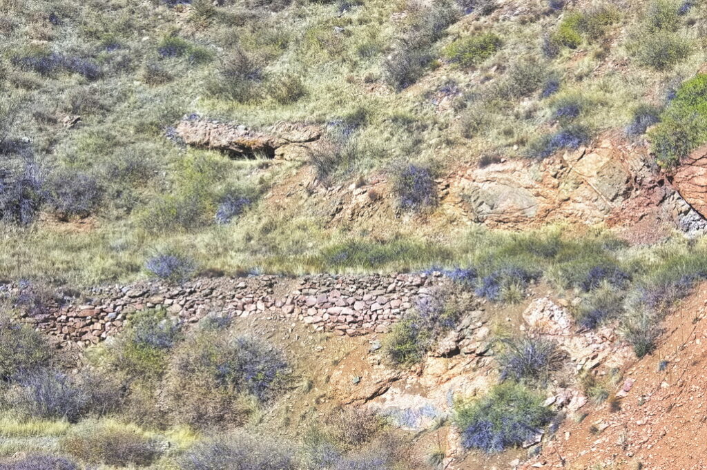
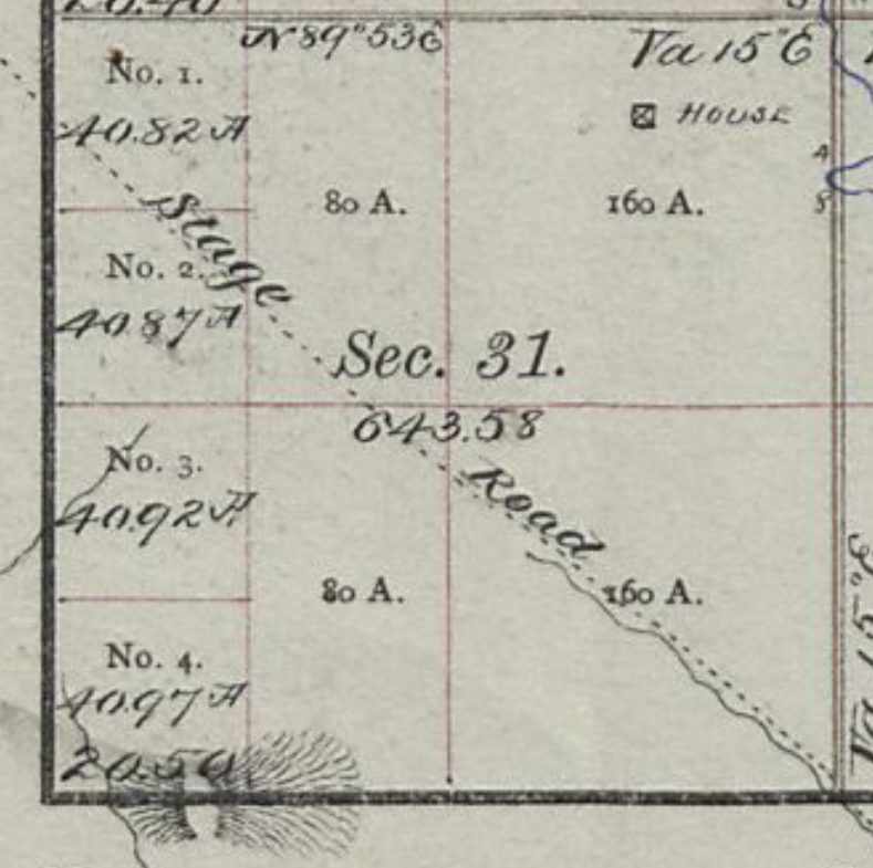
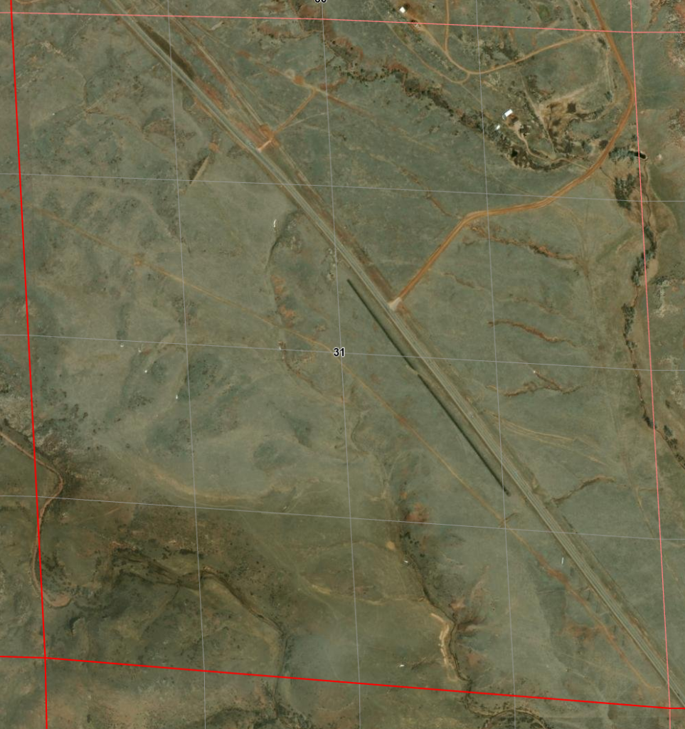
The Pass Creek Station was located at the west side entrance to Rattlesnake Canyon. This was a favorite place for Indians to hide and ambush. Nothing remains of the station. Aerial views show the creek has changed course quite often in the days since the stage making determination of the exact location essentially impossible. The 1873 map shows a junction at one feasible location which is marked; also shows another slightly south.
1873 + 2023 merge Modern rattlesnake Pass Rd in MAG dots probable station location within CYN square
1873 map
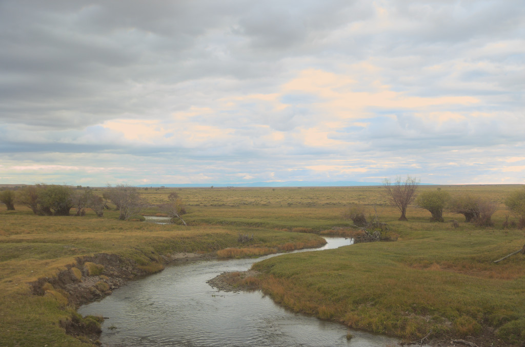
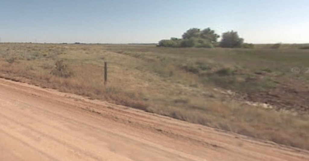
Pass Creek low water this time of year
Next: past the North Platte crossing to the Bridger Pass station
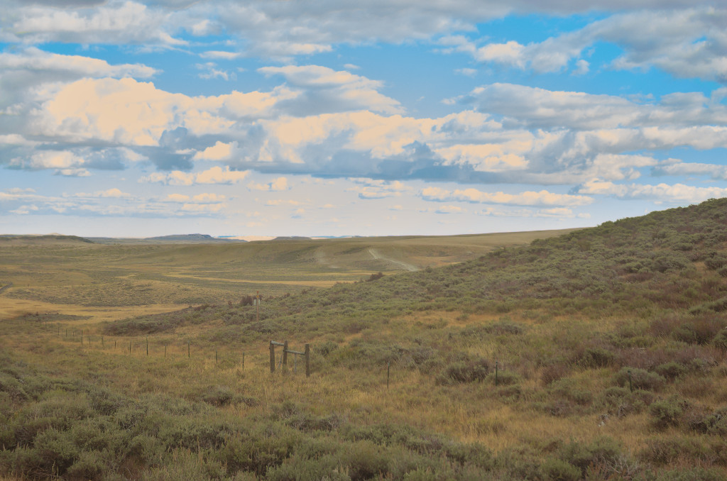
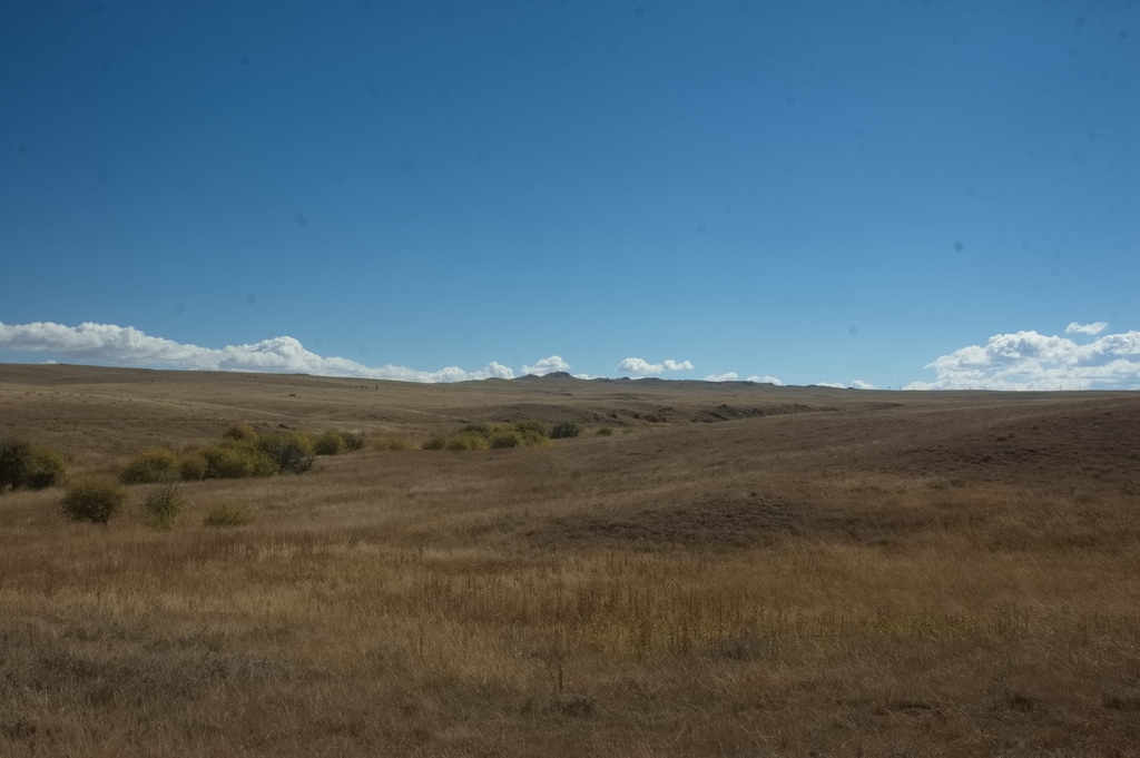
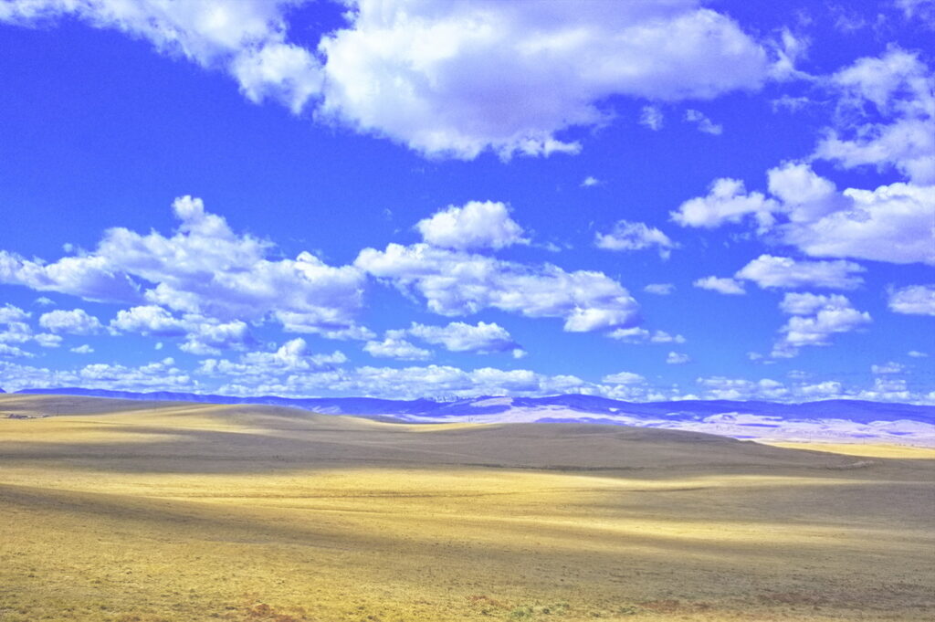
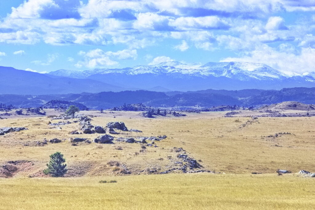
The border of Colorado and Wyoming on US287 crosses near the top of a mild pass. Descending down into Wyoming, one enters the Laramie Plains - a vast arid, lightly populated valley at about 8000 ft. A cold climate with short growing season, the valley is full of grazing lands and hay fields; scattered here and there with the remains of failed homesteads.
Indians did not occupy the land but Arapaho, Cheyenne, Sioux, Shoshone, Crow, and Utes all hunted here - sometimes buffalo, sometimes each other.
The Pony Express, the Overland Stage, the Transcontinental Telegraph, the Transcontinental Railroad, the Lincoln Highway, US30, now I-80 all pass through this region.
Stage route through the Laramie Plains Essentially a straight NW/SE route
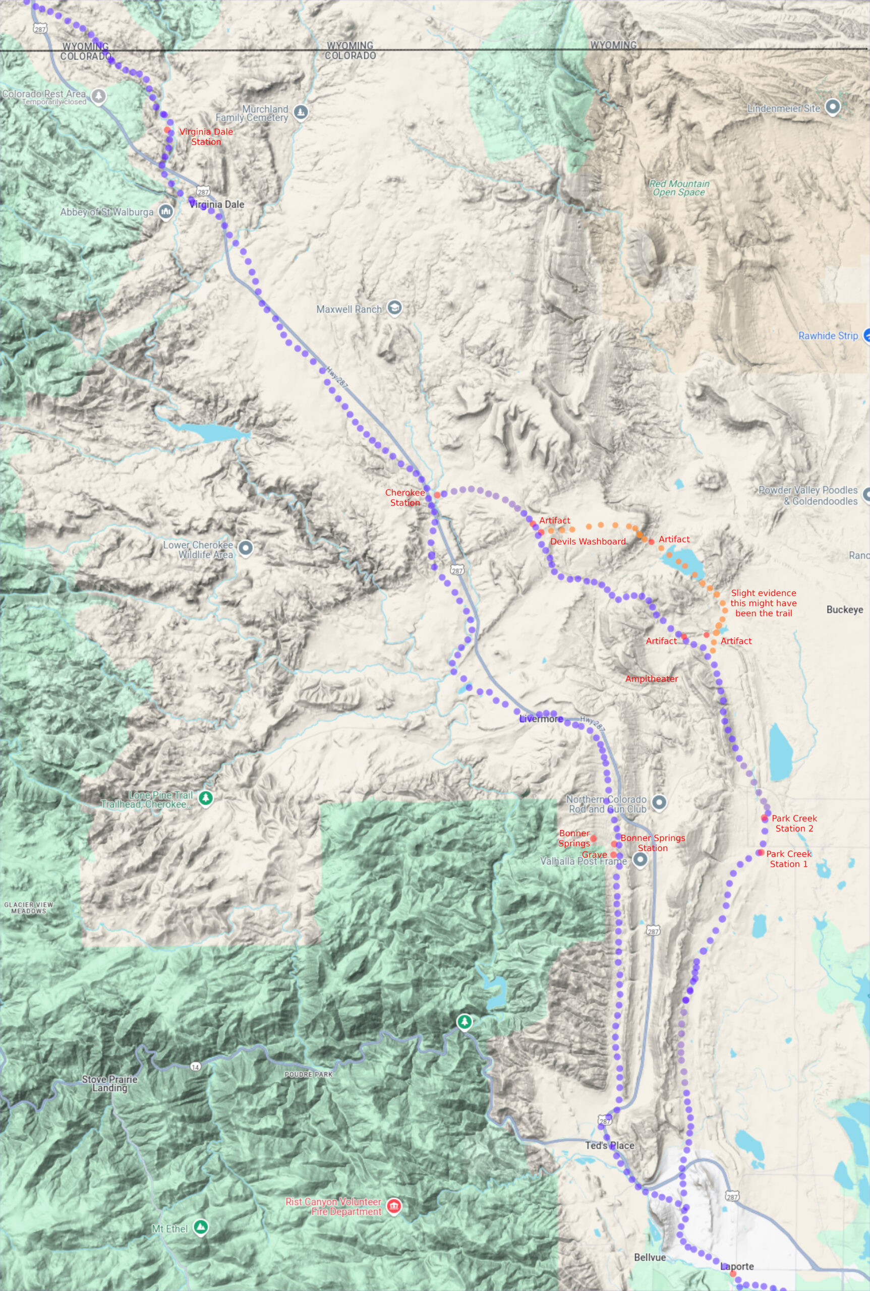
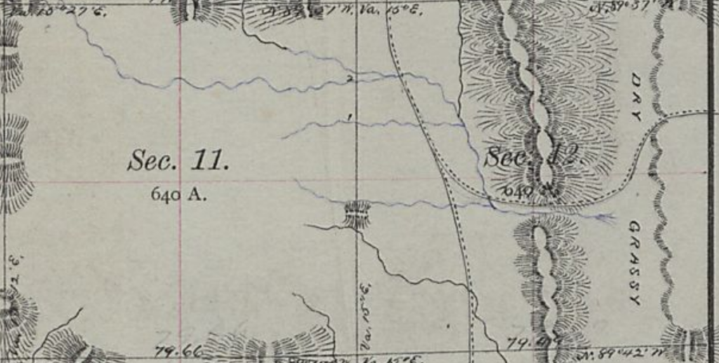
Note on the maps: I have prepared very detailed maps of the Overland Route compared to 1970s/80s USGS Topo maps (for some reason, the USGS maps later than about 1982 do not show the detail those issued only a few years earlier do). They are large files with high resolution. Links will be provided; to include them on the contents page would slow page loading to the point of intolerable.
The route is indicated on the two (once or twice, three) sets of maps that I examined - the late 1970s/early 80s USGS topo maps and the original land surveys of the 1870s. Both were based on township/range/section boundaries. Comparing the two, it is obvious there were adjustments made to the boundaries of each in some places although, for the most part, both sets lined up well. I did a best fit without searching the interim corrections; there are 157 township maps - missing only one - in the 1870s series between South Platte Station in Nebraska to Echo Station in Utah. There are 86 USGS 1970s series of topo maps.
By overlaying the two sets by township/range, I was able to compare the routes - and in most cases, they closely agreed. In others, there were significant differences. Two sections I was not able to compare: the first within what became the Fort Sanders Military District - in the area leading to Big Laramie Station. The fort was established in 1866 - the year Ben Holladay sold the Overland Stage to Wells-Fargo - but the survey maps were drawn 10-20 years afterwards and did not include those military lands. The survey map for the fort proper was done in the mid 1880s, after the railroad had run a spur along the Laramie River. It is likely there were no significant objects in that area - the stages headed in basically a straight line between Willow Creek and Big Laramie.
The other was a missing 1870s survey map in Wyoming west of Ft Bridger. Based on the data on either side, it appears that the trails of both maps were closely related - not always true.
Purple (PUR) dots are the route indicated on 1970s maps; the orange (ORG) dots indicate the route given on the 1870s maps. In places with no ORG dots, the trails overlaid each other unless noted. Happened this way because the modern maps lined up better and I put the modern trail dots down first.
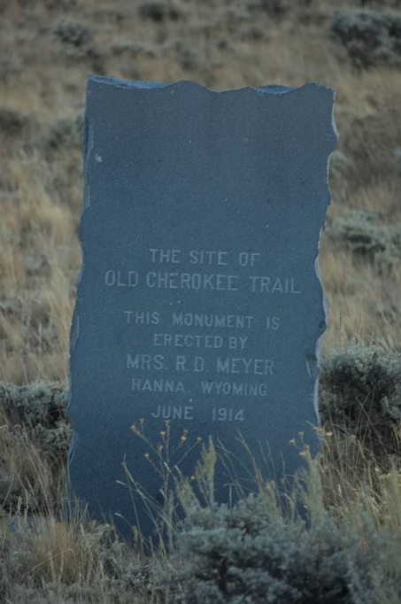
The Overland Route followed the Cherokee Trail in many places
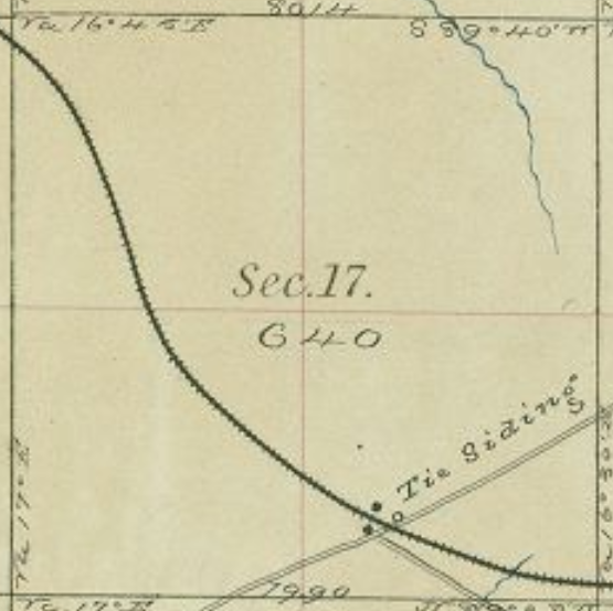
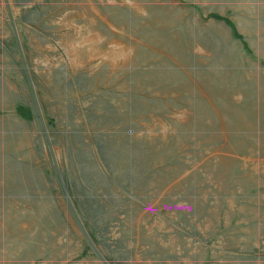
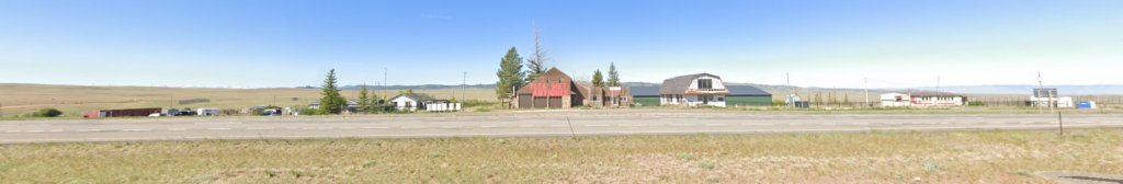
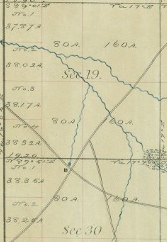
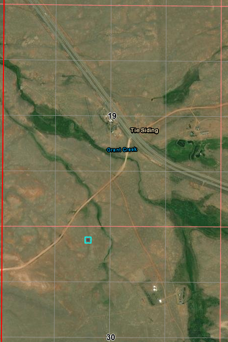
The first station in Wyoming heading west was Willow Springs - very near today's Tie Siding. The name Tie Siding actually referred to a siding on the Transcontinental Railroad close to a mile NE of today's tourist stop near the spot on the railroad labeled Hermosa where ties were gathered for the construction of that railroad.
The railroad route was shifted about 1907
In the mid-1880s, the new Tie Siding area came close to being developed; the developer moved on to Laramie instead.
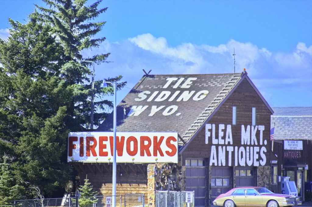
The community of Tie Siding - about 1 mile SW of the railroad - is too small to be a census-designated place and consists of a flea market post office, and not much else. Everything here is "new".
Downtown Tie Siding
The entirety of Tie Siding from northbound US287 (Google view) looking SW Willow Springs would be out on the flats about 1 mile distant off to the left Tie Siding the railroad would be about 1 mile behind to the right
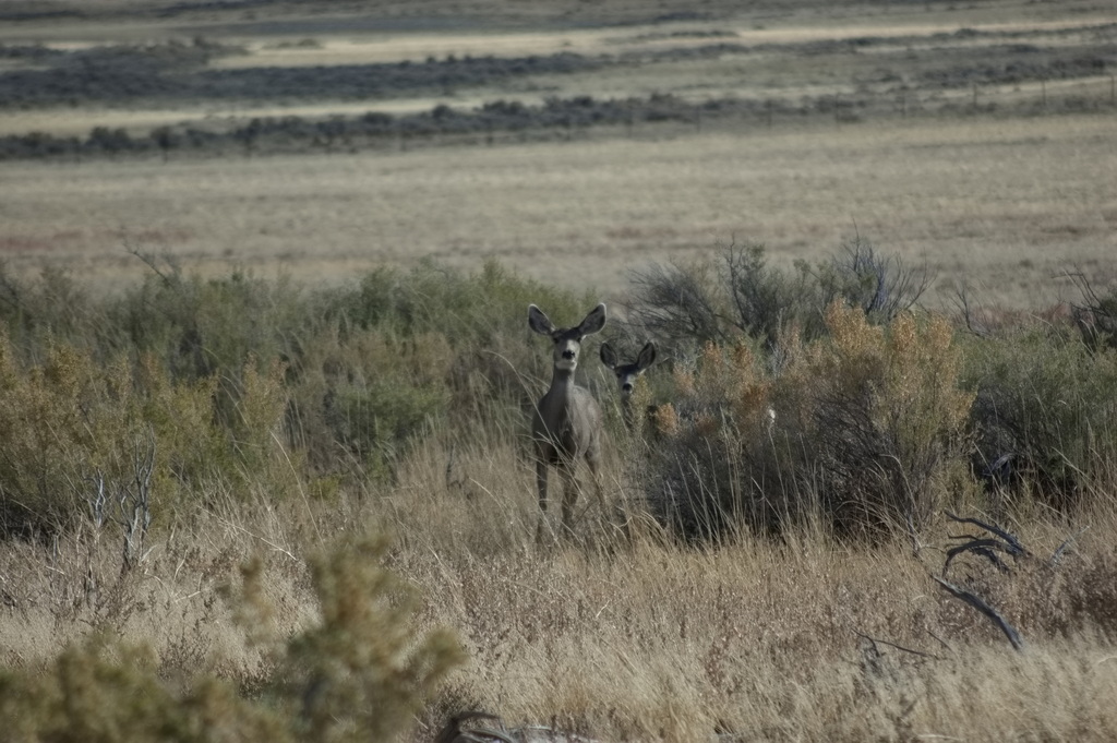
About a mile and a half north of Virginia Dale, the stage crossed into Dakota Territory. The first station was Willow Springs, a swing station originally called Dirty Woman. A nearby "creek" still has that name. Located near a small grove of trees and a spring, the station consisted of a log structure and corral. The station was a target for many Indian raids - it was burned and rebuilt several times. There are no remains but a debris field about 1 mile SW of Tie Siding helps suggest the site.
Probable Willow Springs site Willow Creek is along the bushes
1873
"now"
Equivalent "then and now" maps per township/section/range
The busiest period in Willow Springs' history was when large numbers of workers for the new Transcontinental Railroad cut logs for railroad ties to the SW of the station during the years 1866 to 1868 - after Overland sold out to Wells-Fargo - and hauled them to Tie Siding on the railroad about a mile east along the road past the station. The present "town" of Tie Siding is simply a curiosity for tourists a few miles north of the Colorado/Wyoming border on US287.
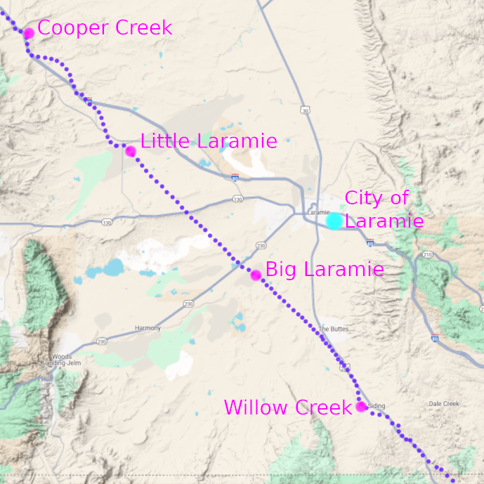
Leaving the Willow Springs station, the trail went pretty much in a straight, northwest line, crossing the Laramie Plains, heading about 15 miles NW of Willow Springs to the home station of Big Laramie.
Big Laramie
15N74WS28 41.23740574939082, -105.6954095566971 East Side 41.24037841117845, -105.70258976618855 West Side
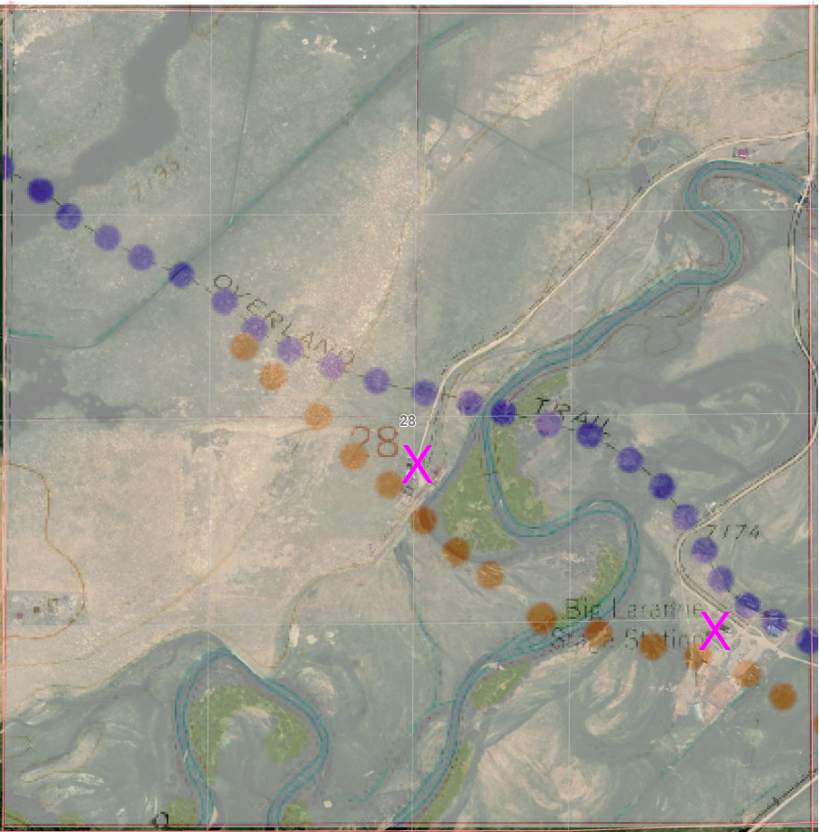
Big Laramie was a home station located on the banks of the Laramie River. There is/was some dispute as to which side of the river the station was actually located; some suggest both sides. There is a structure on the west side on what was the modern Richardson Overland Trail Ranch that is claimed to be of the station; evidence suggests it was built in 1862.
Immediately across on the east side is the Hart ranch. Also built in the 1860s, this is the station location given on the 1970s USGS topo maps but during the nomination process for inclusion on the National Register of Historic Places, the location was stated as being the west bank location. The maps show a divergence in the trail here. ORG dots are from the 1873 map.
Laramie River crossing PUR dots - 1973 map ORG dots - 1873 map Either station location is plausible for either route note how the river course has moved over the years
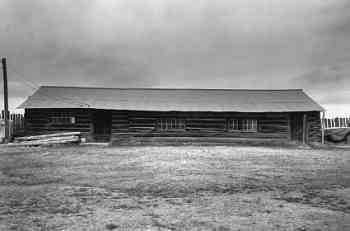
Big Laramie Station was noted by travellers as having a "privy". Travel on the open plains left few alternatives; a closed privy was a luxury. The station was also noted as having a good fresh water spring, a rarity in this country. A blacksmith shop and the large log station still exist at the west side location.
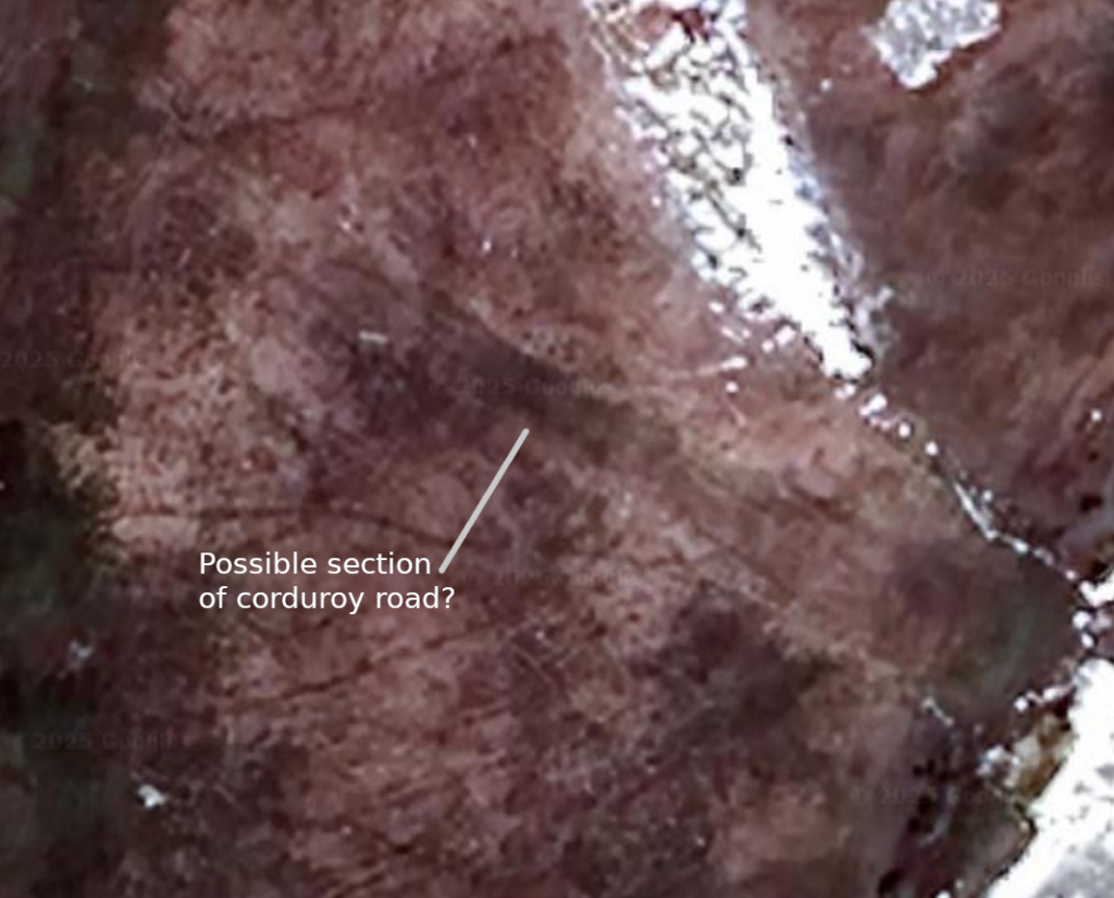
This was an easy crossing point. The banks are low and the bottom is gravel. The land surrounding the river is marshy so a corduroy road was built - for the most part, since subsided into the mud although there is a short section claimed to still be visible. There is a county road that now crosses the river downstream a ways; at one time, this was a toll bridge although this was after the time of the stage.
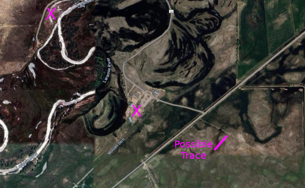
The river course has shifted considerably over the years - hard to determine the "crossing" Both possible station locations are marked The "possible trace" more closely aligns with the 1873 map, but could be either - or neither
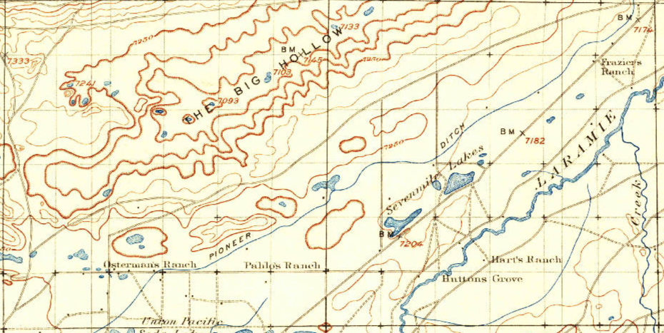
Supposed station structures from the west side
After leaving the Big Laramie Station, the stages and wagons crossed an area on the prairie called "The Big Hollow." It was a depression in the plains where the collected water - if any - was alkaline. It was reported that animals that drank the water died. When dry, large alkali deposits would tun to dust that all that passed breathed in.
This 1925 map of Section 28 shows Hart's Ranch on the east side and crossing but nothing on the west side The Overland Route is not evident here either except perhaps the crossing at Hart's
From here, it was pretty much a straight run across the plains to the Little Laramie Station. Fences have blocked most access; hay fields and livestock grazing have for the most part obliterated traces of the Overland road so tracking the route through here would be a frustrating process.
The trail is marked every so often
The trail headed straight down that-a-way ...
Even now, the trail between Big and Little Laramie stations is sparsely populated/
Although some tried ...
Failed or abandoned - this is still hard country to make a stand.
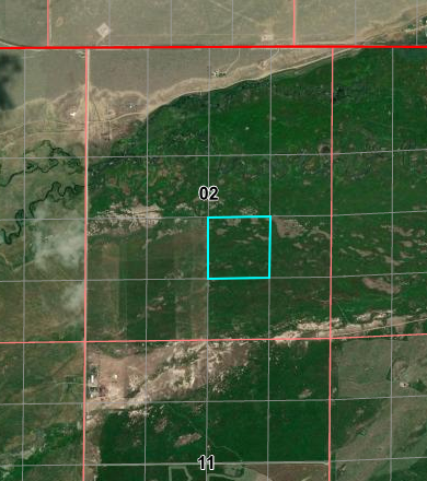
Little Laramie Station
16N76WS02 41.384709210213664, -105.89044376549165
The Little Laramie Station was a swing station built of logs near the Little Laramie River. It had a blacksmith shop but was burned out by Indians in 1865. Fresh meat was offered for sale by a rancher in the area.
Many of the old maps highlight the "Overland Stage" road
Note the shift in alignment and reduction in number of sections It is possible the highlighted portion be moved west by one SW of the intersection of Mandel Lane and Lawrence Road
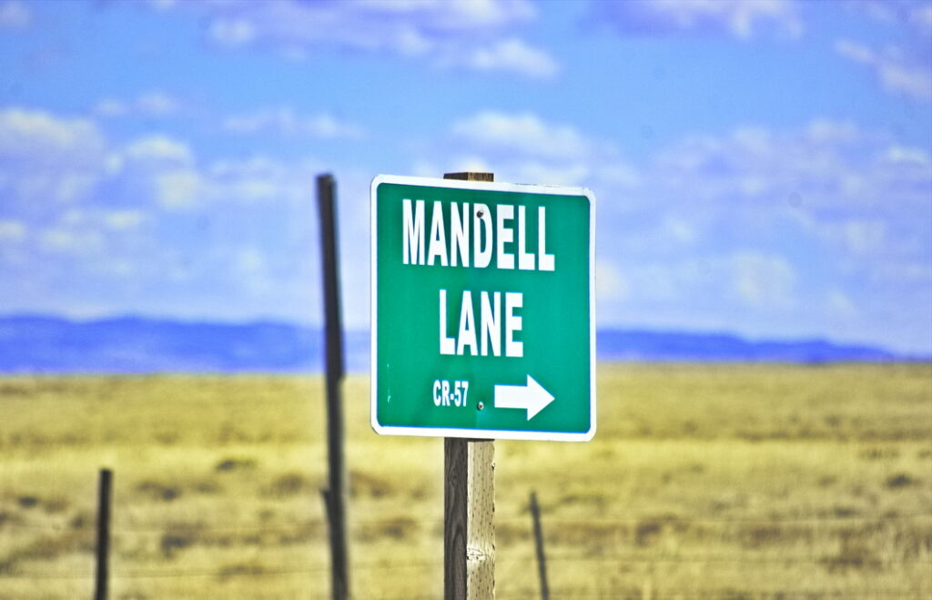
Site of Little Laramie Station
The site is just off Mandell Lane
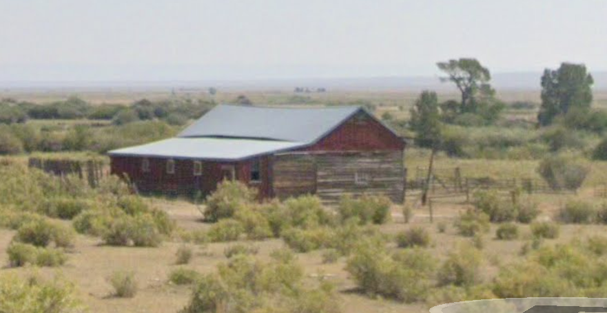
This barn could be of the era but would more likely be the rancher's than the station's. More likely yet, it's a newer structure. It's the only structure for miles around.
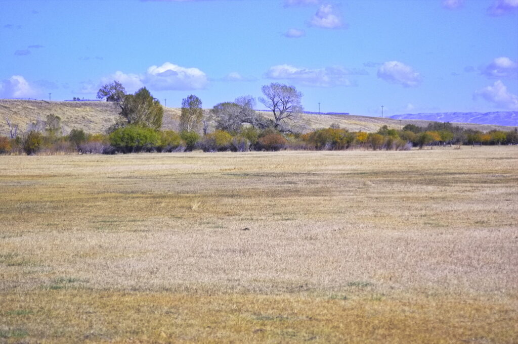
On the Laramie PlainsPast Little Laramie Station Looking SE along the trail towards Colorado There's another barely visible speck of a marker just to the left of center but no hint of the trail itself
"With few exceptions, the drivers were warm-hearted, kind, and obliging. Many of them were capable of filling other and more important positions. The most of them were sober, especially while on duty, but nearly all were so fond of an occasional "eye-opener" that it was unnecessary ever to give them a second invitation to "take a smile." Now and then one would be found who could speak two or three languages and quote Shakespeare and passages from the Scriptures."
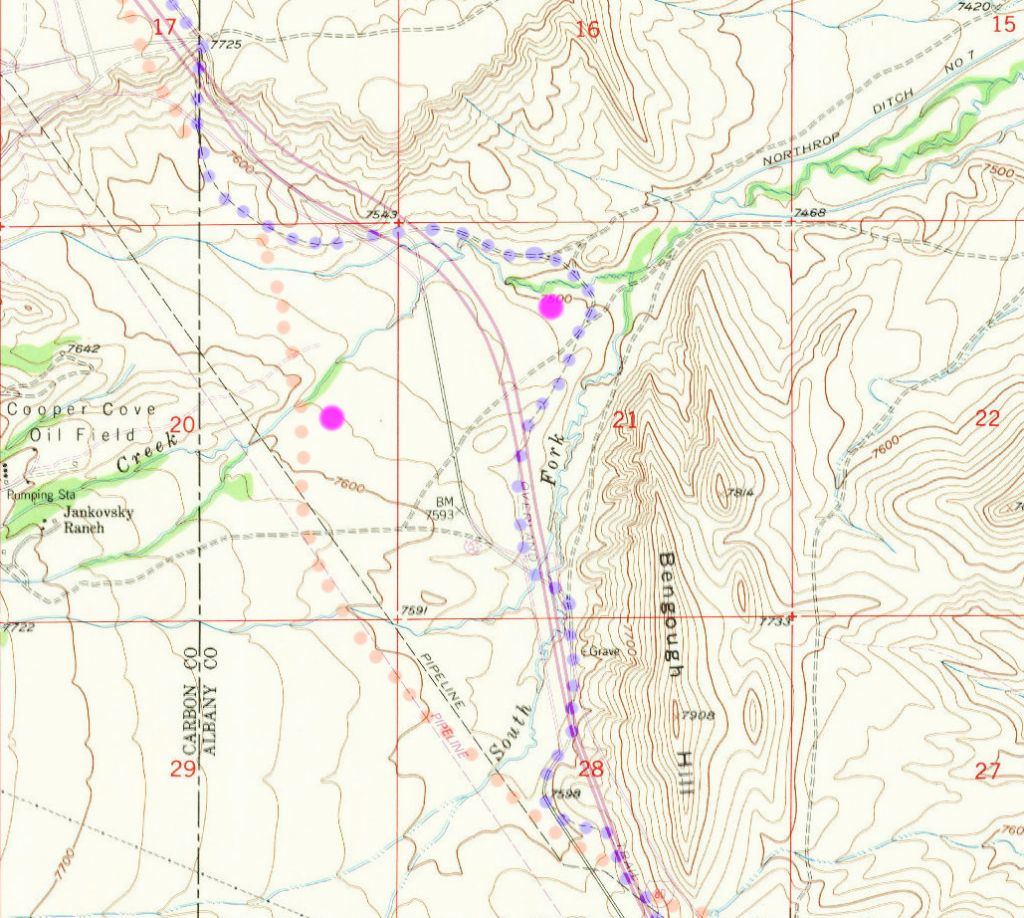
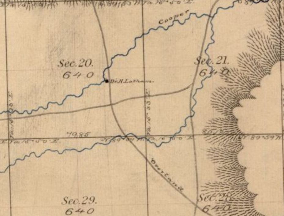
Located right off I-80, it is said ruts of the Overland Trail still exist in the median strip, just west of here. The station was stated by period sources as being located right on the present Albany-Carbon County line along Cooper Creek but neither proposed location is "on" the modern county line. Like the other stations, it was sacked and pillaged several times.
There is a discrepancy in the location: some maps show the crossing of Cooper Creek in a small valley immediately to the north side of I-80, the 1871 map shows the crossing about 1 mile east on the south side of the highway. The 1871 map (ORG dots) shows the location closer to the county line. The PUR dots follow the modern map indication of the trail
It was noted in 1863 that a bullet-ridden stage coach sat near the station.
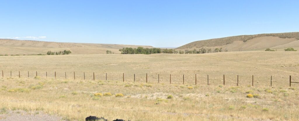
The most probable station location in Section 20
I-80 to the right
North of I-80 - the modern location
Cooper Creek along the line of trees The 1983 location of Cooper Creek Station
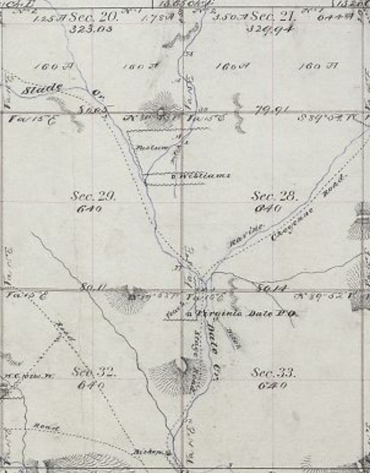
This segment of the route was by far the most difficult to track down. The route changed several times; townships having been surveyed well after stage operations, and the development of the area after the mid-1860s did not aid the search. That and in several places, the maps were either incomplete, showed many roads with ambiguous labeling, or in some places, features did not line up with adjacent townships. It also seems this is an area where survey corrections were made - the newer survey lines have "jogs" that cause the old maps to be out of alignment when compared to known and fixed features - the location of the Virginia Dale structures that still exist for example.
Where possible, descriptions of the route written by travellers of the time were used as aids for tracing the actual road (for example, "the Horseshoe" and "Devil's Washboard"are prominently mentioned yet no map shows a route through these features. The aerial maps helped - the area is even now remote enough that traces of the road and some structure remnants remain; sufficient to align the old with the new.
One can not discount the idea that the old maps are wrong - though for the most part they align nicely with satellite images.
Much trouble was experienced with the Indians in the summer of 1865 along the stage route west of Camp Collins. In July most of the stock was stampeded, seriously delaying the running of stages and transmission of the mail. Tons of mail matter destined for Salt Lake, Montana, Nevada and the Pacific coast accordingly accumulated at Fort Halleck [Wyoming], where as many as half a dozen large Government wagon-loads of it were transported west as far as Green river, under an escort of cavalry. The long delay in the stopping of the mail was practically a repetition of the scenes that had occurred along the Platte during the summer and fall of 1864, when the Indians for six weeks had possession of several hundred miles of the overland line.
Before the stage routes developed and the gold rush led prospectors to explore - and in some cases, settle, the Cherokee Trail was the only route skirting north through the foothills up to Wyoming. The Overland Route followed this trail along this segment.
LaPorte
(Colona until 1862 - HQ Mtn Div Overland Stage) 40.621405361511464, -105.13968091975305 8N68WS32NE
LaPorte is one of two stations along the trail that developed into a town existing today; Ft Morgan and being the other. It is the only "known" station location along the trail until Virginia Dale although possible foundations are visible at other stations.
Trappers built cabins along the Cache la Poudre River as early as 1828 when a band of mountain-men - hunters and trappers - made the LaPorte region a headquarters for related operations - it's a quite pleasant region. The settlement grew, including lodges of Arapaho Indians who also settled along the river.
A town was organized in 1860 as Colona with fifty or so log dwellings constructed along the Cache la Poudre River; by 1861 it was the county seat of Larimer County. The town changed its name to LaPorte in 1862 when it was named the headquarters of the Mountain Division of the Overland Stage line. The station was erected right along the river - a marker at the location is on the present Overland Trail Road crosses the river. The stationed burned down in the 1920s.
LaPorte was also the original location of Camp Collins until a flood almost wiped out the camp, causing the commander to relocate to what is now Fort Collins.
The station before it burned
Cache la Poudre at crossing
Overland Road
Mrs Taylor, wife of the first stationmaster, was a "good cook" and "gracious hostess", and as described by one diarist, knowing "what to do with beans and dried apples." It is claimed that General Grant stayed at the station in 1868.
Fare from Denver to LaPorte was $20.00. While the original trail was on the north side of the river - as was the station - the trail from Denver (slightly west of today's US287) crossed more or less at the site of the present Overland Road bridge. The first bridge was built as a toll bridge and during the rush west, daily traffic could be heavy. The toll ranged from $.50 to $8.00 depending on what was crossing. The bridge washed out by the flood of 1864 and a ferry was rigged up to replace it. Eventually, the county built another bridge.
With wagon trains and stagecoaches passing daily and having status as a division headquarters, it didn't take long for LaPorte to become a busy business and supply center for passers-by. The settlement had four saloons, a brewery, a butcher shop, two blacksmith shops, a general store and a hotel. After the route was changed to pass through Denver, LaPorte became the most important settlement north of Denver, having the stage home station and county court house.
A company of infantry stationed at LaPorte acted as an escort for the Overland Stage on the trail to Virginia Dale. After the flood of 1864, the camp was covered with water, and Col. Collins decided to move the army camp to Fort Collins in August.
Escorting the mail
The terrain from the east - even far east of Julesburg - was mostly level, following the Platte River plain. After LaPorte, the mountainous territory began.
From the terrain map to the left, the narrow NS valleys dictated the stage route. LaPorte itself is now off the main highway route, but today's secondary road heading NW out of LaPorte is still used for local traffic. The first stage route headed north along the valley west of the modern highway.
The modern and stage routes criss-crossed at Owl Canyon - the jog in US287 at the top of the map. There was a stage station just west of the canyon; a new station was constructed just east with the new stage route then heading north along Park Creek. Several segments of the trail are still in use as ranch roads.
The "main" road moved around as development came and went. Tracking down a specific route at a specific time is not straightforward. The oldest known maps are newer than the Overland Stage operation. By the late 1870s (the survey map around Livermore is dated 1878), there were many roads leading to ranches and mining prospects.
This was Jack Slade's "home" territory; he was still a division superintendent and the last station in Colorado - Virginia Dale - was named for his wife
"One pitch-dark night the stage was started from Laporte with Slade and a lot of employees aboard in the convulsions of a 'booze,' and one unfortunate passenger. Six wild mustangs were brought out and hitched to the stage, requiring a hostler to each until the driver gathered up his lines. When they were thrown loose the coach dashed off like a limited whirlwind, the wild, drunken Jehu, in mad delight, keeping up a constant crack, crack, with his ' snake ' whip. The stage traveled for a time on the two off wheels, then lurched over and traveled on the other two by way of variety.
The passenger had a dim suspicion that this was the wild West, but never having seen anything of the kind before, and, being in a sort of tremor, was unable to decide clearly. Slade and his gang whooped and yelled like demons. Fortunately the passenger had taken the precaution before starting to secure an outside seat. The only way in which he was enabled to prevent the complete wreck of stage, necks and everything valuable was finally by an earnest threat that he would report the whole affair to the company.
Slade and some of his men went on a tear on another occasion, when they paid the Laporte grocer a visit, threw pickles, cheese, vinegar, sugar and coal-oil in a heap on the floor, rolled the grocer in the mess, and then hauled him up on the Laramie plains, and dumped him out, to find his way home to the best of his ability. It was only a specimen of the horse-play in which they frequently indulged."
We set out from this place [LaPorte] through the plains, and hills. We succeeded well, from 15 to 20 miles a day, for some time until we got within some 40 to 50 miles of the North Fork of the Platte, when the hills became worse and we had to detain more time hunting out the route and working it.
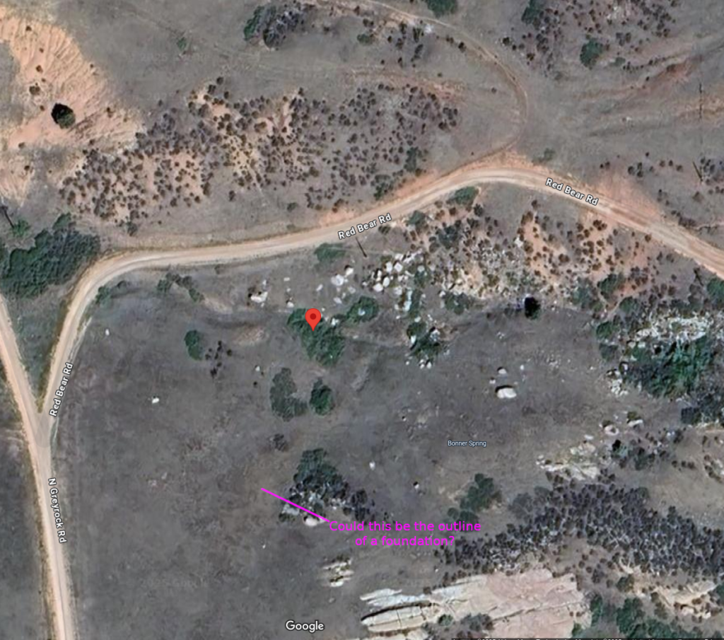
Bonner Springs
9N70WS11SESW 40.758595867977164, -105.19687090088713 40.75337296728025, -105.1862148981457 - Possible station remnants
The Bonner Springs Station was a swing station located near some springs about 10 miles north of LaPorte. Originally called "Boner Station" by Jack Slade (superintendent of the station) after a Dr. Boner who took care of him after being shot by Beni in Julesburg. The name was changed later by travellers from Bonner Springs, KS. The nearby springs made it a favorable camping spot. After the stage line abandoned the station, it became a hideout for the Musgrove Gang who made a habit of stealing government horses.
Musgrove was eventually caught and brought to Denver, Colorado, where he was taken by a group of citizens and hung from the Larimer Street Bridge on November 26, 1868.
1877 - between 10 and 15 years after Bonner Springs was a stop
The spring itself marked in MAG
Marker at springs. Location of station unknown Possible evidence of foundation? The road was a bit east of this point
The route through Bonner Springs was moved east in 1863 and the station was abandoned. There was reported to be a child's grave dated 1864 just south of the station but the headstone has disappeared and there are now several houses in the area. Nothing remains of the station but the apparent remains of foundations near the spring are evident. There is a modern marker at the grave site however.
9N70WS12NWNE
station remnants 40.75337296728025, -105.1862148981457
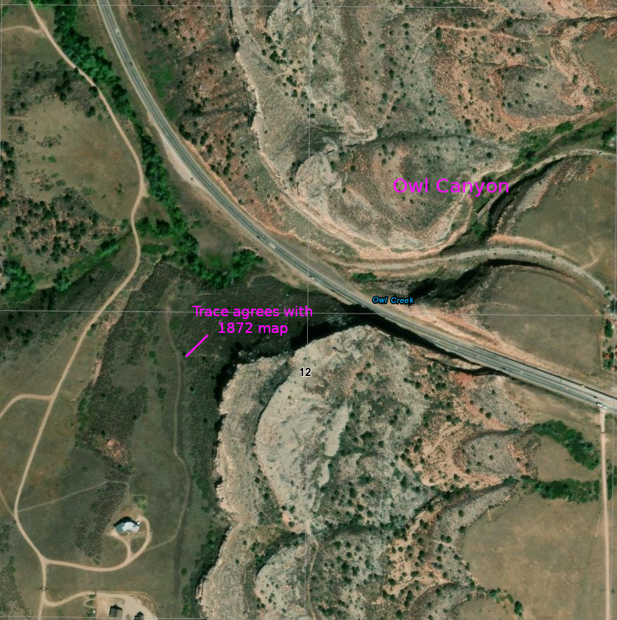
US 287 follows the original stage trail north from this point. Remnants of the 1877 roads are still evident
The old road from Bonner Springs joins the modern US287 just north of Owl Canyon
I get lost in the weeds so to speak in what follows ... exploring the unexplorable; tracking rumors and hidden remnants.
Perhaps one of the most interesting, unchanged, and inaccessible areas of the route in Colorado is that section between Park Station and Virginia Dale. I doubt a truck could get deep into the territory - even if it weren't blocked off by private lands. I'd love to take a dirt bike up into that mess of a landscape and spend a week exploring ... but some places look to be accessible only by foot or horse.
This section was some of the roughest trail along the route.
USGS 1960 - Livermore to Wyoming border
Park Creek
The location of Park Creek Station is not easily determined. Maps and descriptions are both similar and different. The landscape of today is vastly different than of the 1860s. Defining a location as "4 miles east of .." does not work well; even worse when the "east of" location is itself not specific.
For no reason to think differently and speculating from information on the 1872 maps, I favor the first given location ... but there is also evidence to suggest the second is a feasible location.
The Park Creek Station which replaced Bonner Springs was located on the "new" Overland Trail as established in 1862. This was located about four miles due east of the Bonner Springs Station and about four miles south of "The Amphitheater". The Park Creek station was built on the banks of Park Creek. The first station was built of logs and was destroyed by Indians. It was rebuilt as a larger and more defensible station to accommodate overnight travelers although not considered a home station.
I've found no real information about this station and only vague information of its location. It appears nothing remains but it is claimed there is some evidence of a foundation with rubble. The area has been ranched and irrigated with modern roads and power lines passing through such that a specific location of the trail or station in this area is impossible to determine even with aerial maps. It's likely the locals have better information - if they're willing to disclose it.
It is also unclear as to whether a new route heading north from LaPorte was used or if the trail passed east through Owl Canyon. It's likely both were used.
I tend to favor this location ... somewhat south of Owl Canyon - but it's roughly 4 miles east of Bonner Springs and 4 miles south of the amphitheater (a prominent geological structure). This would suggest a route directly north from LaPorte, not passing through Owl Canyon, although the old trail was probably kept in use and Owl Canyon is a convenient break to the other side of the dividing ridge.
9N69WS16NE
possible trail segment directly under the number "16"
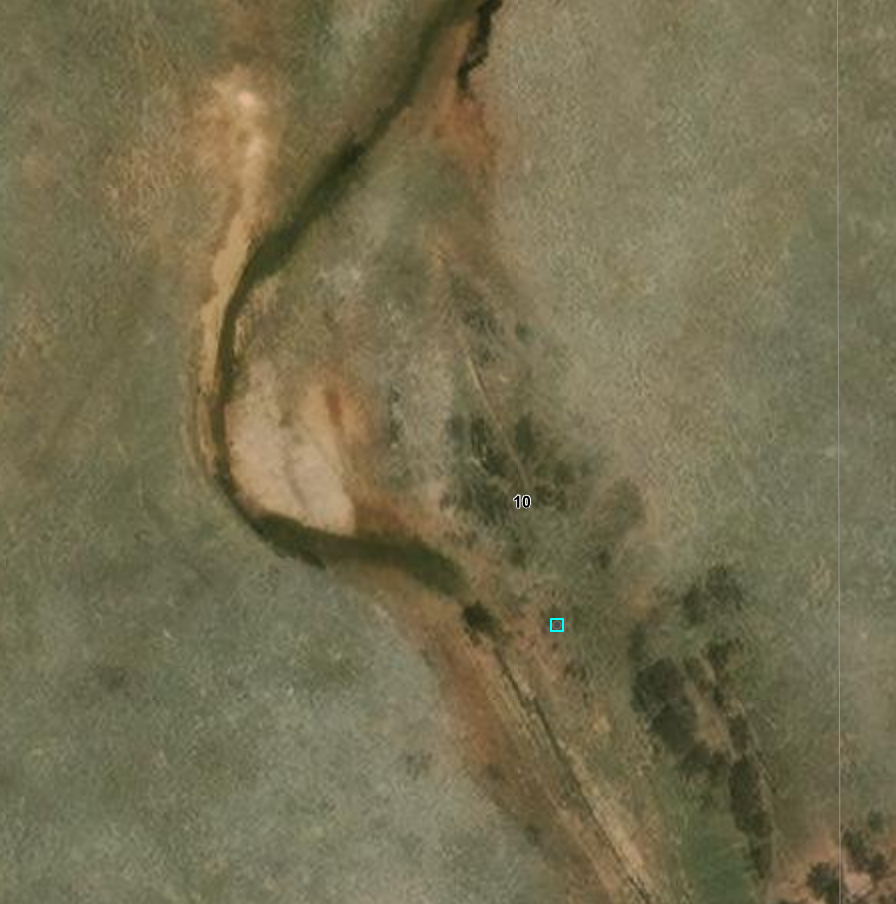
Likely site of Park Creek Station - small circular area immediately right of river Weld County Rd 70 passes along upper edge (section boundary) roads do not agree with 1877 mapFrom Weld County Road 70 - possible trace of Overland Route; road is on section boundary; While the crossing point of section line agrees with old map, stage route would have angled to right of trees
There is a coarse map that suggests a location a bit north of this location. The map is grossly inadequate for determining a specific location.
Park Creek on left; irrigated fields further left Irrigation canal on right; station location between creek and ditch too much activity in area to discern any trace of trail
Heading north along Park Creek (the line of brush)
This was a note I made long ago ... and now I can't find the reference. Apparently, one version of the trail went past here - a trace is faintly visible to the left of the marker and this blacksmith shop was set along the trail just below a rough grade. The location is close to Park Creek and a road of sorts passes by. The marker seems to be in the center of a diagonally placed rectangle which could be the outline of a foundation.
'Twere it a different time in my life - and I didn't now live so far away - I'd be tempted to check it out in person - if I could get to the location. Lots of fences and private land thereabouts..
The trail apparently led up that canyon ... or maybe not
One could almost imagine seeing a faint trace of trail heading up the canyon just to the left of the marker
Maps of the area date well past the early days of the stage; there are no indications the trail ran through here
But this apparent artifact makes one wonder
The Amphitheater
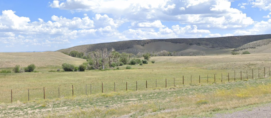
About four miles up from the Park Creek Station is a large area in the shape of an amphitheater called "The Horseshoe" (even on some of today's maps). Roughly one square mile in area and surrounded on three sides by high bluffs, it was a favored spot for stopping for the night.
In later days - after 1868 - the trail split here with one route headed to Cheyenne (which didn't exist before the railroad that killed the Overland/Wells-Fargo stage); the other being the original route heading towards Virginia Dale.
There was a blacksmith shop near here doing business when wagons climbing the steep hills had broken down or whose teams needed re-shoeing. (Gee, my radiator blew going up that hill and I have a flat tire)
9/10N69W 1867
After climbing up out of the Horseshoe, the route had to transverse "The Devil's Washboard". One of the most difficult sections of the trail heading in either direction.
Oops
10N70WS10
3 views of the same section
10N69WS10
10N69WS29NW These tracks line up quite well with the 1872 map
The area was in some ways less remote then than now. Various businesses were established along the route to provide services to travllers - not all of whom were stage riders. Blacksmith shops, saloons, other entities appeared her and there. All gone now, leaving little if anything in their wake.
Modern development - ranches and mines for the most part - have approached this region from the east, but the old stage road exists now only as faint tracks in the sands with nothing but debris and rotting foundations left of the business ventures of the past.
There is nothing definitive about the age of these remnants. A few words in diaries are basically all that tell of the locations of such endeavors - a specific site hard to pin down ... and nothing to differentiate from the air a structure from "then" to something later.
Keeping on the route north to Virginia Dale, the trail goes down to Spring Gulch, passes many Indian Teepee Rings, and then on to Signature Rock, where it is claimed that names carved over 150 years ago can still be read in the sandstone. The location is a guarded secret and on private property. The region is full of sandstone bluffs ...
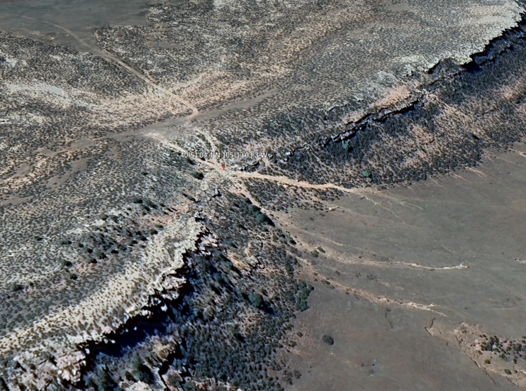
Upon passing through Spring Gulch, the stages came upon one of the steepest sections of the Overland Trail. Named "Devil's Washboard," it is a steep, rocky incline--bad in both directions.
10N70WS10NESW Looking southwest towards Park Creek Station 40.850816783386776, -105.21734129022987 6360 at top; 6130 at bottom 230 ft elevation in about 500 ft lateral then back up to 6300 ft at a gentler grade to Cherokee Station
The welcome sight of a saloon for many drivers and passengers alike was at the bottom of Devil's Washboard.
Possibly at 40°51'14.0"N 105°13'10.0"W ; the base of Devils Washboard
This is the historically rich area that has been the "Robert's Ranch" for over 100 years. (Note: That portion of the trail from north of the Horseshoe, up past Spring Gulch and the teepee rings, to north of Signature Rock is where a mining company is proposing to strip mine. Please visit that page, read the information, and e-mail your opposition to the Larimer County officials named.)
A few traces of the trail are still visible from air; it may be harder to detect at ground level
10N70WS09NW This view represents the NW quadrant of the 1877 map to the left
10N70WS09NWNE Trail traces
It was imperative that the stage-coach axles be greased (or rather "doped," as the boys used to call it) at every "home" station, and these were from twenty-five to fifty miles apart. This duty had time and again been impressed upon the drivers by the division agents, but occasionally one of them would forget the important work. As a natural consequence the result would be a "hot box."
One afternoon early in the summer of 1863, while we were on the rolling prairies, one of the front wheels of the stage was suddenly clogged and would not turn. On examination, it was found to be sizzling hot. The stage had to stop and wait until the axle cooled off. As soon as practicable, the driver took off the wheel and made an inspection, the passengers and messenger holding up the axle. On further examination, it was found that the spindle had begun to "cut," and there was no alternative but to "dope" it before we could go any farther. But we were stumped; there was no "dope" on the stage.
The driver, an old-timer at staging, suggested, since "necessity is the mother of invention," that as a last resort he would bind a few blades of grass around the spindle, which he was certain would run us part way to the station, and we could stop and repeat the experiment. But one of the passengers chanced to have a piece of cheese in his grip sack, and a little of it was sliced off and applied ; and it worked admirably, and was sufficient to run the coach safely to the next station, where the difficulty was quickly remedied by application of the proper "dope."
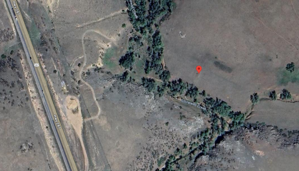
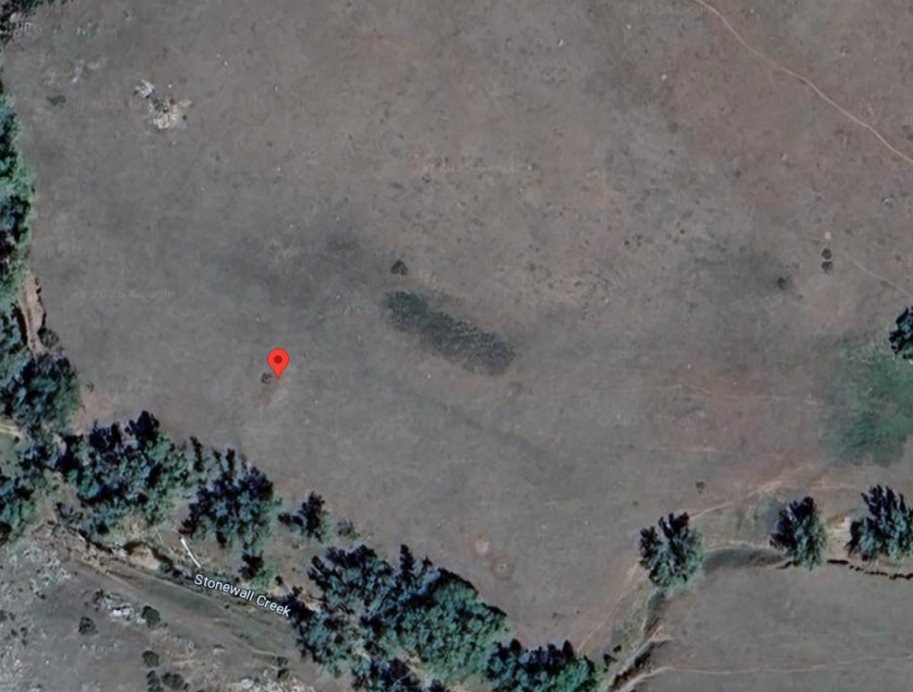
Cherokee Station
10N70WS05NWNE 40.861253143242386, -105.25797804712926 (cemetery per map)
Also known as Ten Mile Station, it was the last stop before Virginia Dale and was located just west of Steamboat Rock on Ten Mile Creek (Stonewall Creek on modern maps). It was said the Cherokee Station was burned out by Indians but a recent excavation found no evidence of charcoal, indicating that the station was probably not burned. Which does not mean the station was not attacked.
1878
Just off the highway but on private property.
North of Cherokee, the Overland Route is essentially overlain with US287 although there are some variations. This segment of the old route is just south of the Virginia Dale church and on the west side of US287.
11N71WS10NWNW 40.94360390207408, -105.34315301087189Probably doesn't look too different from when the stages ran
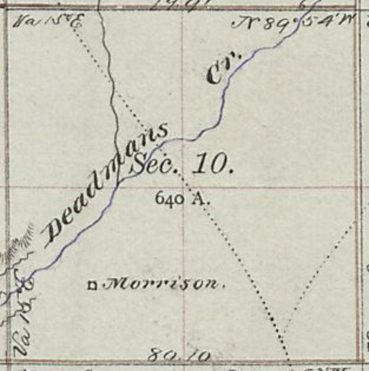
Crossing of Deadmans Creek - coming into Virginia Dale it appears US287 cuts directly through Morrison
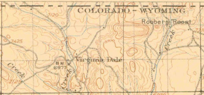
Heading about 10 miles north from Cherokee Station, the next station is Virginia Dale, perhaps the most famous of all Overland Trail stations. The station was named for Jack Slade's wife while he was superintendent of the division. This is the last station in Colorado being less than two miles from the Wyoming border.
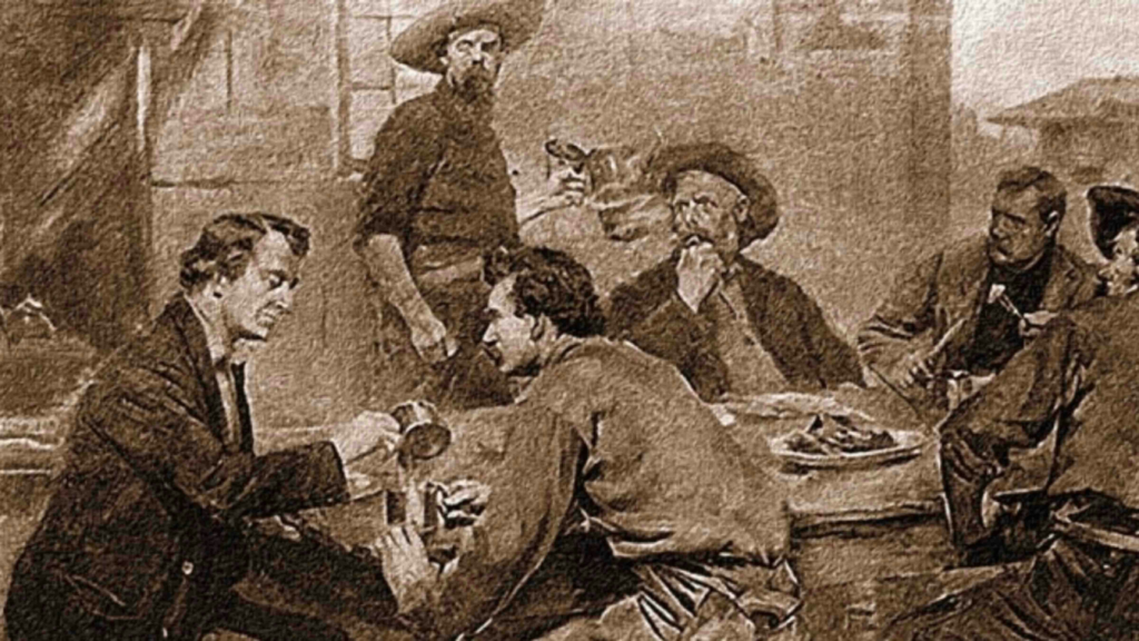
"The Indians were not the only source of annoyance in the early days. The Overland Stage Company's employees were in many cases more carefully guarded against. They were a drunken, carousing set in the main, and absolutely careless of the rights or feelings of the settlers. The great desperado, Slade, who was for a time superintendent of this division, and was later hung in Montana by a vigilance committee on general principles, exhausted his ingenuity in devising new breadths and depths of deviltry. In his commonest transactions with others, Slade always kept his hand laid back in a light, easy fashion on the handle of his revolver. One of his most facetious tricks was to cock a revolver in a stranger's face and walk him into the nearest saloon to set up the drinks to a crowd. He did not treat the passengers over the line any better.
Virginia Dale was a "home station" on the Overland Trail, meaning that passengers could disembark, get a meal, and stay overnight in a hotel if the stage was delayed by weather or nightfall. Thirty to fifty horses were kept at the station which was located in a pleasant, grassy glade (or "dale") along a clear bubbling stream, later named Dale Creek. Slade probably named the post after his wife Virginia, whose maiden name might have been "Dale". Slade was an excellent stage manager as long as he stayed sober. Many stories credit him with outrageous actions from shooting up a saloon in LaPorte for serving his stage drivers whiskey, or for having "a fondness of shooting canned goods off grocery store shelves" [5] to robbing the stage of $60,000 in gold, which later disappeared. Slade was fired as stage manager in November, 1892 after a drunken shooting spree at nearby Fort Halleck and left with his wife for Virginia City, Montana where he was hanged in early 1894 by angry miners.
1865 "Virginia Dale deserves its pretty name. A pearly, lively-looking stream runs through a beautiful basin of perhaps one hundred acres, among the mountains - for we are within the entrances of one of the great hills-stretching away in smooth and rising pasture to nooks and crannies of the wooded range; fronted by rock embankment, and flanked by the snowy peaks themselves; warm with the June sun, and rare with an air into which no fetid breath has poured itself-it is difficult to imagine a loveable spot in Nature's kingdom."
At midnight we drew up at Virginia Dale Station ... Nature, with her artistic pencil, has here been most extravagant with her linings. Even in the dim starlight, its beauties were most striking and apparent. The dark evergreen dotted the hillsides, and occasionally a giant pine towered upward far above its dwarfy companions, like a sentinel on the outpost of a sleeping encampment. - Edward Bliss, Overland Trail stagecoach passenger, 1862
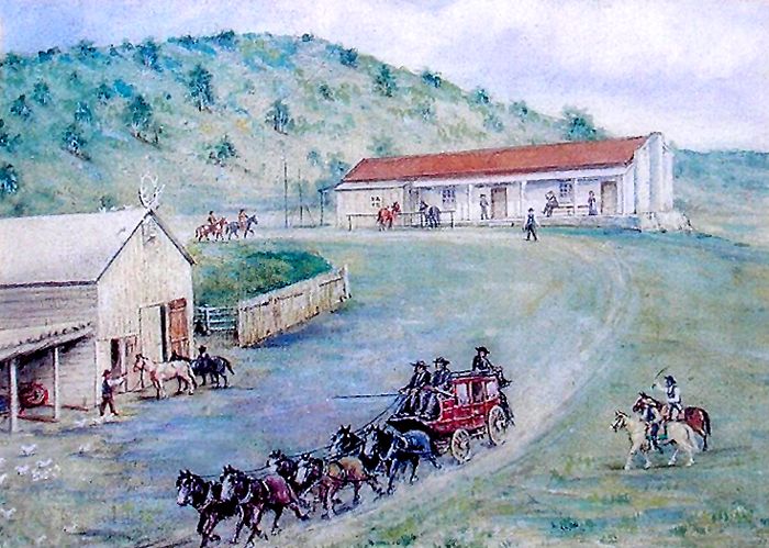
“it was not uncommon to see 50 to 100 wagons with their loads of merchandise and freight encamped at the [Virginia Dale] station.”
12N71W 1877USGS 1909
Wagon road to Virginia Dale is still in use
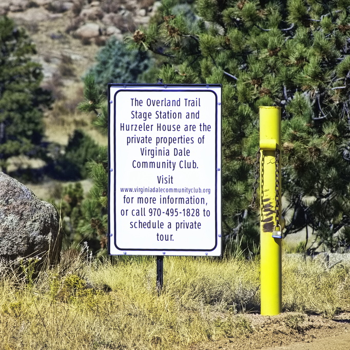
Not far off to the east of US287, north of Fort Collins, Colorado, the Virginia Dale station is not accessible to the general public, but tours may be arranged. Jack Slade named the station for his wife, Virginia Dale Slade, and he was a successful manager for the stage line until his drunken tempers got out of hand. He was eventually fired from the Central Overland Stage Company. More on Jack Slade can be found here.
As division superintendent of the stage line, Slade worked from Julesburg in the east, along the South Platte to LaPorte, and up through Virginia Dale and along the southern route across Wyoming. He made his home base at Virginia Dale and managed stations spaced roughly 20 miles distant to Fort Bridger near the Utah line.
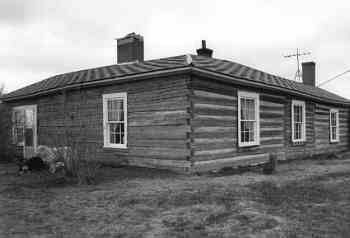
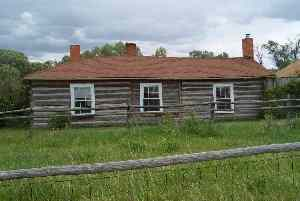
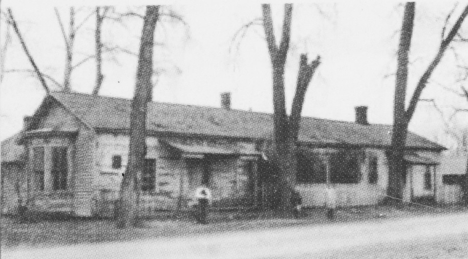
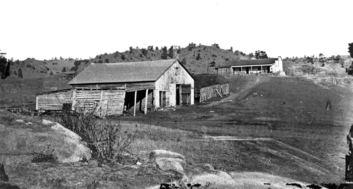
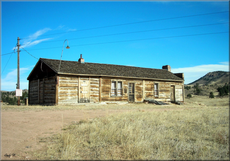
The Virginia Dale Station was built in 1862 and still exists as the only standing station on its original site. It sits on top of a knoll, north of the trail which is now a county road. The structure remains an intact hand-hewn log building and the location appears much as it did when the line was active.
Jack Slade not only managed the stage line, he oversaw the construction of the main building, the stables, and other out-buildings. A well was added a couple of years later. The station was of built of logs, but of a more uncommon mortise and tenon technique introduced by fur trappers who built cabins in the Rocky Mountains by this method.
Some reports suggest the meeting between Sam Clemens and Jack Slade took place at Virginia DaleHenry Jackson photo station on knoll in background
The station consists of three parts with vertical posts separating each section and into which the end logs are mortised. The east and center unit have clapboard siding and were originally covered by an open shed-roofed porch. The building was used as a general store in the 1920s when the open porch was closed in. The porch was gone by the early 1940s. There was originally a shed on the west end section which extended to the edge of the porch.
The first shingles were brought in from St. Joseph, Missouri at the cost of $1.50 per pound. There were/are three doors on the front (south side); one for each section. There are two 1 x 1 windows in the center section and one 1 x 1 window in the east end. There are two pieces of log plate, joined over the center door. The back wall appears to be plain - no doors or windows.
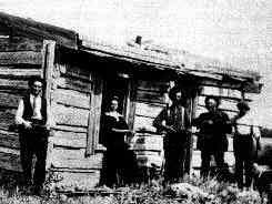
Virginia Dale station, Colorado. It is claimed that Jack Slade is on the left, and his wife, Virginia, for whom the station is named, next to him.
An anomaly of the above picture: Note the position of the window and door as well as the length of the roof. If this is Virginia Dale Station, this must be one of the out-buildings - it does not appear to be of the main station building itself.
The east end has a parapet wall with chimney and 6 x 6 window. The corner posts have a continuous mortise which still shows the marks of the original auger. The wall extends above the slope of the roof which suggests that a second story addition to the east was planned - but there is no evidence such ever existed.
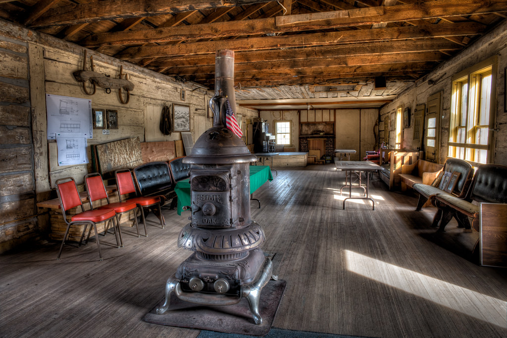
Station interior
A large stone chimney is attached to the east wall with a six-over-six pane window to the side. Historic photos reveal that the stone rubble in evidence around the base of the chimney was present at the time of construction. By 1864 a hand dug well 65 feet deep and though solid granite was added.
Sketch of the station. The porch and shed are evident here.
In the early 1960s. tar paper siding was applied to the north wall to prevent snow from blowing in during winter. The chinking on the north wall has eroded leaving gaps between the logs. The window bays have been sealed but there presence is obvious from the inside.
The interior is one open room with log walls. Remnants of white wash is visible. The caretakers have placed a woodstove in the center of the room, using on the brick chimneys. The ceiling has been lowered from the original and the brick fireplace has been rebuilt.
There is a cellar under part of the station with access through a doorway at the front. The cellar stairs and walls are built with stone. The floor joists were cut at a reciprocating sawmill.
Slade, now Mud, Creek
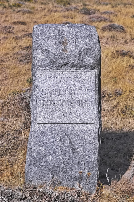
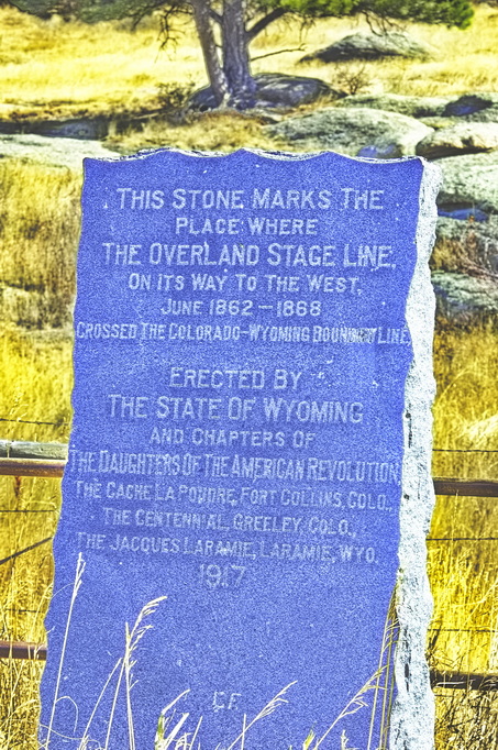
A little less than two miles north of Virginia Dale is the Wyoming border - then, Dakota Territory. Right on the Wyoming/Colorado border - which happens to be the peak of a hill - along Highway 287 is a granite marker placed by the DAR on July 4, 1917. The original crossing was actually about 1 mile east of this point.
Except it actually crossed a mile and a half east but then, US287 is accessible and the actual crossing place is not
These two maps line up together
Contrary to the monument on the border at US287, the Overland Route crossed into Wyoming a mile or so east of the highway.
What is labeled Mud Creek here is labeled Slade Creek on the older maps.
A stage carrying an army payroll of $60,000 in 10 and 20 dollar gold coins was headed for Fort Sanders [Laramie] in Wyoming. About a mile from Virginia Dale, the stage was robbed by six masked outlaws at Long View Hill. The gang took the strongbox from the stage and headed west towards the wooded foothills, where they blew the lock off the box, removed the gold coins, and buried them. The robbers were pursued and killed by the U.S. Cavalry ("Steal our pay, will you?"). The strong box was later found in a nearby creek, the sides and bottom gone, riddled with bullet holes – and empty. The money was never found.
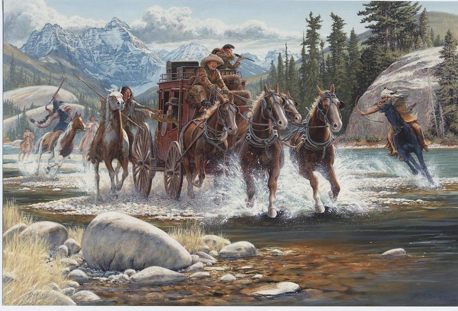
On July 31, 1865 a band of Cheyenne and Arapaho attacked a train of 75 wagons including those of the family of Jasper Fletcher just east of the Rock Creek stage station. Most of the train was of heavy freight wagons pulled by oxen - progress was slow; perhaps 4 miles per day. The two Fletcher wagons were pulled by faster mules; Jasper developed the habit of travelling ahead of the main train, stopping at a likely camping spot and waiting for the main group to catch up. The Fletchers had come from England and were headed for the gold fields in California - Jason had been captured by the gold bug while in England and came seeking "fabulous wealth". His wife was not so excited but they left Liverpool for New York in 1861. Illness caused them to stop with friends in Illinois.
Jasper, 37; his wife Mary Ann, 36; eldest daughter Amanda "Mary", age 17; William, 11; Jasper Jr, 6; Oscar, 4; and Elizabeth, 2 left Illinois in May 1865, passed through Omaha - there joining a large wagon train following the Platte. The train split at Julesburg, the Fletchers followed the South Platte route with a freight train of 75 wagons heading for Salt Lake City.
By the time they approached Rock Creek, the Fletcher wagons were several miles ahead of the main train, stopping east of the ferry across creek for lunch while waiting for the main train, intending to cross over to the station with the main train.
While camp was being prepared, Mary Ann and her two daughters wandered away from camp. As they approached the creek, the Indians attacked, killing Mary Ann and capturing the two girls. The Indians then attacked the two wagons, wounding Jasper. He told the three boys to run back to the main train; Jasper managed to hide in a ravine. The Indians ignored him, seeking treasures in the wagons. They took what they wanted - including the horses - and burned the rest. The Fletchers had travelled too far in front to allow rescue.
The boys had been rescued by the main train, but having thought to be orphans, they were placed on another train heading back to Denver. Jasper was discovered by a following train a couple of days later and taken to Salt Lake. Father and sons were reunited several months later. Mary Ann was buried near the stage station but the grave location has been lost.
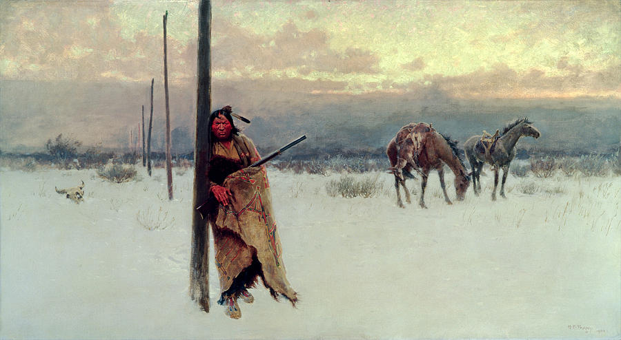
We were just camped for dinner, and a party of the Indians just came right down on us, - about three hundred of them as I afterward learned, - Cheyennes and Arapahoes.
Frightened, I seized my mother by the hand, at the same time snatching up my baby sister. The Indian ponies circled and wheeled, their riders hurling spears and wielding axes as they rode their horses over us. We stood there, hand in hand, too terrified to move, and then, without a word, mother sank to the ground. A spear had pierced her head and she died with the whisper, “Mary" on her lips. As I knelt there a brave galloped by, leaned down from his pony and snatched the baby away from me. Except for a glimpse of the baby later that same night, I never saw her again. I was picked off my feet, tied and thrown on the pony, then led off in the gathering darkness.
I had my mother by her hand and my sister under the other arm. My mother was killed by my side and my sister taken. Then I was taken, picked up and put on horseback and taken back to the wagons. Where I was picked up I could not tell just exactly, but it must have been 300 or 400 yards from the wagons.
Three days after Mary was captured, she recalled the Indians attacking another single family, unwisely travelling alone on the same road. Mary said the entire family was killed, “with the exception of the white woman. She was captured, and killed shortly afterwards.”
Amanda spent a year with the tribe before being bought by a trader and returned to Illinois. The fate of her sister was unknown. It was believed that she was killed but in 1900 Mrs. Cook believed that a white woman living with the Arapahoe near Casper was her sister. The claim was never verified and the woman refused to leave the tribe.
Latham Station was the last stop on the South Platte River Route. From Latham after 1864, one went south to Denver on what was now the main line, or crossed the South Platte and followed the Cache la Poudre NW into the foothills at LaPorte and points west. Only a short run away - 30 miles or so - LaPorte was another major home station. The route that had headed south to Denver came from the south to cross the la Poudre at the LaPorte station and re-join the original trail.


