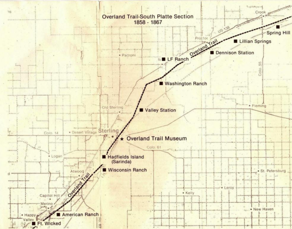
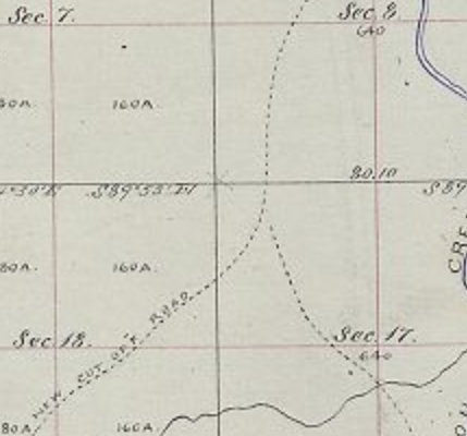
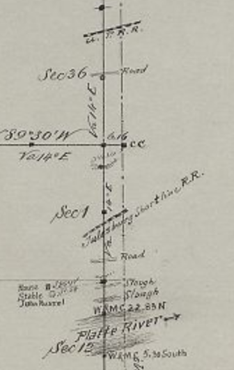
Survey maps along the old trail for the most part didn't appear until after the line had shut down - mostly in the period 1868-72, but closer in to the mountains, the surveys occurred in the mid-1860s - there were gold and property rights involved. Unfortunately, the mapping of the Latham area didn't take place until 1865; the year after the disastrous flood that caused the original location to be abandoned. By that time, the cut-offs to Denver from Junction had become the main route and the trail from Latham to LaPorte became secondary at best. The main trail went from Junction (Ft Morgan) directly SW to Denver, then back north to LaPorte and on into Wyoming unless one was headed west and skipped the Denver section - not the majority of traffic.
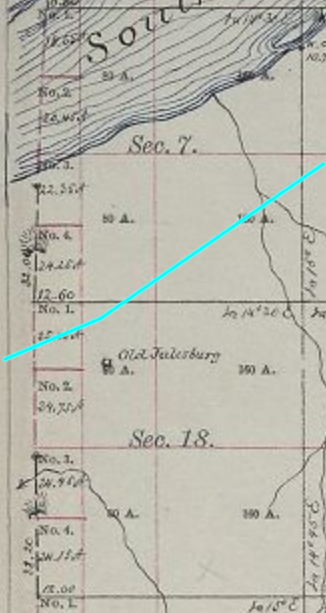
The original route from Latham to Laporte is inferred from the 1864 maps which indicate the road. There are no stations in-between listed on the official time tables but the distance from Latham to LaPorte was about 30 miles - swing stations usually being only 10-15 miles apart. There is a station roughly midway maintained by a historical society in what much later (1890s) became Windsor - now known as the Halfway House - but as the claim also states the structure was built in 1873, it would not have been used by the Overland/Wells-Fargo companies. Another more likely stop was Sherwood's Ranch, a few miles east of present-day Ft Collins.
It seems reasonable a swing station near here would have been active in the earliest days; with all the other swing stations at least mentioned, it seems unusual a station here doesn't warrant any attention. But that was the same problem with the South Platte and Eagles Nest stations as well.
These are the things that make tracking obscure details fun ....
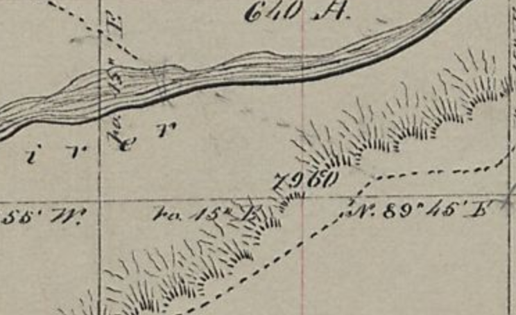
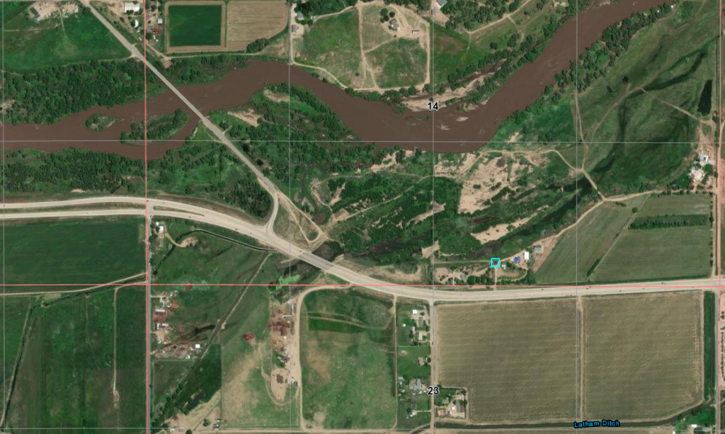
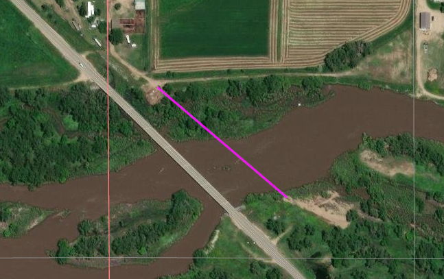
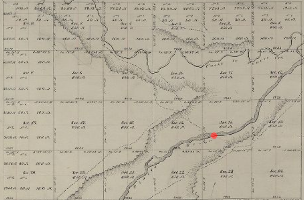
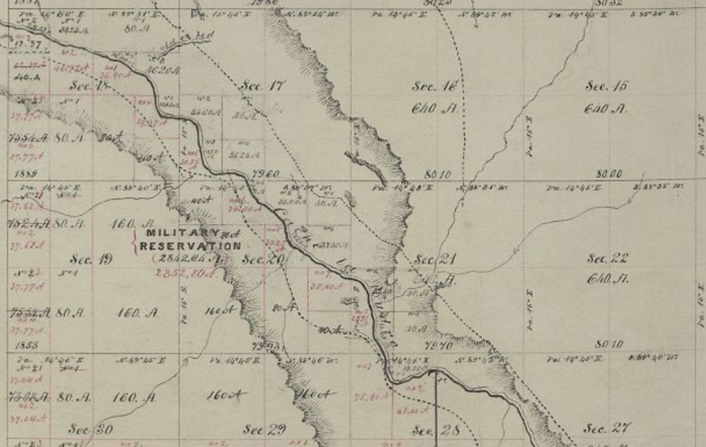
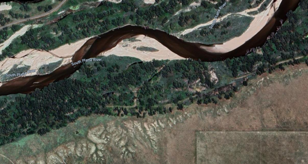
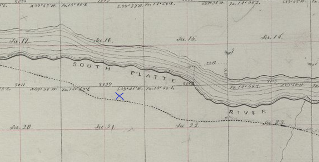
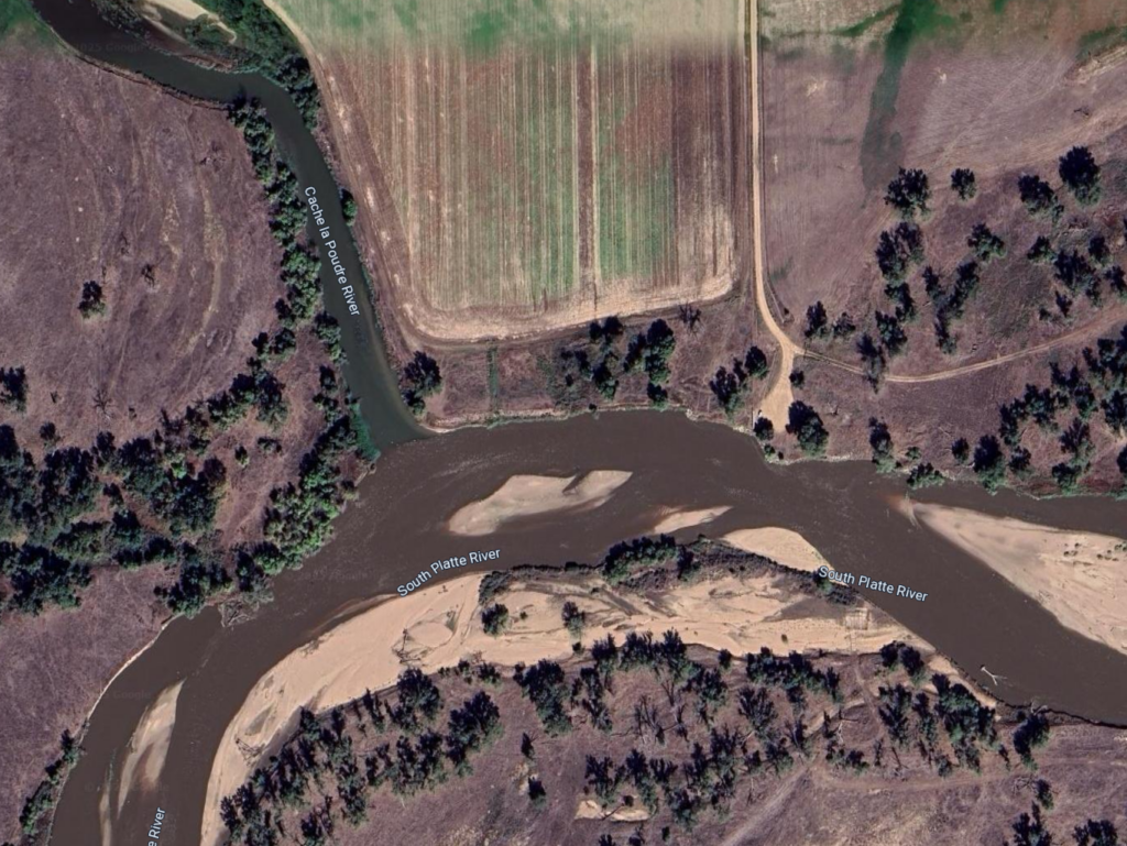
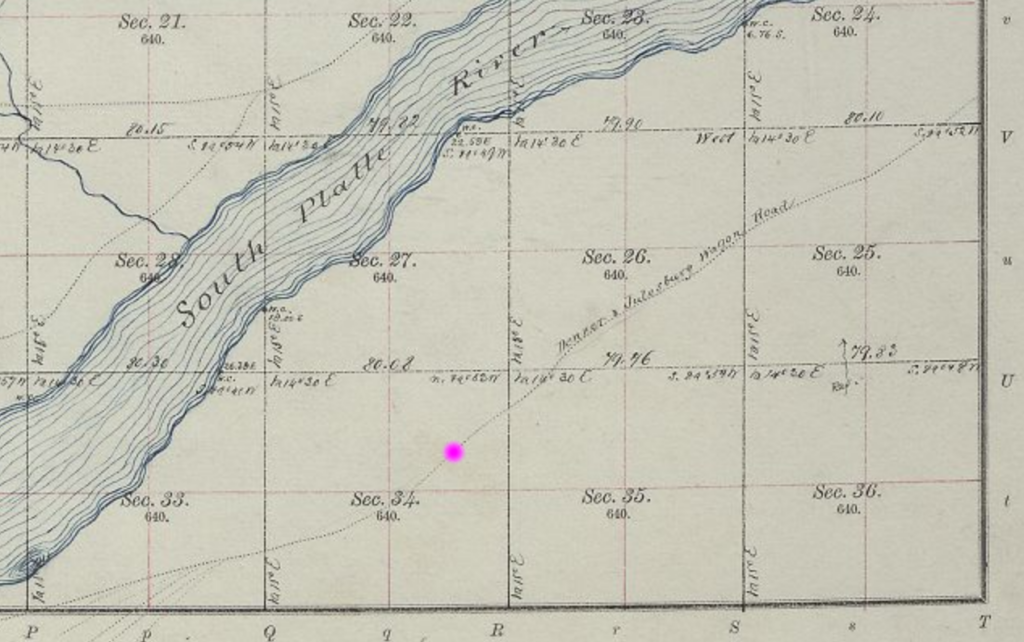
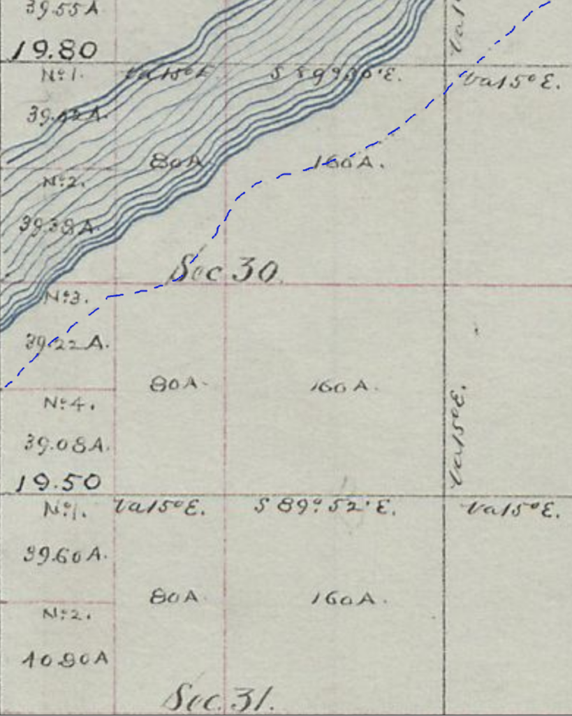
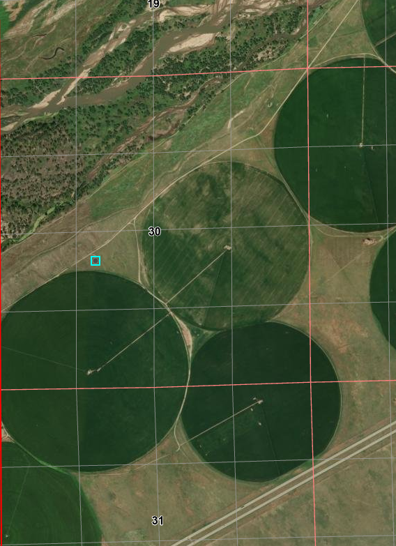
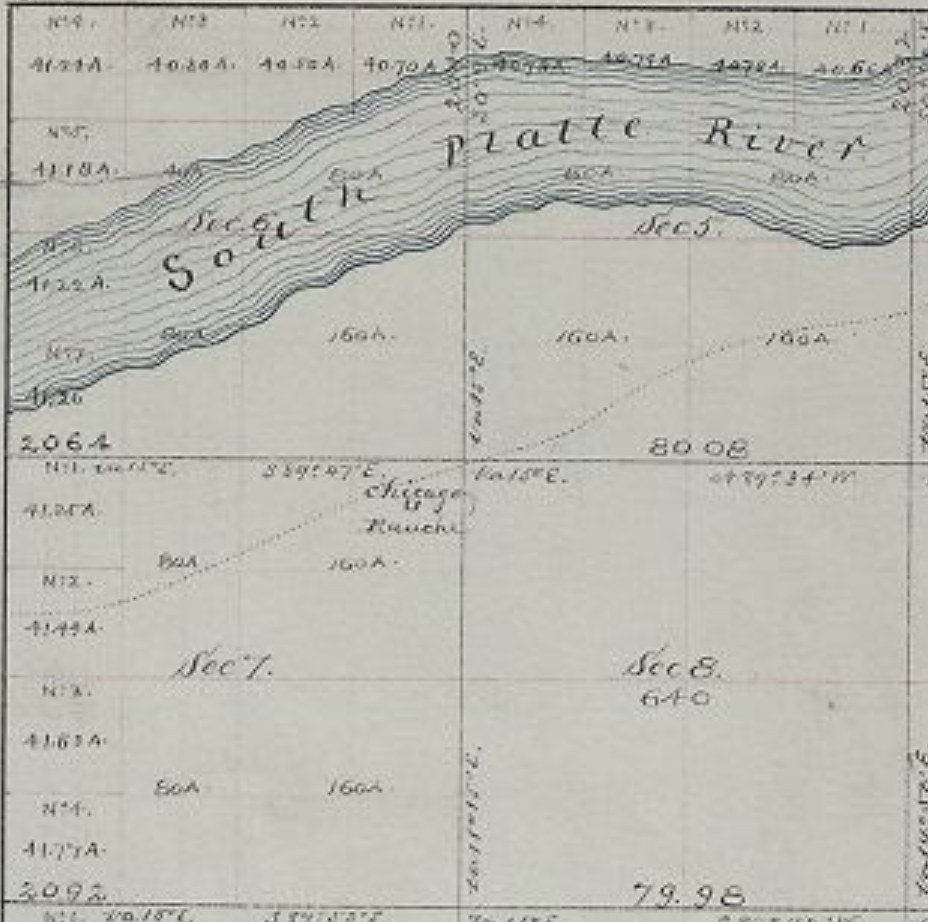
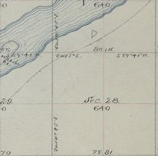
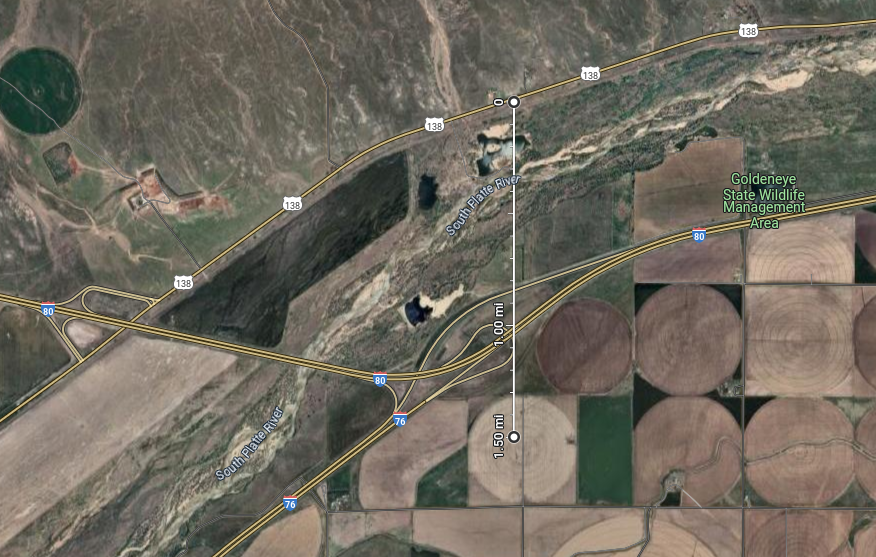
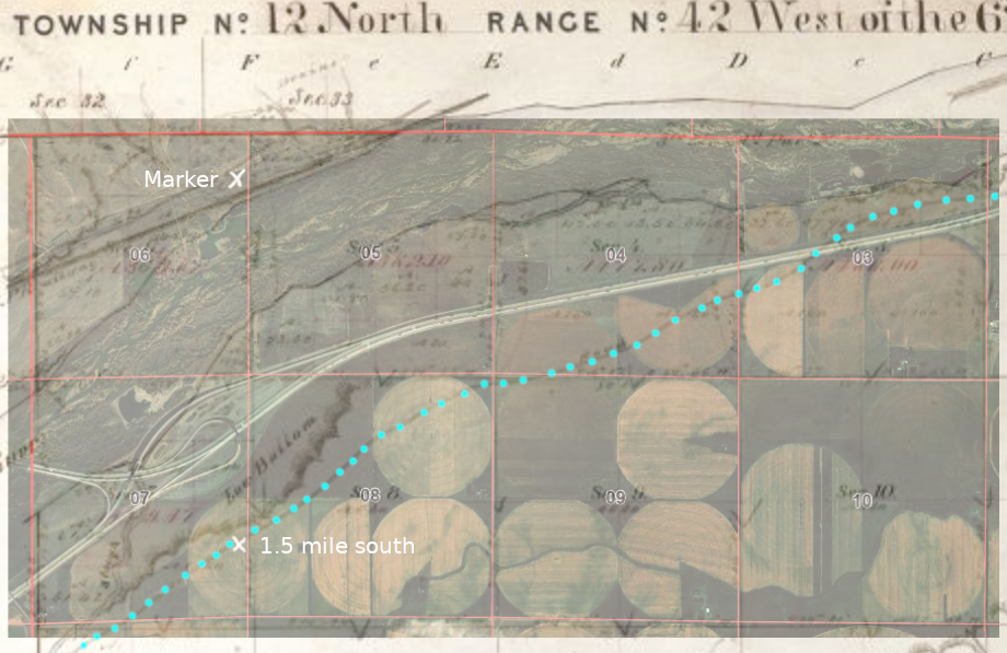
Start with the crossing of the South Platte at Latham. Based on the survey maps of 1865, the crossing then appears to be at the same location now; the present crossing of US34BR into Greeley - within the 20-acre area of the west half of the SW quadrant of T5N R65W.
The junction of the old map is indicated on the new. 5N65WS14SWSE 1864 (junction) 40.39261884051857, -104.62841944615846
The original crossing appears to be quite close to the current bridge - the likely original crossing is indicated below. Or also likely, the indicated crossing was an earlier highway bridge But close to this location corresponds to the 1864 map
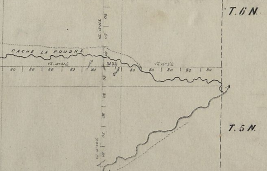
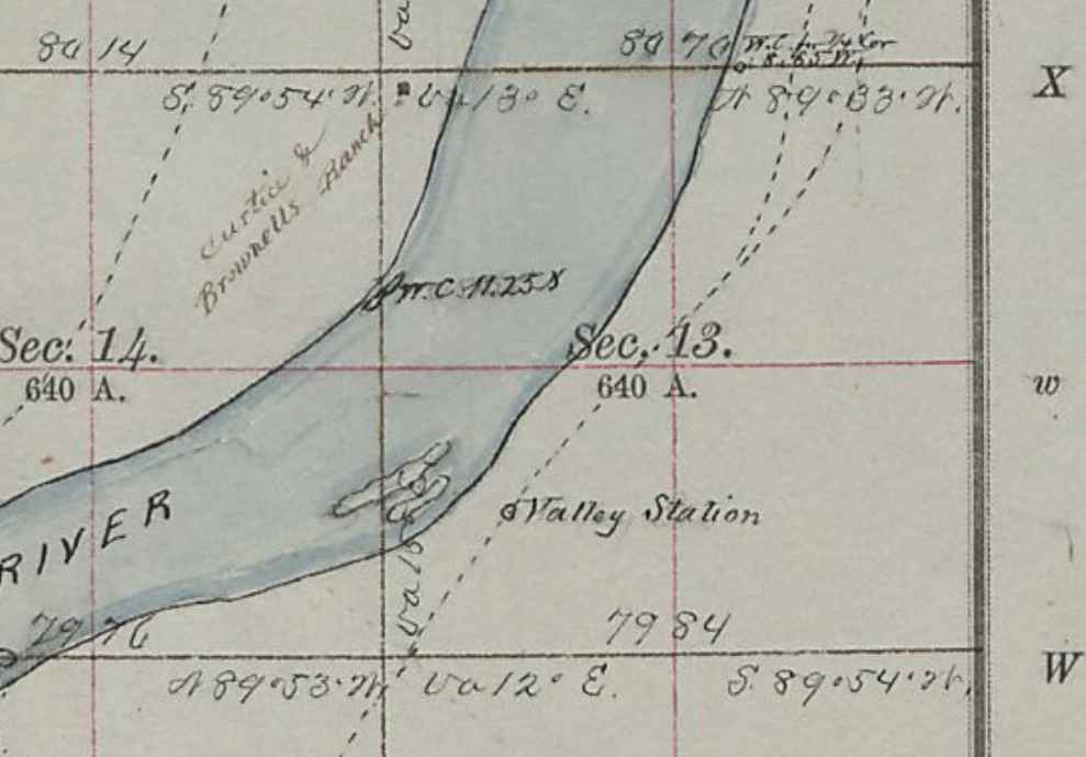
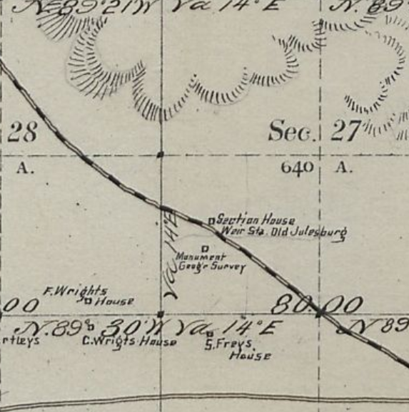
Following the survey map of 1865 The original crossing appears to have been at the location indicated The bridge is US34BR into Greeley to the NWTrails in the Latham area - 1865 - Latham being somewhere in the lower right corner South Platte and Cache la Poudre Rivers crossing marked in RED
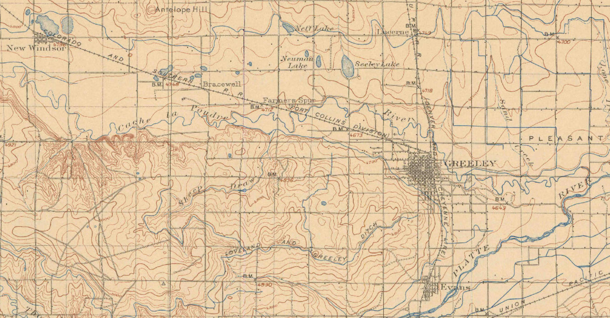
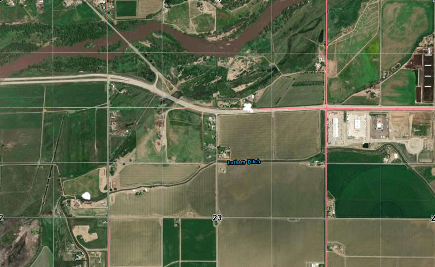
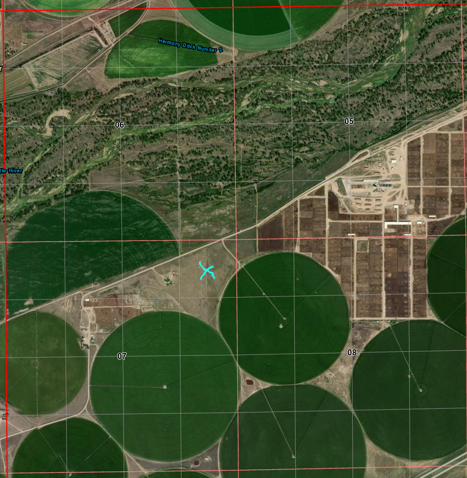
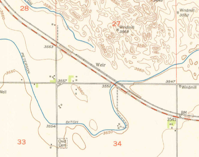
This 1902 map shows the region between the confluence of the Cache la Poudre and South Platte Rivers on the east to "New Windsor" on the west. The crossing appears to be in the same place for all three time periods; there is no hint of the Overland trail on the 1902 map - the trail would have roughly followed the railroad which still exists. There is no hint of Latham on any maps I've examined other than a trace of "Latham Ditch".".
USGS 1902
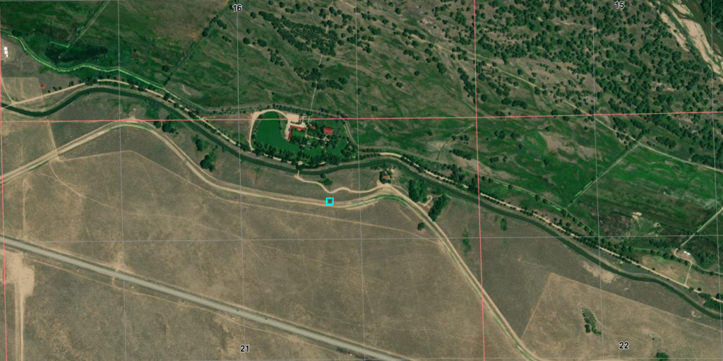
The original route based on 1865/66 surveys is marked on the following maps: alongside the south bank of the Cache la Poudre River through what is now downtown Greeley, crossing to the north bank near the NW side of Greeley and getting to high ground; continuing to follow along the bluffs north of the river above what would become Ft Collins - the fort wasn't established until 1864 although there was a military presence in 1862 - and on to LaPorte - the next stop; a major home station.
This area is now over-loaded with what most call "civilization" and true remnants of the trail rarely - if at all - exist except on historical markers or segments turned into traffic-heavy modern roads.
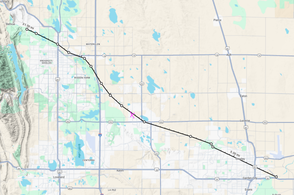
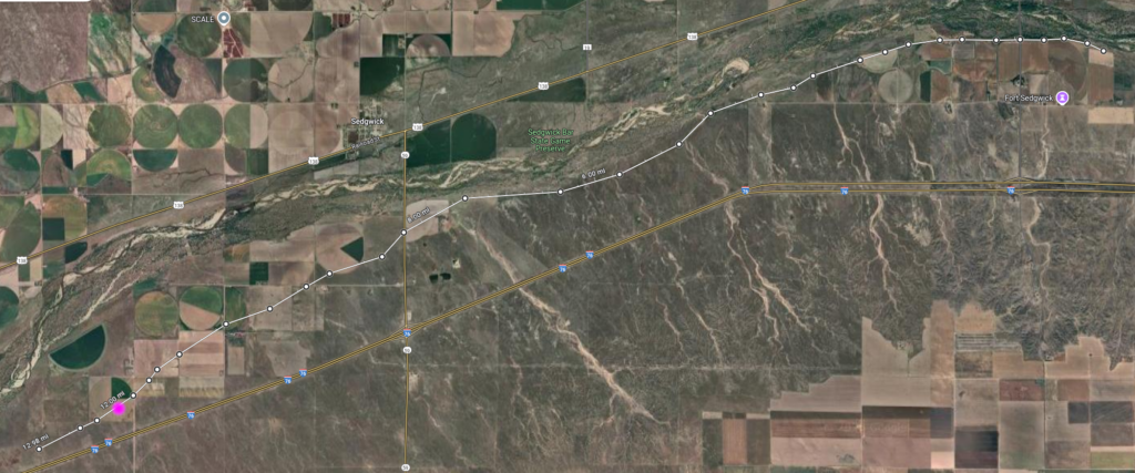
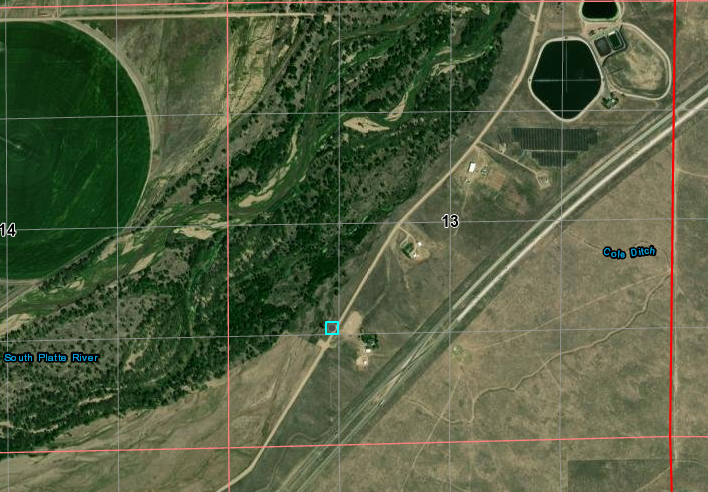
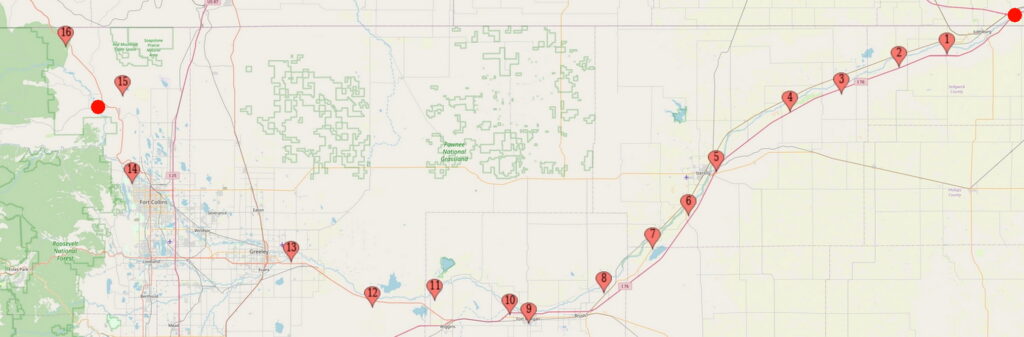
From Latham to LaPorte. This segment was relegated to secondary status after 1864 although both Latham and LaPorte remained major stations. US287 runs NS on the left; I-25 runs NS left of center; US85 runs NS on the right; US34 runs EW along the bottom.
Further up the trail from the crossing of the South Platte, travellers crossed over the la Poudre to the north bank on what is now the north side of Greeley. From there, the trail closely follows the railroad - it is likely the railroad used the trail for part of its right-of-way.
The river has shifted and the trail route is now along the railroad
crossing the Cache la Poudre 40.445110180118355, -104.76637948766346 6N66WS34NWSE 1864
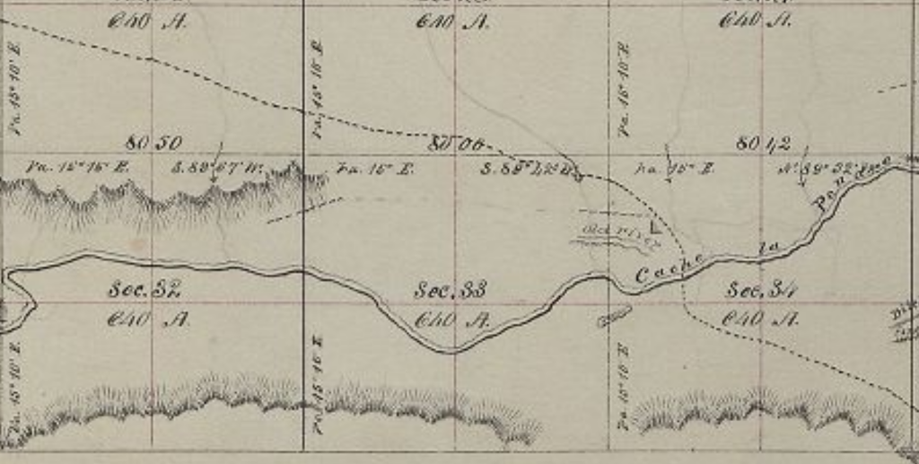
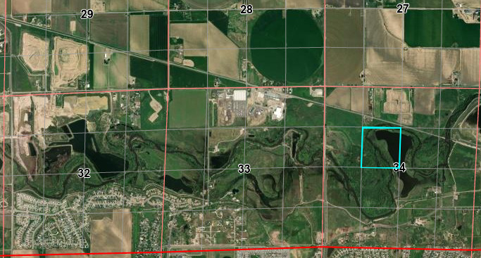
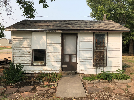
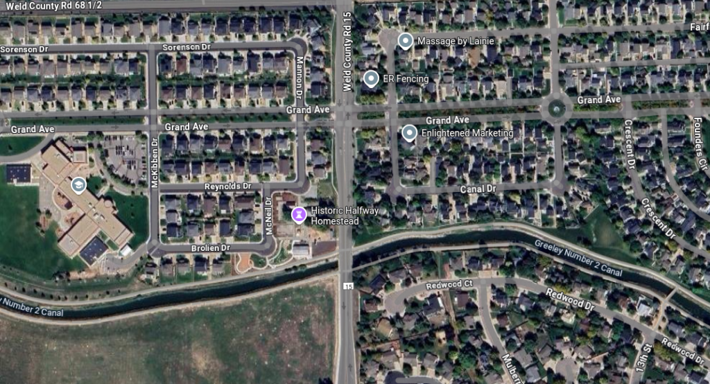
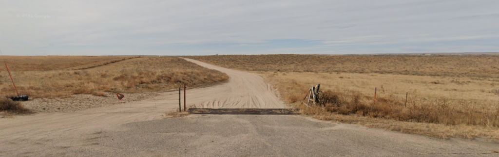
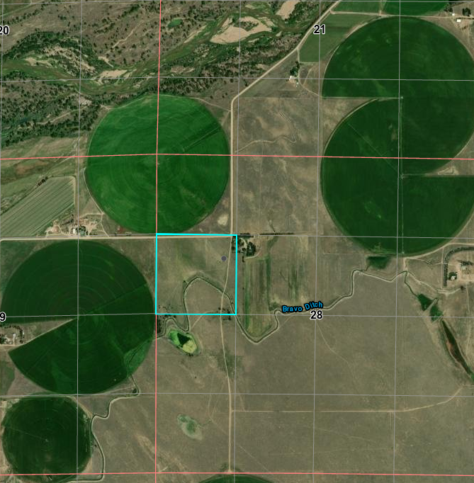
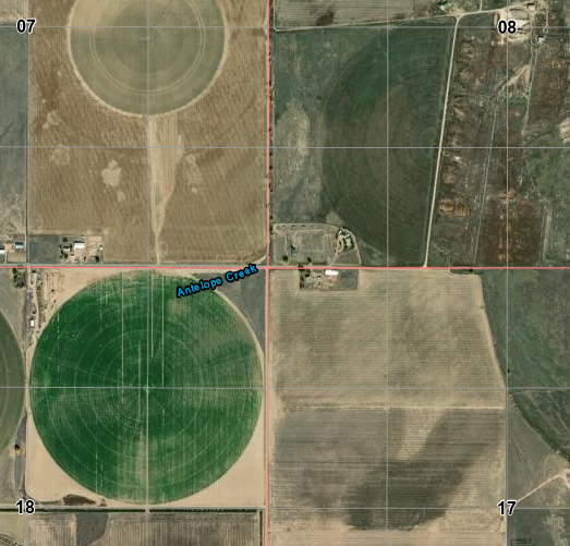
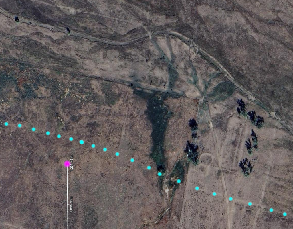
About halfway along the run from Latham to LaPorte, one would expect to find a swing station. This "Halfway House" stage station in now-Windsor is claimed to be on the Overland Trail route - it is; but it was built in 1873, several years after the Overland/Wells-Fargo stage lines shut down but many years before the town of Windsor existed (1890).
In addition to being a stage stop on a local run, it was also at the same time a pub and post office. The structure still exists as an outbuilding on private property. It is the oldest building in Windsor.
Windsor Halfway House 6N67WS18SENE 40.48426440340697, -104.92713988633022
Looking south County Road 15 on left
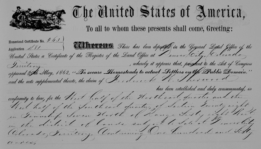
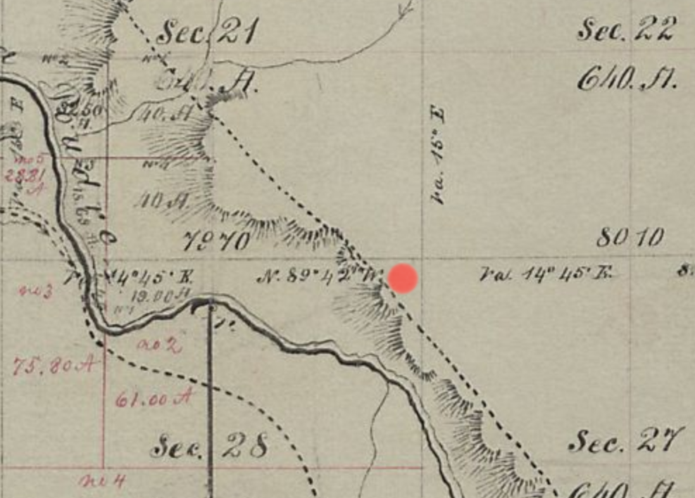
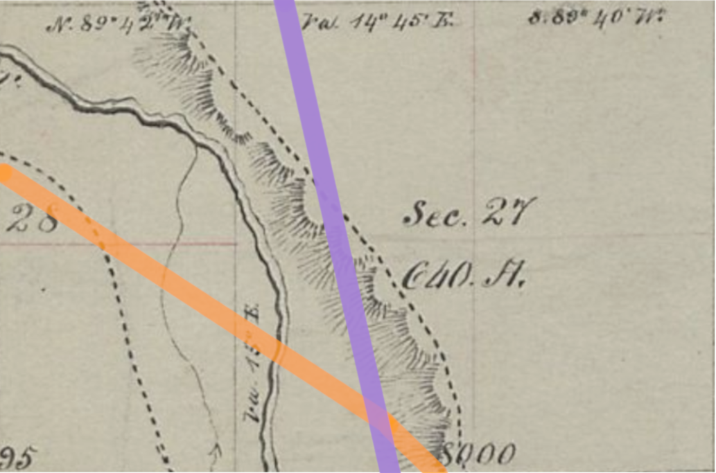
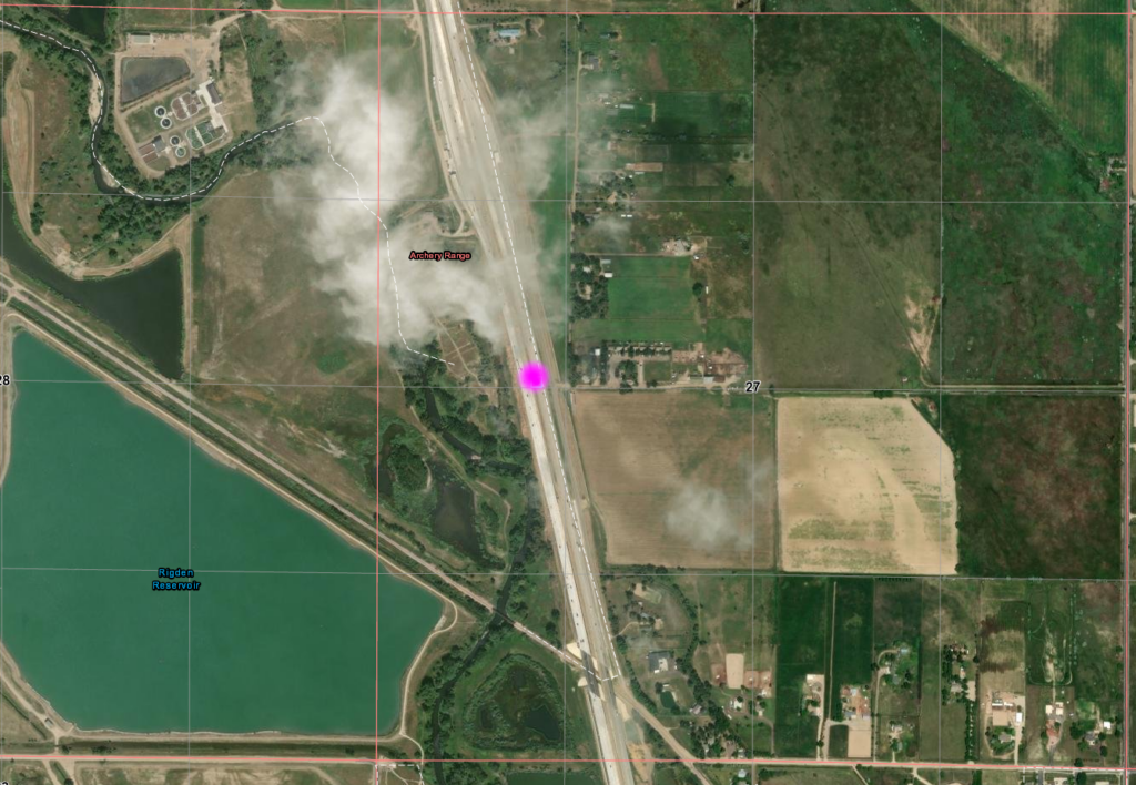
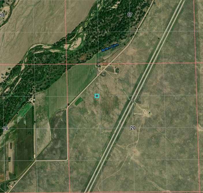
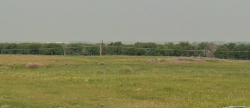
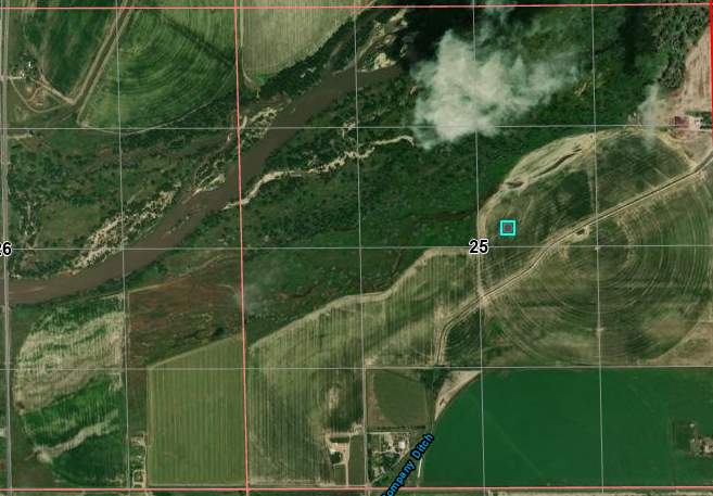
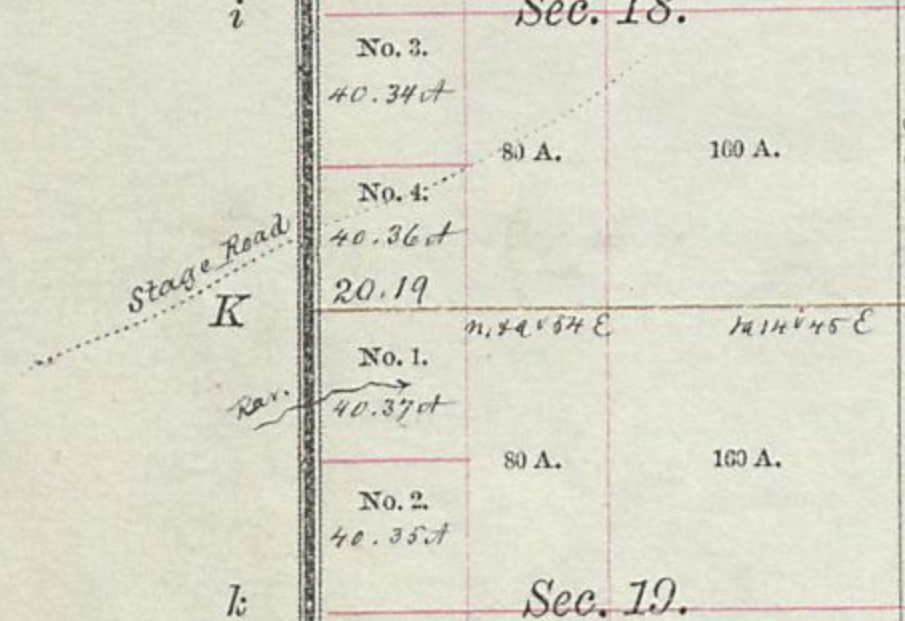
An almost certain candidate for a swing station is the Sherwood ranch. Jesse and Frederick Sherwood joined the gold rush in 1860, using an ox-team to haul supplies from Wisconsin. They started mining at Russell Gulch, but eventually settled in at a ranch along the Cache la Poudre near-on 5 miles below what would become Fort Collins. Logs were hauled from the mountains for building materials and they began raising and selling livestock, feed, and vegetables. There is a minor reference stating this ranch had been a station on the line.
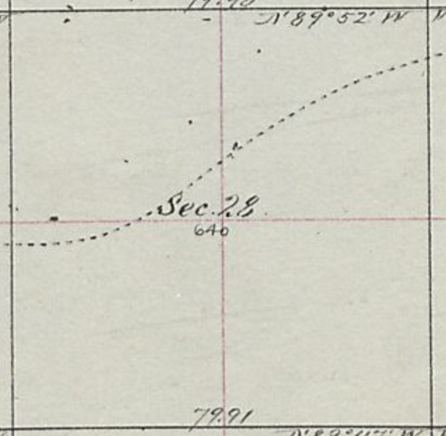
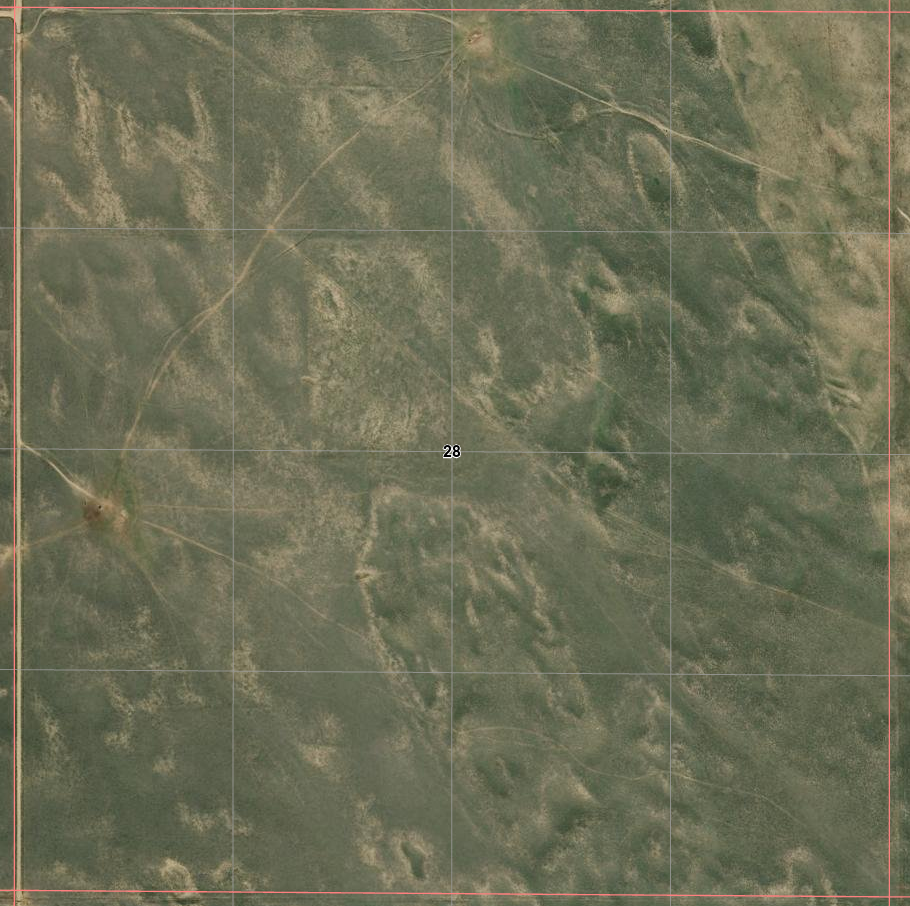
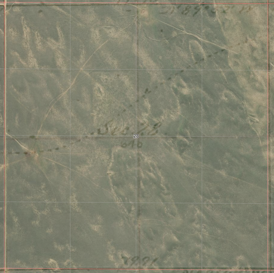
Sherwood Land Patent 7N68WS28NE/SE
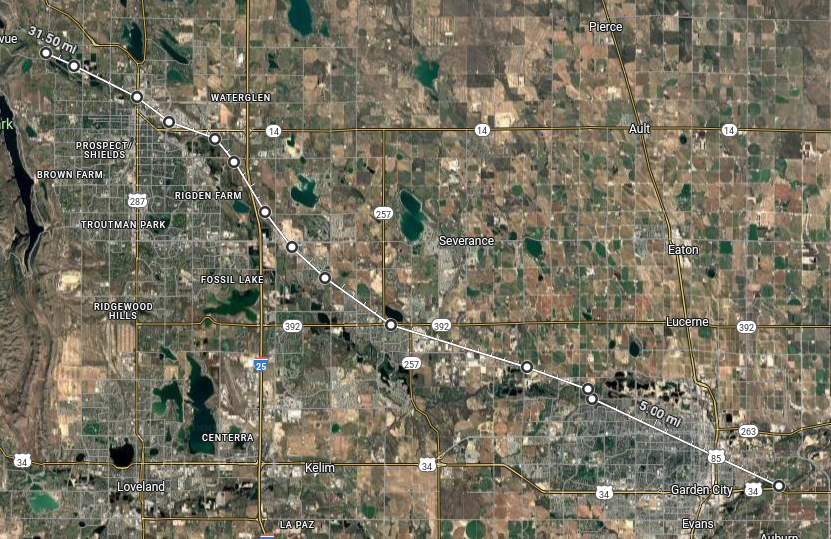
A minor piece of trivia, the trail crosses I-25 at an acute angle where located with the MAG dot in the right image; north of Exit265 but just south of the weigh station.
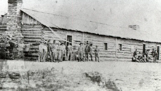
Camp Collins was established near LaPorte in 1862 to protect the mail run of the Overland Stage. The camp was moved to what is now the city of Fort Collins after being severely damaged by flooding in the summer of 1864. When re-established in its new location (away from the saloons and dance halls of LaPorte) on the Denver Road (today's Jefferson St/Riverside Rd/CO14), it was renamed Fort Collins. The fort didn't last long; it was abandoned in 1866. Portions of the site are now a park but nothing remains of the original fort.
Fort Collins 1865
The town itself began building shortly after the 80+ acre fort was abandoned but wasn't officially platted until the military surrendered the property in 1872. Although quite likely the stage stopped near here, there is no record of an "official" station being located here.
Fort Collins barracks - 1865
The fort location was roughly bordered by today's Lincoln Ave, Jefferson Ave (CO14), N College Ave (US287), and the Cache la Poudre River. About 150 soldiers were stationed here. Life at the fort has been described as "boredom on the frontier". The main military duties were escort services for the mail. The fort was on the south bank of the river; the trail on the north side.
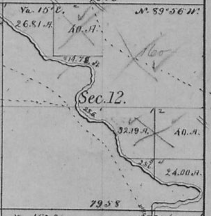
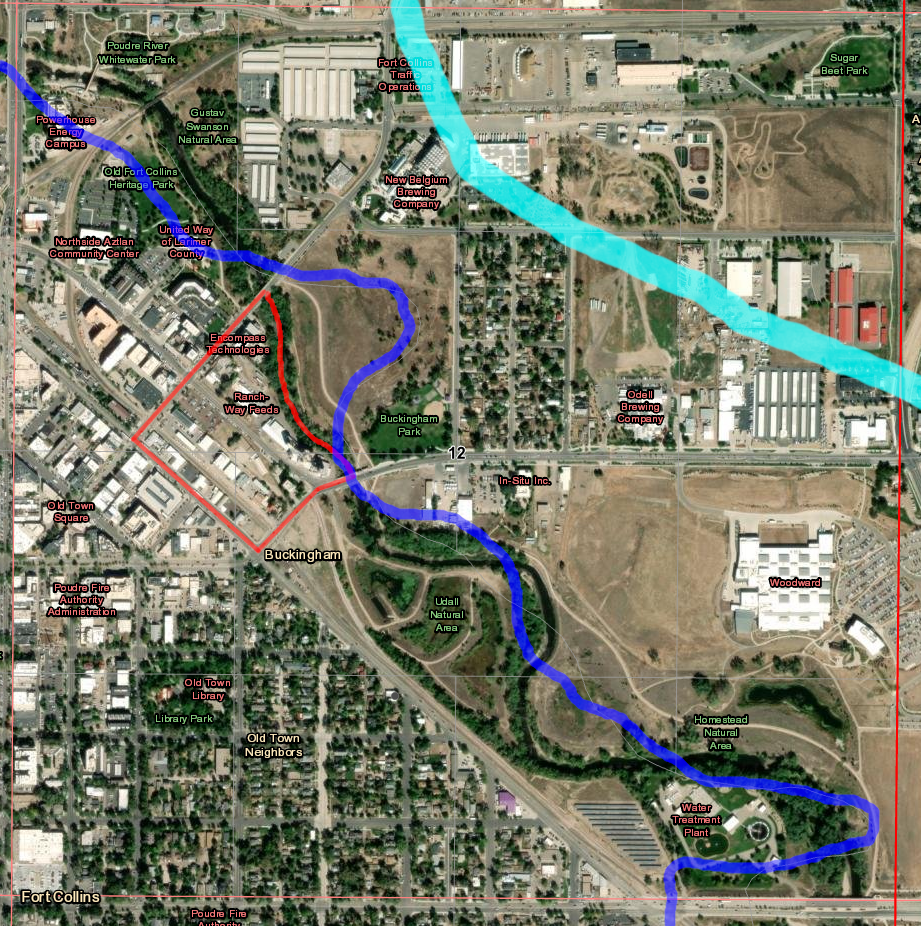
Section 12 1877
Section 12 - now Fort outlined in RED; Overland Stage in CYN 1877 River in BLU
Things have shifted a bit. On the old map, the original trail is the one north of the river; the "Denver Road" on the south. Below is a modern segment of the Denver Road.
Along the Riverside Road, CO14 (aka "The Denver Road") The railroad runs through the old fort site
The stage route from I-25 to LaPorte
Fort at BLU dot Trail crosses US287 40.60114455515733, -105.07667401105024
Maps of the fort region of Ft Collins
From here, it was a short ride up the river to LaPorte, a major home station on the line.
There was no "Junction Station" in the earliest days; there were no stations between Beaver Creek and Bijou Creek. Muir Springs near Bijou provided fresh water but there was no real relief until the stage reached Fremonts Orchard.
This segment of the route was the most difficult; drifting sands, alkali dust, biting insects. Travel often required special teams of heavy mules - and even then, often able to travel no faster than a walk. Several routes were explored to bypass this segment; the later cut-offs directly overland to Denver eased the traffic but not the difficulty - and those heading west usually chose the river route over the alternatives. Even now, there is no improved road following the route along side the south bank of the river ... and no town of any significant size along this stretch on either side of the river.
For this chapter, "Junction Station" is the one that became Ft Morgan. Next stop - Bijou Creek.
Part 5 - Julesburg to Junction Station is now live.
After the layover in Julesburg, actual travel begins. This segment of the route was the most profitable, the most heavily travelled, and certainly not the least dangerous.
"Junction Station" was actually the name given to several stations - each being a junction between the trail to the west and multiple cut-offs to the mining regions west of Denver. This Junction Station became Ft Morgan; a handy stopping point for this series before continuing west in later chapters.
After that bit of detour a short way towards Denver from Junction, we return to our regularly scheduled journey to Latham.
From Junction Station, our route takes us to what was the next station after Beaver Creek Station in the original days before the cut-off to Denver was built, the station at Bijou Creek.
After leaving the cut-off [near Fort Morgan], there is a long strip of heavy sand to cross, which extends to Bijou Creek, a small clear running stream, but which is more or less tinctured with alkali, and it was generally considered unsafe to allow the cattle to drink of it. This alkali consists of potash, soda, lime, magnesia, etc., the products of burnt grass and plants, which have been consumed by the fires that often sweep over these vast prairies.
Even today, this stretch of what was one of the most difficult sections of the Overland Trail does not have a road following the stage route.
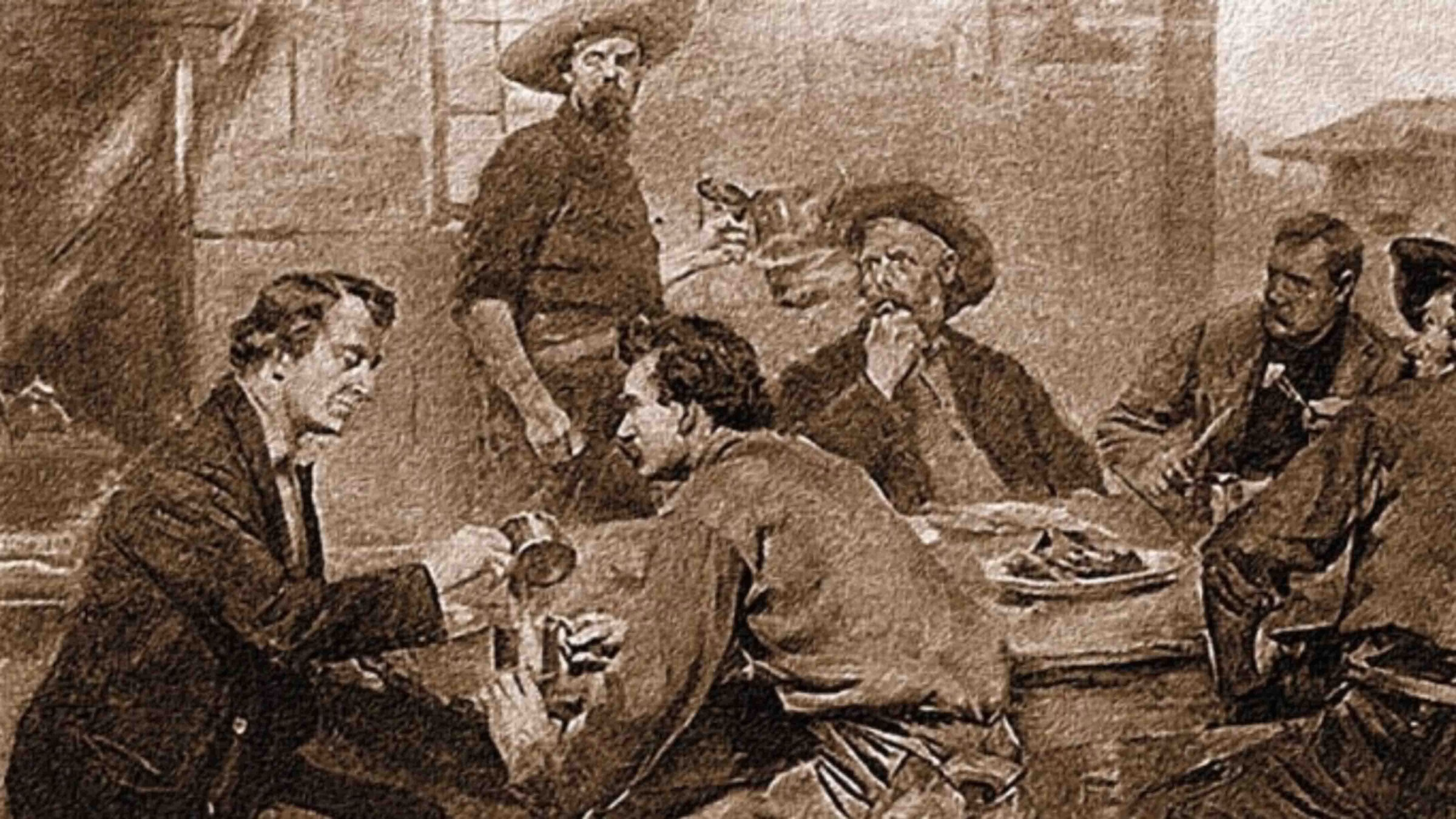
It is a notorious fact that many of the overland stage drivers and stock tenders, between three and four decades ago, were inhabited by a species of vermin known as pediculus vestimenti, but on the plains more vulgarly called "'gray backs." Some of the boys at times were fairly alive with them. It is not at all surprising, however, for they slept from year to year on ticks filled with hay — they called it "prairie feathers" — and their blankets were seldom washed from one year's end to another. Some of the stage company's employees didn't indulge in a bath for several months at a time, especially during the winter season, when the weather was way down below the freezing-point and even the most plain and simple conveniences for a bath were greatly lacking.
During the hot weather of midsummer, when the vermin were rapidly multiplying, it was the custom of the boys at the station to take their underclothing and blankets in the morning, spread them out on the ant-hills, and get them late in the afternoon, minus the last grayback. This was the way they did their washing. They found it an excellent substitute for making the music of a John Chinaman on the wash-board. For a time, at least, after the "washing days," they could enjoy some rest. But in a few weeks it would become necessary to repeat the operation of a general clean-out by placing their garments and blankets at the disposal of the ants. Nearly every stage-driver, stock tender, and bull-whacker along the South Platte infested with this kind of vermin, during the days of overland staging and freighting, well remembers the valuable services of these ants. Mammoth ant-hills, upward of a third of a century ago, were common in the South Platte valley in sight of the Rockies.
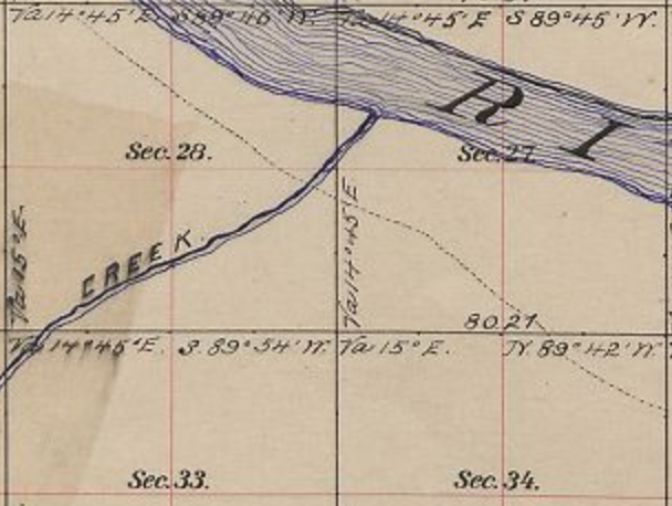
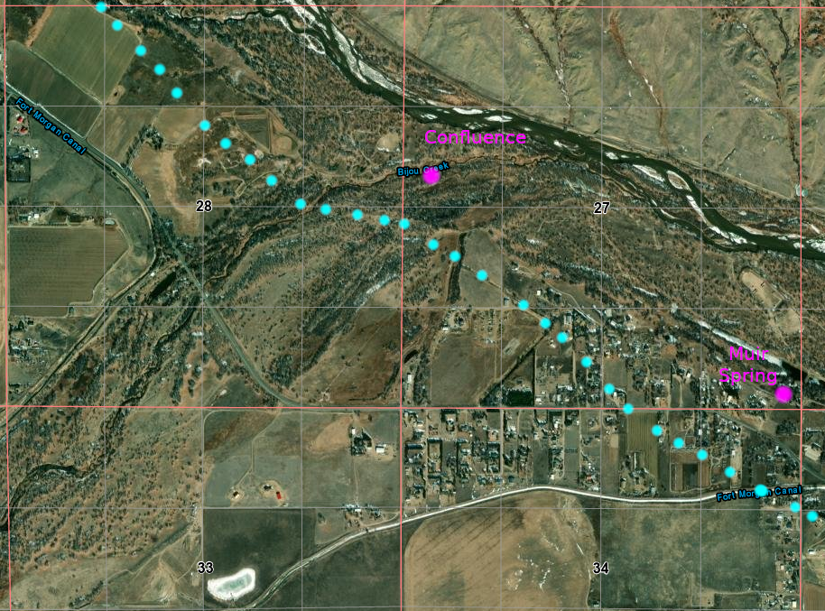
Bijou Creek
confluence w South Platte 4N58WS27NWSW 40.28540267305183, -103.86325537182204
Muir Springs 40.27662203737985, -103.84907444553562 at intersection S27/26/34/35 NW of Ft Morgan; SE of Bijou confluence
Joseph Bijeau dit Bissonet (d 1836) worked as a fur trapper for the Missouri Fur Company in 1806. In 1820, Bijeau was living with the Pawnee when he joined the Long expedition as a guide up the South Platte River to the Rocky Mountains.
In June “…we discovered a blue strip, close in with the horizon to the west – which was by some pronounced to be no more than a cloud….when the atmosphere cleared, and we had a distinct view of the sumit [sic] of a range of mountains…”. Their first view of the mountains came just west of Fort Morgan near a creek later named Bijou by Major Long in honor of the expedition’s guide.
While going up the great Platte valley on a Concord four-horse stage-coach towards the grand old mountains at a gait of five or six miles an hour for twenty-four hours, the sight of over 100 miles along the snow-capped "back-bone of the continent,'' the sun shining in dazzling splendor on the white mantle, it seemed as if we would never reach them.
The Bijou Creek Station was located about three miles beyond Fort Morgan. Two routes headed west from there; neither appealing. One went up over a steep bluff, the other through sand deep enough that double teams were necessary to pull the wagons and stages.
Two routes between Bijou and Freemont Orchard The lower route more closely follows today's I-76/US34 There is no modern road following the upper route
In October 1864, a change was made to the route. The South Platte segment of the route ended at Latham. The original trail, crossing to the north side of the river at the original site of Latham, then on to LaPorte and points west, was relegated to secondary status. The main line now detoured south to Denver from Latham - still a major station and supply depot, but an alternate 90 mile direct route to Denver from one of the "Junction" stations saved 3 days and the mileage from Bijou to Latham then the sixty miles to Denver from Latham. Leaving the South Platte at Bijou Station, its course to Denver over a toll-road was pretty much a straight shot of about ninety miles. Through Indian territory.
Bijou Station was one of several known as "Junction Station".
Crossing Bijou Creek
Same area today
Muir Springs was the source of fresh potable water for Bijou Station, the creek being too alkali to be safe or pleasurable to drink.
1951 USGS
Muir Springs - now a private conservatory
Even today, there is no road following along the length of the south bank of the South Platte River between Bijou Creek Station and a point between the Orchard and Eagle Nest Stations. Even what few ranch roads exist in the area - too small to be shown on this map - are not continuous and are broken by sand and irrigated fields.
While I-76 and US34 closely follow the southern alternate route cutting off the northern bow of the river, even now, Wiggins (1882; pop 1500) is the only town in that region of Colorado. Although a shorter alternate path, the majority of travellers on the Overland stayed with the river.
Perhaps a hint of the trail just inside the greenery
This road, CO-144 at this point looking west, is essentially on the trail per the 1871 maps A glimpse of the river to the right
The next drive was likewise a long and tedious one — sixteen miles to Fremont's Orchard. Much of this distance was through beds of sand, and there was not a drop of water nor a tree or a shrub for the entire distance. On this drive a "spike" team was used; i. e., five mules were hitched up, two on the wheel, two ahead of them, and the fifth hitched single in the lead. There was no going out of a walk on this drive, and no easy matter for the animals to haul a full load of passengers, with the express, mail and baggage that usually accompanied them.
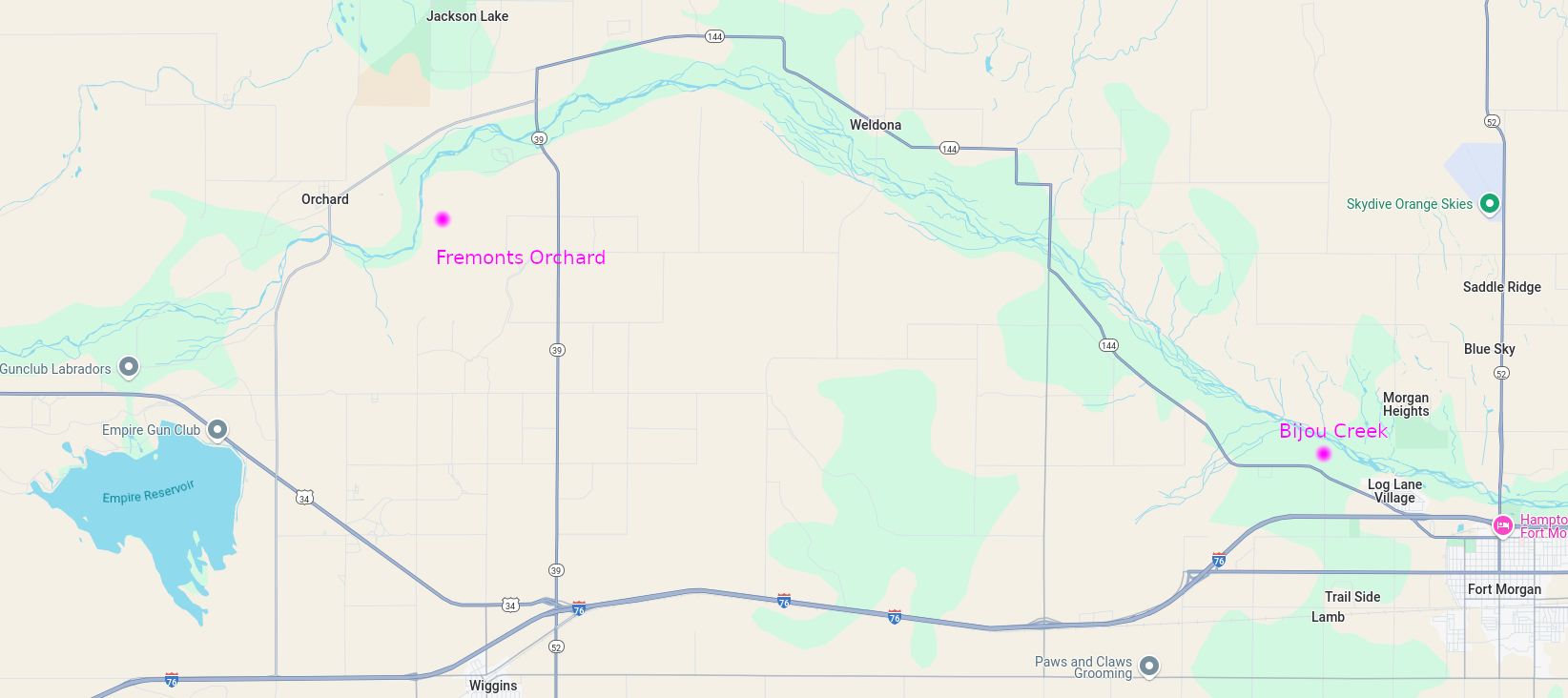
The next station west of Bijou Creek was Fremont’s Orchard, named for Captain John C. Fremont. This major stopping place and station was located approximately 18 miles from Junction Station and south of the South Platte River SW of modern-day Goodrich. A post office operated here in 1863/64 and again in 1874-1877.
In 1861 it was a logical site for a stage station [built 1862], an oasis after 16 barren and difficult miles from the previous stop. As with other stations along the Platte River Trail, Fremont’s Orchard became the center for early settlers in the region. It was a supply center, social center, a place for settlers to congregate to learn the latest news from “the states” or just to watch the hopeful emigrants go by. As was necessary for stage stations of the day, Fremont’s Orchard had thick sturdy walls, “a fortress” for settlers during the Indian scares – and there were many….
It was a real pleasure, after going so long on a walk through such a dreary stretch of sand, to reach the "Orchard." There was quite a cluster of stunted cottonwood trees in the bottom that looked much like an old Eastern apple orchard; hence the name of the station. For years the trees furnished the station keepers and ranchmen in that vicinity all the fuel needed. A post-office was located here ; the first one west of Julesburg, more than 100 miles east. Eagle's Nest was the next station, eleven miles west of the "Orchard."
Fremont’s Orchard was not an orchard but simply a grove of cottonwood trees. Some emigrants noted that the large cottonwoods looked like apple trees, but another questioned the name, and wrote "...why it is called an orchard I cannot understand..." Later irrigation and development have increased the growth of mostly cottonwoods but reports from travellers of the day suggest such significant growth was rare. Fremont’s Orchard had long been a meeting and trading place along the South Platte and many early travellers camped there.
[June 1860] 14th.… Yesterday we drove 18 miles and passed Fremont Orchard & Fremont hills too, I guess, judging by some steep ones we came down. Came down one big hill into one of the most picturesque place one can imagine – the river filled with islands on one side and on the other were steep bluffs.... Fremont Orchard is a beautiful grove of trees that appear to stand in rows, it looks more like home to see the trees close by. Come over a very large sand hill and Mrs. Wimple and I went down the side to the bank and found a beautiful road and shade but we had just got to the teams again when we came to an alkali stream which we went around by a path on the mountain to where we camped for dinner on the Platte and a tribe of Cheyennes came along with their dogs & ponies, some of them have this year’s colts saddled for the papooses to ride. Some of the prettiest ponies for only ten dollars, but they won’t take any thing but silver dollars and we have nothing but half dollars. It is a very large tribe, we see one squaw 80 years old, she laughs at my bloomers. We afterward see her lugging a great bundle of wood as large as two men ought to take. See Indians all day. Find more alkali and some sand but we go the newest roads and so keep on the flats. Camped again on the flats and find a well already dug for our benefit. Campers keep coming down until 8 or 9 o’clock. There is a cloud coming up ugly and black that looks like rain. We get meat on the stove to boil. We don’t more than get into bed than the wind comes up and takes everything kiting. Among the rest of the Company’s tent [?] and they give a loud call for the hammer. Finally all gets still again and I go to sleep after concluding I will not blow away or it will not rain. I awake in the night dreaming everything horrid.
The trail at this point was a difficult one through heavy sands. Charles Clark described the journey from Bijou Creek to Fremont’s Orchard:
We frequently saw large surfaces thickly incrusted with it, and so thick was the deposit, that we could have scraped up bushels of it. It is more frequently observed after a heavy rain, it being dissolved, and then precipitated upon the surface of the ground. Passing on from this creek, we found near the river bank, a fine spring of water, issuing from a crevice on the wall rock, falling into a moss lined basin, and passing through a pebbly channel to the river - one of those crystal founts whose beauty is full as refreshing as its water.
After some miles of travel over the upland, we descended, and encamped for the night on a beautiful bottom, where we found excellent feed for our stock. After supper, and while many of us were seated within the tent, engaged at euchre, several of our number, who were without, discovered what they termed an ingis fatuus, or will-o'-the-wisp, dancing oer the bottom, near a line of marsh, and all were called out to look at it....
Just then, another one appeared, moving backwards and forwards, and apparently approaching us, and several of the party, with Fred at the head, proceeded after it. After some minutes, they returned and stated that they had succeeded in getting quite close to it, and one remarked that it was the “prettiest thing he ever saw, burning with a blue, flickering flame” -...[we] were about ready to start, when a smothered, tell-tale snicker, from one of the party, arrested our attention, and we decided to remain in status quo and await the denouement.... our will-o'-the-wisps were two lanterns, in the hands of men, who were out looking up their cattle....
On leaving here, we follow up the bottom, and soon rise a heavy hill, which leads us over a ridge for a distance of about two miles, when we descend a precipitous bank, and find ourselves in Fremont's orchard, where there are many ancient looking cottonwoods, bearing a striking resemblance to so many old apple trees, which is the first timber that is met with after leaving O'Fallon's bluff. The bluffs or sand hills that border this orchard on one side, are cut and divided into many channels, which wind and circle back for long distances, sometimes terminating abruptly, but oftener dividing into others, which, if followed, will sometimes lead to the summit of the hill, or back again to the bottom from whence we started.
In following them up, we notice on either side many niches and caves, together with isolated pillows and columns of sand; indeed, in many places it is like groping through the ruins of an ancient city. Here is an old cathedral front, with its gothic arches and columns, its pinnacles and spires, its ornamented niches and canopies, and large ramified windows; and there are numerous pedestals, towers, and fantastic figures, all of which are exceedingly curious, and well worthy of more than a passing notice. We continued our way through the orchard, which stretches out for a half mile or more; and at a distance of four miles, reached Fremont's Hill...
A toll road was built between Bijou and Fremont’s Orchard in 1862 along the south side of the Platte, but even so, the road was still difficult to travel. A charter was issued a year later to improve the road, but the improvements did little to ease travel. The route through Fremont’s Orchard became less traveled in 1865 when the Overland Mail cut-off at Fort Morgan and went directly overland to Denver.
4N60WS02SWSW The rectangular area - possible site of Fremont Orchard structures
Section 02 - topography showing the bluff along which the trail ran
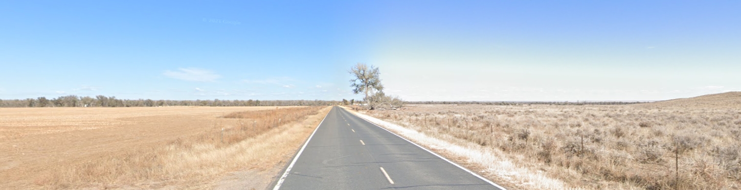
The trail as it is today. The station was about 2-3 miles down this road
The trail heading east to Bijou Station - about 13-14 miles from here
1864, Apr. 12 Lt. Clark Dunn, 1st Colorado Cavalry, and 40 men pursued some Cheyenne Indians into the bluffs north of Fremont's Orchard to recover some mules and fought a short battle. This was the first serious fight with the Indians. A Cheyenne chief said that this was an unwarranted attack that started the war with the Plains Indians.
Battle at Fremont's Orchard
On April 12, 1864, a company of about 20 soldiers based at Camp Sanborn (near Fremonts Orchard station) set out to find a group Cheyenne who reportedly stole stock from a local rancher:
…Ripley, a ranchman, living on the Bijon [sic] creek, near camp Sanborn, came into camp and informed Captain Sanborn, commanding, that his stock had all been stolen by the Indians, requesting assistance to recover it. Captain Sanborn ordered Lieutenant Clark Dunn, with a detachment of troops, to pursue the Indians and recover the stock; but if possible, to avoid a collision with them. Upon approaching the Indians, Lieutenant Dunn dismounted, walked forward alone about fifty paces from his command, and requested the Indians to return the stock, which Mr. Ripley had recognized as his; but the Indians treated him with contempt, and commenced firing upon him, which resulted in four of the troops being wounded and about fifteen Indians being killed and wounded, Lieutenant Dunn narrowly escaping with his life….
The Indians recounted a different version of events:
[E]arly in April, fourteen young men, all Dog Soldiers, left the camp on Beaver Creek and started north to take part in the expedition against the Crows. Before they reached the South Platte they found four stray mules on the prairie and drove them along with them. That same night a white man came into their camp and claimed the mules. The Indians who had found them told him that he could have them if he would give them a present to pay them for their trouble. The man went away to a camp of soldiers nearby and told the officer that a party of hostile Indians had driven off his animals…. According to the statements of Indians who were of the party the troops charged on them without any warning. Four men were shot by the Indians, one of whom they supposed to be an officer. Of the Indians Bear Man, Wolf Coming Out, and Mad Wolf were wounded. The soldiers retreated and the Indians, thoroughly frightened, gave up their expedition to the north and returned to the camp on Beaver Creek. They took with them the head of the officer, which they had cut off, and his jacket, field-glasses, and watch.
The military accounts paint the Cheyenne as the aggressors and in the Cheyenne accounts, the military charged without warning. It is possible that that the fault lay on both sides, the battle resulting from a grave misunderstanding; the military attempting to take weapons away from the Cheyenne may have been misinterpreted as a hostile act and the Cheyenne responded accordingly to protect their own safety. The discrepancies also include the injuries. The Cheyennes reported wounding a soldier and cutting off his head. The military records report four wounded soldiers (two mortally) who were taken back to Camp Sanborn and does not mention a soldier killed on the battlefield.
The Battle at Fremont’s Orchard signaled the start of the war with the Cheyenne. Over the coming months, Indians raids along the South Platte River and the military response escalated, culminating in the Sand Creek Massacre.
At a ranch out on the South Platte, the keepers had placed a board across .the top of two barrels to give the inside of the building something like the appearance of a frontier bar. At this place, it was said by a few of the stage-drivers and stock tenders that there was sold over this " bar " a decoction of some of the vilest stuff under the name of "old Bourbon whisky " that ever irrigated the throat of the worst old toper.
Eagles Nest
4N62W 40.30249677011092, -104.32635193640856
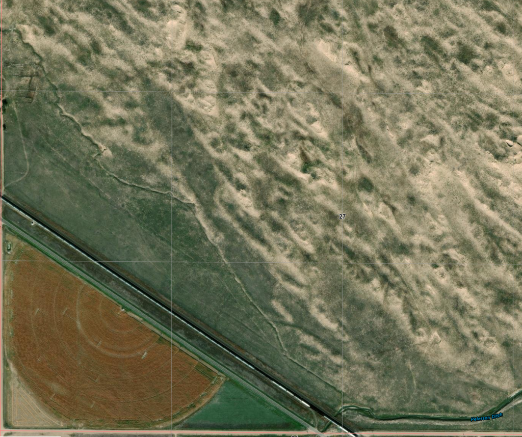
I find virtually nothing about this station - or even about this now-resort with the same name and close to the station location based on Overland mileage. It is listed as a ranch on the oldest "new" maps; it appears to be a resort on the latest maps. It appears to be not open for business nor presenting anything more than a name.
Similar to South Platte Station in the sense of obscurity. Apparently, a very small station, consisting of only a barn, corral and house. It is the last station before Latham, a major station, and the next after Fremonts Orchard, a place of notable relief, which may explain the obscurity of information - other than casual mentions in writings of the time.
The location shown here is based on the location of Eagles Nest Ranch. This location fits the mileage logs of the time given variations in the road over the years.
On the plains one would experience all kinds of weather. Sometimes, while making a trip, after a long dry spell, accompanied by a strong wind, the dust encountered was almost intolerable. Where there was so much travel, in hot weather, there were usually immense quantities of dust. Along the Platte river, where there was such enormous traffic — hundreds of wagons, some drawn by six yoke of cattle, passing over the road daily — it was worse than on any other part of the route. Portions of the road at times were like ash-heaps, because much of the way the soil was very sandy.
When the road was lined with mule and ox trains moving east and west, as a matter of course the animals were constantly stirring up the dust, which in places frequently was from three to six inches deep. With a strong wind blowing clouds of dust in one's face — sometimes constantly for two or three days — the result can better be imagined than described.
The diagonal trace on the modern view is US34
If the location is correct, the station was located this side of the trees, about ¼ mile away
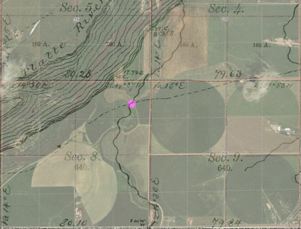
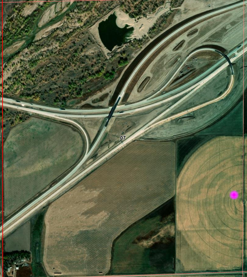
Latham
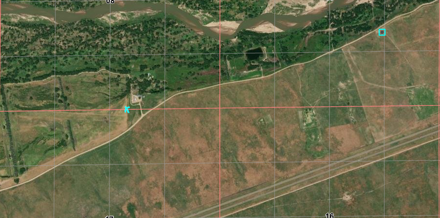
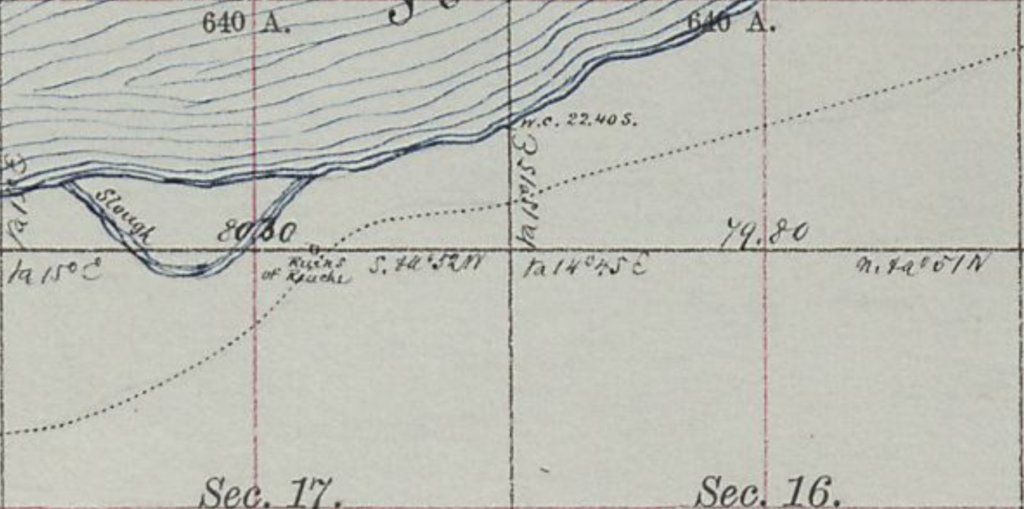
40.41937698438087, -104.59741610352786 south side at confluence - 1st Latham 40.42237220662745, -104.59953840459076 (2nd crossing) looking at map shows river crossing 5N65WS14SW station likely S23NE 40.390399386458874, -104.62352690811124 2nd (main) Latham
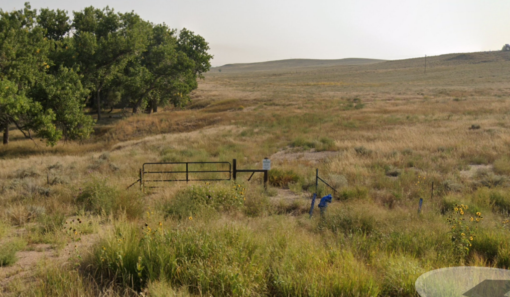
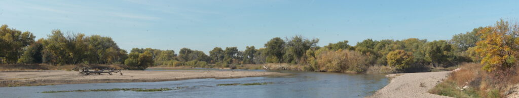
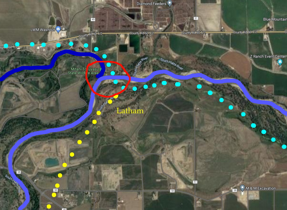
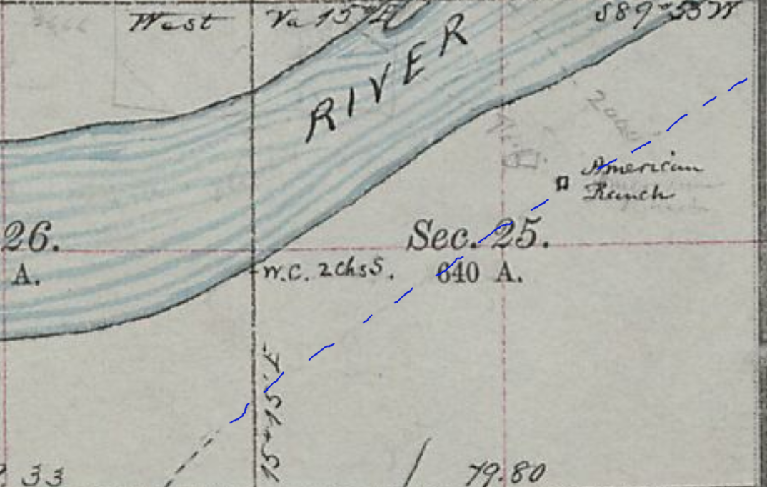
Latham Station - the first of two sites - was the western terminus of the South Platte River route of the Overland Stage. First established near the confluence of the Cache la Poudre River, this is where travellers crossed to the north side of both rivers and travelled onward along the la Poudre to LaPorte.
The station was moved upstream after the flooding of 1864. The town of Greeley did not exist at that time and is built on the land between the two rivers. The la Poudre now flows along the northern edge of the city.
This is the location of the confluence today from the north bank. Old Latham would have been on the south side of the river to the left. After the river flooded and damaged the station, it was moved about 1 mile upstream and to higher ground.
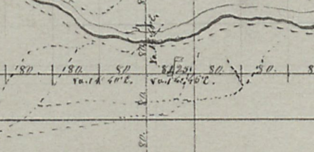
South Platte River looking west- Cache la Poudre coming in at right 5N64WS06SWSW 40.4221881270978, -104.59971307954274
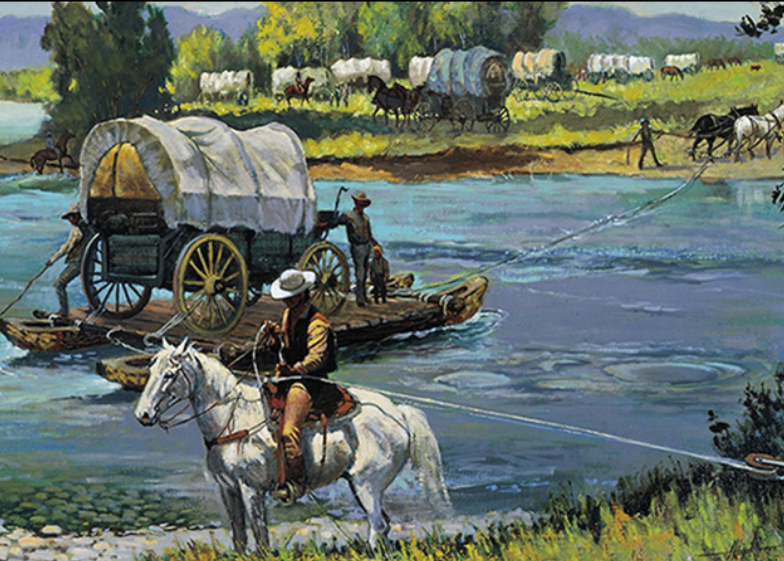
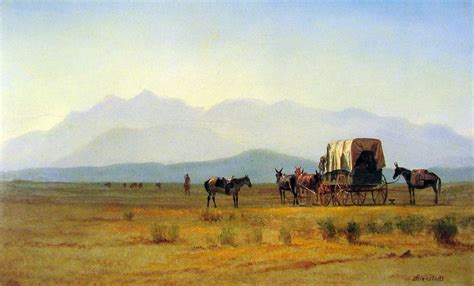
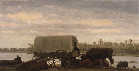
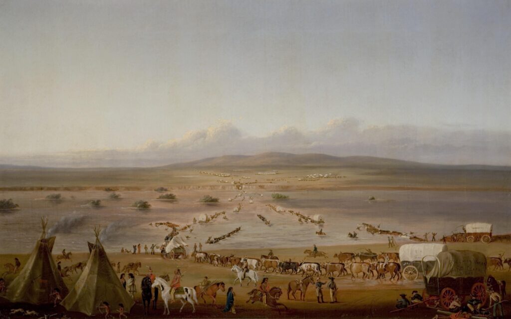
Crossing The South Platte - Albert Bierstadt
Crossing the Platte
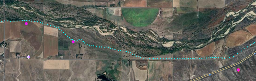
Confluence of the South Platte and Cache a Poudre Rivers - today. It is speculated Latham Station was here on the south side of the river. Remote as this image seems, this area is highly developed many things - including the river - have likely shifted around with time
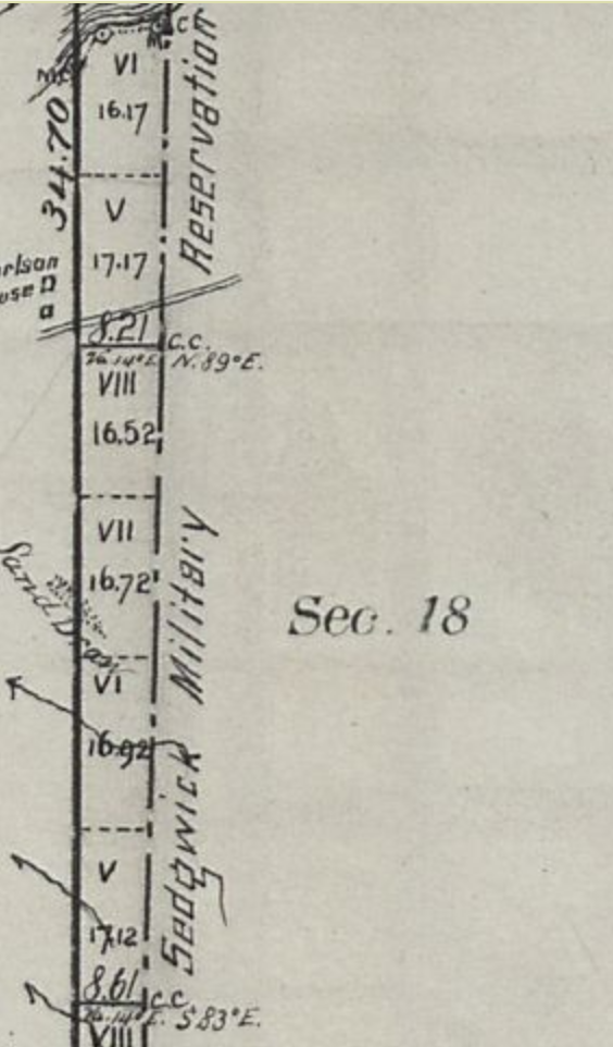
1863 - Main route does not yet go to Denver Route from Latham to la Poudre not shown Unfortunately, the confluence - and likely station location - are on the edge of township and range
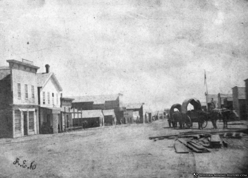
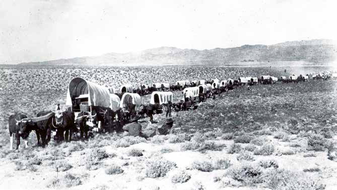
Latham was the starting point of the southbound stagecoach line to Denver, the northeastern stagecoach route along the South Platte River Trail, and the northwest turning point along the Cherokee Trail toward the Overland Trail through Wyoming to Salt Lake and beyond. As such, it was one of the most important of home stations. Latham was never attacked by Indians, but Mother Nature did the original town in during the floods of 1864.
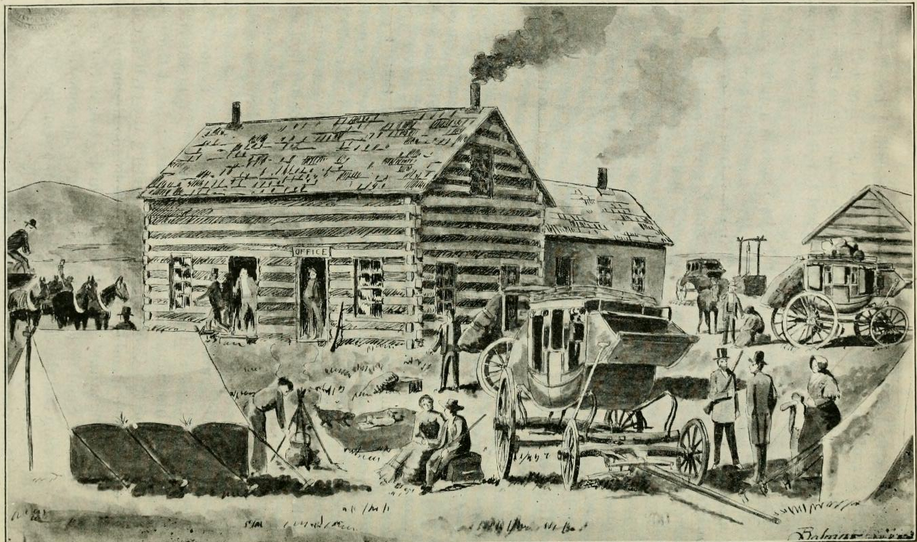
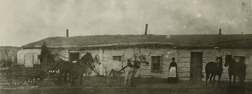
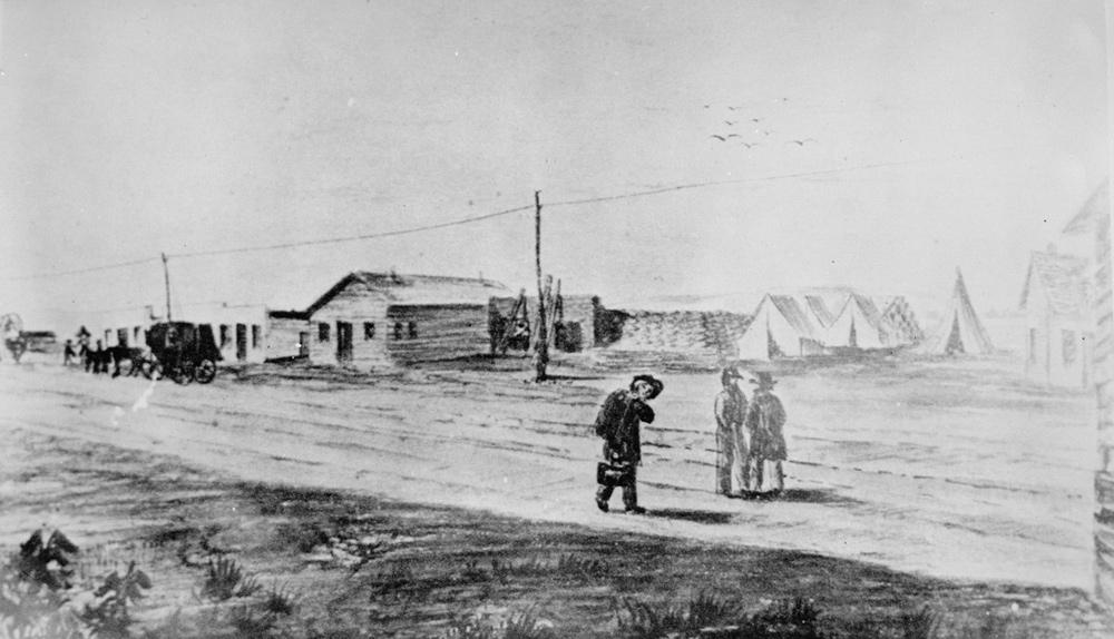
Latham Station - 1864
Latham was a major stop. A rest from travel for both people and horses. Latham was the "Flying J" of its time - offering a variety of services including food, water, a place to wash, outhouses, animal feed, a bed, tobacco, a blacksmith, timetables, mail, stamps, rope, ammunition, medical assistance, newspapers, leather repairs, whiskey, weather reports, conversation.
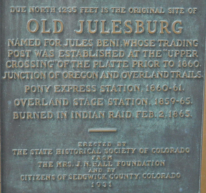
Latham (first known as "Cherokee City") was the next station, and an important one it was, too. The distance was a little over 592 miles west of Atchison, and sixty miles northeast of Denver. Here was the junction of the stage lines for Denver and California, after the old Julesburg crossing was abandoned, in the fall of 1863, and here it was that the coaches for Salt Lake and points beyond forded the South Platte
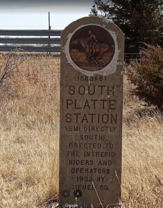
And now - not even a hint of what existed at either location except an obscure historical marker in someone's front yard (and apparently, since removed).
1866 Crossing
based on Township/Range plots, the original location of Latham was at the white x after flooding, the station was moved about 1 mile to the white dot
Approximate location of the second Latham Station The trees in back line the river
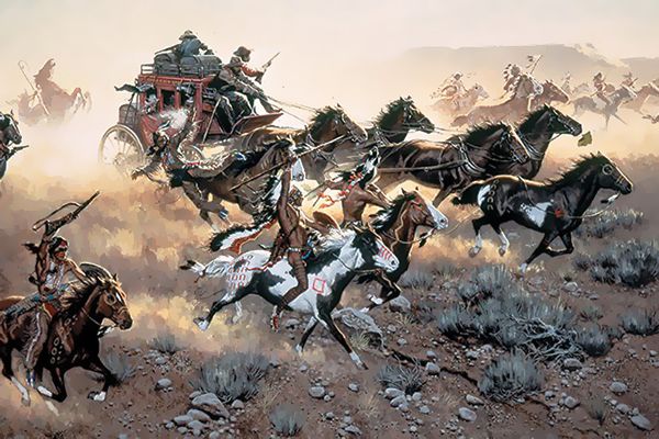
For hundreds of miles down the Platte east of Latham the Indians were bold and defiant, and apparently ran matters to suit themselves. They had in many instances run off the stage stock, burned the company's buildings, destroyed hay and supplies, and a number of emigrants had been horribly murdered, scalped, and left by the wayside.
Precaution was taken by Mr. Mcllvain, the station keeper, to lay in an ample supply of flour, ham, bacon, potatoes, dried fruit, sugar, coffee and other eatables at the beginning of the troubles, and, by his foresight, he saved for himself several hundred dollars, and his guests were well cared for. Latham was the best eating-house between Fort Kearney and Salt Lake City.
As mentioned earlier, Latham was built in 1862 as the last station on the South Platte route near the mouth of the Cache la Poudre River. It was built on a flood plain - convenient to the crossing - but heavy flooding destroyed much of the town in 1864. The station was too important to abandon; it was moved upriver a mile or so to higher ground.
As a junction point for both the trail to Denver and the river crossing for points west, it became the most important and busiest facility on the Overland Trail. The station was a long, low, one and a half story log structure. An addition held a dining room, kitchen, bedroom, storehouse and the telegraph office. It was located near and south of the present US34BR bridge into Greeley.
Being a major junction point, traffic could be heavy from three directions. As the major station, it provided storage for company supplies - grain, soap, candles, tack, etc - for all three Overland divisions. Heavy traffic could see as many as 40 passengers at one time - 5 or 6 stages worth. Mail was collected, stored, and sorted here for transport to the next destination.
Unlike now, the station was in a desolate location; the nearest neighbor was a rancher down the road towards Denver.
The road south to Denver would follow a trail continuing along the east (south) bank of the South Platte. For those headed west, the trail crossed the South Platte here, at times, over a mile wide. Crossing in late spring could be troublesome when water ran high due to the spring melt. A ferry was established and charged $1.00 per wagon, but the wagons had to be disassembled first.
The next stage station west was LaPorte, a trip of some 35 miles, with one small station in between (maybe - as it is reported) of questionable location; one being claimed in what is now the town of Windsor, another more likely at a ranch closer to what is now Ft Collins.
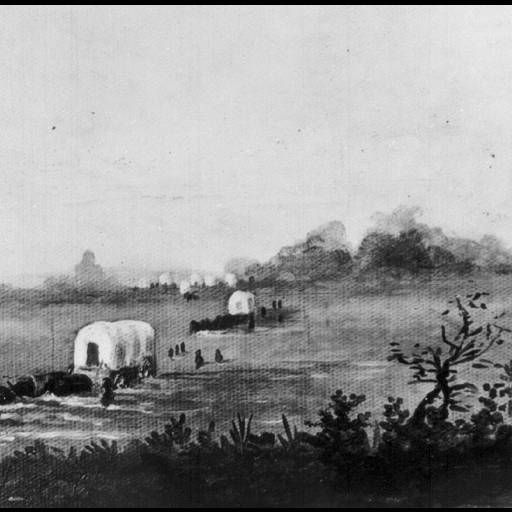
Crossing the river
A mishap
Latham was never attacked by Indians, although reports of nearby problems kept the station staff on edge.
From Frank Root's reminiscences (1901):
The original county-seat of Weld county was located at old St. Vrain. Later it was given a temporary abode at the houses of two neighboring ranchmen. Next it went to Latham, four or five miles from Greeley and three miles due east from Evans, and remained for several years, that town and Greeley being about four miles apart. There was a lively competition between the two latter towns, and for several years there was a bitter county-seat fight, first one getting it and then the other. The election in 1877 settled the contest, when Greeley won the prize, and ever since it has remained there. Greeley is a temperance town, never having had a saloon, while Evans is a licensed-liquor town.
The stage station was the only house there. It was a substantially built one-and-one-half-story log structure, fronting south. There was a large one-story, rough-board addition built on the north side, fronting both east and west, in which were a large dining-room, kitchen bedroom, and a storehouse. Its location was important. It was the junction of the branch stage line to Denver, and stages made close connections east and also with the main line to Salt Lake and California. Besides, it was a storehouse for supplies for three divisions, and this made it the most important way station on the overland route between Atchison and Placerville. Prominent as Latham was in 1864, the name of it at this late day is seldom mentioned. There are scores of people born in Weld county and still living there who probably have never heard of this station which was wiped out five years before the capital of the county was dreamed of. There are hundreds of people now residing in the vicinity who could tell little or nothing of the history of the old station as it was in the palmy days of overland staging.
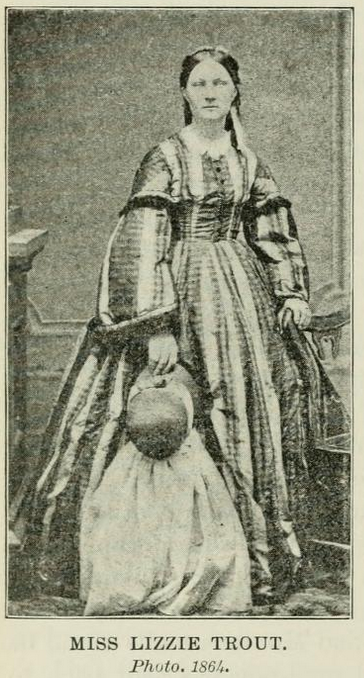
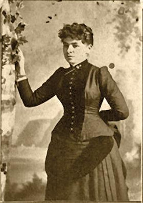
The eating station was kept by Mr. W. S. McIlvain, a genial warm-hearted man, who was also the stage company's agent. With the aid of his estimable wife, assisted by Miss Lizzie Trout, whose services had been secured at ten dollars a week as cook, he gained the reputation of keeping one of the best eating-houses on the entire line of nearly 2000 miles.
He spared no pains to have his table supplied with the best to be found in the Denver market. He bought the very best coffee, paying one dollar per pound for it. He also bought fresh butter and eggs from the ranchmen in the vicinity, often paying $1.25 per pound for the former and $1.50 per dozen for the latter. The price of nearly everything else used on the table was in proportion. Except at the hours when the stages arrived and departed each day, the station at Latham was a desolate and lonesome place. The nearest neighbor was a ranchman named Westlake, nearly three-quarters of a mile southwest toward Denver. He was on the main road and kept a gin-mill and a few goods for sale to the ranchmen in the neighborhood. He made the most of his money selling "cold pizen" to the numerous freighters and ox drivers passing up and down the Platte.
Lizzie Trout - 1862 Lanham Station cook
While it was against the rules of the stage authorities to allow any liquor about the station, the thirsty drivers and stock tenders knew they could always get a drink or a private bottle filled at Westlake's. They had often heard the pioneer ranchman and keeper of the place say that he might run short on the "luxuries of life," but the "necessaries" he would always keep in stock.
In a radius of ten miles from Latham there were less than that number of ranchmen; but, in a number of respects, the station was looked upon as a very important point. It was a storehouse for grain, soap, candles and "dope" for the stage company. There it was that the stage teams forded the South Platte on their way to and from Salt Lake and California, and there it was that the mail-pouches for the Pacific slope were taken off the stages, immediately on their arrival, and examined, reloaded and rechecked for their destination. It was only a few miles from Latham to where is now the county-seat of Weld county, the wide-awake city of Greeley. But at that early day --1864--Greeley was not dreamed of. The first building in that town--named for the New York Tribune founder--was erected in the spring of 1870.
There had been little difficulty in the stage teams fording the river at Latham until the great flood in Cherry Creek, which occurred on the night of the 20th of May, 1864. At that time the flood, which came with hardly any warning, swept away, almost in an instant, the Rocky Mountain News office and a score or more of other buildings in Denver, resulting in the destruction of a large amount of property and considerable loss of life. This flood caused the Platte to rise at Latham so it was nearly bank full on the afternoon of the 21st. The next morning it was several feet higher, and out of its banks.
And here we leave the South Platte and head up along the Cache la Poudre ...
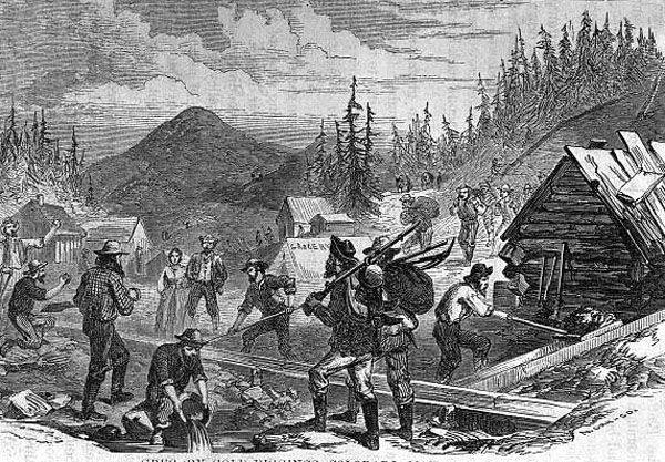
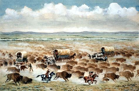
Gold was discovered in what was then western Kansas at Gregory Gulch (Central City/Blackhawk) in 1858, on Chicago Creek (Idaho Springs), on Cherry Creek near the confluence with the South Platte (Denver), and along Boulder Creek (west of Boulder) in 1858/59. The rush was on - known as the Pikes Peak Rush even though Pikes Peak itself was almost 100 miles south. An estimated 100,000 people swarmed to the Rocky Mountains in the spring of 1859.
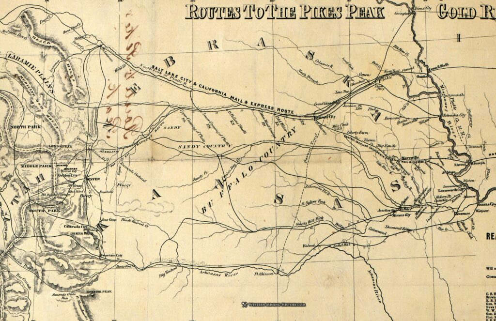
Routes to the Pikes Peak (Colorado) gold rush in 1860
The early years of the rush centered along the South Platte River near Cherry Creek, up both forks of Clear Creek west of Golden City at Gregory Gulch and Chicago Creek, and up Boulder Creek Canyon. By late 1859, the deposits at Denver, Golden, and Boulder had proven weak but those places became gathering points and supply centers while the deposits west of Golden and Boulder were the center of mining activity - for 20 years or more. The population grew so quickly, it led to the creation of first the unofficial Jefferson Territory, then the official Colorado Territory in 1861 with Golden City the capital of both until 1867 when the Colorado Territory was formed and Denver made capital. Colorado became a state in 1876.
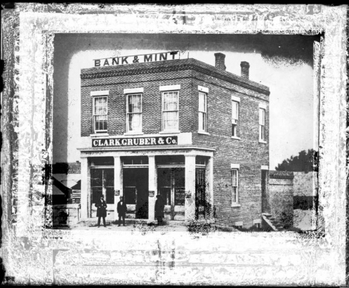
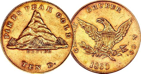
Gold production of the Pikes Peak mining region in 1861 was 150,000 troy ounces (a little over 10,000 lbs) and 225,000 ounces in 1862. By 1865, these districts had produced 1.25 million ounces. Keeping in mind that physical gold was money at that time - officially about $19/oz - and that there was no "central bank", one didn't exchange gold for money - it was money - but using raw gold as a medium of exchange was awkward. The cost of insurance as well as the cost and difficulty due to natural disasters and robbery in transporting gold nuggets and dust from Denver to the Philadelphia mint, then back as gold coins, were the main reasons a private mint - Clark, Gruber and Company - was opened in Denver in the summer of 1860. Miners could deposit gold into the bank and receive a nice return of 10-25% on their deposits. The Gruber $10 gold pieces - containing just shy of ½ oz gold - were minted at the rate of "fifteen or twenty coins a minute". They also minted coins of $2.50, $5.00, and $20.00. (The $10 Gruber coin is now worth over $45,000; uncirculated towards $100,000)
First Denver mint
1860 $10 Gruber gold coin
"Letting the eagle fly" referred to getting paid with a $10 coin - referred to as an "eagle". The $20 coin was a double eagle; the $5 coin a half-eagle.
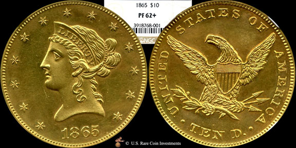
When the $20 gold coin was added, the company declared "the weight will be greater, but the value the same as the United States coin of like denomination". Production reached $18,000 per week but the coins of pure gold were too soft, so an alloy was added lowering the gold content somewhat. By 1862, Congress allowed the formation of a new US Mint in Denver; it opened in late 1863.
1865 US Mint $10
The Overland Stage Company provided transportation services for such cargo, as well as for passengers and other goods. In the earliest days before the rush, there was no "Denver" to speak of - settlements such as Montana City, Auraria, St Charles - were the "towns" of the region; the name Denver was given to St Charles for political reasons; named after the governor of Kansas as the capital of the western-most Kansas county. The gold deposits in the region were sparse down on the flats - the mines were west up in the foothills. Rather than fading away like the other small settlements in the area, Denver's location on the South Platte made it an acceptable site for a supply center.
The original South Platte River Route left the Platte just east of what is now Greeley and headed NE along the Cache la Poudre on the road through the Laramie Plains, over Bridger Pass to Ft Bridger via Bitter Creek, and on to Salt Lake City. However, with the mining boom and associated traffic, Denver grew quickly and a route to "the diggings" - continuing down the South Platte with the main stage station located at Denver - was established. Traffic along the South Platte became the heaviest along the entire line.
Earliest known photo of Denver - 1859 There was no "Denver" in late 1858
Colorized image - Colorado prospectors 1858
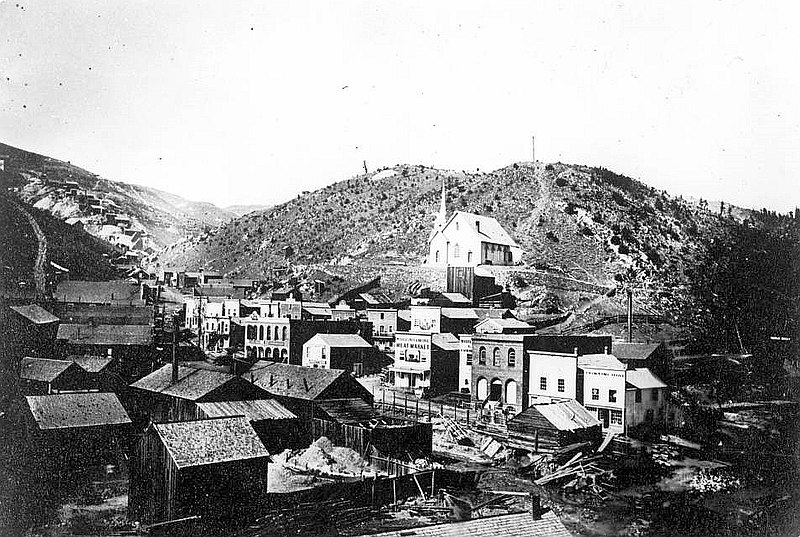
Early days of mining in Gregory Gulch
Black Hawk (mouth of Gregory Gulch) 1864 Central City was up the canyon
Up Gregory Gulch - Central City in 1860
Both towns exist today - much changed - as tourist/casino centers
The South Platte River Route - Julesburg to Lanham
Little is known about the next several stations upriver from Julesburg. It is likely most were simply ranches - swing stations - which provided a place to change teams with no facilities for passengers. Most were burned out by Indian attacks in early 1865; not all were rebuilt. Wells-Fargo took over the line in 1866.
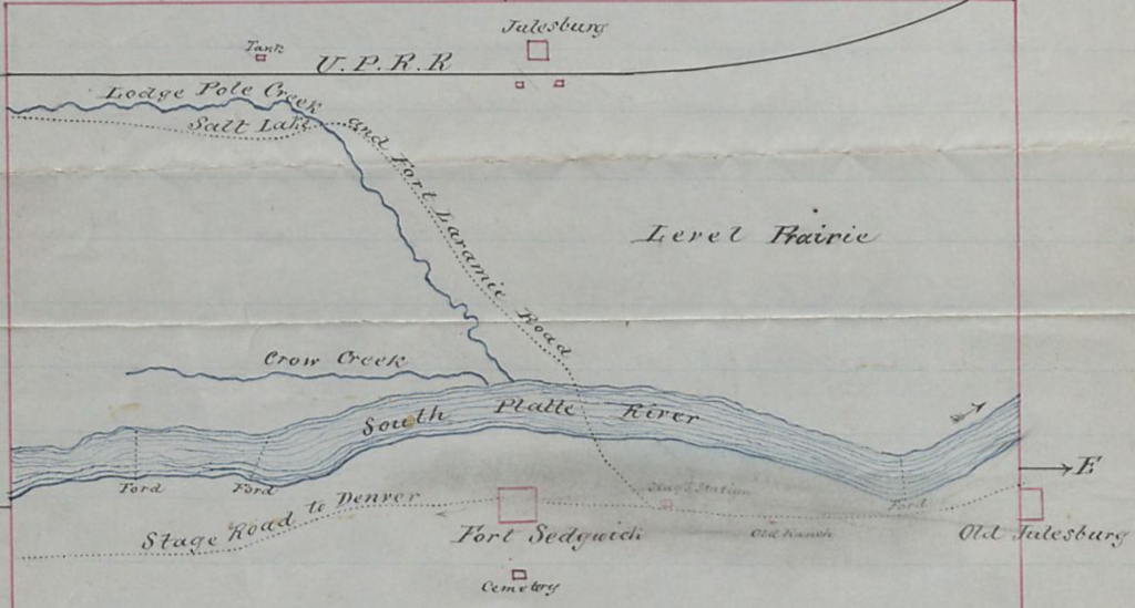
Colorado Route South Platter River Route - Julesburg (point 1) to Latham (point 13): 136 miles including South Platte station and the section from Latham to Virginia Dale: 61 miles
By 1863, the increased traffic in people, valuables, and the mail, caused the Army to plan on establishing several forts along the road, assuming this would provide the most effective protection. However, it wasn't until the summer of 1864 before such action was effective when 1,000 troops were sent to patrol the Platte River Road and set up outposts. Four sites were located, Camp Rankin - later Ft Sedgwick - near Julesburg, among them.
The Valley Station near what is now Sterling was taken over for military use. Camp Tyler was set up near Bijou Creek; later renamed Camp Wardell, then becoming Fort Morgan. Camp Collins - later Ft Collins - was built along the Cache la Poudre River to protect westbound travelers on northern stage roads. Camp Weld, just north of the current US6/I-25 interchange in Denver, was used as a base and supply depot for the regular Army. These forts were constructed of sod and adobe rather than having wooden stockades.
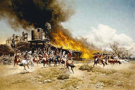
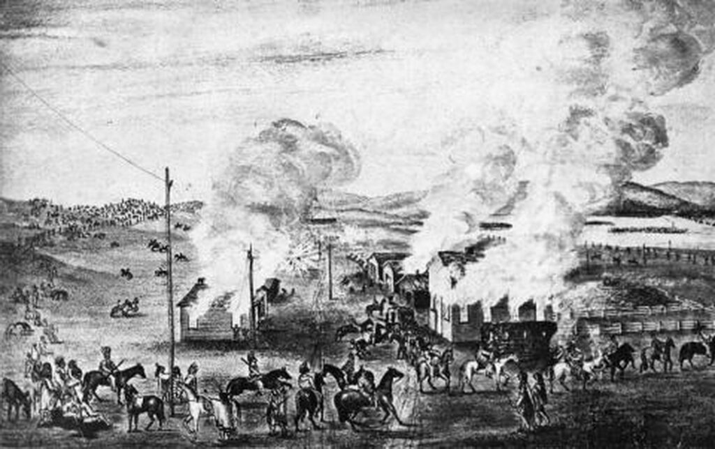
Although Indian relations at the beginning of stage operations were relatively benign, the Sand Creek incident in late 1864 enraged and unified the various Indian tribes of the region - mainly Arapaho, Cheyenne, and Sioux -inciting a desire for revenge. The attacks started in January 1865, when Julesburg was first raided. A second attack in February burned out the town. More attacks spread down the South Platte as marauding Indians attacked stage stations and ranches. Travel along the route became dangerous and was halted for a time in 1865.
galvanized Yankee soldier
During the war back east when manpower for western operations was low, the Federal government offered Confederate POWs "freedom" in exchange for moving to multiple frontier posts, including those in NE Colorado and Wyoming. The now ex-POWs were required to swear an oath of loyalty to the US, then were enrolled into the Union army to serve in western outposts. These soldiers were nicknamed galvanized Yankees, referring to a galvanizing process which stopped iron from rusting. "A few days of terror surrounded by months of boredom" pretty much described a soldier's life on the frontier. Garrison and escort duty led to low morale; alcoholism and drug addition (opium) became problems.
Peaceful farmland for the most part today, it's hard to imagine the desolation along with constant fear of Indian attack along the South Platte of the 1860s. Population of the entire region was only in the low hundreds, if that - many being stage employees. Travelling along essentially the same route (Julesburg to Latham - 150 miles) on I-76/CO14/US34 "where wagon drivers cursed the endless sand and the insects and the heat of the treeless river bottom" now only takes 2.5 hours or less. In the days of the stagecoach, such a journey might take 18-20 hours or more - maybe days, depending on several factors - weather, Indians, road conditions, breakdowns.
Times change. Indians are no longer a problem, but road conditions, breakdowns, and weather are still possibilities - this is blizzard and tornado country.
.
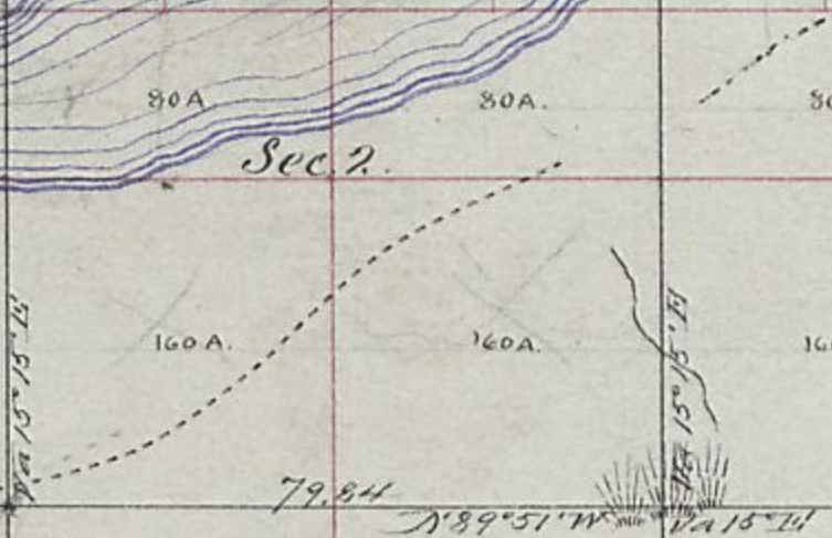
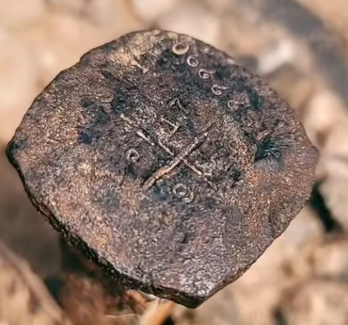
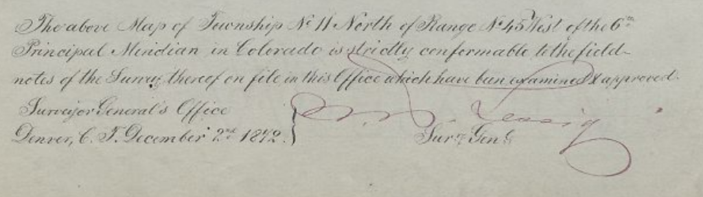
The region was formally surveyed during the period towards the end and just after the time of the Overland/Wells-Fargo stage lines - about 1865 - 1873. The surveyors mapped out the territory, carrying their equipment in wagons. Sections of those maps are shown to show the trails were the stagecoaches ran. Not all the information desired is indicated - most, not all, station locations are not included. By the time of the surveying efforts, they had mostly been destroyed, abandoned, or turned over into ranches - or just not important to the survey efforts.
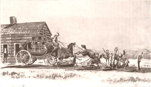
"The Surveyor's Wagon" - Bierstadt
An original section corner marker possibly 10N48W corner 18/17/19/20
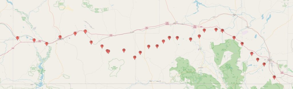
West from Julesburg
Eleven miles west of old Julesburg, along a somewhat rough road, was Antelope ; and thirteen miles farther was Spring Hill, a "home" station, kept by Mr. A. Thorne; thirteen miles farther was Dennison's; and another twelve miles brought us to Valley, also a "home" station. Fifteen miles farther was Kelly's (better known as "American Ranch"); and Beaver Creek was twelve miles farther west. Then came the longest drive without a change of team on the road between the Missouri and the Pacific. It was Bijou, twenty miles from Beaver Creek; there being no suitable location between the two stations for another one. To go over this long drive, where there was considerable alkali and sand and a number of sloughs, required some of the best teams on the entire line, and there were extra teams, so that all in turn would have a day's rest and none of them be overworked.
Antelope Station
11N47WS35NWNW 40.89439201370095, -102.5727573854817 County Rd 22 goes past the approximate site
40.90183013712542, -102.58533271845896 11
40.88351881577574, -102.61680143036618 13
Antelope Station was the first station upstream from Julesburg. somewhere 11-13 miles distant, it was burned out in January 1865
Approximate route - Julesburg (1) to Antelope Antelope site marked at 12-mile point; could be a mile either directionMark is 12 miles from Julesburg 1 along trail actual location perhaps 1 mile either side - (one section is 1 mile on a side)
In areas not under irrigation, there are faint traces of what might be remnants of the trail - or imagination seeing things no longer present in places where such things may have been at one time. Such questions make the search interesting.
5 ½ miles west of Julesburg 1
1865, Jan. 28 Antelope Station was burned out in January, 1865, including a house of two rooms, a barn, and a corral; all the buildings, valued at three thousand dollars, along with 25 tons of hay and 125 sacks of corn were burned during the Indian raids. After the buildings were destroyed, the Indians spent the rest of the day hauling provisions from the storeroom back to their camp. They loaded up their poledrags with bacon, ham, flour, sugar, molasses, and even oysters.
Comparing the 1872 maps with today's, it appears the station site has been plowed under - if indeed this was the station site.
"An Overland stage station occupied by the CO Cavalry. Undetermined location, more than 10 miles from Fort Sedgwick. Attacked and destroyed by Indians in January 1865."
approximate Antelope Station site from I-76 not quite 1/2 mile out between "here" and the trees in mid-distance (the river) based on 1871 map of road and distance from previous station
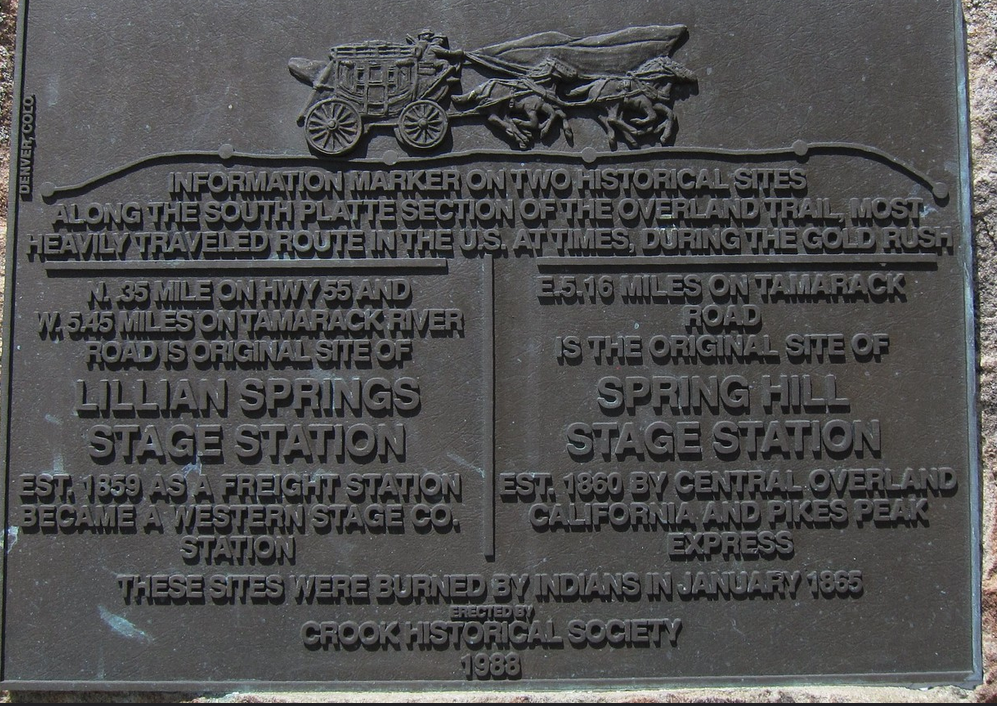
Spring Hill/Lillian Springs
Neither of these stations is well located; site locations estimated from information on this historical marker and evidence on aerial photos.
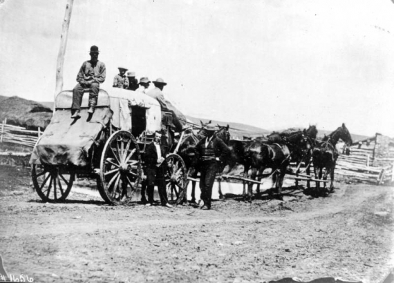
Often there could be seen a string of four- and six-horse (and mule) teams and six to eight yoke of cattle hauling the biggest heavily loaded wagons. Frequently a train a mile long might be seen on the road. Many times a number of trains could be seen together, and the white, canvas-covered vehicles extended for many miles, or as far as the eye could see. were the ox trains of Russell, Majors & Waddell, of Leavenworth. Their ponderous wagons were made to order in St. Louis and built so they could carry from 5000 to 7000 pounds of merchandise.
Spring Hill
10N48WS09 40.85090355294632, -102.73714562628182 based on ruins located on 1871 map or: 40.85613444290205, -102.71466751842938 based on historical marker roughly 1 mile apart
The Spring Hill location was a "home station" - one that provided food and took on passengers. It was a new station in 1860 but in an indefensible location. It was reported to have been one of the best along this section of trail, valued at over six thousand dollars. It was destroyed on January 28, 1865
Harlow's Ranche was burned, and three men were killed and a woman was captured; Buffalo Springs Ranche was burned; Buler's Ranch below Julesburg burned; Spring Hill Station, a home station, burned including dwelling house of four rooms, barn, and furniture; 500 cattle were stolen and 100 tons of government hay burned at Moore's Ranch. Dennison's Ranche burned. The Indians camped between Moores Creek and Twin Buttes from January 28 to February 2 and raided every day.
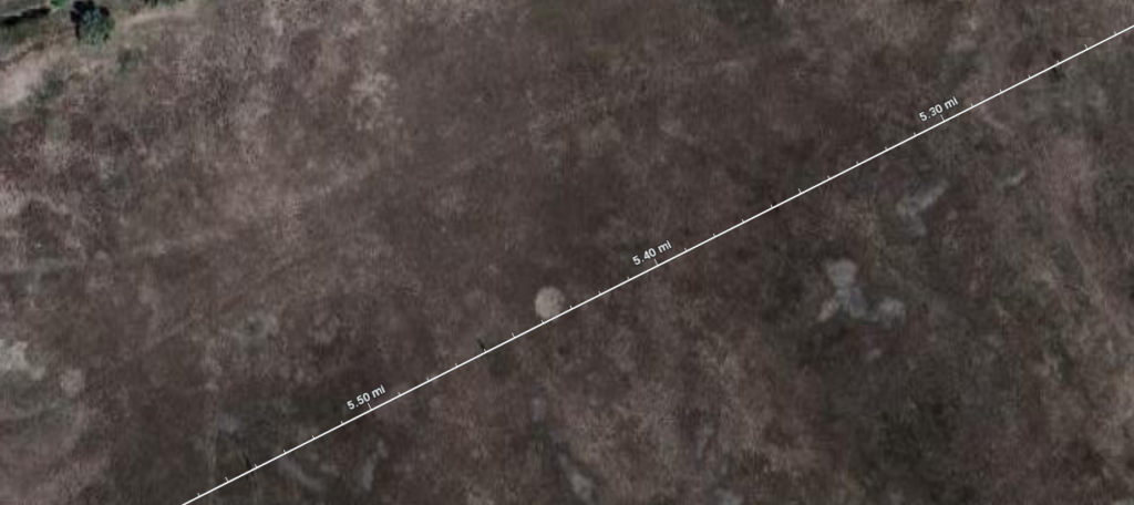
Picking the site based on the highway marker, the station is located only about 8 miles from Antelope. However, the distance works if considering Lillian Springs. At some point, Lillian Springs is reported to have been replaced by Spring Hill, yet both are described as having been destroyed by Indians in 1865.
A bit of discrepancy here: Antelope is 13 mi from Julesburg based on Overland mileage logs - this works for the original Julesburg. Spring Hill is 13 miles from Antelope. However, Spring hill is 5.2 miles east of CO55 (to Crook) according to the marker. This works out if measured from "now" Julesburg 4 but not from original Julesburg 1.
The 1871 map shows ruins at "proper" location for Spring Hill based on mileage.
Julesburg 4 is about 6 or 7 miles east of the original Julesburg stage station. Could it be later chroniclers confused stations?
It appears the present county road is the same as that of the original stage road. Both potential station locations are indicated; the x by the ruins on the 1871 map; the square suggested by the historical marker. The diagonal path across the bottom is I-76
Assuming ranch ruins are station location
Lillian Springs (aka Sand Hill Springs)
approx 40.81170873093629, -102.8779128175366 10N49WS30SWNE Location estimated by measuring distance from historical marker
This station was built in the summer of 1859 - the year of the gold discovery. It was used by three stage companies: the Leavenworth and Pikes Peak Express was reorganized early in the 1860s as the Central Overland California and Pike’s Peak Express Company (COC&PP), followed by the Overland Stage Company after the former firm went bankrupt. Lillian Springs was the primary station until the Spring Hill station was built in 1860. A post office operated here for 9 months from summer 1863 to spring 1864. It was among the stations destroyed by Indians in 1865.
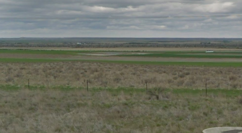
CO385 looking west towards Lillian Springs Station near Tamarack Ranch likely the old stage road
1865, Jan. 27 Lillian Springs Ranche was burned after 3 white men fought 500 Indians and then escaped.
Col. Robert R. Livingston (1st NE Cavalry) reports a skirmish [with Indians] at Lillian Springs Ranch on January 27, 1865
estimated Lillian Springs station location based on distance given by historical marker Diagonal trace at bottom right is I-76
In staging overland, it was all-day and all-night riding over the rolling prairies, as it was across the plains and over the rugged mountain passes. But one would enjoy the long all-night rides far better when going along the Platte river, especially when there was a moon, which lighted up the surrounding country, its silvery rays being reflected in the waters of the beautiful stream, which silently flowed along the great overland pathway.
There were from eight to twelve animals kept at each station. At some of the stations it was necessary to keep a few head of extra stock, as occasionally an animal would be liable to get lame, sick, or be crippled, and at times unable to work; hence the necessity of a few extra head where they could be got without delay.
In the Platte valley were a great many deer, antelope, and an occasional elk, while a few miles distant, south from the stream and away from the heavily traveled thoroughfare, buffaloes abounded by hundreds of thousands. A great many came north to the Platte and there slaked their thirst. Buffalo-wallows were numerous along the Platte in staging days.
The native prairie wolves — the coyote — were quite numerous.
Trouble along the river
Dennisons Ranch
40.77357358010095, -102.9813433861555 1870 9N50WS07NENE labeled as Chicago Ranch CO385 on trail at this point - east of Iliff - but heavy irrigation efforts have changed the road.
A CO Cavalry post at an Overland stage station located near the mouth of Cedar Creek [Cedar Creek no longer shows on maps; perhaps absorbed by irrigation efforts]
1864, Late Dec. Dennison's Ranche, barn, hay, and corral were burned by Indians. Horses were stolen from American Ranche.
Unknown Colorado Overland Station
1865, Jan. 10 Indians killed four men between Valley Station and Dennison's Station (U.S. Senate, 46th Cong., 2d Sess.). Captain O'Brien and the 7th Iowa Cavalry left the post to go to Camp Cottonwood [near Denver] to join General Mitchell on January 16 for a campaign near the Republican River. They went out after the Indians and returned January 30 after marching 500 mi and finding none.
The ranch provided fresh teams but was destroyed in the Indian uprising in January, 1865 and not replaced.
Dennisons about 1 1/3 mile out ... before the faint trees at center horizon
Washington Ranch stage station was operated by the Moore brothers. A detachment of the CO Cavalry was posted here in 1862. This ranch was also attacked by Indians in January 1865.
This ranch was founded by a former Pony Express rider, James Moore, and his brother Charles in 1861 or ‘62. There was a large store and huge corrals with very thick walls. The brothers and their employees successfully defended it against Indian attack on January 30, 1865.
Col. Robert R. Livingston (1st NE Cavalry) reports a skirmish at Charles Moore's Ranch (aka Washington Ranch) on January 26, 1865
I remember the Cheyennes were raising Cain along the overland stage route, attacking stages, plundering stations and mail-bags, and chopping down telegraph wires. This was in Colorado, between Fort Morgan and Fort Sedgwick. I went out with a company of sixty men to reestablish the route. We had just got beyond a place called Moore's, a sort of station for the stage line, and a stage came up as we laid in camp after a hard day's march. The Indians had been crawling around trying to surprise us; but no Indian fighter is ever surprised, and I was ready for them. The men on the stage were for going on; but I said : 'I wouldn't if I were you; for there's about sixty of those devils hiding among those sand-hills over yonder.'
The stage-driver knew his business and went back to Moore's. I told them I was going to march in the morning at five o'clock. There was a woman with her children in the stage, too, by the way. The men were indignant at turning back, but the driver had the advantage. Well, next morning about 7:30 o'clock we saw the stage-coach behind us in the sand-hills, and out popped the Indians. Part of us got back and drove them off. The Indian doesn't fight unless he has clearly the best of it from the start. Well, you ought to have seen the civilians who were so hot to go ahead the night before. They were shaking hands with everybody and crying and carrying on.
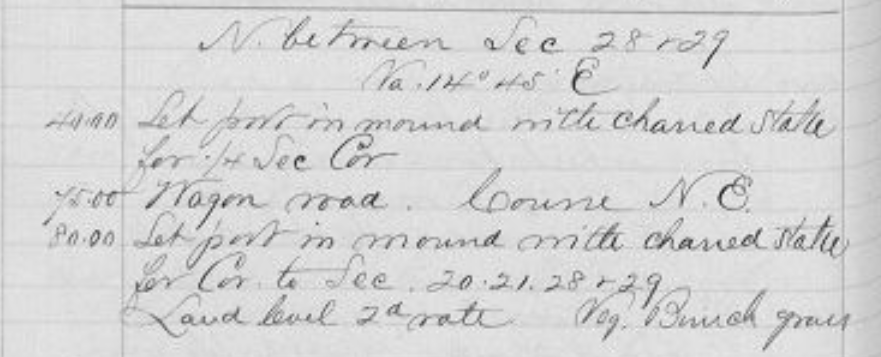
1870
Survey notes - Oct 1870
June 7 [1860]… Camped near an Indian village so we have plenty of company, begging & trying to sell moccasins. One squaw said she had dirt in her eyes and we gave her a wash dish and water and cloth. She washed herself and then her papoose and he cried loudly and it sounded more civilized than anything else we had heard. There was a very bashful young Indian who could not find courage enough to ask for anything so Mother filled a plate of victuals & he began to eat. When he had finished he strung his meat on a weed and got up. Another young one – a warrior – came up smiling enough and hands Edward his tomahawk, which served the purpose of pipe & so he points down into the bowl and said – smoke. He was quite intelligent and talkative, almost as soon as he came in an old Indian came in from the other fire, he shook hands – as they all do – and wanted to know if I was Mother’s papoose and Edward too, she told him yes, he pointed to the warrior and said HE was HIS papoose and talked quite loudly. The warrior took hold of the bashful ones tassel that hung around his neck on a breast plate of beads, and pointed to me and that plagued the bashful one considerably….
Preparing to make bread to bake in the morning, as we can’t have a fire tonight. We are camped about as far from another Indian village as we were last night so we expect company. We bake finally in Mrs. Wimple’s stove. Go to bed after preparing for rain, when we know it wouldn’t even sprinkle. Edward tells me of passing a grave Tue. On the headboard read – H. Wilson, Wis., 1859.
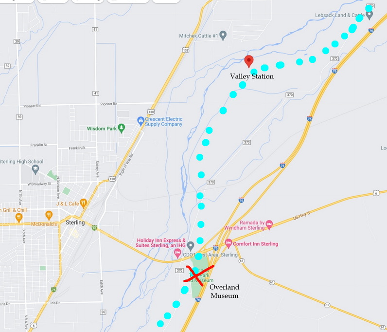
The Valley Station, near today's Sterling, was built in 1859 by the L&PP and was active throughout the life of the various stage companies. The station was sometimes referred to as Fort Moore, named for the operators of the station.
A telegraph office was built here in 1863 and served as the headquarters for the 3rd Colorado Company Volunteer Cavalry in 1864. During the Indian raids of January 1865, about $2000 worth of damage was done to the telegraph office and supplies but the station itself was spared as the soldiers used sacks of corn as a defensive structure. The soldiers were prepared; the Indians never attacked and retreated at sunset. When a company of cavalry arrived as reinforcements arrived, the station had been so severely damaged that "adobes" (bricks) were used to strengthen the defenses.
County Road 370 follows the trail here
George Bent, a half-white/half Cheyenne, participated in a raid with the Cheyenne near the Valley Station. The Cheyenne captured 500 cattle and had a skirmish with a company of army cavalry. The army claimed they killed 20 Indians and recovered the cattle; Bent said none were hurt, two soldiers were wounded, and only a few cattle were re-captured by the soldiers.
Col. John M. Chivington (1st CO Cavalry) reports a skirmish near Valley Station on October 10, 1864
Col. Thomas Moonlight (11th KS Cavalry) reports reports a skirmish at Valley Station on January 7, 1865
Col. Robert R. Livingston (1st NE Cavalry) and Lt. Judson J. Kennedy (1st CO Cavalry) reports a skirmish near Valley Station on January 15, 1865
Col. Robert R. Livingston (1st NE Cavalry), Lt. Judson J. Kennedy (1st CO Cavalry), Lt. Albert Walter (2nd CO Cavalry) reports a skirmish at Valley Station on January 28, 1865
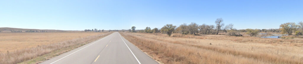
Valley Station was located near those buildings across the berm this side of the trees Picture taken from I-76
To add to the annoyances in operating the line, scattered here and there over the plains and in the mountains were small bands of desperadoes from Texas, Arkansas, and other parts of the West, ostensibly hunting buffalo and other animals for their hides; but really it was plain that their object was to steal stock, rob the express coaches and passengers, and at times murder was resorted to in carrying out their hellish designs.
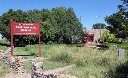
Sterling Overland Trail Museum 40.617810335882766, -103.18025912631857 8N52WS33/34 Located at Sterling exit of I-76
A railroad town, a post office was first established here in 1874.
Not a station or other significant place on the Overland Route, but located directly on the trail and a worthy stop for those interested in such things.
Overland Trail Museum in Sterling, Colorado The stage road ran between I-76 and the river - through the museum site
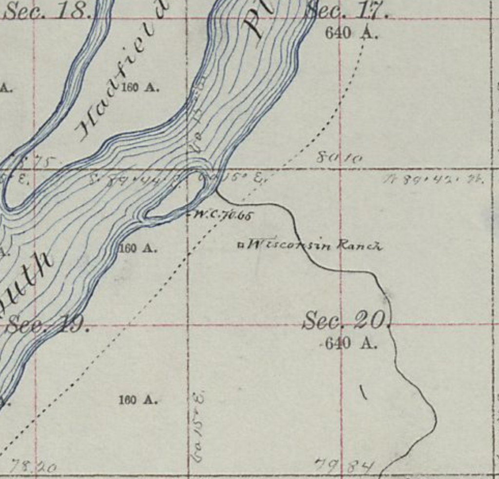
Wisconsin Ranch
7N52WS0NW 40.56310678353177, -103.21522166513049
Also referred to as Bull Ranch, this ranch was established by brothers Ralph and John Coad in 1862 as a supply station for their freighting business. A herd of oxen was kept here as well as storage for supplies to be taken to Denver during winter when prices were high. A third brother, Mark, was here with his sister, her husband, and their two children when Indians attacked in January, 1865.
Mark claimed that not only did he hold off the Indians but that he killed three of them. Soldiers later evacuated the family after the Indians had withdrawn. The ranch was nearly destroyed and it was abandoned.
Col. Robert R. Livingston (1st NE Cavalry) and Lt. Judson J. Kennedy (1st CO Cavalry) report a skirmish with Indians at Wisconsin Ranch on January 15, 1865
One of the few stations to be indicated on maps of the time
site between "here" and power lines
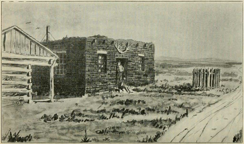
American Ranch
6N54WS25NESW 40.457887679548804, -103.35895269085525 Just west of Road 55 within irrigation circle
Also known as Kellys Ranch - Kelly being the name of the operator, the station was located 15 miles from the Valley Station. The station became a post office in 1863. A swing station for changing teams, it was burned out in 1864 and suffered the loss 250 head of livestock. Kelly then abandoned it to the Morris family. During the Indian attacks in 1865, the Morris men were killed and the wife and children were taken. The wife survived; the children did not.
American Ranch
Col. Robert R. Livingston (1st NE Cavalry) and Lt. Judson J. Kennedy (1st CO Cavalry) report a skirmish with Indians at Morrison's Ranch (aka American Ranch) on January 15, 1865
another station locate on maps of the time
Note what looks like faint diagonal road in this close-up of the site section This faint trace appears to line up with the road in the 1872 map
1863: After leaving American Ranch, about seven o'clock in the evening, we were caught in a severe snow- and wind-storm - a regular old-fashioned plains blizzard--and the night being dark we lost the road, and wandered about for four or five hours. The outlook was anything but encouraging. I was on the box with the driver facing the storm, but it was impossible to see ahead twice the length of the coach. Neither of us could tell where we were or in which direction the road lay, and everything indicated that we must stop there all night, and, perhaps, lose the team by freezing. But we managed a little before midnight, by the instinct of the faithful stage animals, and very much to our surprise, to pull up at Beaver Creek station.
The storm was still raging and, what seldom occurred on the overland line, we were obliged to lie up until morning. Many rough snow-storms have I encountered in Kansas, Nebraska, and on the plains, but was never caught in one more severe than this. We lay down on the floor at the station, rolled up in our blankets and robes for a few hours' sleep, got an early breakfast, and, with fresh team and a new driver, rolled out from Beaver Creek by daylight, the storm in the meantime having subsided. But it had left drifts like miniature mountains in many places, So that for the next sixty miles westward to my destination the team could not go out of a walk.
1865, Jan. 14 Beaver Creek Station was burned; Godfrey's Ranche was attacked but withstood the attack; Morris's American Ranche was burned and three men were killed, including William Morris. Mrs. Sarah Jane Morris and two children were captured by the Indians.
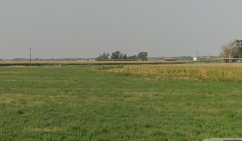
Godfreys Station/Ft Wicked - south of Merino 6N54WS35SE 40.44433160419779, -103.38195515543414
Even by 1873, the trail was called "The old Platte Wagon Road"
Not originally a stage station, the Godfreys operated a store here for travellers until 1867. It was known as Godfrey's Ranch until the Godfreys successfully defended the ranch against Indian attacks. Godfrey then gave it the name Ft Wicked. The site was abandoned after the railroads came, the sod buildings dissolved with the weather, and the trails were filled in or plowed under.
Not easily visible on this map, the road travelling up the mid-section line is US6/I-76BR to Merino
Ft Wicked - located just inside the cornfield in center
1865 Frank Williams, a traitorous stage driver, was tracked to Godfrey's stage station and captured by the Montana Vigilantes, who returned him to Denver and hanged him.
Col. Robert R. Livingston (1st NE Cavalry) reports a skirmish with Indians at Godfrey's Ranch on January 14, 1865
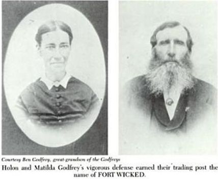
On January 14, 1865, about 130 mounted, painted warriors attacked Holon Godfrey's ranch on the east side of the South Platte, thirty miles northeast of Fort Morgan. Inside were the 52 year old Holon Godfrey, his 42 year old wife, Matilda, two of their daughters, 14 and 21, their six year old son, three month old daughter, and several men.
Holon was not unprepared. His ranch could be better characterized as a fortress, surrounded by six foot high adobe walls with one completed tower and one under construction, with port holes all around the compound.For two days, the Indians laid siege to the ranch, setting the surrounding prairie, the fodder for the animals, and the Godfrey's roofs on fire. They attacked with periodic sorties, raining arrows and bullets down on the defenders for the full two days.
When dawn broke on the 16th, the Indians were gone, leaving seventeen dead braves behind. There were no casualties in the compound. Holon Godfrey's resourcefulness and preparedness had saved his ranch, while many of his neighbors were being killed and driven off.
When Godfrey learned that the Indians had named him "Old Wicked" for his efforts during those two days, characteristically, he cackled and then nailed a sign up over the compound's entrance:
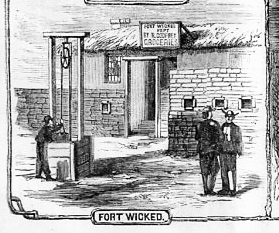
FORT WICKED Kept by H. Godfrey Grocery Store
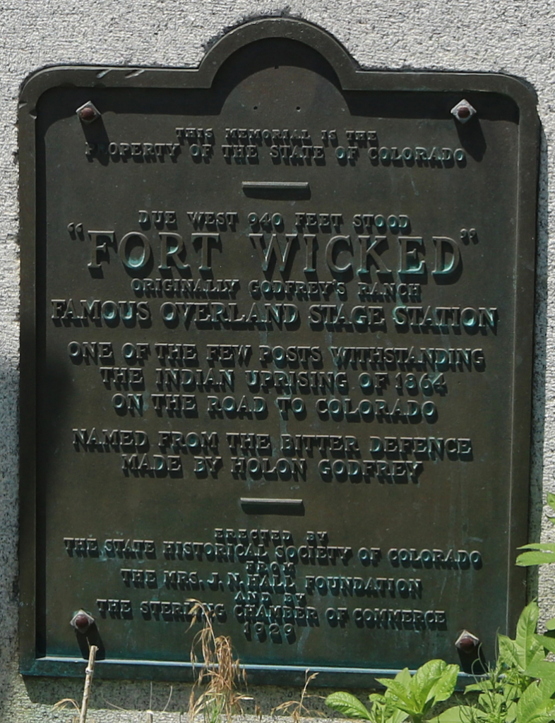
Godfrey went on to be one of the largest cattle ranchers in the West. Matilda died in 1879, while Holon Godfrey died at the age of 88 in 1899.The ranch and Fort Wicked are long gone as well but there's a plaque and historical marker at the site of the ranch and battle on the side of Highway U.S. 6 about three miles southwest of Merino, Colorado.
“…We saw a great many Indians and passed a great many villages, some large ones. At first they were Sioux and then Cheyennes, the Arapaho Indians occupying the territory immediately east from the mountains. Of the three tribes, the Sioux were much the most numerous; but all three tribes had been friendly for generations and their language was very similar. The end of that week, Sunday 27th, found us camped on the south bank of the South Platte, a little east of Beaver Creek, and about five hundred miles from Nebraska city…. At this point we began to meet some returning pilgrims, with tales of disaster and impending attack from the Indians; the latter rumor did not disturb us because the presence in all the Indian villages of the usual number of squaws and papooses was a sign of no immediate trouble….
This is about 12 miles from Kellys and 19 miles from Bijou
1864, July 2 Indians killed two emigrants on the stage road near Beaver Creek. Later in the month ·they killed two more near Junction Station.
Beaver Creek was another 12 miles beyond American Ranch. Diaries of the west-bound travelers noted this as the place they would get their first view of the Rockies.
The station itself was built in 1864 and consisted of two log structures having two rooms each. Until burned out by Indians in January of 1865, this was a home station with meals available.
The actual location is unknown - the station is marked as at the proper distance and at a water source.
1871 and "now" maps super-imposed
While coming east along the Platte, early one evening during the summer of 1863, a rather singular accident befell us, while we were bowling along at the usual gait. Just after sunset the off front wheel of the stage — the one directly under the driver's seat — ran off the axle. Before any one on the coach had time to even think, there was an exciting runaway. The team was full of life, and in its wild dash down the valley it seemed that it sped with almost the rapidity of a fast-mail train. I expected every minute to see the driver tumble headlong off the box ; so held on to him as best I could with one hand, saving myself with the other. With my assistance he managed to keep his seat. For 200 or 300 yards or more the four horses fairly flew ; they went so fast that the axle was kept from dragging on the ground. Finally the driver, by application of the brake, succeeded in bringing the team to a halt.
Climbing down from the box, I ran back to find the wheel and the missing nut. I knew when the wheel rolled off and where it should be found, but it was some time ere I succeeded in finding the nut, which was accomplished by the aid of one of the coach lamps and a careful search. Inside the stage were five or six frightened passengers, but they all had to alight and help lift to enable us to get the wheel in place, so as to proceed on our journey.
Junction Stations ...
Plural as there were several "Junction Stations" - perhaps as many as five - set in this area near present-day Ft Morgan area as different paths heading SW to Denver were developed. Upstream - west-bound - from this area, the river swung NE for many miles before swinging SE again. A cut-off from this region shortened the distance to Denver and avoided a bad stretch of trail between Bijou Station and Freemonts Orchard ... but had its own problems as well.
1867 - showing multiple junctions
Locating these junction stations has proven difficult; most surveys of the area were completed after the Overland/Wells-Fargo lines no longer ran and the area showed significant development in the five years between 1869 and 1874 as the danger of Indian attacks had lessened considerably and ranches were developed along the bottom-lands of the river.
The first and main cut-off was established at Ft Morgan - or Ft Tyler at the time. It was constructed in 1864, about 18 miles upriver from Beaver Creek. A swing station named Junction was established and a company of Colorado cavalry was stationed here during the time of Indian raids. However, several other "Junction Stations" were established in the region.
Setting a discussion of Ft Morgan aside for now, there were two other possible locations fitting the descriptions:
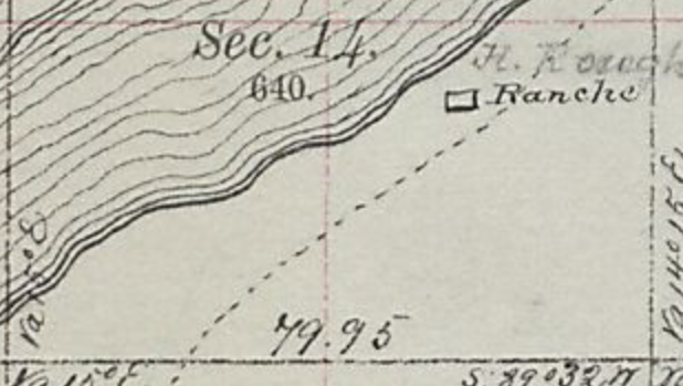
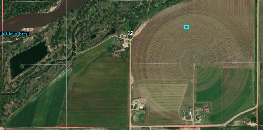
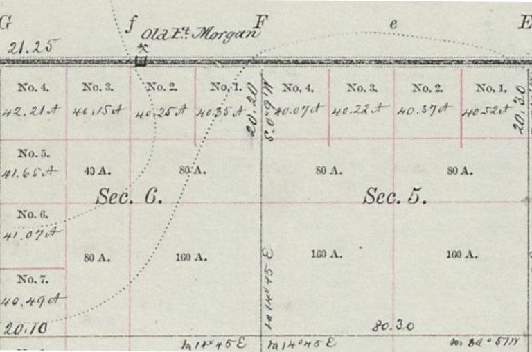
The 1871 map shows the trail passing by the "H. Ro(ce)gh Ranche". The map does not indicate a junction at this point - but then, many of the survey maps neglected to place the trail or the tracings have faded over the years.
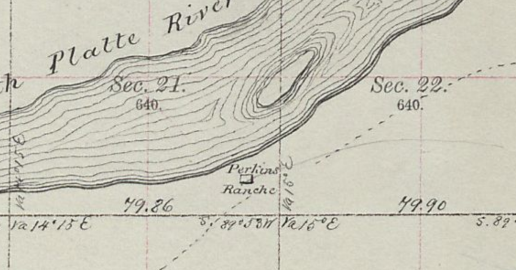
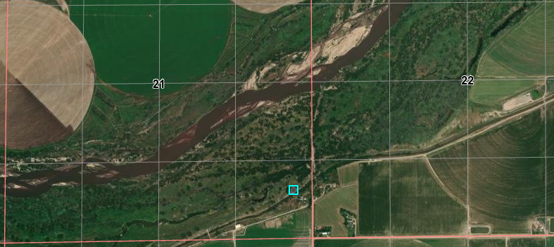
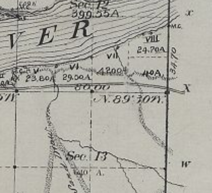
Some records suggest a location for "Junction Station" at what later became Perkins Ranch. So named as the trail split here; one branch heading SW to Denver, the main branch continuing along the river; there were at least five stations known as "Junction" so pin=pointing any one as the "Junction Station" is difficult.
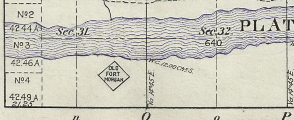
A fur trading post was established in this area in 1838 by a Sam Ashcroft. Later, the site was selected for Camp Tyler, built in 1859 three miles east of the mouth of Bijou Creek along the safest route to the Pikes Peak diggings. It was constructed of log-reinforced sod, located near an Indian crossing of the South Platte River, and used to guard the stage line and nearby ranches. The fort supported a detachment of 150 cavalry troops of galvanized Yankees, later by infantry. The camp was named for a volunteer military unit from Central City. In 1865 the name Camp Tyler was changed to Fort Wardwell, then on July 14, 1865. to Camp Wardwell. A year later, the camp was renamed Fort Morgan. The site of the fort is right on the south bank of the South Platte at the Junction Ranche, the site of the trading post.
The fort had officer's quarters, servant's quarters, lookout towers, flag tower, magazines, close guard houses; long mess rooms, bunk houses, stables, and raised rooms on the southwest and northeast corners of a stockade, each with a 3-inch Parrott gun. The last company stationed at Fort Morgan was of infantry in September 1867. The fort was abandoned in May, 1868 when the railroad reached Denver and the post no longer needed. The remaining detachment was moved to Fort Laramie in Wyoming.
The cutoff was established in October 1864 by Ben Holladay to save about 40 miles and three days travel to Denver as well as attempting to avoid a rough stretch of road and Indian attacks further up the South Platte. By December the military officials had ordered Holladay to officially adopt this cutoff, bypassing the stage stations between Fort Morgan and Latham, and the post was temporarily named Post Junction. The cut-off was built along a wagon trail which had been used by freighters as early as 1860. Even though water and good grazing were not as plentiful as along the South Platte, Holladay felt that the savings in time was well worth it. Post Junction Station was built as a home station when the cut-off became active. As a home station, it provide storage for supplies and held a telegraph office. The far to Denver was $3.90.
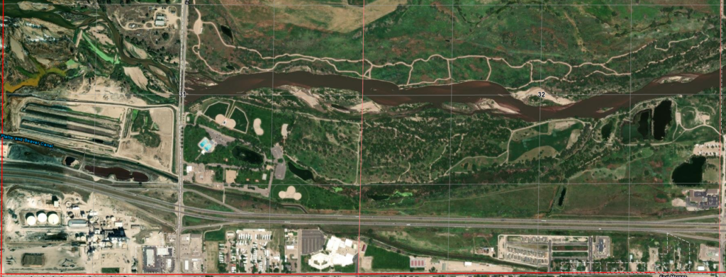
The town of Ft Morgan wasn't established until 1884. Nothing remains of the original fort but a marker in a city park. The city proper lies south of present day I-76 while the stage station was slightly north of the expressway. The Ft Morgan exit off I-70 lies on the former fort grounds
4N57WS31/32 now
Both of the older maps post-date the active Overland operation but the trails would still be used for local stage lines and freight. The 1869 map unfortunately doesn't show the trail but the 1874 map which fits directly below the upper map shows what appear to be the cut-off trails. Since the cut-off was established in 1864, it is assumed the earlier trail passed through Ft Tyler as it was known at that time and continued along the South Platte to Bijou Station, only a few miles upriver from Ft Tyler.
Get fairly early start. Rough is quite well, and if there is no alkali in the soft ground the cattle will do very well. Find some beautiful flowers. See 8 cattle and 2 horses that have died lately, before 1 o’clock. Went to a grave and it had on it G. H. Hopkins – died June 7th, 1860 from Deboque [sic], Iowa. We passed the cut off soon after. We find some sand hills but keep on up the platte as we have been advised to do. We have crossed two alkali sloughs and are now within 7 miles of Fremont Orchard. We camp tonight across an alkali slough where two of the company’s wagons and two others get stuck, they get out after a long time and by that time the wind begins to blow….
There are no modern roads which follow the trail between Ft Morgan and just west of modern Orchard
A Slight Detour - Touching the cut-off trail a bit south to Denver
Examining a bit of the cut-off route to Denver ...
There is some dispute over exactly where some of the stops or stations were located along this cutoff. The Tegler Ranch, located about 14 miles to the southwest from Fort Morgan may have been a station. It definitely was a spot where the coaches could stop.
These map sections show a location roughly 14 miles along the cut=off trail. No ranch is indicated on the older map - which is not surprising - and the site of the stage road today is now irrigated cropland.
A little further on along the cut-off trail, a section that once contained a trail of heavy traffic now shows no sign of the trail
Section 28
40.19533814445095, -103.98022020324836
The two maps super-imposed
Looking across this location - public access not allowed - probably doesn't look too different than it did in the 1860s
Two other ranches, located about one mile apart, the Allred and the Graham Ranches, may also have been the site of a station. These are about 15 miles south of the Tegler Ranch. There is an old building on the Graham Ranch which local tradition claims to have been an Overland Station, and where Indian raids and stage holdups took place.
There was a point where the cutoff divided into the "new" cutoff and the "old" cutoff. Since this section of the trail went over an area of sand dunes, the two routes paralleled each other for 20 miles or so. A station was built right at the base of the bluffs along Rock Creek on the "new" cutoff. This entire section of the trail went over an area of sand dunes. It is possible that the "new" cutoff was just avoiding difficult terrain.
ON Monday morning last, Mr. Beard and I took our seats in the overland coach, at Denver. Our hopes of a comfortable trip were blasted at the outset: there were seven passengers for Fort Kearney, and four for the “Junction,” [Fort Morgan] as it is called, on the Platte. The fare of one hundred and twenty-five dollars which one pays the Holladay Company, is simply for transportation: it includes neither space nor convenience, much less comfort. The coaches are built on the presumption that the American people are lean and of diminutive stature — a mistake at which we should wonder the more, were it not that many of our railroad companies suffer under the same delusion. With a fiery sky overhead, clouds of fine dust rising from beneath, and a prospect of buffalo-gnats and mosquitoes awaiting us, we turned our faces toward “America” in no very cheerful mood. The adieus to kind friends were spoken, the mail-bags and way-bill were delivered to the coachman, the whip cracked as a sign that our journey of six hundred miles had commenced, and our six horses soon whirled us past the last house of Denver…. Toward evening the clouds lifted for an hour or two, and we took our last look at the Mountains, lying dark and low on the horizon. The passengers for the Junction were pleasant fellows, and I mean no disrespect in saying that their room was better than their company. After sunset another setting in of rain drove them upon us, and by eleven at night (when we reached their destination) we were all so cramped and benumbed, that I found myself wondering which of the legs under my eyes were going to get out of the coach. I took it for granted that the nearest pair that remained belonged to myself…. The coach is so ingeniously constructed that there are no corners to receive one's head. There is, it is true, an illusive semblance of a corner; if you trust yourself to it, you are likely to lean out with your arm on the hind wheel. Nodding, shifting of tortured joints, and an occasional groan, made up the night. There was no moon, and nothing was visible except the dark circle of the Plains against the sky.
Tuesday night, the 29th, [May 1860] we camped on the bank of the Platte where the new trail called “The Cut Off” leaves the round-about river trail and strikes straight across to Denver. We understood that as our teams were in such good condition it was possible for us to go through in two good days travel. The only real trouble was said to be the very poor water and a great scarcity of it. But it was finally decided to take “The Cut Off” trail, although it was also said to be a very sandy heavy track. So Wednesday morning, May 30th, after having filled every keg, canteen, or other utensil in which a little of the Platte River water could be carried, we left the river behind us and hit the new trail for Denver. That night we camped near a stage station where we could get water for the teams. Thursday we traveled on through a region apparently made up of sand, cactus, and Prairie Dog towns, and at night camped on Kiowa Creek, a little very brackish water along in pools. Friday morning we drank the last of the Platte River water and hit the trail early, expecting to be in Denver before night. The next water was said to be a little shallow pond of surface water about half way between Kiowa Creek and Denver. It proved to be a very hot day and before noon we began to suffer for water. About noon we came to the place where the pond had been, but there was no water, just a small area of damp soft mud, all tracked up by the feet of men and of animals, wild and domestic. We tried digging for water but got none. Gave the teams some grain but they ate very little. We ate what we could of some cold corn bread and raw side meat, then started on.
At sundown with Denver still at an unknown distance, we stopped to rest and feed the teams, but they would not eat; neither could we. Things began to look very serious much of the trail was very sandy, and the loads cut deep and dragged heavily. Fortunately the moon was at the full, sailing high in a cloudless sky, and as night came on the air got cooler. We started on again, hoping as we came to the top of each roll in the prairie, to see the lights of Denver below us. I shall never forget the hours that followed as we toiled on in the moonlight, with frequent stops to rest the exhausted teams, and then with whip and voice urging them to drag along the heavy loads. My thirst was also becoming unbearable – torturing. At last, somewhere near midnight as we came up on a little rise of ground and stopped for a moment, our mules cocked their ears forward and began to he-haw – he-haw most vigorously. I think that was one of the sweetest strains of music that I ever heard, for it told us that the mules smelt water ahead. We had no more trouble urging them forward. A mile or so farther and from a little rise in the prairie, we looked down on a host of twinkling lights that said Denver lay before us .”
Beginning with this article, each of the stations are discussed east to west - at least as far as what information is available.
Starting at South Platte Station - at the present junction of I-76 and I-80 in western Nebraska, this page stops at Julesburg to ramble on about all four versions of Julesburg, Ft Sedgwick - the inspiration for the fort in Dances With Wolves, and the notorious Jack Slade, who gets a side page to himself and his legend.
I'll head west ... from the junction of I-80 and I-76 in Nebraska to the junction of I-80 and I-84 in Utah, skipping the detour to Denver.
Straight ahead ... Heading southwest in Nebraska on I-80 - Colorado, I-76, and the South Platte River route is just ahead. The gravel road to the right is called "Trail Road"; the South Platte River is to right among those trees The South Platte Station site is just beyond trees to left- the first station of my journey. I-80 to Cheyenne passes over and actually cuts off NE to the right just beyond the small speck of green signs up the road in the center
The South Platte River flows east. Travelling west is heading upstream.
Station locations are given as Township/Range/Section/Quadrant/Sub-quadrant as well as lat/long. Often the specific location is "best guess".
The original trail was a military road to Fort Bridger in western Wyoming with the intent of avoiding the Oregon Trail to the north. The road was completed late 1858 and opened to both military and civilian use. By 1859, Denver's Rocky Mountain News (one of my favorite newspapers until it died in 2009) was printing guides to the Overland Trail for travellers.
Indian attacks along the Oregon Trail and a gold rush near Denver caused Ben Holladay to change the route of the Central Overland, California and Pikes Peak Express Company south to follow the South Platte River gaining access to the growing business along Colorado's Front Range towns, then north through Virginia Dale and along southern Wyoming to Fort Bridger and eventually Salt Lake City.
The trail was recognized by the army as one difficult due to lack of water, grass and fuel but improvements were made as the stage line expanded its facilities and the nation's second telegraph line was constructed along the route.
The last station in Nebraska following the South Platte River; less than 5 miles from the Colorado border.
Comparing the 1871 maps to the later ones, the site has long since been plowed under and it was located near what is now the center pivot of an irrigation system - it is not surprising there are no remains.
The modern map to the right shows the junction of I-76 cutting south towards Denver from I-80 heading towards Cheyenne.
Section07 - 1 mile on each side; 640 acres I-80 to Cheyenne/I-76 to Denver junction station location indicated.
There is little to no information about this station. Aside from the obvious historical marker, it is only mentioned on some lists of Pony Express stations but not all, it is also mentioned in Frank Root's memoirs - but neither provide any information other than its existence.
Being between Diamond Springs which was a major junction - splitting between the Oregon Trail and the South Platte trail - and Julesburg, itself a major division station, the South Platte station was most likely nothing more than a minor swing station constructed of sod and logs and placed for convenience. Much traffic passed this way as Julesburg - the next station west, was a major supply point for both those travellers headed along the Overland route and those who avoided Ash Hollow and used the Upper California Crossing to head back north to Ft Laramie and the original Oregon Trail after refreshing supplies.
There is a historical marker due north of the site along US138, north of the river and expressway
Google map Highway marker at top; measured 1.5 mile south
Merged with 1870 map Stage road is south of I-80/I-76 here each division is a section - 1 mile square
South Platte Station site center of image; this side of small trees (roughly 1/5 mile out)
Julesburg Station
and Fort Sedgwick
I no more than start the journey, than take a break ...
Julesburg was such an important station with a complex history that it - along with nearby Ft Sedgwick - deserves a page dedicated to both these places.
First, many words about old Julesburg's most famous resident ...
Jack Slade
The infamous Jack Slade - perhaps with a reputation not fully deserved - was a division superintendent in the early days and a major part of the history of Julesburg.
"On the eve of the Civil War, on the sole street of Julesburg in the northeastern corner of what would become Colorado, two antagonists faced off for the first time. One was long-haired Jules Beni, the namesake hamlet’s hulking, swaggering French-Canadian boss. Old Jules was suspected of tampering with the mails and stealing horses from the Central Overland stagecoach line and its famous offshoot, the Pony Express. His younger, shorter opponent was the red-haired company agent who had arrived to replace him." Dan Rottenberg
One of the best-known desperadoes the West ever produced was Joseph A. Slade, agent of the Overland stage line on the central or mountain division, about 1860, and hence in charge of large responsibilities in a strip of country more than six hundred miles in extent, which possessed all the ingredients for trouble in plenty.
There was such magic in that name, SLADE! Day or night, now, I stood always ready to drop any subject in hand, to listen to something new about Slade and his ghastly exploits. Even before we got to Overland City, we had begun to hear about Slade and his "division" (for he was a "division-agent") on the Overland; and from the hour we had left Overland City we had heard drivers and conductors talk about only three things -- "Californy," the Nevada silver mines, and this desperado Slade. Mark Twain - Roughing It
I ended up writing so much about Jack Slade instead of the stage station, I added an addendum as a separate page. Slade is also discussed along with the Virginia Dale station - named for his wife, Virginia. For more on Jack Slade including the story told by his biographer, Dan Rottenberg, see this
Julesburg Station (Julesburg 1)
11N45WS10 (based on historical marker) 40.94222411272488, -102.36182779279535
In 1856, U.S. Army Lieutenant Francis Bryan found an Indian trail on the south side of the South Platte River with an easily crossed ford to the north bank. With increasing travel westward, it was a place that allowed the avoidance of Ash Hollow where emigrants had a hard time traversing the 300 foot hill at a 25-degree angle.
Upper California Crossing at Julesburg 1
Originally referred to as the Upper California Crossing (the lower crossing being about 20 miles downstream, just west of present-day Brule, Nebraska), Jules Beni set up a trading post on the south side of the river in about 1857. As traffic at the crossing increased and people began to settle around the trading post, some half-dozen buildings were built including the necessities - a saloon providing billiards and the "vilest of liquor at two bits a glass" as well as a restaurant.
Julesburg became a focal point for several trails - a crossing point to the Oregon and Bozeman trails to the north as well as the South Platte route to points west. Travellers would avoid the problems of Ash Hollow along the North Platte in Nebraska, swing south to Julesburg where supplies were often available, then cross the South Platte heading north to re-join the original California/Oregon Trail.
The settlement became the largest along the 350-mile stretch between Fort Kearny and the Pikes Peak gold diggings west of what was to become Denver. Seeing financial opportunities, Beni expanded his establishment to include a warehouse, blacksmith shop, and stable. The settlement became known as Julesburg after its proprietor. Julesburg was a gathering place for gamblers, horse thieves and desperadoes, all under the control of Jules Beni. Alone on the vast prairie, Julesburg was a wild town of of wild times, loose women, and the mining of travelers.
When the stage lines first came through in 1858, Julesburg was the natural place to establish a major station and in 1860, it became a home stop on the Pony Express. After the Pony Express failed in 1861, Ben Holladay made Julesburg a division station for the Overland Stage with Jules Beni the station agent.
Holladay tried to call the place Overland City but that name didn't catch on. This was the first of four towns of the same name at four different places all within a few miles of each other. They are referred to as "Julesburg 1-4" for clarity even by local residents but the number was never included in the name.
The 1860 federal census was the first of the Nebraska Territory which included the area north of the 40th parallel (the present Nebraska/Kansas border) - extending west along a line just south of present-day Boulder, CO over to the Continental Divide. Within the Platte River district were counted only 173 residents with Julesburg being the largest settlement. There were 7 station keepers, 10 traders, 5 stage drivers, and 2 express riders but less than 10 families with children.
"At Julesburg - in early staging days one of the most important points along the Platte - were erected the largest buildings of the kind between Fort Kearney and Denver. They were built of cedar logs, hauled from near Cottonwood Springs by oxen, a distance of 105 miles." By 1865, Old Julesburg had 12 buildings, including a station, telegraph office, blacksmith shop, warehouse and shed for coaches, stable, and a store for travellers. It was a home-stage station, the end of a Supervisory Division, and with a river crossing, the junction of the Oregon and Overland Trails. It also was the southern terminus of the Bozeman Trail."
"From Old Julesburg a branch line went up the South Platte River to Denver. The coaches ran semi-weekly on a seven day schedule during summer, but weekly in the winter. Each stage could carry eight passengers; cost was $100 from Leavenworth to Denver, board included. The stage stopped every 10- 15 mi to change the four-mule-team or for the passengers to eat. The passengers had to sleep enroute.
The express charge for letters was 25 cents in addition to 3 cents U.S. postage, for newspapers 10 cents, and 20-40 cents a pound for express. When the branch line was established along the South Platte, route stations were built at frequent intervals (generally 12-15 mi apart) including stables capable of holding 2 four-mule teams. Ranches and trading posts also were established and housed the stage stock, drivers, and other employees."
There are no known photos of the original Julesburg; this sketch is the only known illustration.
A stone monument was placed in 1931 near the site of the Old Julesburg stage station (1859) about one mile east of the mouth of Lodgepole Creek, on County Road 28 about three miles southeast of the present town.
Historical marker on County Road 28 40.93882324995625, -102.36179969448717
40.94222411272488, -102.36182779279535 11N45WS10 apparent traces of the stage road at approx location of old Julesburg agrees with 1871 maps This upper trace of the road extends 3/5 of a mile west and becomes the modern "River Road" along which the fort was located
Between January and February of 1865, the Overland Trail was repeatedly attacked by Indians. They burned twelve ranches, destroyed 100 tons of hay, and attacked a large 20 team wagon train. Over 1000 Arapaho, Sioux, and Cheyenne attacked and destroyed all the buildings at Julesburg and took down the telegraph line all the way to Valley station. The burning of Julesburg station was the greatest financial loss of any station on the stage line. Holladay reported to Congress losses of $35,000 for buildings, $1500 for hay, $78,000 for 3500 sacks of corn, provisions for $2000, for a total of about $115,000.
1865, Jan. 7 At about 7: 00 A.M. 1, 500 Cheyenne, Sioux, and Arapaho Indians attacked Old Julesburg. They enticed the soldiers under Captain O'Brien out of Camp Rankin and killed 5 civilians and 15 soldiers of the 7th Iowa Cavalry, took over the stage station, destroyed the mail, and took $30,000 in money. All stations on the main line and every ranche except Moore's Ranche on the road between Julesburg and Valley Station ultimately were burned.
1865, Feb. 2 Old Julesburg frame home station and eating house, warehouse and granary, dwellings, boarding house, express offices, blacksmith and repair shop, large barn, store, telegraph office, stable, corral and supplies were burned by 1, 500 to 2,500 Indians; a large quantity of supplies was taken; part of the telegraph line was torn down; and about 1,500 cattle were stolen between Old Julesburg and Washington Ranche. After the raid on Julesburg, the Indians departed northward along Lodgepole Creek, and destroyed the telegraph line as they went.
The Burning of Julesburg
The town was rebuilt a few miles east of the fort (Julesburg 2) - outside the boundaries of the military reservation it is said, so that liquor and women could be sold to soldiers posted at the fort.
About a year after the destruction of the original Julesburg in February 1865, the town was rebuilt - but not on the original site. Moving three miles down river put the town outside the military reservation where whiskey could not be sold; the site of Julesburg 2 was on the edge but just outside the fort boundary. Soldiers could come and buy all the liquor and other pleasures they desired.
Julesburg 2 was planned to be a substantial town. Enthusiastic organizers, knowing the Union Pacific Railroad would be coming along soon, planned a town a mile long and half-mile wide with 13 streets running east-west and 13 streets running north-south.. They left a 58-foot wide path for the railroad tracks. Room was allowed for a county courthouse and, hoping to establish the state capital here, set aside a larger area for the state capital building thinking that if Julesburg would have the only railroad in Colorado at the time of statehood, it would become the capital (not considering the money was in the mountains west of fledgling Denver).
Dream big ...
By July, 1866, it was reported the town had a two-story hotel nearly completed, a store, and a billiard room. There were also three ford crossings on the river and later a ferry.
However, by 1867, Julesburg 2 was still only a little town of three completed buildings, all rude frame shanties, by the time the railroad end-of-track reached what would become the third Julesburg on the north side of the river. After the railroad arrived, the entire town was packed up, moved across the river, and located next to the rails (Julesburg 3). The not-for-long remnants of second Julesburg served as a station for wagon trains even after third Julesburg was established. Nothing now remains, not even foundations.
1866, Feb. 7 Second Julesburg was laid out about a year after Old Julesburg was burned. on February 2, 1865. Second Julesburg was established just east of the boundary of Fort Sedgwick (in order that whiskey could be sold to the soldiers) and 2 mi east of Old Julesburg. The town extended 1 mi along the river, was 1/2 mi-wide, and had 150 people and 50 houses at its maximum. In February 1866, Second Julesburg contained "one frame store, one frame house, one log house for a blacksmith shop (last two not completed yet) and 2 houses· now lived in by settlers."
The stage road is indicated on these maps.
The pinpoint location suggested on the 1873 map below would only represent part of the city, being planned out as a full half-section. The trail ran about ½ mile to the north which might suggest the actual location of the structures in town - such as it was - might lie under I-76.
11N45W 1887 Trail inside the formal military reservation boundary
11N44W 1873 Showing Julesburg 2 with I-76 in CYN
11N44W 1887 Detail of the reservation boundary showing the stage road
Julesburg 2 11N44WS18 the RED square is 1 mile on a side - one full section The town was platted as ½ x 1 mile in size
Julesburg 2 Fort Sedgwick eastern boundary in CYN I-76 diagonally across top
Locations of Ft Sedgwick, Julesburg 1 and Julesburg 2
Ft Sedgwick and Old Julesburg locations in MAG to left; Julesburg 2 at MAG dot to right; Overland Route in CYN dots; I-76 cuts diagonally across the right bottom Ft Sedgwick historical marker in PUR to left
Opportunity opened a door when the railroad arrived in June 1867. Even though on the north side of the river, the Overland Stage had been taken over by Wells-Fargo, stage traffic was dying with the advance of the railroad, and money was to be made at end-of-track. Julesburg 2 was packed up and re-located next to the rails to become Julesburg 3. The new Julesburg started out with forty men and one woman, all living in four tents, with an eating house under construction.
Being at end-of-track, it only took a few weeks until the town grew to several thousand inhabitants with over 1000 buildings - mostly dedicated to the "various joys of life" but including a large warehouse and telegraph office operated by Wells-Fargo. Railroad men, soldiers, gamblers, "painted ladies", and other odds and ends of various people, all contributed to a growing reputation as the "wickedest town of the west". Saloons, gambling houses, and "prostitution parlors" were thriving businesses prompting both men and women to go about fully armed.
As end-of-track moved on, it was inevitable that those businesses serving the needs of the construction workers and their friends moved on as well. The town slowly faded from its bawdy days but remained an important shipping point - under the new name of Weir - until those needs also faded away and Weir became first simply a siding on the railroad and finally no more than a name on a map; nothing remains at the location once considered "the wickedest town in the west" to suggest it ever existed there.
This map - from 1884 - indicates that "old Julesburg" was located at a railroad section house even now labelled as "Weir"
1951 map showing Weir
Weir location now
Julesburg 3 site once a town of 5000 people and 1000 buildings
showing two railroads
On an 1872 map of the boundaries of the Fort Sedgwick reservation, there are two railroads indicated: the UPRR and the Julesburg Shortline RR. The Julesburg Shortline is indicated on both sides of T11NR45W at sections 1 and 6. There is no information in between; it is simply a map of the boundary. I've found no information about such a railroad as the Julesburg Shortline, but as this is an official map, I doubt it was made up by the artist.
There is also an 1872 sketch showing the general layout of Ft Sedgwick shortly after de-commissioning which indicates a "Julesburg" along the UPRR which is in the same location as the "Julesburg Shortline" on the east side of Lodgepole Creek. This sketch also indicates "Old Julesburg" which corresponds to Julesburg 1.
Perhaps there was a small, short-lived station to service the fort which was informally known as Julesburg. The indicated tank is where the town of Ovid formed towards the turn of the century on the north bank of the South Platte just above what is labeled here as Crow Creek.
Mysteries abound ...
1872 Layout of Ft Sedgwick - note split of trail ("Upper California Crossing") and location of "Old" Julesburg The fort was active between 1864 and 1871; Old Julesburg was destroyed in 1865 A railroad - also UPRR - still exists in this location.
The railroad and bend in the river are still visible The town is Ovid
Julesburg 4
12N44WS28 40.98616186495653, -102.26197247320312
To complete the story - well after the time of stagecoaches - the Union Pacific Railroad built a branch line to Denver in 1881 a few miles east of Julesburg 3 and named the facilities Denver Junction. Julesburg 3 had been fading away and renamed Weir, most residents moved to Denver Junction. This lasted for a few years but another town with the same name was creating problems for mail sorting and delivery.
So the Post Office requested an increase in postage, new facilities, and additional funding for labor-saving devices.
No they didn't, but the Post office did request a name change.
Denver Junction/Julesburg(4) Depot this station was replaced in 1930
This Denver Junction not being the first to use the name, a new name was needed. Local sentiment was in favor of maintaining the connection to Jules Beni - residents of Julesburg 3 outnumbering those of Denver Junction -so the town was incorporated in summer 1886 as yet another Julesburg, this - the present town - being Julesburg 4.
Downtown Julesburg 4
Fort Sedgwick
11N45WS09SWNW 40.946544281063574, -102.38122158380403 - approx location of flagpole
Camp Rankin, then Fort Rankin, then better known Fort Sedgwick - was located near the stage station at Julesburg 1. It has been said that Ft Sedgwick was the inspiration for the abandoned fort in Dances With Wolves although the movie presentation does not reflect the reality of the actual fort - though perhaps the early days of Camp Rankin would be a better representation.
Camp Rankin was established in 1864 with a few sod huts about 1 mile from the Julesburg stage station in order to provide protection to the US Mail and telegraph lines as Indian raids became increasingly common. Both the fort and settlement were attacked in January 1865; several soldiers were killed and the town looted.
A small band of Cheyenne attacked a stage coach and wagon train in early January, 1865. When news of the raid reached the camp, 37 troopers were sent in pursuit. The Indians pulled back into the hills and the soldiers followed. Oops! Suddenly finding themselves almost surrounded by over 1,000 warriors, the soldiers managed to fight their way back to the camp and regrouped, using two cannon to keep the Indians away. Meanwhile, some of the Indians moved into Julesburg, looting the town. By the end, five civilians and fifteen soldiers were killed.
Cheyenne version of the January 1865 raid on Ft Sedgwick a wounded soldier trying to escape
In February, the Indians attacked again; they failed against the fort but this time, the settlement was totally destroyed. By 1866 - after the destruction of the original Julesburg - the camp had turned into a full-fledged military installation.
Not Sedgwick but a typical military outpost of the time
Various documents from the time indicate a lifestyle of boredom and terror led to a life at the post of a "saga of fraud and corruption, bravery and daring-do…triumph and tragedy…where conditions were considered unlivable, pleasures were few and the nearest bath was the South Platte River".
The fort was inspected in September 1866. The report stated: "The general character of post buildings was found to be bad, and is believed to be a fruitful source of discontent, desertions. One post inspected had lost 25 men by desertion in one month, with their cavalry horses, accoutrements, Spencer carbines, complete, and many instances of this kind were reported to me. In fact, no humane farmer east would think of sheltering his horses or cattle in such uncomfortable and wretched structures, huts, willow-hurdles, adobe shanties, as compose many of our posts in the new States and Territories now"
The cost of wood was between $75 and $100 per cord at Fort Sedgwick, where there is not a tree for 50 miles .
The post was abandoned in May 1871 and the buildings were dismantled. The soldiers at the cemetery were reburied at the Fort McPherson Natl Cemetery in Nebraska.
1872 Layout of Ft Sedgwick - note split of trail and location of "Old" Julesburg The "Julesburg" on the railroad is now known as Ovid The present town of Julesburg is about 7 miles east of the "Julesburg" shown here The fort was active between 1864 and 1871 - there is no record of a "Julesburg" being at the upper location noted
County Rd 28 - from 385 just off I-76 at modern Julesburg is a close approximation of the trail from Julesburg 4 to the Sedgwick site (now an irrigated field). The stage road on the above map is about ½ mile north of Rd28 at the road into Ovid.
Formal boundary of the Fort Sedgwick Military Reservation encompassing almost all of T11NR45W, all of T12NR45W in Colorado, extending about ¼ section west and north slightly into Nebraska
The military boundaries of Ft Sedgwick measured 7 miles by 8 miles, taking the almost the entirety of T11NR45W and T12N45W (½ mile above the lower sections) with a mild extension into R44W and ½ mile into R46W. This had a bearing on where Julesburg 2 was located - to be "off the reservation". I-76 runs E/W through the middle of the former military reservation with the fort itself being located roughly 1.5 mile north of the expressway.
Ft Sedgwick flagpole at RED arrow based on 1872 map. A comparison to older maps indicates that "River Road" is likely the old trail
Ruins of Ft Sedgwick appear on maps as late as 1887
Fort Sedgwick Present day County Road 28 passes through the building (hospital) at lower left
The historical marker on County Road 28 is placed on the site of the hospital (bottom building) 40.93899605297376, -102.37856490730093
Layout of fort
Fort Sedgwick - fort within reservation boundary
Looking east. The dirt road is the Overland Road (River Road); looking out over the grounds of Ft Sedgwick to the right of the trail. The stables would have been front center; the river is in the trees
The four Julesburgs
The Julesburgs + Fort Sedgwick map is about 7 miles EW and 3 miles NS
Joseph Alfred Slade was born in Carlyle, Illinois on January 22, 1831, one of three sons of Charles and Mary Slade. One son William was an officer in the Mexican War, another, Charles Jr, died in the Civil War, and Jack, who became the famous gunfighter of this story. Charles Sr was a prominent politician who founded the town of Carlyle. He died of cholera in 1834. Mary remarried in 1838, having another son with her new husband.
Jack married Maria Virginia (maiden name unknown) in 1857 while a teamster and wagon-master. After a stint as stagecoach driver, he became an agent for the precursors to Ben Holladay's Overland Stage Company, including operations of the Pony Express. Jack ended up killing - righteously, it is told - another employee in 1859 and received the reputation of a gun-slinger. Effective at enforcing order for the company's interests, "the scourge of outlaws", the Overland company promoted him to division superintendent with orders to replace the thieving agent in Julesburg, Jules Beni, and that's the story these words tell.
Fame went to Jack's head as did drinking. He was later fired by the Overland company, moved to the gold fields of Montana where he was hung by vigilantes in Virginia City, Montana on March 10, 1864.
The stories:
Frank Root (1901):
In its palmiest days, during overland staging and freighting, old Julesburg had, all told, not to exceed a dozen buildings, including station, telegraph office, store, blacksmith shop, warehouse, stable, and a billiard saloon. At the latter place there was dispensed at all hours of the day and night the vilest of liquor at "two bits" [25¢] a glass. Being a "home" station and the end of a division, also a junction on the stage line, and having a telegraph office in the southeast corner of the station, naturally made it, in the early 60's, one of the most important points on the great overland route. It was also the east end of the Denver division, about 200 miles in length.
When the express line was moved up north to the Platte, Beverly D. Williams, of Denver — formerly of Kentucky, now of Arkansas — was given the general management of the Jones & Russell Stage Company's business, Jules was placed in charge of the station bearing his name that had been built on the south side of the Platte opposite the mouth of Lodge Pole creek [where Ft Sedgwick was later established]. Socially Williams was one of the best fellows in the world, but as manager of a great stage company's property on the frontier he was not a success. He knew very little about the plains, it was said, and much less of the people residing there. He seemed to look upon every one whom he employed as honest, capable, and efficient, when in reality some of them were at heart scoundrels and thieves, who systematically stole the company's property. Because a man knew the plains over which the stages ran, Williams would venture to hire him as a station keeper. Thus it was that he had in his employ a number of unprincipled rascals, who really ought to have been boarding at the penitentiary instead of living at the expense of the stage officials.
Having been nearly bankrupted by what they believed bad management, the company decided to make a change, and Ben. Ficklin was employed as superintendent. He was a good man for the place, and one who thoroughly understood everything in connection with staging. There was no part of the overland route between the Missouri river and the Golden Gate with which Ficklin was not familiar. He was a man with force of character; likewise he had the "sand'' and courage to carry out his plans. From the date of the change in management there was no longer peace and harmony.
One of the first important moves made by Ficklin on taking charge was the placing of Jack Slade on the road as a division superintendent, having charge of the Sweetwater division, extending from Julesburg to Rocky Ridge, on Lodge Pole creek. Naturally there were some " delinquents " on the line, and Slade exercised his prerogative and made them come to time. He was an untiring worker, at first putting in the most of his time night and day for the interest of the company by which he was employed, as well as doing everything he could for the comfort of the passengers. Special attention was given by Slade to the stage stations; particularly was this so with the one at Julesburg.
The discoveries made by Ficklin showed Jules to be a thief and a scoundrel of the worst kind. Jules was at once made to settle with the stage company. He made a vigorous protest, but had to liquidate, knowing there was no escape. But he was determined on revenge, and accordingly lay in ambush one day and gave Slade the contents of a double-barreled shot-gun, which the latter carried off in his person and clothes. The next stage that passed over the road had Ficklin aboard and his first duty was to hang Jules, after which he drove on. Jules, however, was not ready to die just yet. Before he had quite ceased to breathe some one came along and cut the rope, and Jules revived and fled from that part of the country, remaining for a time in obscurity.
But there was revenge in Jules's heart. He was bound to get even, and he never could get rest until he had obtained what he conceived to be his due. Going up on the Rocky Ridge road with a party of his sympathizers, it was not long thereafter until all sorts of depredations were committed on the stage company's property. How to stop these depredations was a matter of serious consideration. In the meantime Slade had recovered from the wounds inflicted by Jules, and Jules having been seen by some of the drivers, who informed Slade, he asked to be transferred to the scene of the depredations.
Knowing Slade to be a terror to all evil-doers, Superintendent Ficklin made the change. For some time Slade rode back and forth over the line, carefully surveying with his keen eyes every rod of the route. In due time he found where Jules and his cowardly gang were located. With a party of resolute, determined men, Slade came along one day and caught them off their guard. A desperate fight took place. In the engagement Jules was badly wounded and, with no power to resist, he was tied by Slade, and stood up against the corral, when his ears were cut off and nailed against the fence, and bullet after bullet was fired into his body. Thus ended the career of one of the worst men that, up to the early '60's, had ever infested the overland line. For weeks following this barbarous act, one of Jules's ears remained nailed to the corral, while the other, it is said, was taken off and worn by Slade as a watch-charm.
When Slade went into the employ of the "Overland" he was regarded, so far as known, as a fair sort of a man. He had driven, and was an experienced stage man — an important requisite — and no one on the line was ever more useful at the time. He had been a division agent, with headquarters at Fort Kearney. He was a sort of vigilance committee single-handed, and it was through his efforts that the line was eventually cleared of one of the worst gangs that ever held forth on the plains. Jules and his crowd having been effectually disposed of, and matters elsewhere having been attended to by Ficklin's orders, the line was shortly put in perfect order, and from that time on the stages ran with great regularity.
Joseph A. Slade was originally from Clinton county, Illinois. In the later '50's and early '60's, while employed on the "Overland," he often visited Atchison, and would occasionally have a "high, old time" when in company with some of the wide-awake stage boys. He was not the bad man at that time, however, that he afterwards turned out to be, for while in the employ of the stage company he was faithful to the trusts reposed in him.
But Slade, important as his services had been to the Central Overland California and Pike's Peak Express Company during the period of its darkest days, finally went the wrong way. He soon lost all character and was unable to bear up under all the excitement he had gone through. Surrounded by all the alluring temptations and vices of the frontier, he commenced drinking, and finally became a terror to those to whom, in the earliest days, he had been a most-trusted friend, and fell into the ways of the ones he had so long fought on the overland express line.
Jules BeniJack SladeMark Twain meeting Jack Slade
Jules Beni established a trading post and ranch - "wickedest city on the plains." - downstream 1 mi from the mouth of Lodgepole Creek on the south side of the South Platte. [Lodgepole Creek is on the north side of the river where Ovid is now] The site became a stage station but after Beni became the station manager, stage robberies became a constant problem. Beni was suspected and the company replaced Beni with Jack Slade, who became a division superintendent.
The two continuously argued; Beni ambushed Slade in 1860, shot him five times but Slade survived and Beni was arrested and forced to leave town. He returned a year later, continued to steal horses, and attempted to kill Slade again whereupon Slade tied Beni to a fencepost and shot his fingers and ears off. Some say Slade killed Beni at the time, putting the gun in his mouth and pulling the trigger - others that Beni was later killed by Slade's men in August 1861.
Mark Twain mentions meeting Slade while Slade was operating the Virginia Dale Station in August 1861. Although Twain referred too Slade as "a vicious killer of 26 men", Slade is only known to have killed one man named Andrew Ferrin ... although legend - true or not - has it Slade killed Beni in 1861 while Beni was tied to a fence post.
Slade had a drinking problem and was fired by the Overland Company in November, 1862. He was lynched by vigilantes in Virginia City, Montana after a drunken rampage in March 1864.
Some say this occurred outside Julesburg, some say at a Wyoming ranch For a completely different version, see Rottenberg's version at the end
Murder of Jules Beni - Charles Russell (1861)
Slade stood out even among the many rabble-rousers who inhabited the wild frontier-mining town of Virginia City, Montana. When he was sober, townspeople liked and respected Slade, though there were unconfirmed rumors he had once been a thief and murderer. When drunk, however, Slade had a habit of firing his guns in bars and making idle threats. Though Slade's rowdiness did not injure anyone, Virginia City leaders anxious to create a more peaceable community began to lose patience. They began giving more weight to the claims that he was a potentially dangerous man. . . . Finally fed up with his drunken rampages and wild threats, on this day in 1864 (October 10) a group of vigilantes took Slade into custody and told him he would be hanged. Slade, who had committed no serious crime in Virginia City, pleaded for his life, or at least a chance to say goodbye to his beloved wife. Before Slade's wife arrived, the vigilantes hanged him.
The hanging of Jack Slade
Slade's wife, Virginia, rode twelve miles at breakneck speed in vain to his rescue. Refusing to have her husband buried where he would not be remembered kindly, she had his coffin lined with tin and zinc to prevent leaks and filled it with whiskey — the best preservative available at the time. The coffin sat in the front room of her small house in town for three months until the road thawed and, in June, she had the coffin loaded onto a stage to Salt Lake City. There he was interred in a pauper's grave in Block 4, "to be removed to Illinois in the fall," according to the city's then-sexton.
Afterwards, "Life sort of overwhelmed" Virginia. She was married twice more and wound up in St. Louis, just 50 miles from Carlyle, but she either never tried or was never able to have her husband dug up and reburied there.
Buried on July 20, 1864, Jack Slade is still interred in a pauper's grave at the Salt Lake Cemetery.
The story as told by Dan Rottenberg, biographer and author of "Death of a Gunfighter: The Quest for Jack Slade, the West’s Most Elusive Legend"
In the fall of 1859, Slade was transferred to the central division, the most dangerous stretch of the struggling stagecoach line, which in the interim had been sold, reorganized and renamed the Central Overland California and Pikes Peak Express Company. The Pony Express, a horseback relay system that would work with the stage line to deliver the mail, also began to take shape in 1859. Slade bought the right kind of horses (fast but tough) to make the Pony work (which it did from April 1860 until October 1861). But his main orders were to “clean up the line”—which meant, above all, replacing one Jules Beni, the corrupt and incompetent station keeper at Julesburg. Beni had been allowing his outlaw friends to steal company stock, which he would then “retrieve” for a reward charged to the company.
After taking over, Slade quickly established order by conspicuously capturing and hanging a few robbers and horse thieves and letting word of mouth drive out the rest. But in March 1860, his nemesis ambushed him as he entered the restaurant at Julesburg Station. Beni fired as many as a dozen times with both revolver and shotgun before fleeing to Denver. “I never saw a man so badly riddled,” said station keeper James Boner of Slade. “He was like a sieve.”
Remarkably, Slade survived this barrage. In a tribute to his value, the Central Overland transported him almost 1,000 miles by stagecoach and rail to St. Louis, where surgeons removed some of the lead from his body. By June, Slade was back at work, his domain as superintendent extended to cover nearly 500 miles from Julesburg west to the Rockies.
The code of the West demanded Slade exact revenge for the shooting. The Central Overland’s new owner, Ben Holladay, impatiently implored him to “get that fellow Jules, and let everybody know you got him.” Yet for more than a year, while scourging his division of outlaws, Slade made no move to pursue Beni. Then, in August 1861, the 52-year-old Beni foolishly returned to Slade’s division to secure some stock, all the while spouting threats and boasting he was “not afraid of any damned driver, express rider or anyone else in the mail company.” Slade posted a $500 reward for his capture and sent four riders after him while Slade followed in a stagecoach.
According to the most reliable account of what happened next, two of Slade’s men, Nelson Vaughan and John Frey, overtook Beni, wounded him in a gunfight and captured him. They then bound Beni to a packhorse and started for Sochet’s ranch at Cold Spring Station (in present-day Wyoming). To their dismay, Beni died before they arrived. Fearful of losing the posted $500 reward—and of arousing Slade’s wrath—once at Cold Spring, they tied Beni in a seated position to the snubbing post in the corral. Soon thereafter Slade pulled into Cold Spring.
“I suppose you had to kill him,” Slade remarked, “and if you did, you do not get any reward.” Vaughan and Frey insisted Jules was not yet dead, only wounded.
“He’s out in the corral.”
When Slade walked out back to the corral and saw Jules’ inert body lashed to the fence, he said, “The man is dead.” Again Vaughan and Frey insisted that Beni was only playing possum. “I’ll see whether he’s playing possum,” Slade said, taking his knife and slicing off an ear. When Jules did not flinch, Slade remarked, “That proves it, but I might just as well have the other ear,” and took that as well. The gesture— the only barbaric act ever attributed to Slade, at least against a human—added yet another page to his legend.
After Beni’s death, Slade’s reputation was such that Mark Twain referred to him as “a man whose heart and hands and soul were steeped in the blood of offenders against his dignity.” Yet despite his Mr. Hyde–like mutilation of his nemesis, Slade had not gone off half-cocked after Beni and had most likely not been the one to actually kill him. Slade even turned himself in at Fort Laramie. Officers there did not press any charges; in fact, some of them had advised Slade to kill Beni.
Subsequent re-tellings of the Beni killing, explorer and Slade acquaintance Nathaniel Langford noted in 1890, were “false in every particular. Jules was not only the first, but the most constant aggressor.” Slade’s actions were those of a levelheaded and competent division agent who would broker no threat against his stage line. But in the aftermath, as Slade began indulging in his own fierce image, carrying one of Jules’ ears with him as a souvenir, cracks started to emerge in his professionalism.
I took some time to explore what I could of the old route between the last station in Nebraska (near the I-80/I-76 split), down into Colorado, and on across Wyoming to the mouth of Echo Canyon not far into Utah (the I-80/I-84 split). There is not much left except along the Bitter Creek Division in Wyoming ... and not much there either. What's left is likely because that segment is well off the beaten path and while mostly not necessary in good weather, 4-wheel drive and "I'm stuck" equipment is highly recommended. Myself? I wouldn't dream of going out there in a car ... now, although when I was much younger, I wouldn't have hesitated.
Significant remains with easy access include the original Virginia Dale station - probably the most complete but is on private land. i understand tours may be available with special permission. The Point-of-Rocks (Almond) Station still exists in arrested ruins just off I-80 exit 130. Granger Station exists not far off US30 a few miles north of I-80 but is fenced off, and the Fort Bridger site is a state park reconstruction. The others - if existing at all - are sites in a field or piles of rubble. A few pieces of walls still stand along the Bitter Creek section.
With the mining activity in Wyoming since, perhaps much of what I discovered even along Bitter Creek has since disappeared. Much of the route is on private land ... that wasn't me anyone saw crossing that fence.
I explored the route from two directions at different times: East from the junction of I-76 and I-80 to Virginia Dale, Colorado (mostly easy access and not much to see) and west from Echo, Utah back to Virginia Dale with special attention to the Bitter Creek division in Wyoming. There was not much to explore along the South Platte and access was blocked between Wyoming highways 130 and 785 - encompassing the North Platte crossing (where I almost got into a bit of trouble) along with the stations Sage Creek, Sulphur Springs, and Washakie. Access to Pine Grove is questionable - the location is redacted in most documents, leaving only the Bridger Pass Station along a publicly accessible road. However, other than Duck Lake - now under an oil field, the stations along the Bitter Creek route are - or were - accessible at the time I spent out that way.
Route Overview
Eastbound, Colorado - South Platte Station to Virginia DaleWestbound, Wyoming - Granger to Willow Springs
Working westward:
From just NE of the upper NE corner of Colorado at the I-80/I-76 junction in Nebraska - South Platte Station - to modern Wiggins, the route lies between I-76 and the river just to the north; at Ft Morgan, directly under I-76. From Wiggins to Greeley (Latham), the route closely follows US34; crossing the South Platte (and leaving it) at or very near the present US34BR bridge into Greeley. From Greeley to Ft Collins, the route roughly follows the railroad along the Cache la Poudre River. From Ft Collins to Virginia Dale (and north into Wyoming), the route closely follows US287 - although later, the route shifted to the other side of the ridge east of US287 for part of that segment.
After 1864, the main route was diverted to Denver from Latham, continuing to follow the South Platte - roughly US85. Later, the route to Denver split off near Ft Morgan (there were several junctions) where I-76 more or less follows the trail. From Denver, the new main route headed north, pretty much following US36, then a bit west of US287 to LaPorte, re-joining the original route.
Sections of the original trail are now county roads, sections are on private land, sections have long since disappeared into flood plains and drifting sand. Even the earliest maps - produced after the time of the Overland - don't always show the road and rarely show station locations (they were abandoned by the time the surveys were conducted), even if only five years later. Latham - once a major supply and shipping terminal - itself has disappeared into open fields and farmland, faded away to the point where few know (or care) where it was; Greeley to the north-east and on the other side of the river has taken over in importance and population.
From Latham - originally near the confluence of the South Platte and Cache La Poudre rivers until the floods of 1864 - the trail splits. In later days, the main trail cut south to Denver continuing to follow the South Platte, then back north to rejoin the original trail near what became Ft Collins. The original route - Denver wasn't truly a town yet - headed NW from Latham following the Cache la Poudre River, passing through the area that eventually became downtown Greeley (founded in 1869 as "The Union Colony" - an experimental utopian farming community "based on temperance, religion, agriculture, education and family values.") and roughly follows the present railroad route along the la Poudre through Windsor (a late-comer - 1882 - which was built directly on the trail) through Ft Collins (not even the fort existed at the beginning), then upriver to LaPorte.
From LaPorte - a major home station, US287 somewhat follows route north past Virginia Dale to the Willow Springs station near Tie Siding, Wyoming where the trail heads straight NW across the Laramie Plains; joining I-80 where it enters the hills west of Laramie just east of Arlington. Not far west of US287 in LaPorte, Overland Drive passes directly past the site of the station (burned down in 1928) and further north just shy of the Wyoming border, US287 passes near Virginia Dale - often advertised as the only remaining station in Colorado. (Perhaps as a home station; a later swing station still exists in Windsor - but Virginia Dale is the most famous.)
One should keep in mind most of these town names are for convenience of location; few if any of these towns existed except possibly as stations in the day of the Overland. The home stations were the big settlements of the time and most of the towns mentioned didn't exist until the railroad came through in 1868/69 ... and the railroad's existence ended the Overland and Wells-Fargo stage lines.
Arlington, Wyoming is purported to have standing an original Overland stable and blockhouse. If true, the stable is just off an I-80 exit and easily visible from the highway. Not that anyone would notice anything special about the building.
From Arlington (then known as Rock Creek) to Elk Mountain - the Elk Mountain Hotel sits on the stage station site along the Medicine Bow river - the trail follows due west, south of I-80. The road from Elk Mountain to Ft Bridger was originally surveyed as a military road in the mid-1850s; the stage line used a path already in existence. The second overland telegraph also followed this road, often using the home stations as telegraph offices.
Portions of this section of the route are plowed under for agriculture, impassable, or on private land - such as the segment passing through the site of Ft Halleck. Past Ft Halleck, the closed section rejoins the original (and public) route, now Rattlesnake Pass Road (which is a public road west of Elk Mountain and north of the site of Ft Halleck). There might still be public access to the Ft Halleck cemetery site but I didn't check it out. Private land and fences abound in this area.
Coming down off Rattlesnake Pass, the trail heads west across the sage and sand covered desert, crossing the North Platte River about 15 miles south of I-80. The trail continues west (inaccessible to the public), crossing the continental divide at Bridgers Pass (which is accessible), then down along Muddy Creek south of Red Desert, following along Bitter Creek to Point of Rocks (aka Almond Station) - another existing station immediately south of an I-80 exit.
The section from Point of Rocks to Green River closely follows I-80 - more correctly, the railroad - then to Granger, still along the railroad, where the Overland Trail re-joined the California Trail. From there to Ft Bridger, across a different Muddy Creek to the site of Bear City and on to the head of Echo Canyon near Wahsatch (an I-80 exit) in Utah, through the canyon to where I-84 splits off I-80 and I end this journey. From Point of Rocks to Granger, much of the trail became one of the versions of the Lincoln Highway.
In May 1859, the mail contract between Julesburg and Denver was purchased by Jones, Russell & Co. The company built stage stations at appropriate distances along the trail and entrepreneurs immediately built ranches and trading posts along the line to serve the "pilgrims." These posts were often called "road ranches" or just "ranches". The occupants of all these posts were mostly squatters and the posts often informally changed hands from 1859 until the area was surveyed in 1867-1872. "Ownership" records were not kept until at least 1861 if then.
There were few neighbors for those at the stations - each being twelve to fifteen miles apart. Entertainment could take the form of dances which frequently took place at the home stations. It was not unusual for the women to ride on horseback or take the stage to travel some ten or thirty miles, dance away the greater part of the night, then ride back home. Some rode as far as fifty miles each way; neighbors and entertainment both being scarce.
The entire South Platte River route was part of Nebraska Territory when the route was formed in 1859 (the border between Nebraska and Kansas Territories followed the current border at 40N latitude west to the mountains. Denver - such as it was at that time - was in Kansas Territory, most of the stage road in Nebraska - the border being just south of present day Boulder, strangely enough, along Baseline Road). Later that year, the route was in the informal Jefferson Territory until 1861 when the Colorado Territory was formed. Golden, not Denver, was the capital at that time until 1867. Formal land transfer records were not kept during this time until Weld County was formed within the Colorado Territory. St. Vrain was the original Weld County seat; later moved to Latham, eventually to Greeley.
For the first several years, relations with the Indians were fairly peaceful; however, the Sand Creek incident in late 1864 changed that. Retaliation by the Cheyenne, Arapaho, and Sioux led to wide-spread killing and the destruction of most stations and road ranches along the Overland Trail in early 1865 to the point of closing the trail for a period of time.
Some stations and road ranches never were rebuilt; when official surveys were completed between 1867 and 1872, the remnants of burned-out stations or ranches were not considered worthy of mention or placement on respective land plats. As a result, the exact locations of most stations and road ranches were not recorded leading to some uncertainty of their actual location.
But that's OK - I've pinpointed the locations for you ... with more details in coming adventures :)
In any event, the trip overland was considered a hazardous one, across the mighty expanse of country, a portion of it beset by savages, and known upwards of half a century ago as the "Great American Desert."
A note on maps. For all intents and purposes, there were none at the time of stagecoach operations. Some military surveys, proposed railroad routes, mining claims, some local sketches, many of which have been lost over the years. Properly conducted surveying efforts did not start until after the stage line was abandoned by both the Overland Stage and Wells-Fargo companies and the railroad having been in place for a year or more. Much development occurred within a few years after the time of the stagecoach and while the stage road itself shows on most maps - other roads built after the time of the stagecoach are included and can cause confusion as to which set of faint tracks was the actual Overland Trail. On those maps, it is rare that the now abandoned and/or burned out station locations are marked except where those stations that were or became ranches ... but not always even then.
Certification of 1872 survey of T11NR45W (Ft Sedgwick)