I do not consider it necessary at present for me to discuss those matters of administration about which there is no special anxiety or excitement.
Apprehension seems to exist among the people of the Southern States that by the accession of a Republican Administration their property and their peace and personal security are to be endangered. There has never been any reasonable cause for such apprehension. Indeed, the most ample evidence to the contrary has all the while existed and been open to their inspection. It is found in nearly all the published speeches of him who now addresses you. I do but quote from one of those speeches when I declare that–
I have no purpose, directly or indirectly, to interfere with the institution of slavery in the States where it exists. I believe I have no lawful right to do so, and I have no inclination to do so.
So called when they built the road and a million dollars was a LOT of money.
This came up based on discussions of yesterday's post "Study In Old Wood" about Ironton. I believe I forgot to mention I'd like to have lived in Ironton during its heyday ... (just like a few other places I know of). Sometimes I have posts scheduled a few days ahead of time; sometimes I'm not sure what's coming up until time to prepare one. This is one that wasn't planned until I reviewed yesterday's post and comments. Yesterday's post was originally to be just the photo of the old siding ... but I got carried away.
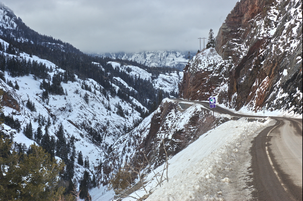
The road passing by the Ironton site is now US550. Ironton is not far below the north side of Red Mountain Pass (11,000 ft) heading towards Ouray (7800ft); this photo is further north of Ironton, dropping down to Ouray ... if you make it.
Road's clear here; try it when it's snowy :)
The original stage/freight road was much narrower than this - as narrow as 8ft in places. A lot of rock was blasted out to build the modern highway.
"Although the road may be both treacherous and intimidating, adventurous drivers are rewarded with breathtaking views from the top."
"a 25 mile stretch of U.S. 550 that is consistently rated as one of the most scenic drives in the country. Red Mountain Pass is the highest point on that road. It is also one of the most dangerous sections during the winter, because of its steep grade and lack of guardrails."
Saw a family in a station wagon go off the road one winter. They went down about 400ft (known from the length of chains required to pull the car back up) but a conveniently-placed tree and snowbank kept them from going over the couple-hundred foot drop-off down to the Uncompahgre River. Only damage to the family was the need for a change of clothing.
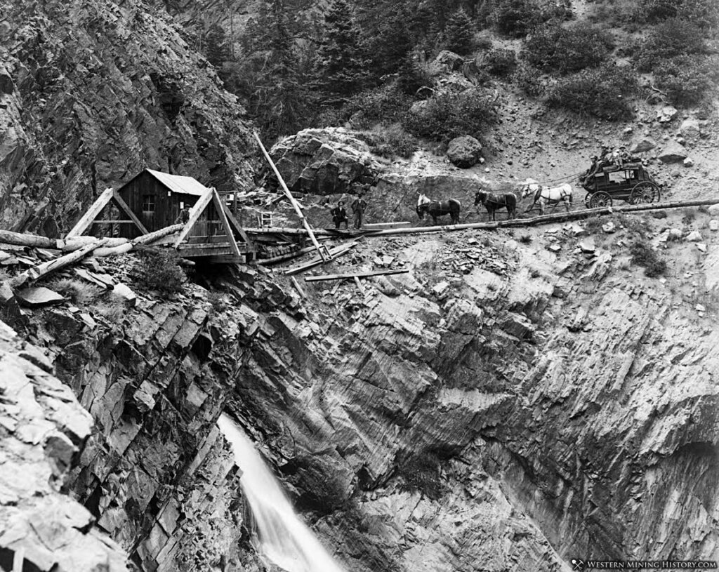
This was the main route between the mining camps of Silverton, Charleston, Red Mountain and Ouray. A railroad came up from Silverton to Ironton but the terrain was too rough for rails down to Ouray. It was originally a toll road; the toll house was on the south side of Bear Creek Falls - this photo (1886) taken from roughly where the scenic turn-out is today. The Bear Creek Falls area is on my list of favorite places to be.
Toll house at Bear Creek Falls; circa 1886
The state took the route over and rebuilt (and widened) the road in the 1920s. It's usually open all year but this is deep snow country and often the road is closed just above Ouray. Fascinating area in both scenery and history.
I was privileged enough to be able to live in both Silverton and Ouray for a short period of my life. Almost - not quite - settled in Ouray. As a friend once told me before she moved on: "You can't eat scenery".