You Can’t Get Here From There…
originally posted by Jean on April 07, 2008
I will not
love you
this time.
Go away.
Stay away.
Come again
no other day.

originally posted by Jean on April 07, 2008
I will not
love you
this time.
Go away.
Stay away.
Come again
no other day.
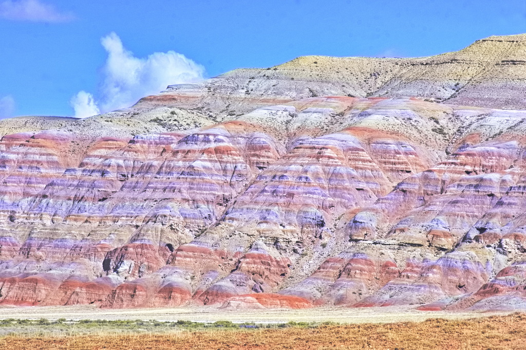
Down in SW Wyoming and into Utah not far from where Utah, Wyoming, and Colorado come together is the lesser-known Flaming Gorge Reservoir and National Recreation Area. Named by John Wesley Powell during his 1869 expedition down the Green River, the reservoir was formed in 1964 when the river was dammed.
Continue reading →Sneffels Range in the background
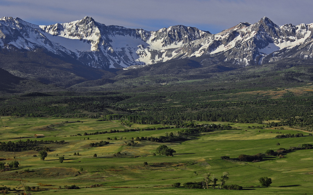
One would not be far off to declare this region among the most beautiful on the planet. Property prices seem to suggest many think the same way.
The Divide is the 9000 ft pass on CO62 west of Ridgway which separates the San Juan Mtns on the south and the Uncompahgre Plateau to the north.
There was once a town within this view down in the valley; a toll road had been built in 1880, a railroad came through in 1890. The town's post office closed in 1910; there is nothing left of the town.
The railroad ran along the faint line across the bottom with the line of trees to the right; Hwy62 is barely discernible in the trees just above the midline.
This view was captured from a friend's home on the north side of the pass.
Continue reading →Cheney's funeral is today - maybe right now as I write this. I hope they remember to shove a silver stake through where his heart should have been before they plant him (it's not his heart; they had to give him one via transplant).
I hope no one gets the impression I don't think he was one of the most evil people in the history of the US government.
Continue reading →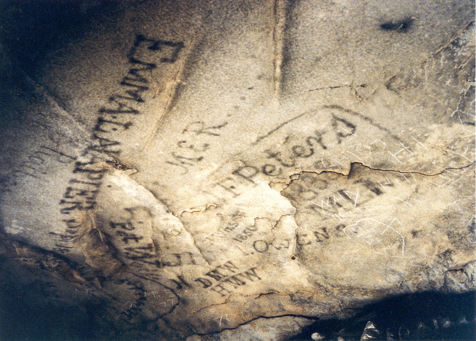
The longest (known) cave system in the world is in south-central Kentucky. The Mammoth Cave - some 425 known miles of connected caverns - is now a national park. New passages are continuously discovered. Evidence of human activity within the cave goes back at least 5000 years. (37°11'13.0"N 86°06'04.0"W)
A body crushed by a large rock was discovered in 1935; the victim was a pre-Columbian miner. The cave environment appears to have been stable for thousands of years. The cave contains many ancient human remains and artifacts - most being hidden from the public.
The first Europeans visited the cave in 1797 when a hunter chased a wounded bear to the site. A saltpeter mine (potassium nitrate, a gunpowder component) was established in the early 1800s. The mining activity ended after the War of 1812 and became a tourist attraction using the owner's slaves as tourist guides. Viewing the mine workings are still part of the visitor's experience.
A tuberculosis center operated for a short while before the war; the thought being the cave atmosphere had curative effects.
Photos of the cave were produced after the war, increasing tourist interest. As the region is pockmarked with smaller caves, a "war" for tourists broke out in the early 1900s, increasing with the advent of auto traffic.
Land ownership was a contentious subject until the last of the majority land owners died off in the 1920s. Interested parties became interested in forming a park in 1924; the Mammoth Cave National Park Association was formed and led to the forced removal of a variety of land owners in the area under eminent domain. CCC camps were set up in the '30s and '40s; the government declared the formation of a national park in 1941.
The park is so popular that advance reservations to enter the cave are highly recommended.
One thing that sticks in my memory from the almost 40 years since I visited was southern-style Coca Cola in the 6oz bottles for 5¢. Tasted far better than the usual Coke. Doubt those are available anymore.
are karens with robes (including that most karen of judges, Boasberg)
"Judge Blocks Trump From Power-Washing Office Building Near White House"
"Judge Dabney L. Friedrich ordered Trump not to power wash the filthy Eisenhower Executive Office Building (EEOB) next to the White House."

How is this even a judge's business? Can't clean the grime of the city off a government building? Granted the inside perhaps needs more cleaning than the outside, but still ...
As an article asks: "we have to ask why we had an election a year ago to pick a president when judges can simply prevent him from doing anything they don't approve of?"
My civics class suggested only the Supreme Court has jurisdiction with the Executive branch. The captains are telling the generals what they can and can't do.
There's no fixing the problems of this country without extreme measures of some sort.
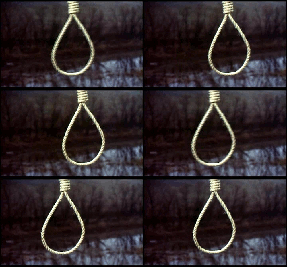
"You might not be interested in politics, but politics is interested in you"
Continue reading →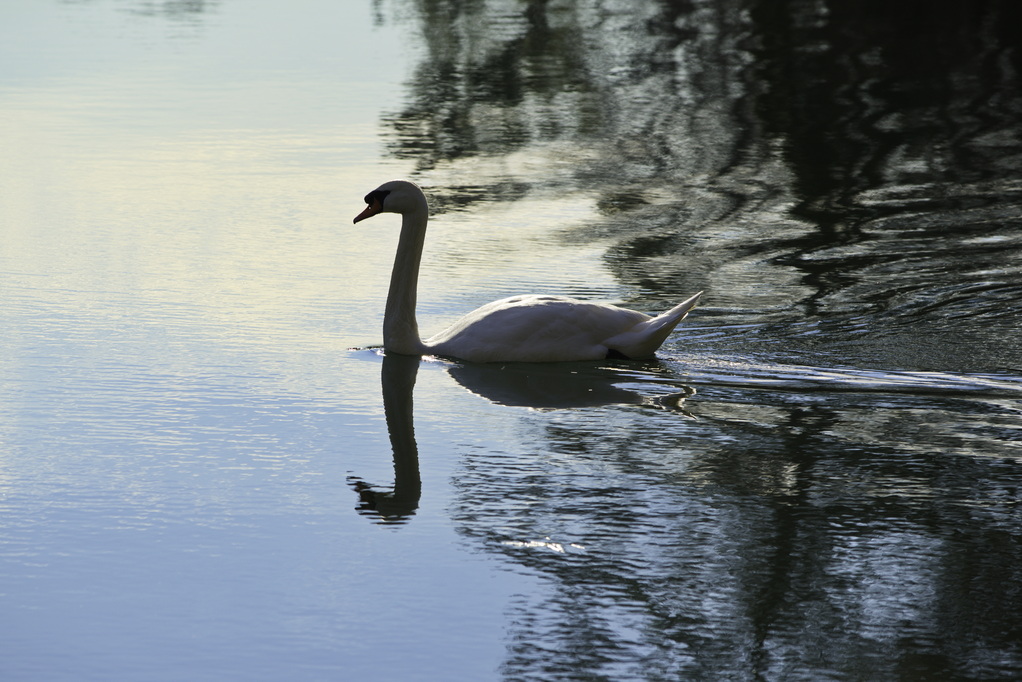
Behind what were American lines at Yorktown in 1781 is an earthen dam (37.2168N, -76.4919W) across Wormley Creek over which American troops travelled to and from the siege lines. At one time, a grist mill operated by Augustine Moore was located here. It was at Mr Moore's home nearby that the British surrender was given and accepted.
The same battlefields and ramparts of the Revolutionary War were used during the Civil War with the Confederates holding Yorktown as did the British and the Yankee armies laying siege where the French and Americans had done so 80 years earlier. There is a Union cemetery on the grounds but most of the region focuses on the Revolutionary War.
This was the same area where McClellan's forces were held back in 1862 by Confederate General Magruder and where 2nd Lt George Custer first came to prominence. Today's Colonial Parkway roughly follows what was the Warwick Line of 1862.
Now part of the Colonial National Historic Park and surrounded by a Navy ammo depot and Coast Guard training center, the dam is now crossed by the "Historical Tour Road". The road is one way and just off the main tourist area of the battlefield. Because the road is one way leading away from the main area along the York River, there is less traffic here even though it does lead to "Surrender Field".
When I lived in Williamsburg, I spent a lot of time between Jamestown at one end of Colonial Parkway and Yorktown at the other. If I were ever to go back east - not likely but never say never - this would be one area I'd return to.
One evening, I caught this swan swimming by on Warwick Pond ...
Continue reading →A sample of some obscure - and maybe not obscure - tunes from my strange and off-the-wall collection.
Today's selection: Jane - "Jane Session" - 1974
German "kraut rock".
Jane was formed in 1970. This cut is off their third album, Jane III - "a scorching guitar blowout"
Wiki describes Jane as "Playing a melodious synthesis of symphonic hard rock, that has occasionally been compared to Pink Floyd"
Not sure I agree with that description, particularly "compared to Pink Floyd" but I like a fair amount of their stuff.
This cut is a dual-guitar instrumental.
The Owyhee (O Y Hee) Mountains lie in far SW Idaho and spill over into Oregon (and geologically into Nevada). If one looks on a map, the Owyhee mountains and desert lie roughly between US95 on the west, ID51 on the east, the Snake River on the north, and (mostly) the Nevada border on the south. This area is the most remote, undeveloped region in the lower 48.
In 1816, a group of "mountain men", including three native Hawaiians, were sent up the now-Owyhee River to the mountains on a fur trapping expedition but never returned, likely killed by the local Paiutes. Word spread about the incident and they were to be memorialized by naming the waterway the Hawaii River, but the early spelling of "Owyhee" stuck.
The physically largest "town" within the region is the mostly-ghost town of Silver City sitting at 6200 ft. Other towns - mostly with populations less than 100 - exist on the fringes of the area, mostly along the south bank of the Snake River.
Silver City was one of the first places in Idaho to have electricity and telephone service. After a peak population of a few thousand in the 1880s, the population died off when the mines played out. The population fell to 1 in the 1940s but recent population growth of over 2000% has increased it to perhaps 25. That's enough that strangers are welcome to wander around but don't go picking through the ruins - it's a long way from law enforcement and close to plenty of old mine shafts. Even if law enforcement was nearby, locals stick together.
The town is never fully abandoned but in winter, you can't get there from here ...
The biggest business in town is the Idaho Hotel - nice place; the only other two businesses are much smaller - neither of which are a gas station or "general" store. The Idaho Hotel is popular; one needs reservations: no electricity, no heat, no pets, no in-room bathrooms, great food - if you let them know in advance. (www dot historicsilvercityidaho dot com/idahohotel/brochure.html)
On the fringe of the region is the only real town - on US95 and the Jordan River is the town of Jordan Valley; population about 140.
Don't - do NOT - speed through Jordan Valley. 26mph may get you a ticket ...
Do stop at the Rock House on the west side of town for some pretty good huckleberry ice cream (is there such a thing as bad huckleberry ice cream?)
Jordan Valley has a gas station if you really, really need gas but Marsing (46mi) or Homedale (53mi) up on the Snake in Idaho are the closest places to buy groceries ... don't forget the milk. Many of the place names on a map of the region are most useful in filling the emptiness. For example, Arock has a post office and 24 residents. It was named for a nearby rock.
For those interested in tales of the region, I can suggest "Owyhee Trails" (1973) by Mike Hanley of Jordan Valley.
Putting a tire on a wooden wheel at the Owyhee County Museum last mid-October at the county seat of Murphy, ID (pop 188). Mike's the old guy in the blue shirt:
https://newamericandigest.org/wp-content/uploads/2025/11/Fixing-A-Flat.mkv
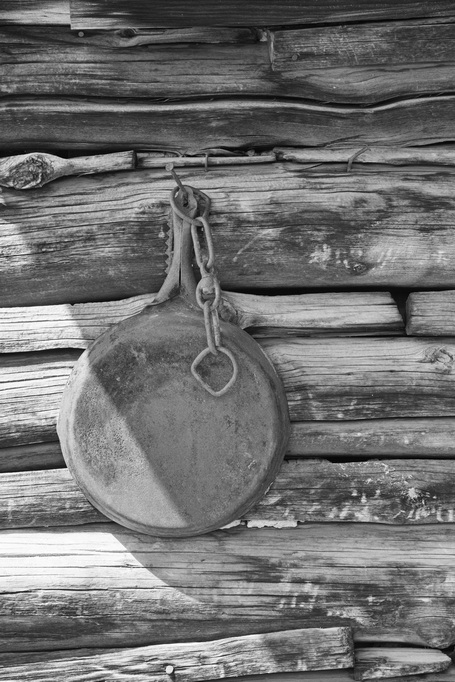
Oh yes - the pan:
So, wandering around places in the Owyhees that I shouldn't have been when poorly equipped as I was, I stumbled across this old (prospector?) cabin. It was so remote, I found this old pan still hanging on an exterior wall where whoever, whenever left it.
It was still there when I left. Sometimes I find interesting things following those overgrown 2-tracks.
Continue reading →originally posted by Jean February 05, 2007
I love men,
for the most part,
at least one part,
yes, I do.
OK, two of their parts
are good parts.
Of the ones who have good hearts,
they have three parts
that are good parts.
And, those with functioning brain parts
have four parts
that make good parts.
Let's not forget twinkling eye parts
and add to that nice butt parts.
So, now we're up to five parts
that make the whole part good.
I've mentioned before their hand parts
being one of my favorite good parts.
A sweet smile makes my own parts
get warm, and that's always good.
Well, I guess it's time to say this part,
I can't think of a part that's not good!
'course, being a woman, I could change my mind tomorrow.
Continue reading →