Introducing "Little Calico":
I've never made any secret of my fondness for cats. I have nothing really against dogs but to have a dog - or dogs - requires room to run, at least in my eyes. I don't like fencing a dog in yet most places I've lived do not allow dogs to roam free nor are dogs of the size I like suitable for the apartments I've lived in.
Yes, I know there are exceptions.
I wouldn't mind having two right now - two, because I live in coyote country and a coyote will injure or kill a single friendly dog, even of German Shepherd size. The dog wouldn't realize it was in a serious fight right away. But Wile E won't mess with two though - two dogs would tear the coyote apart if it wasn't fast enough on the escape. Can't though; I'd have to keep them penned up where I live. I wouldn't want a feather duster; I'd want one or two to take boonie-bouncing with me.
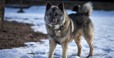
My last dog was a female Norwegian Elkhound:
Had her as a pup ... No, this is not her; even if circumstances had not gotten in the way, she'd have lived her life out sometime in the 80s. By then, my life was on a path that having a pet was not practical.
This was the mid-70s; she was stolen by someone I had thought was a friend - I never saw the dog or "friend" again; never even knew where they went. She was the last dog of mine ... I suppose after almost 50 years I don't miss her much anymore, only had her for about 6 months as a puppy. But sometimes I think about her. Time has a way of fading some memories ...
Sometime around 1990, I had a girlfriend with a retriever. We'd travel - for fun or work - but I-Can't-Recall-His-Name didn't take to travelling well. Said girlfriend passed ICRHN off to a friend who was better able to take care of him. They got along very well and when the inevitable breakup with the girlfriend came, it turned out the dog preferred to stay with the friend.
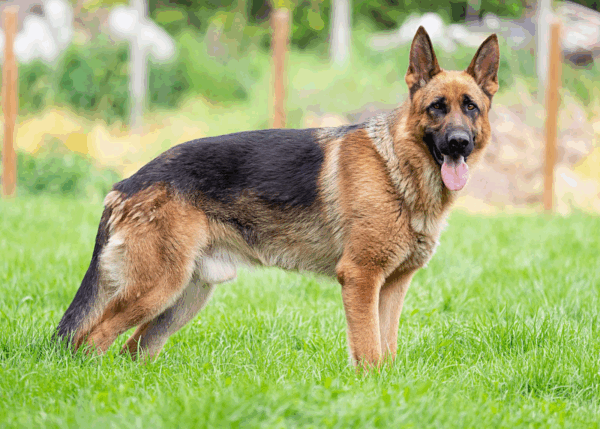
God visited me some time ago ... oh, it might have been about 1997. I didn't realize it at the time. Didn't think about it at the time. No burning bushes but a beautiful healthy German Shepherd deep in the Wilderness.
At least it was a dog that looked like a German Shepherd. Kind of like this picture but a little fuller.
I was out in central Nevada someplace out along US50. There's a lot of not-much through there. I had pulled off the highway to take a break. This dog came out of nowhere - I was a long way from any town or ranch, yet this dog came up to me from out in the sagebrush and just stared at me.
I stared back.
Where did this dog come from? He obviously hadn't been wandering for long; his coat was too clean, he appeared well-fed.
A dilemma.
Do I take him in? I live in a small apartment. Besides, if he had wandered off, his owners must be looking for him.
Or did they dump him? I didn't think about that at the time.
Do I try to bond with him? Then what? I can't care for him.
So I ignored him until he wandered away.
A few minutes later, I had second thoughts. Called out to him - he couldn't have gotten too far away yet; no response.
I didn't think much of it at the time, but - not even being sure "God" exists - I now feel I failed a biblical test.
And it bothers me much more now than it did 30 years ago.
Figure that.
Continue reading →