A sample of some obscure – and maybe not obscure – tunes from my strange and off-the-wall collection.
Today’s medley selection: Airdance: “Tamlin-Devil In The Strawshack – Return To Tchernobyl” 2003
A bit of fiddlin’ music here. Off the “Flying On Home” album
“One of the foremost exponents of New England style for the past 40 years, Rodney Miller’s exploratory fiddle style also invites quite a few surprises.“
“Flying on Home: Acclaimed as a masterpiece, this second album from Airdance features the playing of Rodney Miller, David Surette, Mary Cay Brass, Stuart Kenney, Sam Zucchini, and Marko Packard.“
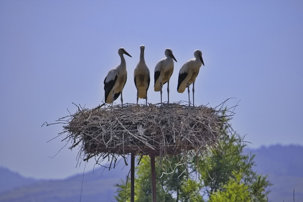
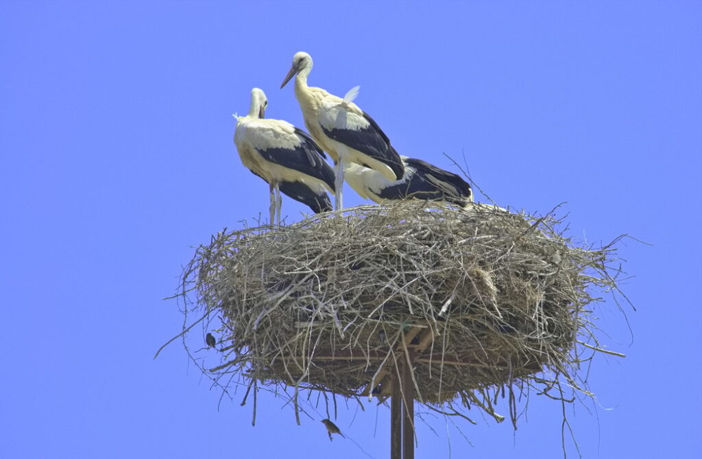
Big birds that can weigh almost 20 lbs with wingspans that can approach 10 feet. For the most part, storks do not inhabit North America – these were photographed in western Turkey.
aka: more than you ever wanted to know about my background
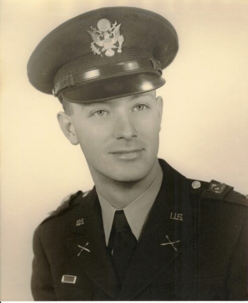
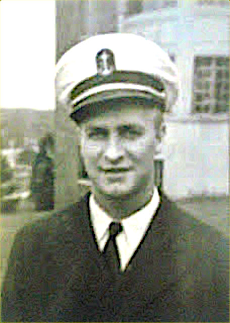
1952 – age 24
Dad turns 98 today. Still healthy … for a 98yo – still mobile, still not as dumb as I thought he was when I was 16, not in a nursing home. Hearing not so good … eyes not far behind. Still does yard work.
God willin’ and the crik don’t rise, I’ll see him on my trip back east come August.
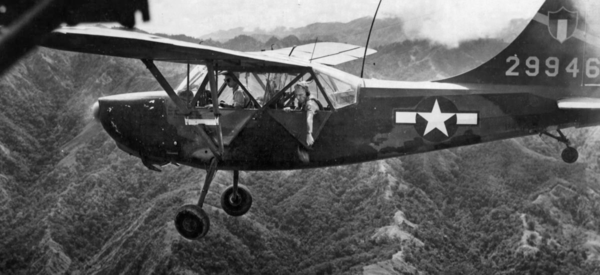
A 1st Lt in the Army Field Artillery, a forward observer, Daddy played boom-boom games with the Chinese in Korea within an area known as “The Iron Triangle”. Never talked much about his time there; except one time he mentioned his camp was over-run by the Chinese – his dog was killed. Mentioned that just sort of as an aside. He didn’t talk about others but I can guess. I think he mentioned one time receiving a Purple Heart. Once. Long ago. Even now, he doesn’t answer questions.
Loved to watch MASH. Spent much of his Korea time in itty-bitty unarmed kites with propellers, or for a change, sometimes in forward observation posts.
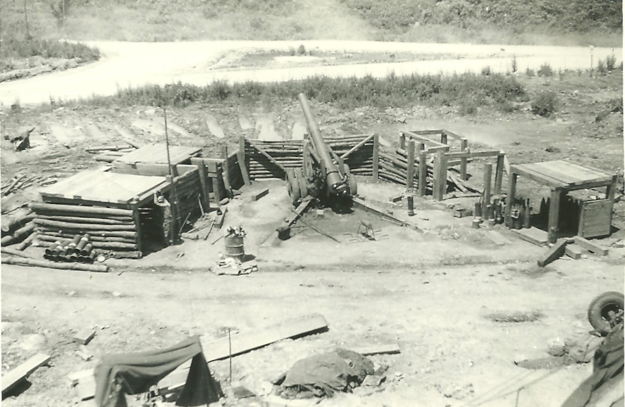
Since he doesn’t talk about it, I search the history files. This one was interesting:
Apparently, he was one of the artillery participants in the Battles of White Horse and Pork Chop Hill. I never knew which battery he was assigned to but his brigade fired the last artillery shell of the war at the time he was there.
He was home in time for my first Christmas … barely. A few years later, he got me hooked on trains – a lifelong addiction.
Jean posted this in 2012 and suggested it to me. Even though he didn’t die in war, I didn’t want to wait until next March 11 so I thought I’d post it on Memorial Day … which is still worthy of a day to itself – May 30 – and not an excuse for a 3-day weekend.
I know I’ve mentioned before that my dad served in the Navy on the USS Randolph during WW2.
As is so common with veterans, he didn’t share many details of his service with his family. He talked about learning to box and getting his nose broken. He talked about making an attempt in track and breaking his ankle in the long jump… or, was it pole vaulting?
The most serious thing he talked about for a long time was one of his mates who died from alcohol poisoning after a day of drinking in the hot sun.
If he was asked where he served, he would only say “in the Pacific”. He mentioned being in Hawaii and having no desire to go back. He enlisted after Pearl Harbor.
One day he showed us a scrapbook he made. The cover is a piece of scratched plexiglass with some brown stains near the edge. When I asked him what the stains were, he said, “Oh, that’s blood from the Kamikaze pilot who hit our ship.” He wouldn’t say anymore.
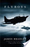
Not long ago, I read the book “Flyboys” by James Bradley. It talks about US forces bombing a tiny (three miles by five miles) island called Chichi Jima and eight pilots who crashed there, were captured, tortured and killed by the Japanese. This book mentions the USS Randolph as part of the support forces in the bombing raids on Chichi Jima. This is where dad’s ship was when it was hit.
I lift a beer in memory to a couple of Mr B-Bar buddies from long ago.
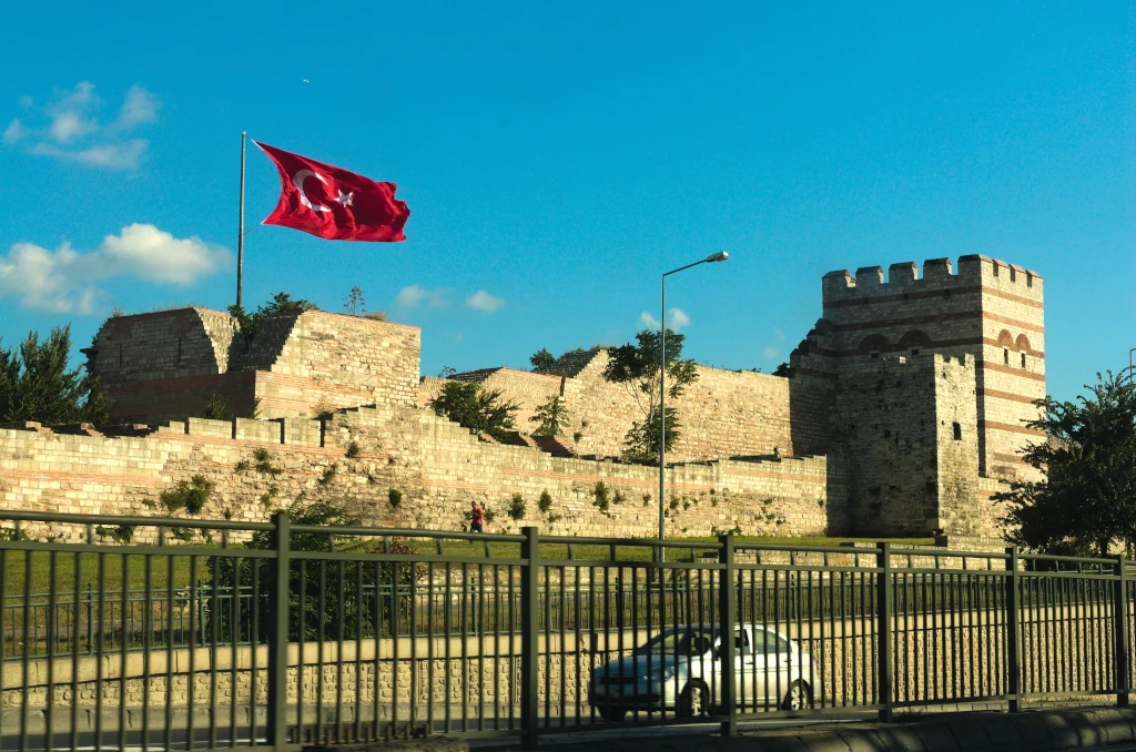
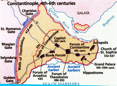
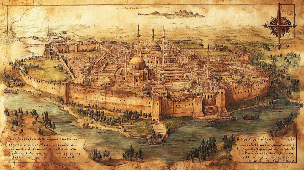
On May 29, 1453, the siege of the capital of the Byzantium Empire ended and it fell to the forces of the Ottomans. Considered the final end of the Roman Empire and the beginning of the modern age, these walls in their time were considered the finest of defensive systems. The advent of an effective use of artillery along with over-whelming force marked the end of walls as defensive structures. 1000 lb cannon balls broke through the walls, leaving entry points for the 60,000 Ottoman infantry to overcome the 7000 Byzantium defenders. The schism between the Latin and Orthodox Churches ultimately prevented western Europe help in defending the city.
Constantine XI, Byzantium emperor, placed a chain across the mouth of the Golden Horn and added 60ft wide moats along the 12 miles of ancient walls.
Sultan Mehmet II defeated the defenses: the Ottomans dragged their ships overland through Galata to bypass the chain barrier and used heavy artillery to open breaches in the wall.
“Everywhere there was misfortune, everyone was touched by pain. There were lamentations and weeping in every house, screaming in the crossroads, and sorrow in all churches; the groaning of grown men and the shrieking of women accompanied looting, enslavement, separation, and rape.“
A Byzantine survivor:
“On the third day after the fall of our city, the Sultan celebrated his victory with a great, joyful triumph. He issued a proclamation: the citizens of all ages who had managed to escape detection were to leave their hiding places throughout the city and come out into the open, as they were to remain free and no question would be asked. He further declared the restoration of houses and property to those who had abandoned our city before the siege. If they returned home, they would be treated according to their rank and religion, as if nothing had changed.“
The city wasn’t officially named Istanbul until 1930 after the collapse of the Ottoman Empire and the formation of the Turkish Republic.
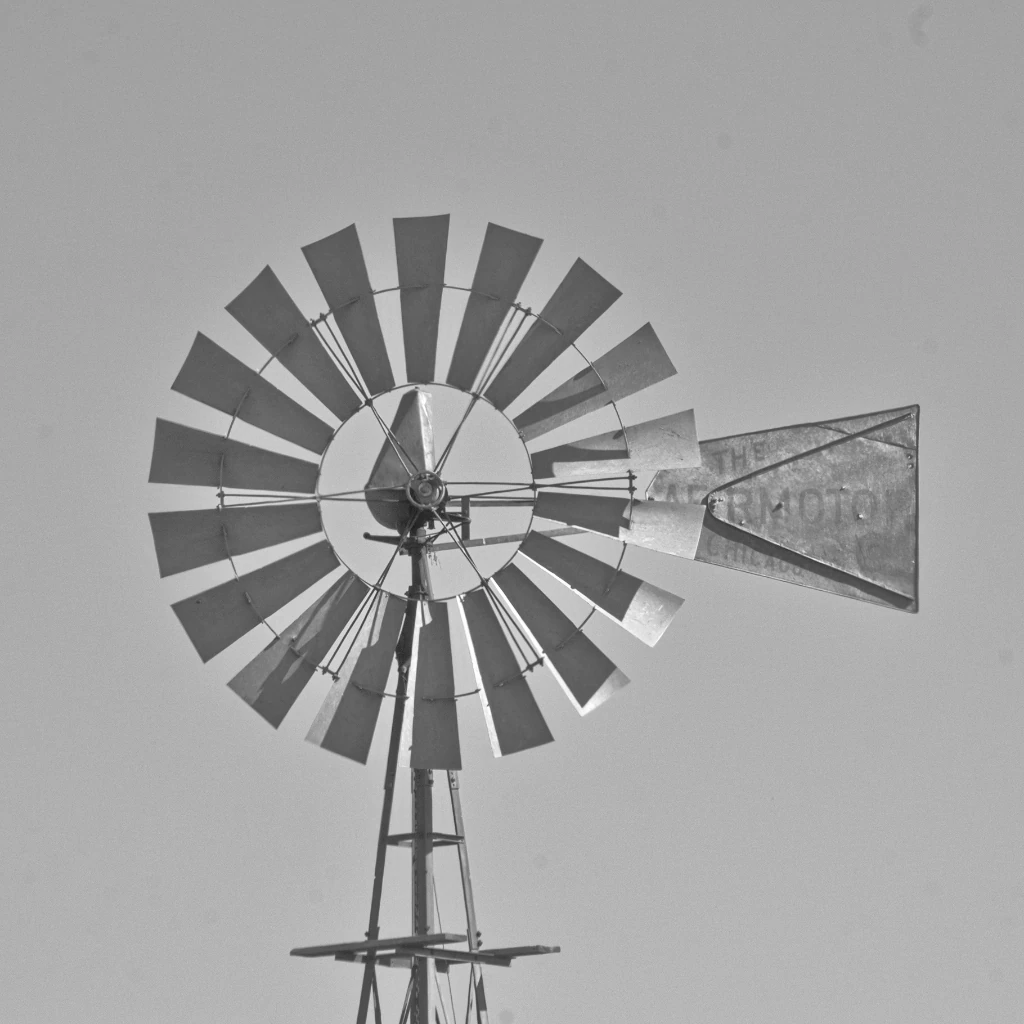
Scattered throughout the dry country, these windmills stand alone, pumping water into stock tanks … or standing broken and discarded as the homesteaders and ranchers moved on.
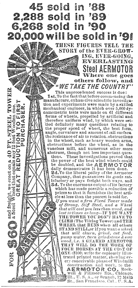
The Aeromotor Company began experimenting with wind engines in 1883 and sold its first 24 all-metal windmills in 1888, selling over 20,000 by 1892. Through many changes in operations, names, and ownership, the company still exists, owned by a consortium of ranchers in Texas – having reverted back to its original name.
In 1890, the factory consisted of one large building. Sales were so great that by 1892, the factory had expanded to three buildings, the newest one-story building covering an acre.
By 1904, an 8ft mill cost $25 and a 20ft mill, $300 – but the mills required weekly maintenance. By 1915, an automatic oiler was developed that reduced maintenance to a yearly task rather than weekly.
The owner of the company, LaVerne Noyes, established university scholarships for veterans of WWI, primarily at Univ of Chicago and Iowa State. He died in 1919, leaving the company to a taxable trust. The scholarships are still available.
So are the windmills.
1891 Ad – stolen from Wiki
Today (2024 catalog), a basic 8ft windmill on a 21 ft tower weighs 795 lbs and costs just about $8600 and is of the same basic design as the 1888 windmill.
A sample of some obscure – and maybe not obscure – tunes from my strange and off-the-wall collection.
Today’s selection: Blue Oyster Cult – “Last Days Of May” 1972
Off Blue Oyster Cult’s first album. I saw the band at a back road, non-tourist bar in Reno in 1985 (I think). Maybe 300 people, probably 250 – maybe not even that many. They played under the name of “Soft White Underbelly“. They said they missed playing for small crowds. Played for a few hours; one break. One of the best concerts I’ve been to.
Wouldn’t be interested in coming along Instead of staying here It’s said the west is nice this time of year It’s what they say
She was 18 when I asked her. She said Yes. We didn’t come back. Maybe a tale I’ll tell someday.
It’s next Saturday … this is the Monday of a 3-day weekend.
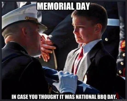
Stolen from the wundernet:
As evening sets in, I do not honor “National BBQ Day”. I will pay my respects on the proper day. To a couple of high school buddies that breathed their last in the jungle. Traditions are more important than 3-day weekends.
In 1968, the U.S. government passed the Uniform Monday Holiday Act, which put major holidays on specific Mondays to give federal employees three-day weekends. Memorial Day was one of these holidays, along with Washington’s Birthday, Labor Day and Columbus Day. The act also codified the name “Memorial Day” into law.