Daily Archives: January 26, 2026

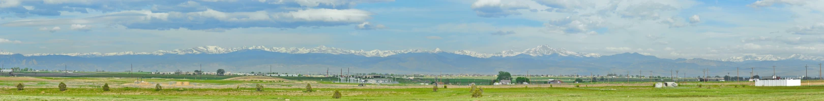
I’m Headed Out To The Boonies …
(I made some sort of comment to ghostsniper about measuring distance in "tanks of gas". Comes from being in the center of not much. So, it's time to post this one ahead of schedule.
There's a fair amount of babble around the wunderweb about "heading for the hills".
That's ambiguous - I've lived in places where people thought a 2-acre lot was "out in the country".
I like the idea of being able to shoot a rifle anywhere around my house and only have to worry about hitting trespassers.
We all have our dreams ... and a backhoe.
So I got curious the other day: what does a map of US metropolitan areas really look like?
Let's start with larger metropolitan areas. The following map shows the 111 metropolitan regions having over 500,000 population.
I was born in one of them; I've lived in 8 of them - by this definition.
(many weren't large enough to be on this list at the time I lived in them; the one I was born in was larger).
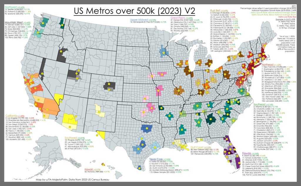
But looking more closely to those areas I'm familiar with, this map could be misleading. Take region 103: Reno (pop 564782). It was about ½ that size when I lived there but the point being is it shows all of Washoe County. Reno proper is just about where the yellow dot is; one gets a bit north of there, especially above Pyramid Lake, and northern Washoe County could be used as the definition of "empty" (except during the damned Burning Man event which tears up the southern end of Black Rock desert - another story.
Or the region I live now - on the NW extremes of region 74 (Boise, pop 824,000). It's hard to see on this scale, but Owyhee County (below Boise's yellow dot) is the extreme SW corner of the state. A 7900 square mile county, south of the Snake River, with a total population under 12,000 people concentrated in three "cities" (the largest has 2,600 people) and half a dozen communities - yet it's considered part of the Boise metro area - even though the county seat is an hour away from Boise City ... and is on the closer side of the county.
One could say the same of the area west of Salt Lake City/Ogden/Provo (region 46, 88, and 82, pop 2.6 mil). West of the I-15 corridor is hard desert.
I'm sure other regions - at least in the west - are similar.
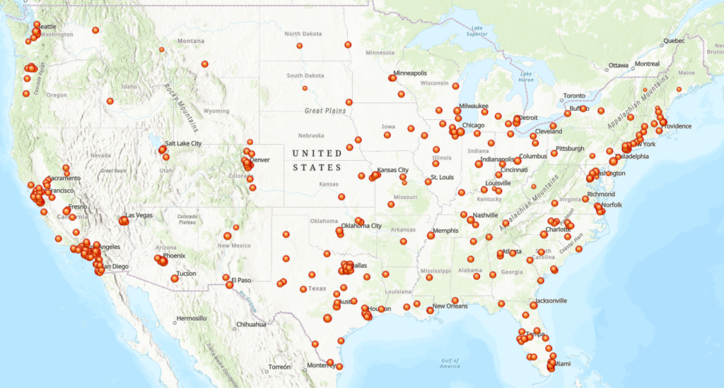
So let's change the map: If I look for the distribution of cities of over 100,000, the map looks like this:
Boise is considered the most "remote" large city of the lower 48; two of the top 10 "remotest" areas of the lower 48 are not far from Boise (River of No Return Wilderness is #1, the Owyhee Canyonlands is #8)
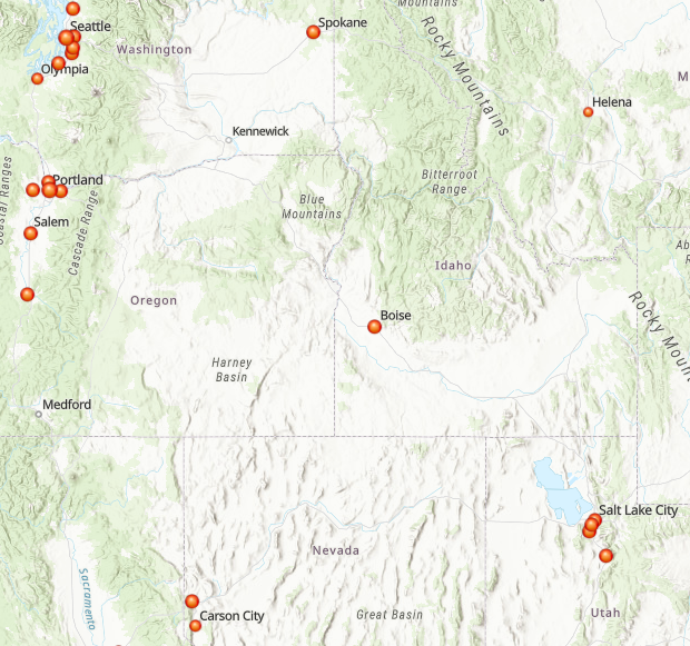
"As the crow flies"
Boise-Helena: 290
Boise- Salt Lake: 300
Boise-Reno: 470
Boise-Portland: 344
Boise-Seattle: 554
Boise-Spokane: 425
Biggest city in nowhere. Takes me an hour or so to get to Boise proper.
Continue reading →