The Cairn
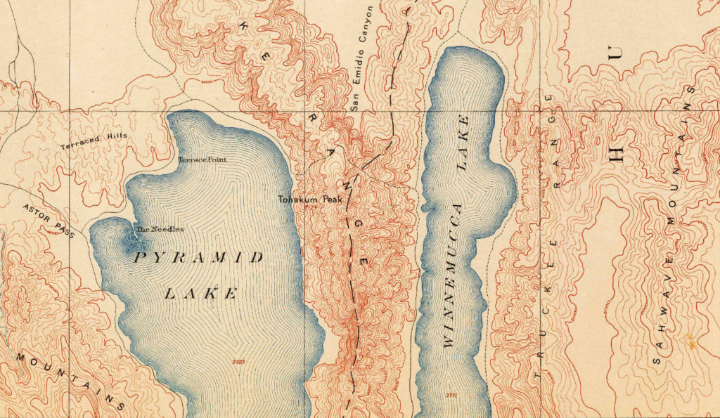
Once upon a long, long time ago from forever ago until the 1930s, there was a body of water known as Winnemucca Lake not far east of Pyramid Lake in Nevada. The lake was roughly 30 miles north-south and 4 miles east-west. In the hills between Pyramid Lake - which still exists - and Winnemucca Lake - which doesn't - appear the oldest petroglyphs known in North America, estimated to be more than 10,000 years old.
One can see a road following the western shores of the lake on this 1894 map which is now Nevada Highway 447.
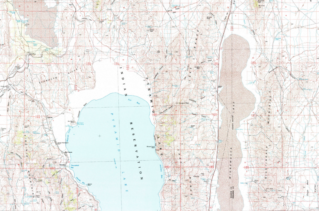
The combination of a dam built in 1903 on the Truckee River to the south (which drains into Pyramid Lake) and construction of a modern highway in the 1930s which closed the run-off between the lakes, what was Winnemucca Lake - a shallow, tule filled breeding ground - is now a dry, barren wasteland; it lost its status as a National Wildlife Refuge in 1962 due to the lack of water.
John Fremont is the first American known to have travelled through the area but the lake is not present on his maps. Originally known as Mud Lake - the water level fluctuated but it was often shallow. The maximum level recorded was 85ft in the 1880s.
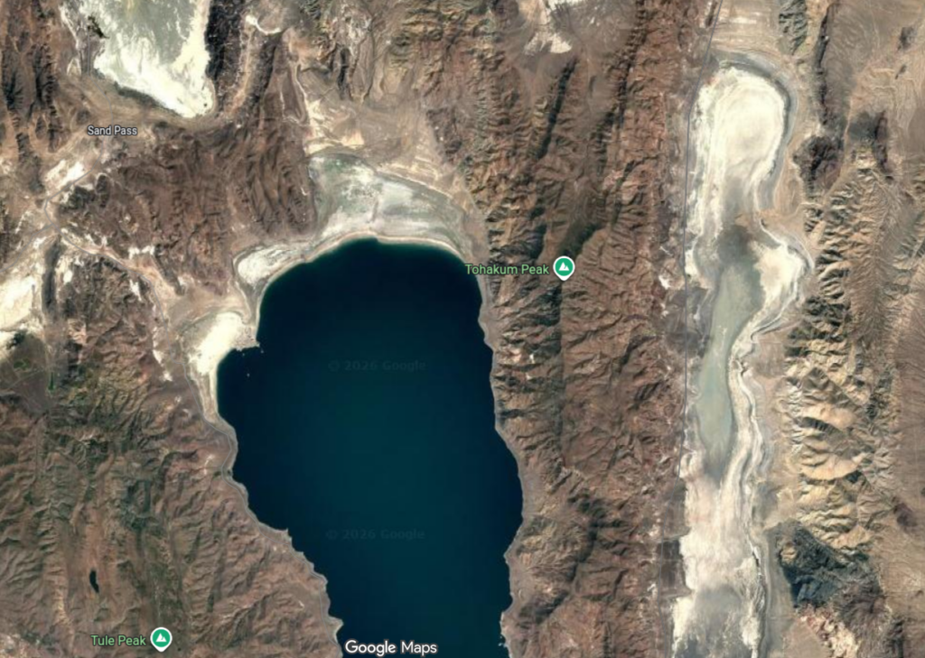
[Y'all know my interest in old roads. There's a road indicated on the 1894 map between the two lakes just to the north of Tohakum Peak passing by the "A" in "Range". Yet another road I'll not explore ... and there's no hint of it on modern maps or satellite view.]
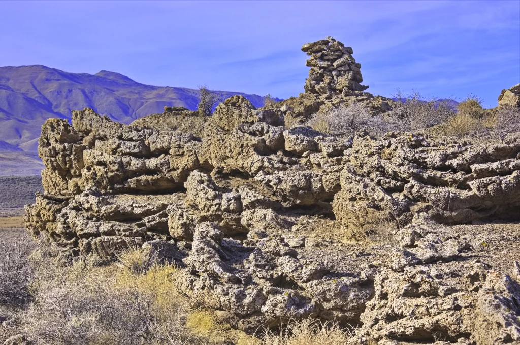
I was wandering around the hills along NV447 sometime in the early 80s looking for I don't recall what when I came upon this cairn. It had been in place long enough that the desert varnish on the cairn appeared as old as that on the surrounding rocks. Many rocks in the area were covered in petroglyphs but apparently those were not "officially" discovered until the 1990s. Wish I knew where my photos of those were ... probably in these totes laying around here that I'll get around to examining "someday".
So the cairn is old ... Did Fremont have that cairn built or is it even older? What did it signify?
A campsite? A trail? A survey point?
The area is on the Pyramid Lake Paiute Reservation; it appears the tribe has restricted access to these sites in recent years and it's not likely I'll ever travel that trail again ...